
Ocean
Cannon Beach Oregon: A First Time Visitor Guide


Cannon Beach Oregon: A First Time Visitor Guide
If you’ve been dreaming of a Pacific Northwest beach town that feels like it was made for you, Cannon Beach is calling your name. Nestled along Oregon’s stunning coastline, this charming little town offers dramatic rock formations, miles of sandy shoreline, and a laid-back atmosphere that makes you never want to leave. Whether you’re planning a romantic getaway, a family vacation, or a solo adventure, this guide has everything you need to make the most of your first visit.
Key Takeaways
- Cannon Beach is home to Haystack Rock, a 235-foot sea stack and one of Oregon’s most iconic landmarks
- The best time to visit is June through September for warm weather and clear skies
- The town has a thriving art scene with over 20 galleries showcasing local and regional artists
- Tide pooling at Haystack Rock is a must-do activity, especially during low tide in summer
- Cannon Beach is about 90 minutes from Portland, making it an easy weekend getaway
- The area offers excellent hiking opportunities in nearby Ecola State Park
- Accommodations range from cozy beachfront motels to luxury vacation rentals
Why Cannon Beach Is So Special
There’s something about Cannon Beach that hits different from other coastal towns. Maybe it’s the way Haystack Rock rises out of the surf like a giant sentinel, or how the town manages to feel both quaint and vibrant at the same time. Unlike some beach destinations that have been overrun by chain hotels and souvenir shops, Cannon Beach has held onto its small-town charm while still offering everything a visitor could want.
The town sits along a gorgeous stretch of the Oregon Coast, roughly 80 miles west of Portland. It’s part of the larger Cannon Beach community, which includes the main town area and surrounding neighborhoods that stretch along the coastline. The beach itself runs for miles in both directions, giving you plenty of room to explore without feeling crowded, even during peak season.
The geological history of the area is fascinating. Haystack Rock and the other sea stacks along this part of the coast were formed millions of years ago from ancient lava flows that hardened into basalt. Over millennia, the relentless force of wind and waves wore away the softer surrounding rock, leaving behind these dramatic pillars that now define the Cannon Beach skyline. Standing at the base of Haystack Rock, you’re looking at a piece of Earth’s history that stretches back to a time when volcanoes shaped the entire Pacific Northwest landscape.
What really sets Cannon Beach apart is the combination of natural beauty and cultural richness. You can spend your morning watching the waves crash against Haystack Rock, browse local art galleries in the afternoon, and enjoy fresh seafood at a waterfront restaurant in the evening. It’s the kind of place where every day feels like a vacation, even if you’re just walking down the street.
The area has a long history of attracting artists and nature lovers. The town’s commitment to preserving its natural environment and supporting the arts has created a community that feels authentic and welcoming. You won’t find big commercial developments here — instead, you’ll discover locally owned shops, family-run restaurants, and a genuine sense of place that’s increasingly rare in popular tourist destinations.
Top Attractions in Cannon Beach
Haystack Rock
No visit to Cannon Beach is complete without spending time at Haystack Rock. This massive sea stack towers 235 feet above the shoreline and is one of the most photographed landmarks on the entire Oregon Coast. It’s not just a pretty backdrop for your Instagram photos — Haystack Rock is a thriving ecosystem that’s home to tufted puffins, common murres, and a variety of other seabirds that nest on its rocky ledges during spring and summer.
The best way to experience Haystack Rock is during low tide, when the ocean pulls back to reveal a fascinating world of tide pools teeming with sea stars, anemones, hermit crabs, and purple sea urchins. The tide pools at the base of Haystack Rock are some of the best on the Oregon Coast, and they offer an up-close look at marine life that you simply can’t get anywhere else. Just remember to watch your step and never remove any creatures from the pools — these animals are protected.
If you’re visiting between April and September, bring a pair of binoculars. The puffin nesting season is a special time at Haystack Rock, and you can watch these charismatic birds as they come and go from their burrows on the rock’s upper ledges. The best viewing is typically in the early morning or late afternoon when the birds are most active.
Ecola State Park
Just north of Cannon Beach, Ecola State Park offers some of the most breathtaking coastal views in all of Oregon. The park stretches across Tillamook Head and provides panoramic vistas of the coastline, including a stunning view of Haystack Rock and the Cannon Beach shoreline from above. It’s the kind of view that makes you want to just sit and stare for hours.
The park features several hiking trails, including the popular Tillamook Head Trail, which winds through old-growth coastal forest before emerging at dramatic cliff-top overlooks. The trail is moderately challenging, with some steep sections, but the views along the way are absolutely worth the effort. You’ll pass through tunnels of Sitka spruce and western hemlock, with shafts of sunlight filtering through the canopy above.
Ecola State Park is also a great spot for wildlife watching. Keep your eyes peeled for bald eagles soaring overhead, harbor seals resting on offshore rocks, and during whale migration season (December through May), you might even spot gray whales passing by in the distance. The park requires a day-use parking fee, but it’s a small price to pay for access to one of Oregon’s most beautiful natural areas.
The coastal forests surrounding the park are home to an impressive variety of wildlife. Roosevelt elk can sometimes be spotted grazing in meadows near the park entrance, and the dense undergrowth provides habitat for black-tailed deer, coyotes, and a variety of smaller mammals. Birdwatchers will be in paradise here, with opportunities to see everything from great blue herons wading in tidal pools to peregrine falcons diving along the cliff faces. The diversity of ecosystems within a relatively small area makes Ecola State Park one of the best wildlife viewing destinations on the Oregon Coast.
Cannon Beach Town Center
The heart of Cannon Beach is its charming town center, a walkable district filled with art galleries, boutique shops, bookstores, and restaurants. The town has a strong artistic community, and you’ll find everything from traditional landscape paintings to contemporary sculptures and handmade jewelry. Many of the galleries host artist receptions and special events throughout the year, so there’s always something new to discover.
One of the best ways to explore the town center is simply to wander. Park your car and spend an afternoon browsing the shops, stopping for coffee at a local cafe, and chatting with gallery owners about their work. The town is compact enough that you can easily cover the entire center on foot, and you’ll find that the slower pace is part of the appeal.
Don’t miss the Cannon Beach History Center and Museum, which offers a fascinating look at the area’s past, from its Native American heritage to the Lewis and Clark expedition’s visit to the region. The museum is small but well-curated, and it provides great context for understanding the land and community you’re visiting.
Oswald West State Park
Just south of Cannon Beach, Oswald West State Park is a hidden gem that many first-time visitors overlook. This sprawling coastal park offers miles of hiking trails, secluded beaches, and some of the most dramatic scenery on the Oregon Coast. The park is named after Oswald West, who served as Oregon’s governor from 1911 to 1915 and was instrumental in preserving the state’s beaches for public use.
The most popular trail in the park is the Short Sand Beach Trail, which leads through dense coastal forest to a beautiful sandy cove surrounded by towering cliffs. Short Sand Beach (often called “Short Sands”) is a favorite spot for surfers and beachcombers, and it has a wild, untamed feel that’s quite different from the more accessible Cannon Beach shoreline. The trail is about a mile and a half each way and is moderately easy, making it suitable for most fitness levels.
Another highlight of Oswald West is Neahkahnie Mountain, which offers a more challenging hike with spectacular rewards. The trail to the summit climbs through forest and meadow before reaching the top, where you’ll be treated to sweeping views of the coastline stretching in both directions. On a clear day, you can see for miles, and the sense of accomplishment at the top is hard to beat.
Best Time to Visit Cannon Beach
Cannon Beach is a year-round destination, but the best time to visit depends on what you’re looking for. Summer (June through September) is peak season, and for good reason — the weather is warm and relatively dry, with average highs in the low to mid-60s Fahrenheit. This is the ideal time for beach activities, tide pooling, and outdoor exploration. The downside is that summer also brings the biggest crowds and the highest accommodation prices.
Fall (October through November) is a wonderful time to visit if you prefer fewer crowds and don’t mind cooler temperatures. The ocean takes on a dramatic quality in autumn, with bigger waves and moodier skies that create stunning photo opportunities. Many locals consider fall to be the best season on the Oregon Coast, and you’ll find that hotel rates drop significantly after Labor Day.
Winter (December through February) is storm-watching season, and it’s an experience like nothing else. The Pacific Ocean puts on a spectacular show during winter storms, with massive waves crashing against the rocks and sending spray high into the air. If you bundle up and brave the weather, you’ll have the beach largely to yourself. Winter is also whale-watching season, as gray whales migrate along the coast on their way to breeding grounds in Mexico.
Spring (March through May) brings wildflowers, migrating whales, and gradually warming temperatures. It’s a great time for hiking and exploring the parks around Cannon Beach, as the forests are lush and green from winter rains. The crowds are still relatively thin in spring, making it a good compromise between the busy summer season and the stormy winter months.
Where to Stay in Cannon Beach
Cannon Beach offers a wide range of accommodations to suit every budget and travel style. For the most authentic experience, consider staying at one of the town’s many vacation rentals, which range from cozy beachfront cottages to spacious homes that can accommodate large groups. Vacation rentals give you the flexibility to cook your own meals and settle in like a local, which can be a big money-saver for longer stays.
If you prefer a more traditional hotel experience, the Surfsand Resort is one of the most popular options in Cannon Beach. Located right on the beach with views of Haystack Rock, it offers comfortable rooms, an indoor pool, and easy access to the sand. The Ocean Lodge is another excellent choice, with a prime location just steps from the beach and a warm, welcoming atmosphere that keeps guests coming back year after year.
For budget-conscious travelers, there are several motels and inns that offer clean, comfortable rooms without the premium price tag. The Waves Cannon Beach and the Tolovana Inn are both solid options that provide good value for money. Many of these properties are family-owned and operated, and the personal touch you get from the staff can make your stay feel extra special.
Regardless of where you stay, it’s a good idea to book well in advance if you’re visiting during the summer months. Cannon Beach is a popular destination, and the best properties tend to fill up quickly, especially for weekends and holidays. If you’re flexible with your dates, consider visiting midweek for better availability and lower rates.
Where to Eat in Cannon Beach
The dining scene in Cannon Beach is surprisingly diverse for a small coastal town. Seafood is, of course, the star of the menu at most restaurants, and you’ll find everything from casual fish and chips to upscale Pacific Northwest cuisine. The Wayfarer Restaurant is a local favorite, known for its fresh seafood, stunning ocean views, and creative cocktails. It’s the kind of place where you can watch the sunset over the Pacific while enjoying a perfectly prepared meal.
For a more casual experience, check out the Lazy Susan Cafe, which serves excellent breakfast and lunch in a relaxed, friendly setting. Their menu features locally sourced ingredients and plenty of options for vegetarians and vegans. The Irish Table is another popular spot, offering hearty comfort food with a Pacific Northwest twist in a cozy, welcoming atmosphere.
If you’re in the mood for something sweet, don’t miss the Cannon Beach Chocolate Cafe, which makes incredible truffles, hot chocolate, and other treats. And for coffee lovers, Sleepy Monk Coffee Roasters serves some of the best coffee in town, roasted right on site. It’s the perfect place to grab a morning pick-me-up before heading out to explore.
Getting to Cannon Beach
Cannon Beach is located about 80 miles west of Portland, making it an easy drive from Oregon’s largest city. The most direct route is to take US-26 (Sunset Highway) west from Portland to the junction with OR-53, then head north to Cannon Beach. The drive takes about 90 minutes under normal traffic conditions, and the route takes you through some beautiful coastal mountain scenery along the way.
If you’re coming from the south, you can reach Cannon Beach via US-101, the iconic highway that runs the entire length of the Oregon Coast. The drive from Newport to Cannon Beach along US-101 takes about two and a half hours and passes through some of the most scenic stretches of coastline in the Pacific Northwest. It’s a drive that’s as much about the journey as the destination.
For those without a car, the NorthWest POINT bus service offers daily connections between Portland and Cannon Beach, with stops in several coastal towns along the way. It’s an affordable and convenient option, especially if you prefer not to drive. The bus drops you off in the center of town, within walking distance of most accommodations and attractions.
Travel Tips for First-Time Visitors
Here are some practical tips to help you make the most of your Cannon Beach adventure. First, always check the tide tables before you go. The difference between high and low tide at Cannon Beach is dramatic, and knowing when low tide is will help you plan your visit to the tide pools at Haystack Rock. You can find tide tables online or at the local visitor center.
Second, dress in layers. The Oregon Coast is known for its unpredictable weather, and even on a sunny morning, conditions can change quickly. A waterproof jacket is essential, and you’ll want to have warm layers available even in summer. The wind off the Pacific can be surprisingly cold, especially in the evening.
Third, respect the natural environment. Cannon Beach is part of the Oregon Islands National Wildlife Refuge, and the area around Haystack Rock is a designated marine garden. This means there are strict rules about what you can and cannot do on the beach. Never climb on Haystack Rock, don’t remove any natural objects from the tide pools, and always stay on designated trails when hiking in the state parks.
Fourth, bring a good camera. The photographic opportunities at Cannon Beach are endless, from the iconic silhouette of Haystack Rock at sunset to the intricate details of tide pool creatures. If you’re into photography, consider visiting during the golden hour just before sunset, when the light is warm and the shadows are long.
Finally, take your time. Cannon Beach is not a place to rush through. The beauty of this destination lies in its slow pace and simple pleasures — walking along the beach, watching the waves, browsing a gallery, or enjoying a quiet meal. Give yourself permission to relax and soak it all in.
Comparison Table: Top Attractions Near Cannon Beach
| Attraction | Location | Best Time to Visit |
|---|---|---|
| Haystack Rock | Cannon Beach shoreline | Year-round (low tide for tide pools) |
| Ecola State Park | 2 miles north of Cannon Beach | June through September |
| Oswald West State Park | 10 miles south of Cannon Beach | Year-round |
| Cannon Beach Town Center | Downtown Cannon Beach | Year-round (summer for events) |
| Short Sand Beach | Oswald West State Park | May through October |
| Neahkahnie Mountain | Oswald West State Park | April through October |
| Tillamook Head Trail | Ecola State Park | May through September |
Frequently Asked Questions
Is Cannon Beach worth visiting?
Absolutely. Cannon Beach is one of the most beautiful and charming coastal towns in the Pacific Northwest. With its iconic Haystack Rock, stunning natural scenery, vibrant art scene, and welcoming community, it offers something for everyone. Whether you’re a nature lover, an art enthusiast, or just looking for a relaxing beach vacation, Cannon Beach delivers an unforgettable experience. It’s consistently ranked among the best small coastal towns in the United States, and once you visit, you’ll understand why.
How many days do you need in Cannon Beach?
For a first visit, we recommend spending at least two to three days in Cannon Beach. This gives you enough time to explore the main attractions, including Haystack Rock, Ecola State Park, and the town center, without feeling rushed. If you want to venture further afield to Oswald West State Park or take a day trip to nearby towns like Manzanita or Seaside, consider adding another day or two. Many visitors find that a long weekend is the perfect amount of time to experience the best of Cannon Beach.
Can you walk on the beach at Cannon Beach?
Yes, the beach at Cannon Beach is public and free to access year-round. Oregon’s landmark Beach Bill guarantees public access to all beaches along the state’s coastline, so you can walk, play, and explore to your heart’s content. The beach stretches for miles in both directions from the town center, and you’ll find several public access points with parking and walkways down to the sand. Just be aware of the tides and never turn your back on the ocean — sneaker waves can be dangerous.
What is there to do in Cannon Beach when it rains?
Rainy days are actually quite common on the Oregon Coast, but that doesn’t mean your trip has to be a washout. Cannon Beach has a wonderful art gallery scene, and spending a rainy afternoon browsing the galleries is a delightful way to pass the time. You can also visit the Cannon Beach History Center and Museum, cozy up with a book at a local cafe, or enjoy a leisurely meal at one of the town’s excellent restaurants. If you’re feeling adventurous, a walk on the beach in the rain can be a magical experience — just bring a good rain jacket.
Is Cannon Beach family-friendly?
Cannon Beach is an excellent destination for families. The beach is safe and easy to access, the tide pools at Haystack Rock are endlessly fascinating for kids of all ages, and the town center is compact and walkable. Many accommodations cater specifically to families, offering suites and vacation rentals with multiple bedrooms and kitchen facilities. The nearby state parks provide opportunities for family-friendly hiking, and the overall atmosphere of the town is relaxed and welcoming to visitors of all ages.
Do I need a car in Cannon Beach?
While having a car gives you the most flexibility, it’s possible to enjoy Cannon Beach without one. The town center is very walkable, and most of the main attractions, including the beach, galleries, shops, and restaurants, are within easy walking distance. If you want to explore the surrounding state parks, you can arrange transportation through local taxi services or ride-sharing apps. The NorthWest POINT bus also provides service to and from Portland, making it possible to visit Cannon Beach entirely without a car.
What should I pack for Cannon Beach?
The key to packing for Cannon Beach is layers and waterproof gear. Even in summer, the Oregon Coast can be cool and windy, so bring a warm jacket, long pants, and a waterproof outer layer. Comfortable walking shoes are essential for exploring the beach and hiking trails, and you’ll want water shoes or boots for tide pooling. Don’t forget sunscreen and sunglasses — the sun can be surprisingly strong even on overcast days. A camera, binoculars for wildlife watching, and a reusable water bottle are also great additions to your packing list.
Conclusion
Cannon Beach is one of those rare destinations that lives up to the hype and then some. With its dramatic coastline, iconic Haystack Rock, charming town center, and endless opportunities for outdoor adventure, it’s a place that captures your heart from the moment you arrive. Whether you’re watching the sunset paint the sky in shades of orange and pink, exploring the fascinating tide pools at low tide, or simply strolling through the galleries and shops, Cannon Beach offers an experience that’s both relaxing and inspiring.
The beauty of Cannon Beach lies not just in its stunning natural scenery, but in the way it makes you feel. There’s a sense of peace and contentment that settles over you here, a reminder that sometimes the simplest pleasures — the sound of waves, the feel of sand between your toes, the sight of a puffin in flight — are the ones that matter most. So start planning your trip today, and discover for yourself why Cannon Beach has been captivating visitors for generations.
Share this post with your friends and start planning your Cannon Beach adventure today!

10 Best Michigan Lighthouses to Visit
If you love the Great Lakes, you already know Michigan is a lighthouse state. With more lighthouses than any other state in the US — over 120 of them — Michigan’s rugged coastline is dotted with these iconic beacons. Whether you’re a history buff, a photographer chasing golden hour, or just someone who loves a good road trip along the water, this guide covers the ten best Michigan lighthouses you need to see.
Key Takeaways
- Michigan has more lighthouses than any other US state, with over 120 along its Great Lakes coastline
- Many of these lighthouses are open for tours and even offer overnight stays in the keeper’s quarters
- The best time to visit is late spring through early fall when tours are running and the weather is mild
- Several lighthouses are located inside state parks and national lakeshores, combining lighthouse visits with hiking and camping
- Photography is spectacular at most of these locations, especially at sunrise and sunset
- Some lighthouses require a vehicle entrance fee or climbing ticket — budget $5-15 per site
- Many are accessible year-round from the outside, but interior tours typically run May through October
Introduction
There’s something about a lighthouse that just pulls you in. Maybe it’s the way it stands against a stormy sky, or the way it looks at sunset with the lake stretching out behind it. Michigan has been guarding its shores with these beautiful structures for nearly two centuries, and today they’re some of the most popular tourist destinations in the state.
We’ve rounded up the ten best Michigan lighthouses to visit, from the Upper Peninsula’s remote shores to the charming towns along Lake Michigan. Each one has its own story, its own character, and its own reason to put it on your travel list. Whether you’re planning a dedicated lighthouse road trip or just want to add a few stops to your next Michigan adventure, we’ve got you covered.
1. Big Sable Point Lighthouse, Ludington State Park
About
Standing 112 feet tall against the backdrop of Lake Michigan, Big Sable Point Lighthouse is one of the most photographed lighthouses in the state. Located within Ludington State Park, this black-and-white tower has been guiding ships since 1867. The lighthouse sits along a beautiful stretch of sand dunes and forest, about a 1.5-mile walk from the nearest parking area.
Highlights
The climb to the top of Big Sable Point rewards you with panoramic views of Lake Michigan that stretch for miles in every direction. The surrounding state park offers over 5,000 acres of dunes, forests, and shoreline to explore. The lighthouse itself is a classic example of Great Lakes architecture, with its distinctive spiral stripe pattern that makes it instantly recognizable. Nearby, you’ll find the Hamlin Lake area, which is perfect for kayaking and swimming on hot summer days.
Experience
Plan to spend at least half a day here. The walk to the lighthouse along the beach or the trail through the dunes is an experience in itself. Once you arrive, you can climb the 130 steps to the top for a small fee — it’s worth every step. The keeper’s house has been restored and gives you a real sense of what life was like for the families who kept the light burning. In the summer months, rangers lead interpretive programs that dive into the history of the lighthouse and the many shipwrecks that lie beneath these waters.
Best Time to Visit
June through September is the ideal window. The lighthouse tower is open for climbing from late May through early October, and the weather is warm enough to enjoy the beach and hiking trails. July and August bring the biggest crowds, so if you prefer a quieter experience, aim for June or September. Fall colors in late September and early October make this spot absolutely stunning.
Why You Should Visit
Big Sable Point is the quintessential Michigan lighthouse experience. It combines natural beauty, history, and adventure in one package. The walk through the dunes to reach the lighthouse makes you earn the view, and that makes it all the more rewarding. It’s also one of the few lighthouses where you can climb to the top and see the original Fresnel lens up close.
Travel Tips
You’ll need a Michigan Recreation Passport to enter Ludington State Park — it’s $12 for a daily pass or $38 for an annual pass. Bring water and sunscreen for the walk to the lighthouse, as there are no facilities along the trail.
2. Whitefish Point Light Station, Paradise
About
Whitefish Point is the oldest active lighthouse on Lake Superior, first lit in 1849. It sits on the southeastern shore of Lake Superior near the town of Paradise in the Upper Peninsula. This lighthouse is famous for its proximity to the Edmund Fitzgerald shipwreck site — the final resting place of the SS Edmund Fitzgerald, which sank in a brutal storm in November 1975 with all 29 crew members lost.
Highlights
The Great Lakes Shipwreck Museum on site is the main draw, featuring artifacts recovered from shipwrecks throughout Lake Superior, including the Edmund Fitzgerald’s recovered bell. The lighthouse tower itself is an elegant white structure that contrasts beautifully with the deep blue of Lake Superior. The surrounding Whitefish Point area is also one of the best birding spots in the Midwest, with the Whitefish Point Bird Observatory recording over 340 species. The beach here is rocky and wild, giving you a real sense of the power of the Great Lakes.
Experience
Most visitors spend two to three hours exploring the museum, the lighthouse grounds, and the beach. The Shipwreck Museum is incredibly well done — it tells the stories of the ships and crews who braved these dangerous waters. You can see the Edmund Fitzgerald’s bell, which was recovered from the wreck site and now serves as a memorial to the lost crew. The lighthouse grounds are peaceful and windswept, perfect for contemplation and photography. Birdwatchers should bring binoculars, especially during spring and fall migration seasons.
Best Time to Visit
May through October is when the museum and lighthouse are open to visitors. Summer months offer the warmest weather and the most tour options, but September and early October bring fewer crowds and beautiful fall colors along the shore. Bird migration peaks in May and September, making those months ideal for birders. Winter visits are possible but most facilities are closed.
Why You Should Visit
Whitefish Point is more than a lighthouse — it’s a memorial to the sailors who lost their lives on Lake Superior. The combination of maritime history, natural beauty, and the haunting beauty of the Edmund Fitzgerald story makes this one of the most moving lighthouse experiences in Michigan. It’s a place that stays with you long after you leave.
Travel Tips
The museum admission fee is around $12 for adults. The drive to Whitefish Point from the Mackinac Bridge is about two hours through beautiful Upper Peninsula scenery.
3. Grand Traverse Lighthouse, Leelanau Peninsula
About
Perched at the very tip of the Leelanau Peninsula where Grand Traverse Bay meets Lake Michigan, the Grand Traverse Lighthouse is one of the most scenic in the state. The current structure dates to 1858, though a lighthouse has stood on this spot since 1852. The lighthouse sits within Leelanau State Park, at the end of a beautiful drive through wine country and cherry orchards.
Highlights
The location is simply spectacular. From the lighthouse, you can see both the North and South arms of Grand Traverse Bay, with the blue water stretching out in every direction. The lighthouse itself is a charming white building with a red roof, and the keeper’s dwelling has been converted into a small museum. The surrounding state park offers hiking trails through hardwood forests and along rocky shoreline. The drive up the Leelanau Peninsula is one of the most beautiful in Michigan, passing through charming towns like Suttons Bay and Northport.
Experience
This is a great lighthouse to combine with a Leelanau Peninsula wine tour — the area is known for its vineyards and tasting rooms. The lighthouse museum covers the history of the light station and the maritime heritage of Grand Traverse Bay. You can climb the tower for views that are truly breathtaking. The park also offers camping if you want to stay overnight and catch the sunrise over the bay. The beach below the lighthouse is perfect for skipping stones and watching the waves roll in.
Best Time to Visit
Late May through October is the best period. The lighthouse museum is typically open from Memorial Day through mid-October. Summer brings warm weather and the most services, but September and early October are magical — the fall colors reflecting off the bay are unforgettable. The Leelanau Peninsula Wine Trail is active year-round, but summer and fall are the most popular seasons.
Why You Should Visit
Grand Traverse Lighthouse offers the perfect combination of lighthouse history and Northern Michigan beauty. The drive alone is worth the trip, but the lighthouse itself — sitting at the tip of the peninsula with water all around — is the kind of place that makes you want to pull out your camera every thirty seconds. It’s romantic, peaceful, and quintessentially Michigan.
Travel Tips
You’ll need a Michigan Recreation Passport for Leelanau State Park. The lighthouse climbing fee is typically $5 for adults.
4. Point Betsie Lighthouse, Frankfort
About
Point Betsie Lighthouse is often called the most photographed lighthouse in Michigan, and when you see it, you’ll understand why. Located just north of Frankfort on the Lake Michigan shore, this white lighthouse with its attached keeper’s house sits on a narrow strip of sand with dunes behind it and the endless lake in front. It was first lit in 1858 and is now operated by the Friends of Point Betsie Lighthouse, a dedicated group of volunteers who have restored the property beautifully.
Highlights
The setting is absolutely postcard-perfect. The lighthouse is framed by sand dunes and beach grass, with Crystal Lake visible in the background and Lake Michigan in front. The restoration work done by the Friends group is impressive — the lighthouse and keeper’s house look better than they have in decades. The fog signal building has been converted into a gift shop and visitor center. The beach here is wide and sandy, perfect for walking, and the sunsets over Lake Michigan from Point Betsie are legendary among photographers.
Experience
Visitors can tour the lighthouse and climb to the top for stunning views of the shoreline. The volunteer guides are passionate and knowledgeable, sharing stories about the lighthouse’s history and the keepers who lived here. The grounds are beautifully maintained, with native plantings and interpretive signs. The beach is open for walking and swimming, and on a warm summer day, the water is surprisingly comfortable. The nearby town of Frankfort has a charming downtown with shops, restaurants, and a lovely harbor.
Best Time to Visit
The lighthouse is typically open for tours from late May through mid-October, with extended hours in July and August. Sunset is the most popular time to visit — the golden light on the white lighthouse is breathtaking. Summer weekends can be busy, but the site never feels overcrowded. Fall visits offer beautiful colors and fewer visitors.
Why You Should Visit
Point Betsie is the lighthouse that belongs on the cover of a magazine. Its setting is unmatched in Michigan, and the restoration work has brought it back to life in a way that honors its history. Whether you’re a serious photographer or just someone who appreciates beautiful places, Point Betsie will leave a lasting impression.
Travel Tips
Admission to the lighthouse is by donation — the Friends group relies on visitor contributions to maintain the property. Parking is available in a lot just off M-22, and it’s a short walk along a boardwalk to the lighthouse.
5. South Manitou Island Lighthouse, Sleeping Bear Dunes
About
South Manitou Island sits about seven miles off the mainland in Lake Michigan, part of the Sleeping Bear Dunes National Lakeshore. The island’s lighthouse, first built in 1839 and rebuilt in 1871, is the tallest in the national lakeshore at 104 feet. Getting to the island is an adventure in itself — you’ll need to take a ferry from the town of Leland, and once you arrive, there are no cars, no stores, and no modern conveniences. It’s just you, the lighthouse, and one of the most beautiful islands in the Great Lakes.
Highlights
The isolation of South Manitou Island is its greatest asset. The lighthouse tower has been restored and is open for climbing, offering views of the island, the lake, and on clear days, the Michigan mainland. The island is also home to a massive grove of white cedars, some over 500 years old, including the “Valley of the Giants” where trees reach over 100 feet tall. The beach is pristine and usually empty. Shipwrecks are visible just offshore in the shallow, crystal-clear water. The island has a fascinating history as a stopover for ships seeking shelter from Lake Superior storms.
Experience
This is a full-day adventure. The ferry ride takes about 90 minutes each way, and you’ll want at least three to four hours on the island to explore. Bring everything you need — food, water, sunscreen, and comfortable walking shoes. The hike from the dock to the lighthouse is about 1.5 miles through forest and along the beach. The climb up the lighthouse tower is steep but rewarding. The old village site, including a restored schoolhouse and cemetery, gives you a glimpse into the island’s past. The Valley of the Giants trail is a must — walking among these ancient trees is a humbling experience.
Best Time to Visit
Ferries run from late May through early September, with the most frequent service in July and August. Summer offers the warmest weather and the calmest lake crossings, though Lake Michigan can be unpredictable — check the forecast before you go. The ferry schedule varies by season, so book in advance, especially for weekend trips. Weekday visits are less crowded.
Why You Should Visit
South Manitou Island is a true escape. There’s something magical about standing on a remote island, climbing a historic lighthouse, and looking out at nothing but water in every direction. It’s the kind of experience that reminds you why the Great Lakes are called “inland seas.” If you want a lighthouse adventure that feels like a real expedition, this is it.
Travel Tips
The ferry costs approximately $45-50 for adults round trip. Reservations are strongly recommended, especially in summer.
6. Big Bay Point Lighthouse, Marquette
About
Big Bay Point Lighthouse sits on a remote stretch of Lake Superior shoreline about 25 miles northwest of Marquette in the Upper Peninsula. What makes this lighthouse truly unique is that you can stay overnight in it — the keeper’s quarters have been converted into a bed and breakfast, making it one of the only lighthouses in the country where you can sleep inside the tower. The lighthouse was first lit in 1896 and is still an active aid to navigation.
Highlights
The bed and breakfast experience is unlike anything else. Guests stay in rooms within the lighthouse tower itself, with views of Lake Superior from your window. The isolation is part of the appeal — there’s no cell service, no TV, and no distractions. Just the sound of the waves and the sweep of the light at night. The surrounding area is wild and beautiful, with rocky shoreline, dense forest, and incredible stargazing on clear nights. The sunrises over Lake Superior from Big Bay Point are extraordinary.
Experience
If you’re staying overnight, you’ll arrive in the afternoon and check into your room in the lighthouse. The hosts serve a home-cooked dinner and breakfast, and the meals are a highlight of the experience. During the day, you can explore the rocky beach, hike the trails through the forest, or simply sit and watch the lake. At night, you can see the lighthouse beam sweep across the water from inside the tower — it’s an unforgettable experience. Day visitors are also welcome to view the exterior and walk the grounds.
Best Time to Visit
The bed and breakfast operates from May through October. Summer offers the warmest weather and the longest days, but September is a favorite — the fall colors along the Lake Superior shore are spectacular, and the nights are dark enough for incredible stargazing. Winter visits are possible for the truly adventurous, but access can be challenging due to snow and ice on the remote roads.
Why You Should Visit
Big Bay Point offers something no other Michigan lighthouse can match — the chance to sleep inside a working lighthouse. The combination of history, isolation, and natural beauty makes it a bucket-list experience. Even if you don’t stay overnight, the drive to Big Bay Point along the Lake Superior shore is one of the most scenic in the Upper Peninsula.
Travel Tips
Overnight stays start at around $200-300 per night and include meals. Book well in advance — this is a popular destination and rooms fill up quickly.
7. St. Joseph Lighthouse, St. Joseph
About
The St. Joseph Lighthouse sits at the mouth of the St. Joseph River where it meets Lake Michigan in the charming town of St. Joseph. The current lighthouse, built in 1907, features an unusual design — the light is mounted on a steel tower that sits atop a brick fog signal building, creating a distinctive silhouette that’s unique among Great Lakes lighthouses. The pier leading to the lighthouse is open for walking, and the views from the end are spectacular.
Highlights
The walk out to the lighthouse along the North Pier is an experience in itself. On calm days, the pier is an easy stroll with beautiful views of the town and the lake. On stormy days, waves crash over the pier, creating dramatic spray and a real sense of the power of Lake Michigan. The lighthouse itself is photogenic from every angle, and the town of St. Joseph — with its boutique shops, restaurants, and Silver Beach — makes a perfect base for your visit. The nearby Silver Beach County Park has one of the best beaches on the eastern shore of Lake Michigan.
Experience
Most visitors walk out to the lighthouse and back, which takes about 30-45 minutes depending on how much time you spend taking photos. The pier is paved and accessible, though it can be slippery when wet. The lighthouse interior is not open to the public, but the exterior and the walk out are the main attractions. After your visit, explore the town of St. Joseph — the downtown area has excellent restaurants, ice cream shops, and galleries. Silver Beach is just south of the lighthouse and is a great spot for swimming and sunbathing.
Best Time to Visit
Year-round for the pier walk, though summer offers the warmest weather and the most town activities. July and August are peak season, with festivals and events in St. Joseph. The pier is most dramatic during storms, which are most common in fall and spring — but exercise extreme caution when waves are crashing over the structure. Winter visits offer a stark, beautiful landscape but dress warmly.
Why You Should Visit
St. Joseph Lighthouse is one of the most accessible and photogenic lighthouses in Michigan. The pier walk is a must-do, and the combination of lighthouse, beach, and charming town makes it a perfect day trip. It’s also one of the best spots in Michigan to watch a storm roll in across Lake Michigan — just make sure you stay safe.
Travel Tips
Free to walk the pier — no admission fee. Parking is available near the beach and downtown area.
8. Tawas Point Lighthouse, East Tawas
About
Tawas Point Lighthouse sits on a narrow sand spit that juts out into Lake Huron near the town of East Tawas. Often called the “Cape Cod of the Midwest,” Tawas Point is beloved for its sandy beaches, shallow warm water, and relaxed atmosphere. The current lighthouse dates to 1876 and is the only true Victorian-era lighthouse on the Great Lakes. The surrounding Tawas Point State Park is one of Michigan’s most popular camping destinations.
Highlights
The lighthouse is a beautiful red-brick structure with a white tower, and it’s one of the few in Michigan where you can still climb to the top. The views from the top stretch across Lake Huron and the long, sandy point. Tawas Point State Park offers over 180 campsites, hiking trails, and some of the best birdwatching in the state — the point is a major stopover for migratory birds. The beach here is famous for its warm, shallow water, making it ideal for families with young children. The sunsets over Lake Huron from Tawas Point are consistently ranked among the best in Michigan.
Experience
Plan to spend a full day or even a weekend here. The lighthouse is open for climbing in the summer months, and the small museum in the keeper’s house covers the history of the light station. The state park offers camping, hiking, swimming, and birdwatching. The beach is the main attraction — the water is shallow and warm, and the sand is soft and clean. Kayaking and paddleboarding are popular on the calmer days. The town of East Tawas, just a few minutes away, has a charming downtown with shops and restaurants.
Best Time to Visit
June through September is the best time. The lighthouse is typically open for climbing from late May through early October. Summer brings the warmest water and the most activities, but September offers fewer crowds and still-comfortable weather. Spring and fall migration bring exceptional birdwatching — over 300 species have been recorded at Tawas Point. The state park campground is popular, so reserve your site early for summer weekends.
Why You Should Visit
Tawas Point is the perfect family-friendly lighthouse destination. The warm, shallow water makes it ideal for kids, the camping is excellent, and the birdwatching is world-class. The lighthouse itself is beautiful and climbable, and the whole area has a laid-back, vacation vibe that makes you want to stay longer than you planned.
Travel Tips
A Michigan Recreation Passport is required for Tawas Point State Park. Lighthouse climbing is typically $3-5 for adults.
9. Pointe aux Barques Lighthouse, Port Hope
About
Pointe aux Barques Lighthouse sits on the “Thumb” of Michigan’s mitten, along the Lake Huron shore near the small town of Port Hope. The name is French for “point of little boats,” a reference to the shallow waters that made this area dangerous for shipping. The current lighthouse was built in 1857, making it one of the oldest on the Great Lakes. The surrounding area is quiet and rural, offering a peaceful lighthouse experience away from the crowds.
Highlights
The lighthouse has been beautifully restored and now houses a museum in the keeper’s dwelling. The grounds are well-maintained and offer stunning views of Lake Huron and the rocky shoreline. The area is known for its shipwrecks — several lie just offshore in the shallow water, and on calm days you can see the remains of old wooden hulls beneath the surface. The nearby Huron County Nature Center offers additional hiking and nature exploration. The rural setting means dark skies at night, making this a great spot for stargazing.
Experience
This is a quieter, more contemplative lighthouse experience. The museum covers the history of the lighthouse and the many shipwrecks in the area. The grounds are perfect for a picnic, and the beach is rocky and interesting — great for exploring and beachcombing. The nearby town of Port Hope is tiny but charming, with a few shops and restaurants. The Huron County Nature Center, just down the road, offers trails through forest and along the lakeshore. This is a place to slow down and enjoy the simple beauty of the Great Lakes.
Best Time to Visit
May through October, with summer being the most popular season. The museum is typically open from Memorial Day through Labor Day, with limited hours in the shoulder seasons. The area is beautiful in fall when the hardwood forests along the shore turn gold and red. Summer weekends are the busiest, but this lighthouse never gets crowded compared to more well-known destinations.
Why You Should Visit
Pointe aux Barbes is for the lighthouse lover who wants to get off the beaten path. It’s not as famous as some of the others on this list, but that’s part of its charm. The restoration is excellent, the history is fascinating, and the setting is peaceful and beautiful. If you’re doing a Michigan lighthouse road trip, this is a must-add to your itinerary.
Travel Tips
Admission to the museum is by donation. The lighthouse is located about 15 miles north of Port Hope on M-25.
10. Old Mackinac Point Lighthouse, Mackinaw City
About
Old Mackinac Point Lighthouse sits at the foot of the Mackinac Bridge in Mackinaw City, guarding the strategic Straits of Mackinac where Lake Michigan meets Lake Huron. First lit in 1892, this lighthouse played a crucial role in guiding ships through one of the busiest waterways in the Great Lakes. Today, it’s one of the most visited lighthouses in Michigan, thanks to its prime location and its proximity to Mackinac Island and the Mackinac Bridge.
Highlights
The location is unbeatable. From the lighthouse, you can see the massive Mackinac Bridge stretching across the straits, Mackinac Island in the distance, and the waters of two Great Lakes converging. The lighthouse itself is a beautiful limestone structure with a distinctive castle-like appearance. The museum inside covers the history of the lighthouse, the Mackinac Bridge, and the maritime heritage of the straits. The grounds offer excellent views of passing freighters and sailboats. The nearby Mackinaw City is a tourist hub with shops, restaurants, and ferry service to Mackinac Island.
Experience
The lighthouse tour includes access to the keeper’s quarters and the tower climb. The museum exhibits are well-designed and informative, covering everything from the construction of the lighthouse to the engineering marvel of the Mackinac Bridge. The costumed interpreters bring the history to life, and the views from the tower are spectacular — you can see both lakes, the bridge, and the island. After your visit, explore Mackinaw City’s shops and restaurants, or take a ferry to Mackinac Island for a full day of adventure.
Best Time to Visit
The lighthouse is open from early May through mid-October, with the longest hours in July and August. Summer is the busiest season, but the location in Mackinaw City means there’s plenty to do even if the lighthouse tour is crowded. Fall visits offer beautiful colors and fewer tourists. The Mackinac Bridge is visible from the lighthouse year-round, and the views are spectacular in every season.
Why You Should Visit
Old Mackinac Point is the perfect lighthouse to combine with a Mackinac Island trip. The history of the straits is fascinating, the views are incredible, and the castle-like architecture of the lighthouse is unique among Michigan’s lights. It’s also one of the most accessible lighthouses on this list, located right in a major tourist town with plenty of parking, restaurants, and amenities nearby.
Travel Tips
Admission is approximately $8-10 for adults. The lighthouse is located at the southern end of Mackinaw City, just minutes from the I-75 exit.
Comparison Table: Michigan Lighthouses at a Glance
| Lighthouse | Location | Best Time to Visit |
|---|---|---|
| Big Sable Point Lighthouse | Ludington State Park | June – September |
| Whitefish Point Light Station | Paradise (Upper Peninsula) | May – October |
| Grand Traverse Lighthouse | Leelanau Peninsula | Late May – October |
| Point Betsie Lighthouse | Frankfort | Late May – Mid-October |
| South Manitou Island Lighthouse | Sleeping Bear Dunes | June – September |
| Big Bay Point Lighthouse | Marquette (Upper Peninsula) | May – October |
| St. Joseph Lighthouse | St. Joseph | Year-round |
| Tawas Point Lighthouse | East Tawas | June – September |
| Pointe aux Barques Lighthouse | Port Hope | May – October |
| Old Mackinac Point Lighthouse | Mackinaw City | May – October |
Frequently Asked Questions
How many lighthouses are in Michigan?
Michigan has more than 120 lighthouses, more than any other state in the country. They’re spread across the state’s extensive Great Lakes coastline, which stretches over 3,000 miles. Many of these lighthouses are still active aids to navigation, while others have been decommissioned and converted into museums or private residences. About 30-40 are regularly open to the public for tours.
Can you climb to the top of Michigan lighthouses?
Yes, many Michigan lighthouses offer tower climbs during the summer season. Big Sable Point, Grand Traverse, Tawas Point, South Manitou Island, and Old Mackinac Point are among those that allow visitors to climb to the top. Climbing fees typically range from $3-10 per person. Some lighthouses have height or age restrictions for climbers, so check ahead if you’re visiting with young children.
What is the best time of year to visit Michigan lighthouses?
The best time is generally from late May through early October. This is when most lighthouses are open for interior tours and tower climbs. Summer offers the warmest weather and the most services, but September and early October bring beautiful fall colors and fewer crowds. Some lighthouses can be visited from the outside year-round, and winter visits offer a stark, dramatic beauty — just dress warmly.
Do I need a special pass to visit lighthouses in state parks?
Yes, lighthouses located within Michigan state parks — such as Big Sable Point in Ludington State Park, Grand Traverse in Leelanau State Park, and Tawas Point in Tawas Point State Park — require a Michigan Recreation Passport. A daily pass costs $12 and an annual pass is $38. The annual pass is a great value if you plan to visit multiple state parks during your trip.
Are Michigan lighthouses accessible for people with mobility challenges?
Accessibility varies by location. Some lighthouses, like Old Mackinac Point and St. Joseph, have accessible grounds and museums. However, tower climbs require climbing steep stairs and are not accessible for wheelchairs or those with limited mobility. Many lighthouse grounds can be viewed from parking areas or accessible paths. Contact individual lighthouses ahead of your visit to confirm accessibility options.
Can you stay overnight in a Michigan lighthouse?
Yes! Big Bay Point Lighthouse near Marquette operates as a bed and breakfast inside the lighthouse tower. It’s one of the most unique lodging experiences in Michigan. Some other lighthouses offer keeper’s cottage rentals through the US Lighthouse Society’s Lighthouse Accommodations program. These stays book up quickly, so reserve well in advance.
What should I bring when visiting Michigan lighthouses?
Bring comfortable walking shoes, as many lighthouses require a walk along beaches, trails, or piers. Sunscreen, water, and bug spray are essential in summer. A camera is a must — Michigan lighthouses are incredibly photogenic. Binoculars are great for birdwatching and spotting ships. If you’re visiting remote lighthouses in the Upper Peninsula, bring snacks and a full gas tank, as services can be far apart.
Conclusion
Michigan’s lighthouses are more than just pretty buildings on the beach. They’re pieces of living history, standing guard over some of the most beautiful coastline in the country. From the remote shores of Lake Superior to the charming towns along Lake Michigan, each lighthouse on this list offers something unique — whether it’s a tower climb with breathtaking views, a museum full of maritime history, or just a peaceful spot to watch the sun set over the water.
Whether you visit one or visit all ten, Michigan’s lighthouses will give you memories that last a lifetime. So pack your camera, lace up your walking shoes, and start planning your Michigan lighthouse adventure. Share this post with your friends and start planning your trip today!

How Octopuses Use Intelligence to Survive
Octopuses are some of the smartest animals in the ocean, and they prove it every single day. With no bones, no shell, and no armor, an octopus has to rely on its brain to stay alive. From solving puzzles and opening jars to escaping from tanks and disguising themselves as other animals, octopuses use their intelligence in ways that still surprise scientists.
Key Takeaways
- Octopuses have the largest brain-to-body ratio of any invertebrate, with around 500 million neurons.
- Two-thirds of an octopus’s neurons are in its arms, meaning each arm can “think” and act semi-independently.
- Octopuses can solve complex puzzles, use tools, and remember solutions for weeks.
- They are master escape artists, capable of squeezing through openings the size of a coin.
- Some species, like the mimic octopus, impersonate other dangerous animals to avoid predators.
- Despite their intelligence, most octopuses live only 1 to 5 years, making their learning ability even more remarkable.
li>They use camouflage not just for hiding but as a form of communication and hunting strategy.
Why Octopus Intelligence Is So Remarkable
When you think of intelligent animals, you probably picture dolphins, chimpanzees, or maybe crows. Octopuses don’t usually make that list, but they should. These soft-bodied creatures have evolved a form of intelligence that is completely different from anything we see in mammals or birds. They are problem-solvers, innovators, and survivors in a world full of predators.
What makes octopus intelligence so fascinating is that it evolved entirely separately from vertebrate intelligence. The last common ancestor between octopuses and humans was a simple flatworm-like creature that lived over 500 million years ago. That means everything an octopus can do — learn, remember, plan, adapt — it figured out on its own, through a completely different evolutionary path.
How an Octopus Brain Actually Works
An octopus has about 500 million neurons, which is roughly the same number as a dog. But here is where it gets strange. In humans and most vertebrates, almost all neurons are packed into the central brain. In an octopus, two-thirds of those neurons are spread out across its eight arms. Each arm has its own cluster of nerve cells that can process information and react independently.
This means an octopus arm can taste, touch, and respond to its environment even if it has been severed from the body. In the wild, this distributed nervous system lets an octopus do several things at once — one arm explores a crevice for crabs, another holds onto a rock for stability, and a third keeps watch for predators. It is like having eight mini-brains working together.
The central brain still coordinates everything, handling higher-level tasks like learning, memory, and decision-making. Octopuses have been shown to learn by observation, remember individual human faces, and even display what looks like play behavior — something we usually associate with much more complex animals.
Camouflage: The Ultimate Survival Tool
If you have ever seen a video of an octopus changing color in a flash, you know how stunning their camouflage is. But what most people do not realize is that this is not just a reflex. It is a calculated, intelligent behavior that requires constant decision-making.
Octopuses have specialized skin cells called chromatophores that can change color in milliseconds. They also have papillae — small bumps on their skin that can raise and lower to change texture. Together, these systems let an octopus match not just the color of its surroundings but the texture too. They can look like a rock one moment and a patch of coral the next.
But camouflage for an octopus is not just about hiding. The mimic octopus, found in the shallow waters of Southeast Asia, takes this to another level entirely. It can impersonate at least 15 different species, including lionfish, flatfish, and sea snakes. When threatened, it chooses which predator to mimic based on what is threatening it. A damselfish chasing it? It becomes a banded sea snake, the damselfish’s natural enemy. This is not instinct alone — it is real-time tactical thinking.
Problem-Solving and Tool Use
Scientists have tested octopus intelligence in labs with increasingly creative experiments, and the results are impressive. Octopuses can open screw-top jars, navigate mazes, and even unscrew childproof containers. In one famous experiment at the Seattle Aquarium, an octopus figured out how to disconnect a light bulb that was bothering it by squirting water at it until it short-circuited.
Tool use was once considered a hallmark of primate intelligence, but octopuses have shattered that idea. The veined octopus, found in Indonesian waters, collects coconut shell halves from the ocean floor, carries them around, and assembles them into a shelter when needed. This is genuine tool use — carrying an object for future use requires planning ahead, something that demands significant cognitive ability.
In captivity, octopuses are notorious escape artists. They have been documented climbing out of their tanks, crossing the floor, and entering neighboring tanks to eat other fish before returning home. The New Zealand National Aquarium once had an octopus named Inky who escaped through a small gap at the top of his tank, slid across the floor, and disappeared down a drainpipe to the sea. Staff were not even sure how long he had been planning it.
How Octopuses Hunt Using Intelligence
An octopus does not just stumble upon its food. It hunts with strategy. When an octopus spots a crab hiding under a rock, it does not blindly reach in. It approaches from the side, blocks the crab’s escape routes, and uses its arms to flush the prey out. Some octopuses even herd groups of fish into tight balls before picking them off one by one.
The giant Pacific octopus, the largest species, has been observed using a technique called “tenting” — spreading its web over a rock or coral head and reaching underneath to grab anything hiding below. It is a methodical, patient approach that shows the octopus understands the concept of concealment from the prey’s perspective.
Octopuses also use their intelligence to handle dangerous prey. When eating a mollusk with a hard shell, an octopus will drill a small hole using a specialized tooth-like structure called a radula, then inject venom through the hole to paralyze the animal inside. This is a precise, learned behavior that takes practice to perfect.
Memory and Learning
One of the most surprising things about octopus intelligence is their memory. Despite living short lives — most species live only 1 to 5 years — octopuses can remember solutions to problems for weeks. They can recognize individual humans and react differently to people they like versus people they do not.
Research published in the journal Biology Letters showed that common octopuses could remember how to solve a puzzle involving a glass bottle with a screw cap even after a five-week gap. That is significant for an animal with such a short lifespan. It suggests that learning and memory are central to how octopuses survive, not just optional extras.
They also show observational learning, which was once thought to be limited to vertebrates. In experiments, octopuses that watched another octopus choose a specific colored ball were able to copy the choice, even without being trained themselves. This kind of social learning is rare in invertebrates and adds another layer to our understanding of octopus intelligence.
Where to See Octopuses in the Wild
If you want to witness octopus intelligence firsthand, there are some incredible places around the world where you can observe them in their natural habitat. Here is a comparison of the best spots:
| Place Name | Location | Best Time to Visit |
|---|---|---|
| Kona Coast | Hawaii, USA | Year-round, best May to September |
| Lembeh Strait | North Sulawesi, Indonesia | March to October |
| Cabo Pulmo | Baja California, Mexico | June to November |
| Mediterranean Coast | Southern France and Italy | April to October |
| Sydney Harbour | New South Wales, Australia | November to March |
| Seattle Coastline | Washington, USA | Year-round, best June to August |
Kona Coast, Hawaii
The warm, clear waters off Hawaii’s Kona Coast are home to the day octopus, one of the most intelligent and visually stunning species. Divers regularly report watching these octopuses hunt, change color, and interact with their environment in ways that clearly demonstrate problem-solving. The shallow reefs make them accessible even to snorkelers.
Highlights: Daytime-active octopus, excellent visibility, guided night dives available.
Best Time to Visit: May to September for calmest seas, but octopuses are present year-round.
Why You Should Visit: Hawaii offers some of the most reliable octopus sightings in the world, and the day octopus is particularly bold and curious around divers.
Travel Tips: Book a guided dive with a local operator who knows the reef. Night dives are especially rewarding as octopuses are more active after dark.
Lembeh Strait, Indonesia
Lembeh Strait is a muck diving paradise and one of the best places on Earth to see unusual octopus species. The mimic octopus was first documented here, and divers regularly encounter blue-ringed octopuses, wonderpus, and hairy octopuses. The volcanic black sand bottom creates a unique backdrop for spotting these masters of disguise.
Highlights: Mimic octopus, blue-ringed octopus, wonderpus, and many rare species.
Best Time to Visit: March to October for the best visibility and calmest conditions.
Why You Should Visit: Nowhere else on Earth offers such diversity of octopus species in a single location. If you want to see octopus intelligence in its most creative forms, this is the place.
Travel Tips: Bring a good macro lens if you are into underwater photography. Dive guides here are experts at finding tiny, well-camouflaged octopuses.
Cabo Pulmo, Mexico
This marine reserve on the Baja California peninsula has seen a remarkable recovery in recent decades, and octopuses are thriving in its protected waters. The Gulf of California is home to several species, including the giant Pacific octopus. The reserve’s strict no-fishing policy means wildlife is abundant and unafraid of divers.
Highlights: Giant Pacific octopus, abundant marine life, protected reserve status.
Best Time to Visit: June to November when water temperatures are warmest and visibility is best.
Why You Should Visit: Cabo Pulmo is one of the greatest marine conservation success stories, and seeing an octopus hunt in these healthy waters is a privilege.
Travel Tips: The reserve limits the number of divers per day, so book in advance. Local dive shops in Cabo Pulmo village can arrange everything.
Mediterranean Coast, Southern France and Italy
The common octopus (Octopus vulgaris) is widespread throughout the Mediterranean, and rocky coastlines from the French Riviera to the Italian island of Sardinia offer excellent opportunities to spot them. Snorkelers in shallow rocky areas can often find octopuses hiding in crevices, especially during early morning and late afternoon.
Highlights: Common octopus, accessible shore dives, historic coastal towns nearby.
Best Time to Visit: April to October, with peak water temperatures in July and August.
Why You Should Visit: The Mediterranean combines great octopus watching with incredible food, culture, and scenery. It is a perfect destination for travelers who want nature and comfort together.
Travel Tips: Look for rocky, weedy areas rather than sandy beaches. Octopuses are most active at dawn and dusk, so plan your snorkeling accordingly.
Sydney Harbour, Australia
Australia’s coastline is home to a remarkable variety of octopus species, and Sydney Harbour is one of the most accessible places to see them. The gloomy octopus (Octopus tetricus) is common here and has been the subject of fascinating research showing complex social behaviors, including signaling and even what appears to be throwing objects at each other.
Highlights: Gloomy octopus, urban diving, active research sites.
Best Time to Visit: November to March for warmest water and best visibility.
Why You Should Visit: Sydney offers the rare chance to see octopus intelligence in an urban setting. The research being done here is revealing just how complex octopus social lives can be.
Travel Tips: Bare Island and Shelly Beach in Cronulla are popular shore dive sites. Local dive shops offer guided octopus dives.
Seattle Coastline, Washington
The cold, nutrient-rich waters of Puget Sound are home to the giant Pacific octopus, the largest octopus species in the world. These animals can reach arm spans of up to 14 feet and weigh over 100 pounds. Divers in the Seattle area regularly encounter them, and their size makes their intelligence even more impressive to witness.
Highlights: Giant Pacific octopus, kelp forest diving, accessible from a major city.
Best Time to Visit: June to August for the best visibility, though octopuses are present year-round.
Why You Should Visit: Seeing a giant Pacific octopus in the wild is unforgettable. Their size, combined with their obvious intelligence, makes for one of the most awe-inspiring encounters in the ocean.
Travel Tips: A drysuit is recommended as water temperatures rarely exceed 55°F. Edmonds Underwater Park and Sund Rock are two of the best sites near Seattle.
How Octopus Intelligence Helps Them Survive
Every aspect of octopus intelligence serves a survival purpose. Their distributed nervous system lets them react faster than any centralized brain could manage. Their camouflage is not just passive hiding — it is an active, intelligent strategy that changes based on the threat. Their problem-solving skills let them access food sources that other predators cannot reach. And their memory means they can learn from experience and avoid making the same mistake twice.
In a world where they are preyed upon by sharks, eels, dolphins, and even seabirds, octopuses have no physical defenses to fall back on. They cannot swim fast for long distances, they have no shell, and their soft bodies are easy targets. Intelligence is their armor. Every trick they have — from ink clouds and jet propulsion to tool use and mimicry — is a product of their remarkable brains.
Scientists are still discovering new things about octopus intelligence. Recent research has shown that octopuses edit their own RNA at an extraordinary rate, which may contribute to their behavioral flexibility. They also have a unique relationship with their own bodies — an octopus can regrow a lost arm completely, including all its suckers and nerve cells. The fact that they can rebuild part of their nervous system and have it work perfectly is something we are only beginning to understand.
Frequently Asked Questions
Are octopuses really that smart?
Yes. Octopuses are considered the most intelligent invertebrates on Earth. They can solve puzzles, use tools, learn by observation, and remember solutions for weeks. Their intelligence is comparable to that of some mammals, despite evolving along a completely separate path.
How many brains does an octopus have?
An octopus has one central brain and eight semi-independent arm ganglia, which are clusters of neurons that can process information locally. Some people describe this as having “nine brains,” but it is more accurate to say they have a highly distributed nervous system.
Can octopuses recognize humans?
Yes. Research and anecdotal evidence from aquariums show that octopuses can distinguish between individual humans. They often react differently to their regular caretakers compared to strangers, sometimes squirting water at people they seem to dislike.
What is the smartest octopus species?
The mimic octopus and the common octopus are often cited as particularly intelligent. The mimic octopus shows extraordinary behavioral flexibility by impersonating other species, while the common octopus has been the subject of most laboratory studies on cephalopod intelligence.
How long do octopuses live?
Most octopus species live between 1 and 5 years. The giant Pacific octopus lives the longest, reaching about 4 to 5 years. Despite their short lives, they pack an incredible amount of learning and experience into that time.
Do octopuses feel pain?
Research suggests that octopuses likely experience something analogous to pain. They have complex nervous systems, show protective responses to injury, and learn to avoid situations that caused them harm in the past. The UK and EU now legally recognize octopuses as sentient beings.
Is it safe to dive with octopuses?
Generally, yes. Most octopus species are shy and will avoid divers. The blue-ringed octopus is an exception — it is highly venomous and should never be touched. As a rule, observe octopuses from a respectful distance and never try to handle them.
Conclusion
Octopuses are proof that intelligence comes in many forms. They have no backbone, no social structure like primates, and no long lifespan to accumulate knowledge. Yet they have evolved one of the most impressive brains in the animal kingdom. From the mimic octopus performing its underwater theater to the giant Pacific octopus solving problems in cold Pacific waters, these animals show us that survival is not always about strength or speed. Sometimes, it is about being smart enough to outthink everything that wants to eat you.
The next time you see an octopus — whether in a documentary, an aquarium, or out in the ocean — take a moment to appreciate what you are looking at. You are watching an animal that has been independently solving problems, adapting to challenges, and outsmarting predators for millions of years. That is not just survival. That is genius.
Share this post with your friends who love the ocean. And if you are planning a dive trip, consider adding one of these octopus hotspots to your list — seeing their intelligence in action is something you will never forget.

15 Best Places to See the Sunset on the Oregon Coast
If you have ever watched the sun drop into the Pacific from the Oregon coast, you know there is nothing quite like it. The sky turns shades of orange, pink, and purple that almost look unreal. The waves crash against rocky cliffs while the last light of the day sparkles on the water. Whether you are a photographer, a couple looking for a romantic spot, or just someone who loves nature, the Oregon coast has some of the most beautiful sunset views in the world. Here are 15 places you should not miss.
Key Takeaways
- The Oregon Coast stretches over 360 miles and offers incredible sunset views year-round
- Cannon Beach and Ecola State Park are among the most photographed sunset spots in the Pacific Northwest
- Winter months often produce the most colorful sunsets due to dramatic cloud formations
- Many sunset spots are free to visit and accessible from Highway 101
- Bring layers and a camera — coastal temperatures drop quickly after the sun goes down
- Some of the best views come from elevated viewpoints like Cape Kiwanda and Neahkahnie Mountain
- Wildlife like seals, seabirds, and even whales can sometimes be spotted during golden hour
Why Oregon Coast Sunsets Are So Special
The Oregon coast runs along the western edge of the state for about 360 miles, from the Columbia River in the north down to the California border in the south. Unlike many beaches in California or Florida, the Oregon coast is wild and rugged. Instead of wide sandy stretches, you find dramatic cliffs, rocky outcrops, sea stacks, and dense forests that meet the ocean. This landscape creates the perfect backdrop for sunsets.
What makes Oregon coast sunsets different from other places is the combination of the Pacific Ocean and the region’s weather patterns. The ocean provides an unobstructed horizon line, which means you can watch the sun sink directly into the water on clear days. But even when clouds roll in, the results can be even more spectacular. The clouds catch the light and reflect it across the sky, creating layers of color that change by the minute.
The best time of year for sunsets on the Oregon coast depends on what you are looking for. Summer offers long days and often clear skies, but the sun sets late — around 9 PM in June and July. Winter brings shorter days, more dramatic storms, and some of the most vivid sunset colors you will ever see. Spring and fall sit in between, offering mild weather and good chances for clear horizons. No matter when you visit, there is a good chance you will catch something memorable.
Another thing that makes this coast special is how accessible it is. Much of the shoreline is public land, thanks to the Oregon Beach Bill of 1967, which made all land between the ocean and the vegetation line public property. That means you can pull off Highway 101 at dozens of spots, walk a few steps, and find yourself staring at a world-class sunset. You do not need to hike for hours or pay expensive entrance fees. Just bring your sense of wonder and maybe a warm jacket.
15 Best Sunset Spots on the Oregon Coast
1. Cannon Beach
Cannon Beach is probably the most famous beach on the Oregon coast, and for good reason. The iconic Haystack Rock rises 235 feet from the sand just offshore, creating a stunning silhouette against the sunset sky. When the sun goes down behind the rock, the sky fills with warm colors that reflect off the wet sand. It is one of the most photographed scenes in all of Oregon, and seeing it in person is even better than any photo.
The beach itself is wide and flat, making it easy to find a good viewing spot any time of year. Arrive an hour before sunset to watch the tide pools around Haystack Rock come alive with colorful sea stars and anemones. After the sun drops below the horizon, stick around for the afterglow — the sky often stays lit up for 20 to 30 minutes after sunset here.
Why you should visit: The combination of Haystack Rock, wide sandy beach, and easy access makes this the quintessential Oregon coast sunset experience. It is perfect for first-time visitors and families.
2. Ecola State Park
Just north of Cannon Beach, Ecola State Park sits on a cliff overlooking the ocean and offers one of the highest sunset viewpoints on the northern coast. From the main viewpoint, you can see Crescent Beach stretching south toward Tillamook Rock Lighthouse in the distance. The elevated position means you watch the sun set over the ocean from above, giving you a sweeping panorama of sky and water.
The park is part of the Tillamook Head trail system and is covered in old-growth Sitka spruce forest. The drive up to the viewpoint winds through dense trees, and when you suddenly emerge at the cliff edge, the view takes your breath away. Bring binoculars — you can often spot migrating gray whales offshore during spring and fall.
Why you should visit: The elevated cliff-top perspective is completely different from beach-level viewing. It is also less crowded than Cannon Beach, especially on weekday evenings.
3. Cape Kiwanda
Cape Kiwanda in Pacific City is a massive sandstone cliff that rises right from the beach. You can climb to the top for a panoramic view of the coastline stretching north and south. The sun sets directly over the ocean from the top of the cape, and the layered rock formations glow orange and red in the last light. It is a favorite spot for photographers because of the dramatic foreground.
Down at the base of the cape, you will find tide pools and the famous dory boats that launch directly from the sand. Watching the boats return at sunset, silhouetted against the colorful sky, is a scene straight out of a painting. The nearby Pelican Pub and Brewery offers a great place to grab dinner after the show.
Why you should visit: The climb to the top is short but rewarding, and the 360-degree views from the summit are among the best on the entire coast. It is also a great spot for watching dory boats.
4. Neahkahnie Mountain
Neahkahnie Mountain sits along Highway 101 between Cannon Beach and Manzanita, and its summit offers one of the most dramatic sunset viewpoints on the Oregon coast. From the top, you look down over a lush green canopy straight out to the ocean. The sun sets over the water with the Nehalem Bay spread out below you. On clear evenings, you can see all the way to Cape Falcon.
The hike to the top is about 1.5 miles each way through dense coastal forest. It is a moderate climb, so bring water and give yourself plenty of time. The trail can be muddy in winter and spring, so wear good shoes. Once you reach the top, find a spot on the rocky outcrop and enjoy the show. The view from up here feels like you are on top of the world.
Why you should visit: The mountain-top perspective is rare on the Oregon coast and gives you a bird’s-eye view of the sunset that you cannot get anywhere else in the region.
5. Thor’s Well
Thor’s Well is a natural sinkhole in the rocky shoreline near Cape Perpetua, and it looks like the earth is draining the ocean. During high tide, waves rush into the hole and erupt upward through the top, creating a dramatic fountain effect. At sunset, the golden light illuminates the spray and the surrounding basalt rock, making it one of the most unique photo opportunities on the coast.
The best time to visit Thor’s Well is about an hour before high tide, when the effect is most dramatic. Be very careful here — the rocks are slippery and the waves can be unpredictable. Never turn your back on the ocean, and stay well back from the edge. The viewing area is just a short walk from the Cape Perpetua Visitor Center.
Why you should visit: There is nothing else like Thor’s Well anywhere in North America. The combination of this geological oddity and a beautiful sunset creates a once-in-a-lifetime experience.
6. Yaquina Head
Yaquina Head, just north of Newport, is home to the tallest lighthouse in Oregon. The 93-foot Yaquina Head Lighthouse stands on a rocky point overlooking the ocean, and at sunset, the white tower glows golden against the colorful sky. The surrounding area is a protected outstanding natural area with tide pools, seabird colonies, and dramatic cliff views.
The interpretive center has exhibits about the lighthouse history and the marine life in the area. After watching the sunset from the top of the headland, walk down to the cobblestone beach below to explore tide pools filled with green anemones, purple sea urchins, and ochre sea stars. The contrast between the historic lighthouse and the wild coastline is unforgettable.
Why you should visit: The lighthouse adds a historic and visual anchor to the sunset view, and the tide pools below make it a full afternoon-to-evening destination.
7. Samuel H. Boardman State Scenic Corridor
This 12-mile stretch of coastline between Gold Beach and Brookings is often called the most beautiful section of the Oregon coast. It is full of hidden coves, natural rock bridges, and secluded beaches that you access via short trails from Highway 101. At sunset, the rocky arches and sea stacks create dramatic silhouettes against the sky.
One of the best spots within the corridor is Natural Bridges, where you can watch the sun set through a massive rock arch. Another is Secret Beach, which requires a short but steep trail down to a secluded cove surrounded by cliffs. The lack of development here means you can watch the sunset in total peace and quiet, with nothing but the sound of the waves.
Why you should visit: This is the wildest and most untouched stretch of the Oregon coast, and the sunset views here feel private and personal compared to more popular spots.
8. Cape Arago
Cape Arago sits near Coos Bay on the southern Oregon coast and offers a quiet, uncrowded sunset experience. The cape juts out into the ocean and provides views in multiple directions — north toward the Coos Bay harbor and south toward the open Pacific. Shore Acres State Park, just south of the cape, has formal gardens that sit on top of cliffs overlooking the sea.
Shore Acres is particularly beautiful in winter when the gardens are lit up for the holidays, but the sunset views from the cliff are spectacular year-round. The waves crash against the rocks below the gardens, sending spray high into the air. On stormy evenings, the combination of crashing waves and dramatic clouds creates a moody, powerful scene.
Why you should visit: Cape Arago and Shore Acres offer a combination of garden beauty and wild coastline that you will not find anywhere else on the Oregon coast.
9. Otter Rock and Devil’s Punchbowl
Otter Rock is a small community between Newport and Depoe Bay, and its namesake rock is a massive sea stack that sits just offshore. At sunset, the rock blocks the lower half of the sun as it sinks toward the horizon, creating a beautiful silhouette. Devil’s Punchbowl, just to the north, is a collapsed sea cave that forms a natural bowl where the ocean churns and swirls.
The beach at Otter Rock is accessible via a short trail from the parking area, and the sand is usually less crowded than nearby Devil’s Punchbowl State Natural Area. After watching the sunset, walk north to explore the punchbowl at low tide when you can see into the cave from above. The surrounding area is great for spotting gray whales in spring.
Why you should visit: The combination of Otter Rock’s sea stack silhouette and Devil’s Punchbowl’s geological drama makes this stretch of coast a sunset double feature.
10. Cape Lookout
Cape Lookout is a long, narrow peninsula that extends about two miles into the ocean north of Netarts. From the end of the cape, you can watch the sun set over the open water with nothing but ocean in every direction. The cape is part of a state park and requires a moderate 2.5-mile hike each way through coastal forest before emerging onto the open headland.
The hike itself is beautiful, with views of Tillamook Bay on one side and the Pacific Ocean on the other. Once you reach the end of the cape, the sunset views are among the most expansive on the coast. You can see the curve of the shoreline below you and watch the sun drop into the ocean from a truly wild setting. Bring a headlamp for the hike back.
Why you should visit: The hike keeps the crowds away, and the feeling of being surrounded by ocean on three sides at sunset is something you will never forget.
11. Pacific City
Pacific City is a small fishing village that sits at the base of Cape Kiwanda, and its beach offers a completely different sunset experience from the top of the cliff. From the sand, you watch the sun set behind the massive haystack rock of Cape Kiwanda while dory boats launch and return in the surf. The town has a laid-back, authentic feel that many more touristy spots lack.
The beach here is popular with surfers, and watching them ride the waves at sunset adds another layer of visual interest to the scene. After the sun goes down, head to the Pelican Pub for fresh seafood and craft beer with an ocean view. The town is also close to the Tillamook Cheese Factory if you want to combine your sunset visit with some food tourism.
Why you should visit: Pacific City offers a genuine coastal community experience with stunning sunset views and great food, all in one compact and walkable village.
12. Bandon
Bandon sits at the mouth of the Coquille River on the southern Oregon coast, and its beach is famous for its sea stacks and dramatic rock formations. The most iconic is Face Rock, a massive sea stack that looks like a human profile from certain angles. At sunset, dozens of sea stacks create a forest of silhouettes stretching out into the ocean.
The Bandon State Natural Area has several viewpoints along the cliff where you can watch the sunset in relative peace. The beach below is wide and windswept, with driftwood scattered across the sand. Winter storms often produce the most dramatic sunsets here, with dark clouds parting just enough to let the golden light through. The town of Bandon itself has great art galleries and seafood restaurants.
Why you should visit: The sea stack formations at Bandon are among the most dramatic and photogenic on the entire Oregon coast, especially at sunset.
13. Sunset Bay State Park
Sunset Bay State Park, near Coos Bay, is named for a reason. This small, sheltered cove sits inside cliffs on three sides, which means the sunset light reflects off the water and the cliff walls, creating a warm, golden glow within the bay itself. The beach is small but beautiful, with smooth pebbles and fine sand.
The park has a picnic area and a campground, so you can make a full evening of watching the sunset and then staying overnight. The trail from the campground down to the beach is short and easy. Because the cove faces west-southwest, it catches the full force of the sunset light, and the reflections off the still water inside the cove are stunning on calm evenings.
Why you should visit: The sheltered cove creates a unique sunset experience where the light bounces off the water and cliff walls, making the whole bay glow.
14. Depoe Bay
Depoe Bay calls itself the “Whale Watching Capital of the Oregon Coast,” and for good reason. The town sits right on the coast with a seawall that puts you at eye level with the ocean. At sunset, you can stand on the seawall and watch the sun sink into the water while waves crash against the rocks below you. On clear days, the view stretches for miles.
The narrow harbor of Depoe Bay is home to a fleet of charter boats and fishing vessels. Watching the boats return to the harbor at sunset, with the sky turning orange behind them, is a classic Oregon coast scene. The town has plenty of restaurants and cafes where you can warm up with a hot drink after the sun goes down.
Why you should visit: The seawall viewing is accessible and dramatic, and the chance of spotting whales during sunset makes this spot extra special.
15. Gold Beach
Gold Beach sits on the southernmost stretch of the Oregon coast, just north of the California border. The wide, flat beach here offers unobstructed sunset views over the Pacific. The Rogue River meets the ocean at Gold Beach, and the estuary area is a great place to watch the sunset while birds gather for the evening. The town has a quiet, uncrowded feel compared to northern coast destinations.
One of the best sunset spots in Gold Beach is the jetty at the mouth of the Rogue River. From here, you can watch the sun set over the ocean while the river flows past on one side. The combination of river, ocean, and sky creates a layered, complex sunset scene. Afterward, enjoy fresh-caught salmon at one of the local restaurants.
Why you should visit: Gold Beach offers some of the most peaceful and uncrowded sunset experiences on the Oregon coast, with the added bonus of the Rogue River estuary.
Comparison of Best Sunset Spots
| Place | Location | Best Time to Visit |
|---|---|---|
| Cannon Beach | Northern Coast | Year-round (summer for clear skies, winter for clouds) |
| Ecola State Park | North of Cannon Beach | Spring and Fall |
| Cape Kiwanda | Pacific City | Summer and Fall |
| Neahkahnie Mountain | Between Cannon Beach and Manzanita | Summer and Fall |
| Thor’s Well | Cape Perpetua (Central Coast) | Winter and Spring (high tide) |
| Yaquina Head | North of Newport | Year-round |
| Samuel H. Boardman | Southern Coast | Year-round |
| Cape Arago | Near Coos Bay | Winter and Spring |
| Otter Rock | Between Newport and Depoe Bay | Spring (whale season) |
| Cape Lookout | North of Netarts | Summer and Fall |
| Pacific City | Pacific City | Summer and Fall |
| Bandon | Southern Coast | Winter (storm sunsets) |
| Sunset Bay | Near Coos Bay | Summer (calm evenings) |
| Depoe Bay | Depoe Bay (Central Coast) | Spring and Fall (whale season) |
| Gold Beach | Southernmost Coast | Year-round |
Tips for Watching Sunsets on the Oregon Coast
Check the tide: Low tide is often better for beach-level viewing because more sand is exposed and you can explore tide pools before the sun goes down. However, high tide creates more dramatic wave action at spots like Thor’s Well.
Dress in layers: The temperature can drop 15 to 20 degrees after the sun goes down, even in summer. Bring a warm jacket, a hat, and gloves if you plan to stay for the afterglow.
Arrive early: The best color often happens 15 to 30 minutes after the sun dips below the horizon. Arrive at least 45 minutes before sunset to find a good spot and enjoy the full show.
Bring a flashlight: If you are hiking back from a remote spot like Cape Lookout or Neahkahnie Mountain, you will need a light source for the walk back.
Respect wildlife: Many of these spots are near marine mammal haul-outs and seabird nesting areas. Keep your distance and never feed or approach wild animals.
Frequently Asked Questions
What is the best month for sunsets on the Oregon coast?
There is no single best month — it depends on what you want. June and July offer the latest sunsets (around 9 PM) and often clear skies, but the sun sets so late that you may be waiting a while. October through March produces the most dramatic cloud formations and vivid colors, though the weather is less predictable. September is often considered the sweet spot — warm temperatures, clear skies, and a reasonable sunset time around 7:30 PM.
Do I need to pay to access these sunset spots?
Most of the spots on this list are free and open to the public. Ecola State Park, Cape Lookout, Sunset Bay State Park, and Shore Acres State Park require a Oregon State Parks day-use parking permit, which costs $5 per vehicle. Neahkahnie Mountain and Cape Kiwanda are free. All beaches are free to access under Oregon law. Bring cash for the day-use fee if you plan to visit state parks.
Can I watch sunsets from the car?
Yes, several spots are visible from Highway 101 pullouts. Neahkahnie Mountain can be seen from the highway overlook, and there are many pullouts along the Samuel H. Boardman Scenic Corridor where you can watch from your car. However, the best experiences come from getting out and walking to the viewpoints. If mobility is a concern, Depoe Bay’s seawall and Cannon Beach both offer relatively accessible viewing.
Are there guided sunset tours available?
Several companies along the coast offer guided sunset experiences. In Newport, you can book charter boat tours that take you out into the ocean for a sunset cruise. In Pacific City, local guides offer dory boat experiences. On the southern coast, jet boat tours on the Rogue River include sunset options. These tours typically cost between $50 and $150 per person and should be booked in advance during summer months.
What should I bring to a sunset viewing?
Bring layers of clothing, including a windbreaker or rain shell even on clear evenings. A blanket or camp chair makes beach viewing more comfortable. If you are photographing the sunset, bring a tripod for sharp images in low light. A thermos of coffee or hot chocolate is a nice touch on cool evenings. And do not forget your camera or phone — but also take a moment to put it down and just enjoy the view with your own eyes.
Is it safe to hike back after dark?
It can be safe if you are prepared. Bring a headlamp or flashlight with fresh batteries, stay on marked trails, and wear sturdy shoes. Trails like Cape Lookout and Neahkahnie Mountain are well-marked but have roots and rocks that can be tricky in the dark. If you are not comfortable hiking in the dark, plan to be back to your car before sunset. Some beaches, like Cannon Beach, are flat and easy to navigate by phone light.
When is whale season on the Oregon coast?
Gray whales migrate along the Oregon coast twice a year. The southbound migration runs from December through February, and the northbound migration happens from March through May. Depoe Bay, Cape Lookout, and Cape Arago are among the best spots for whale watching. During peak migration, you can sometimes see whales spouting during sunset, which makes the experience even more magical. Bring binoculars for the best chance of spotting them.
Conclusion
The Oregon coast is one of the best places in the world to watch the sun go down. With 15 incredible spots to choose from, ranging from famous beaches like Cannon Beach to hidden gems like Sunset Bay, there is a perfect sunset experience for every type of traveler. Whether you want an easy roadside viewpoint or a challenging hike to a mountain summit, the Oregon coast delivers. Pack your warmest jacket, grab your camera, and start planning your sunset adventure today. You will not regret it.
Share this post with someone who loves sunsets. Save it for your next Oregon coast trip.


Crater Lake National Park: A First Time Visitor Guide
Crater Lake National Park: A First Time Visitor Guide If you’re planning your first trip to one of America’s most...


A First Time Visitor Guide to The Canadian Rockies
A First Time Visitor Guide to The Canadian Rockies The Canadian Rockies are one of the most jaw-dropping mountain destinations...
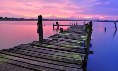

Exploring The Olympic Peninsula: A First Time Visitor Guide
Exploring The Olympic Peninsula: A First Time Visitor Guide The Olympic Peninsula is one of those places that feels like...
-
 World1 year ago
Types of Ants Living in the World and Information
-

 Forests1 year ago
The 10 Best Forests to Visit in the World
-

 Wildlife4 years ago
(10) Insects Are Animals in the world?
-

 Ocean2 years ago
Oceans in the World and Their Information & Locations
-

 Forests4 years ago
What Is The Biggest Rainforest In The World?
-

 Wildlife4 years ago
Most Popular Wild Animals in The World
-

 Forests2 years ago
The Main Factors That Contribute to Forest Destruction
-
 World1 year ago
The 10 Largest Farms in the World