
Mountain
20 Best Appalachian Trail Nature Spots for Hikers


Short Answer
The Appalachian Trail stretches over 2,190 miles through 14 states, and along that incredible journey are some of the most jaw-dropping nature spots in the eastern United States. Whether you are planning a thru-hike, a section hike, or just want to visit a few stunning viewpoints on weekend trips, these 20 destinations represent the absolute best the AT has to offer.
Key Takeaways
- The Appalachian Trail passes through 14 states from Georgia to Maine, offering an enormous variety of landscapes.
- The spots on this list range from easy roadside overlooks to strenuous all-day hikes, so there is something for every fitness level.
- Fall foliage season (mid-September to late October) is the most popular time to visit, but spring wildflower blooms and summer green canopies are equally spectacular.
- Many of these locations are accessible as day hikes from nearby trailheads, so you do not need to commit to a multi-day backpacking trip.
- Always check trail conditions and weather before heading out, especially at higher elevations where conditions can change rapidly.
- Leave No Trace principles apply everywhere on the trail. Pack out what you pack in, stay on marked trails, and respect wildlife.
Introduction
There is a moment, about a mile into any hike on the Appalachian Trail, when the sounds of the road fade away and the forest closes in around you. The air smells different. The light filters through the canopy in long, golden shafts. And somewhere ahead, over the next ridge or around the next bend, there is a view or a waterfall or a meadow that will stop you in your tracks.
The AT is not just a trail. It is a 2,190-mile corridor of natural wonder running from Springer Mountain in Georgia to Mount Katahdin in Maine. Along the way, it crosses rolling Piedmont farmland, cuts through ancient hardwood forests, climbs above the treeline on bald mountaintops, and passes through some of the most biologically diverse temperate forests on the planet.
This guide covers 20 of the very best nature spots along the entire length of the trail. Some are famous and well-visited. Others are quiet gems that most thru-hikers walk right past without stopping to appreciate. All of them are worth your time.
1. Clingmans Dome, Tennessee/North Carolina Border
About
At 6,643 feet, Clingmans Dome is the highest point on the entire Appalachian Trail and the third highest peak east of the Mississippi River. The trail passes just steps from the summit, making it one of the most accessible high-elevation experiences on the AT. A steep half-mile walkway leads to an observation tower with 360-degree views of the Great Smoky Mountains.
Highlights
The observation tower at the summit, panoramic views stretching up to 100 miles on clear days, spruce-fir forest that feels more like Canada than the southeastern United States, and the dramatic cloud inversions that frequently fill the valleys below.
Experience
Hike the half-mile paved path from the parking area to the tower. Walk the AT section that crosses just below the summit. On clear days, you can see seven states. In the early morning, clouds often sit below the ridgeline, creating a sea of white with mountain peaks poking through like islands.
Best Time to Visit
October offers the best combination of clear skies and fall color. Spring (April through May) brings wildflowers to the lower elevations. Summer can be hazy but the spruce-fir forest provides cool relief from the heat below.
Why Visit
This is the highest point on the AT, and the views are genuinely world-class. The spruce-fir forest near the summit is a remnant of the last ice age and contains species found nowhere else in the region.
Travel Tips
The parking area is at the end of Clingmans Dome Road, which is typically open from April through November. Arrive early to avoid crowds. The walkway is steep but paved. Bring a jacket, even in summer, as temperatures at the summit can be 20 degrees cooler than at the base.
2. McAfee Knob, Virginia
About
McAfee Knob is arguably the most photographed spot on the entire Appalachian Trail. This dramatic rock overhang juts out from a cliff face 1,600 feet above the Catawba Valley, providing a natural platform that looks like it was designed specifically for dramatic photos. The knob sits at 3,197 feet elevation on the ridge above the town of Catawba, Virginia.
Highlights
The iconic rock ledge that extends over the valley, views of the Catawba Valley and North Mountain, the sense of standing on the edge of the world, and the relatively moderate 4-mile hike from the VA 311 trailhead.
Experience
The hike from the VA 311 parking area is approximately 8.8 miles round trip with about 1,700 feet of elevation gain. The trail is well-maintained and moderately challenging. The final approach to the knob opens up suddenly, revealing the full scope of the cliff overhang and the valley spread out below.
Best Time to Visit
October is spectacular for fall color. Spring offers wildflowers and comfortable temperatures. Summer mornings are best to avoid heat and afternoon thunderstorms.
Why Visit
This is the most iconic viewpoint on the AT. The combination of the dramatic rock formation and the sweeping valley views makes it a must-see for any hiker. It is also featured prominently in the movie adaptation of “A Walk in the Woods” by Bill Bryson.
Travel Tips
The VA 311 trailhead has a small parking lot that fills up quickly on weekends. Consider the longer route from the Andy Layne Trail if the lot is full. Bring plenty of water, as there are no water sources on the ridge. Do not climb on the ledge in wet conditions.
3. The Pinnacles, Pennsylvania
About
While Pennsylvania has a reputation among thru-hikers for rocky, grinding trail sections, the Pinnacles near Hawk Rock offer a dramatic exception. This series of exposed rock outcrops along the ridge provides sweeping views of the Cumberland Valley and the surrounding Appalachian ridges. The area is part of the Michaux State Forest.
Highlights
Exposed quartzite rock formations, panoramic views of the Cumberland Valley to the east, Hawk Rock overlook nearby, and the unique geology of the ancient Appalachian ridges.
Experience
The Pinnacles are accessible via a short side trail from the main AT route. The views open up suddenly as you emerge from the forest onto the exposed rock. This is an excellent spot for a lunch break or a sunset watch. The nearby Hawk Rock offers an equally impressive overlook.
Best Time to Visit
Fall offers the best visibility and color. Spring is pleasant but can be buggy. Winter provides the clearest views but the rocks can be icy and dangerous.
Why Visit
This spot proves that Pennsylvania has real scenic beauty to offer. The views from the Pinnacles rival anything in the mid-Atlantic region, and the relative lack of crowds compared to more famous AT overlooks makes it feel like a hidden gem.
Travel Tips
The Pinnacles are located near the town of Duncannon, Pennsylvania. Access is from the AT itself, so you will need to hike in. Wear sturdy shoes for the rocky terrain. There is limited cell service in the area.
4. Dragon’s Tooth, Virginia
About
Dragon’s Tooth is a towering quartzite rock formation that rises 35 feet above the surrounding ridge like a jagged fang. Located on a spur trail off the AT near Catawba, Virginia, this geological oddity requires some scrambling to reach the top, but the views from the base are impressive on their own. The formation is part of a larger complex of exposed rock outcrops along the ridge.
Highlights
The dramatic quartzite spire, views of Catawba Valley and North Mountain, the scramble to the top for adventurous hikers, and the unique geological history written in the rock layers.
Experience
The hike from the Dragon’s Tooth trailhead on VA 785 is approximately 6 miles round trip with significant elevation gain. The final approach involves scrambling over and between large boulders. The views from the top of the formation are vertigo-inducing and spectacular. Even if you do not climb to the very top, the base offers excellent views.
Best Time to Visit
Spring and fall offer the best conditions. Summer can be hot and humid on the exposed rock. Winter ice makes the scramble dangerous.
Why Visit
Dragon’s Tooth is one of the most unique geological features on the AT. The combination of the dramatic rock formation, the physical challenge of the scramble, and the panoramic views make it an unforgettable experience.
Travel Tips
Wear gloves for the scramble. The rock can be slippery when wet. Combine with a visit to McAfee Knob and Tinker Cliffs for the “Triple Crown” of Virginia AT hiking. Bring at least two liters of water per person.
5. Tinker Cliffs, Virginia
About
Tinker Cliffs is a long, continuous line of exposed rock cliffs that runs along the ridge above Catawba Creek in Virginia. Unlike a single overlook point, the cliffs offer nearly a mile of dramatic views, with multiple spots to sit and take in the panorama. The AT runs directly along the cliff edge, making this one of the most sustained scenic experiences on the entire trail.
Highlights
Nearly a mile of continuous cliff-edge views, Catawba Creek valley far below, views of McAfee Knob across the valley, and the sense of walking along the edge of a vast, forested wilderness.
Experience
The AT passes directly along the cliffs, so any hiker on this section gets the full experience. The best approach is from the north via the Andy Layne Trail or from the south via VA 779. The cliffs are particularly dramatic at sunrise when the valley below fills with mist.
Best Time to Visit
October for fall color. Early morning in any season for misty valley views. Spring for wildflowers along the approach trails.
Why Visit
Tinker Cliffs offers one of the most sustained and dramatic scenic experiences on the AT. The sheer length of the cliff line means you can find a private spot even on busy days, and the views are consistently spectacular along the entire stretch.
Travel Tips
The cliffs are exposed, so bring sun protection and extra water. The rock edges can be unstable in places, so watch your footing. This is one of the three peaks of the Virginia “Triple Crown” along with McAfee Knob and Dragon’s Tooth.
6. Mount Washington, New Hampshire
About
At 6,288 feet, Mount Washington is the highest peak in the northeastern United States and home to some of the most extreme weather on Earth. The AT passes within a mile of the summit via the Appalachian Mountain Club’s trail network. The mountain holds the record for the highest wind speed ever recorded at the surface of the Earth: 231 miles per hour, measured in 1934.
Highlights
The treeless alpine summit, views of the Presidential Range, the Mount Washington Observatory, the historic Mount Washington Auto Road and Cog Railway, and the chance to experience genuine arctic conditions in the middle of New England.
Experience
The AT crosses the summit via a junction with the Gulfside Trail and the West Side Trail. On a clear day, the summit offers views of five states and into Canada. On a cloudy day, you might not be able to see your hand in front of your face. Either way, the experience of standing on this legendary peak is unforgettable.
Best Time to Visit
July through September offers the best chance of clear summit weather. Fall color in September and October is spectacular at lower elevations. Winter ascents are for experienced mountaineers only.
Why Visit
Mount Washington is a legend in the hiking world. The combination of extreme weather, alpine terrain, and the rich history of the mountain make it one of the most significant peaks in North America. The AT’s proximity to the summit makes it accessible to long-distance hikers and day-trippers alike.
Travel Tips
Weather on Mount Washington can change from sunny to life-threatening in minutes. Bring full rain gear, warm layers, and a map even in summer. Check the Mount Washington Observatory forecast before heading up. The summit is exposed and there is no shelter above treeline.
7. The Hundred-Mile Wilderness, Maine
About
The Hundred-Mile Wilderness is the most remote section of the entire Appalachian Trail, running from the town of Monson to the base of Mount Katahdin. There are no roads, no towns, and no resupply points for nearly 100 miles. This is the AT at its most wild and untamed, passing through dense boreal forest, alongside pristine lakes, and over rugged mountain ridges.
Highlights
Complete wilderness isolation, pristine lakes and ponds, moose sightings, the Gulf Hagas waterfall (side trail), the Barren-Chairback Range, and the sense of being truly far from civilization.
Experience
This is a multi-day backpacking experience that requires thorough preparation. The trail passes through some of the most remote forest in the eastern United States. Lakes like Chairback Pond and Cloud Pond offer campsites with mirror-still reflections. The Gulf Hagas side trail leads to a spectacular gorge with multiple waterfalls.
Best Time to Visit
Late June through September. Black flies are at their worst in early June. Fall color begins in mid-September and peaks in early October. Snow can arrive as early as late October.
Why Visit
This is the wildest section of the AT. If you want to experience what the Appalachian wilderness looked like before European settlement, this is as close as you can get in the eastern United States. The sense of remoteness and the quality of the forest are unmatched.
Travel Tips
This is a serious wilderness trek. Carry a water filter, bear canister or bear bag, and enough food for the full distance. Bug spray and head nets are essential in June and early July. Register at the trailheads. Cell service is nonexistent.
8. Blood Mountain, Georgia
About
At 4,458 feet, Blood Mountain is the highest point on the Appalachian Trail in Georgia and one of the most dramatic peaks in the southern Appalachians. The summit features a rock outcrop with a stone shelter built by the Civilian Conservation Corps in the 1930s. The views from the top extend for miles across the Blue Ridge Mountains.
Highlights
The CCC stone shelter at the summit, panoramic views of the Blue Ridge Mountains, the rocky summit outcrop, and the sense of accomplishment from climbing the highest AT point in Georgia.
Experience
The most popular route is from the Byron Reece Trailhead near Neels Gap, a 5.5-mile round trip with about 1,800 feet of elevation gain. The trail is steep but well-maintained. The summit shelter provides a windbreak and a place to rest. On clear days, the views extend to the Atlanta skyline, nearly 80 miles to the south.
Best Time to Visit
March through May for wildflowers and comfortable temperatures. October for fall color. Winter offers clear views but cold temperatures and occasional ice.
Why Visit
Blood Mountain is the crown jewel of the Georgia AT. The combination of the historic CCC shelter, the dramatic rocky summit, and the sweeping views make it one of the best day hikes in the entire southern Appalachians.
Travel Tips
The Byron Reece Trailhead is located near Neels Gap, home to the Walasi-Yi Interpretive Center, which is the only place the AT passes through a man-made structure. Resupply and gear are available here. Bring layers for the summit, as it is often windy and cold.
9. Roan Highlands, Tennessee/North Carolina Border
About
The Roan Highlands contain the longest stretch of grassy bald mountains along the entire Appalachian Trail. These high-elevation meadows, some above 6,000 feet, offer 360-degree views that are virtually unmatched in the southern Appalachians. The AT crosses a series of these balds, including Round Bald, Jane Bald, and Grassy Ridge, creating one of the most scenic high-elevation walks on the trail.
Highlights
Grassy balds with panoramic views, flame azalea and rhododendron blooms in June, the sense of walking across the top of the world, and views of the Black Mountains and the Great Smoky Mountains.
Experience
The most popular access is from the Carvers Gap parking area on Highway 261. From here, the AT north crosses Round Bald (one of the most spectacular viewpoints in the southern Appalachians) and continues along the ridge through a series of grassy meadows. The entire ridge walk is above treeline, with views in every direction.
Best Time to Visit
Mid-June for the famous rhododendron and flame azalea blooms, which turn the balds into a riot of pink and orange. October for fall color. July and August for warm weather and clear views.
Why Visit
The Roan Highlands offer the most spectacular high-elevation scenery in the southern Appalachians. The grassy balds are a unique ecological feature, and the views from the ridge are among the best on the entire AT. The June bloom season is one of the most celebrated natural events in the region.
Travel Tips
Carvers Gap has a small parking area that fills up quickly during bloom season. Arrive early or visit on weekdays. The ridge is fully exposed, so bring sun protection and rain gear. The balds are fragile ecosystems, so stay on the trail.
10. Harpers Ferry, West Virginia
About
Harpers Ferry is not a mountain summit or a waterfall, but it is one of the most historically significant and visually stunning spots on the entire Appalachian Trail. The town sits at the confluence of the Shenandoah and Potomac Rivers, surrounded by rocky cliffs and forested hills. The AT passes directly through the historic district, crossing the Potomac on a pedestrian bridge before climbing the cliffs of the Blue Ridge.
Highlights
The confluence of two rivers, the historic town with 19th-century architecture, the view from Jefferson Rock, the AT Conservancy headquarters (the psychological halfway point of the trail), and the dramatic cliff walk along the Shenandoah.
Experience
Harpers Ferry is the self-proclaimed “psychological halfway point” of the AT, and thru-hikers traditionally celebrate here. Walk through the historic district, visit the AT Conservancy headquarters, climb to Jefferson Rock for views of the river confluence, and explore the National Historical Park. The trail through town is paved and easy, making it a welcome break from the mountains.
Best Time to Visit
Spring and fall offer the best weather. Summer can be hot and humid but the rivers provide cooling. The town is beautiful year-round.
Why Visit
Harpers Ferry combines natural beauty with deep American history. The setting at the river confluence is genuinely dramatic, and the town offers food, lodging, and resupply for hikers. It is also a place of immense historical significance, site of John Brown’s raid in 1859.
Travel Tips
The town is accessible by car and by train (MARC commuter rail from Washington, D.C.). Parking can be limited, so consider taking the train. The National Historical Park charges an entry fee. Several restaurants and shops cater specifically to AT hikers.
11. Sunfish Pond, New Jersey
About
Sunfish Pond is a glacial lake nestled in a natural bowl atop Kittatinny Ridge in New Jersey. Designated as a National Natural Landmark, this pristine body of water sits at 1,400 feet elevation and is surrounded by dense hardwood forest. The AT passes directly along its shore, making it one of the most scenic water features on the entire trail.
Highlights
The crystal-clear glacial lake, the surrounding hardwood forest, the quiet and solitude despite being in relatively populated New Jersey, and the opportunity for a refreshing swim on hot days.
Experience
The AT runs along the eastern shore of the pond. A short side trail loops around the entire lake, offering different perspectives of the water and the surrounding forest. The pond is popular for swimming in summer, and the surrounding rocks make excellent sunbathing spots. In fall, the reflection of the colorful trees on the still water is breathtaking.
Best Time to Visit
June through September for swimming. October for fall foliage reflections. Spring for wildflowers and migrating birds.
Why Visit
Sunfish Pond is a hidden gem in a state not typically associated with wilderness. The glacial lake is beautiful, the swimming is excellent, and the AT’s passage right along the shore makes it easily accessible to thru-hikers and day-trippers alike.
Travel Tips
Access is from the Dunnfield Creek trailhead on I-80 or from the AT itself. The lake is a designated Natural Landmark, so follow all posted rules. No camping is allowed at the pond. Bring a towel and swimsuit in summer.
12. The Priest, Virginia
About
The Priest is a 4,063-foot peak in the George Washington National Forest of Virginia, and the trail to its summit is one of the steepest on the entire Appalachian Trail. The climb gains over 3,000 feet in just a few miles, making it a serious workout. But the reward at the top is a rocky summit with views that stretch across the Virginia Piedmont.
Highlights
The brutally steep climb, the rocky summit outcrop, views of the Shenandoah Valley and the Piedmont, the sense of accomplishment, and the relatively uncrowded trail compared to more famous Virginia peaks.
Experience
The AT crosses the summit of The Priest, so thru-hikers get the full experience. Day hikers can access the summit from the Crabtree Falls trailhead, which also passes the spectacular Crabtree Falls along the way. The climb is relentless, with long sections of steep switchbacks. The summit rewards with a rocky perch and sweeping views.
Best Time to Visit
Spring and fall for comfortable hiking temperatures. October for fall color. Summer can be extremely hot on the exposed climb.
Why Visit
The Priest offers one of the most challenging and rewarding climbs on the AT. The views from the summit are excellent, and the sense of accomplishment after the steep ascent is real. The combination with Crabtree Falls makes this one of the best day hikes in Virginia.
Travel Tips
This is a strenuous hike. Bring plenty of water (at least 3 liters per person) and snacks. Wear sturdy hiking boots with good ankle support. The descent is hard on the knees, so consider trekking poles. Start early to avoid afternoon heat.
13. Saddleback Mountain, Maine
About
Saddleback Mountain in Maine is one of the most dramatic peaks on the northern AT, featuring a long, narrow alpine ridge with steep drops on both sides. The summit area is above treeline, offering 360-degree views of the Maine wilderness. The Saddleback Mountain range includes several peaks connected by the exposed ridge, creating one of the most thrilling and scenic high-elevation walks on the trail.
Highlights
The narrow alpine ridge, views of the Rangeley Lakes region, the sense of exposure above treeline, alpine tundra vegetation, and the dramatic approach through dense boreal forest.
Experience
The AT crosses the Saddleback range via the ridge trail, which is fully exposed above treeline for over a mile. The approach from either side involves a significant climb through dense spruce-fir forest. Once on the ridge, the trail follows the narrow spine with steep drops on both sides. The views of the Rangeley Lakes and the surrounding Maine wilderness are spectacular.
Best Time to Visit
July through September for the best weather. Fall color begins in mid-September. Avoid during thunderstorms, as the ridge is extremely exposed.
Why Visit
Saddleback offers one of the most dramatic alpine experiences in Maine. The narrow ridge walk is thrilling and scenic, and the views of the Rangeley Lakes region are among the best in the northern Appalachians. This is the AT at its most rugged and beautiful.
Travel Tips
The ridge is fully exposed to weather. Bring full rain gear and warm layers even in summer. Do not attempt the ridge in thunderstorms or high winds. The approach trails are steep and rocky. Bring plenty of water and food.
14. Max Patch, North Carolina
About
Max Patch is a grassy bald mountain on the North Carolina-Tennessee border that offers one of the most spectacular 360-degree views in the entire southern Appalachians. The summit is a broad, open meadow at 4,629 feet, and the AT crosses directly over the top. The bald is maintained by the U.S. Forest Service to preserve the open character that has existed for centuries.
Highlights
The 360-degree panoramic views, the open grassy summit, views of the Great Smoky Mountains to the south and the Black Mountains to the east, excellent stargazing, and the sense of standing on top of the world.
Experience
The AT crosses the summit of Max Patch, and the views open up gradually as you climb the final approach. Once on top, the entire world seems to spread out below you. This is one of the best spots on the AT for watching sunrise or sunset. The open meadow is also excellent for stargazing on clear nights.
Best Time to Visit
Year-round. Spring brings wildflowers to the meadow. Summer offers warm evenings perfect for stargazing. Fall color surrounds the bald in October. Winter provides the clearest views.
Why Visit
Max Patch is one of the most scenic and accessible bald mountains on the AT. The 360-degree views are among the best in the southern Appalachians, and the open summit creates a sense of freedom and space that is rare in the forested southern mountains.
Travel Tips
The summit is exposed, so bring layers and sun protection. Camping is no longer allowed on the summit to protect the fragile meadow. The parking area is a short walk from the summit. This is an excellent spot for a picnic lunch.
15. Taggart Hill to Franconia Ridge, New Hampshire
About
While the entire Franconia Ridge is spectacular, the section from Taggart Hill through the Falling Waters Trail approach to the ridge offers one of the most scenic day hikes in the White Mountains. The ridge walk crosses Little Haystack Mountain, Lincoln, and Lafayette, all above treeline, with views that rank among the best in the eastern United States.
Highlights
The above-treeline ridge walk, views of the Pemigewasset Wilderness, Eagle Falls along the Falling Waters Trail, the Greenleaf Hut, and the summit of Mount Lafayette at 5,249 feet.
Experience
The Falling Waters Trail passes three waterfalls on the way to the ridge. Once above treeline, the trail follows the narrow ridge with dramatic views on both sides. The Greenleaf Hut provides shelter and water (seasonal). The descent via the Old Bridle Path loops back to the trailhead, creating one of the best loop hikes in New England.
Best Time to Visit
June through September. Fall color in September and early October is spectacular. Winter ascents require mountaineering experience and equipment.
Why Visit
Franconia Ridge is widely considered one of the top three ridge walks in the eastern United States (along with Mount Washington and Katahdin). The combination of waterfalls, alpine terrain, and sweeping views makes this an essential AT experience.
Travel Tips
This is a full-day hike of 8.9 miles with over 4,000 feet of elevation gain. Start early. The ridge is fully exposed, so bring full rain gear and warm layers. The Falling Waters Trail parking lot fills up by 7 AM on summer weekends. Consider the shuttle from the Cannon Mountain tramway.
16. Catawba Meadows, Virginia
About
The Catawba Valley in western Virginia is a broad, fertile valley surrounded by the ridges of the Appalachian Mountains. The AT crosses the valley and follows its western edge, offering views of farmland, meadows, and the surrounding mountains. The valley is named for the Catawba people who once inhabited the region, and the area has a rich cultural history alongside its natural beauty.
Highlights
The pastoral valley views, the contrast between farmland and wild mountain ridges, the Catawba Creek, the wildflowers in spring, and the peaceful, gentle terrain after the rigors of the mountains.
Experience
The AT crosses the Catawba Valley between McAfee Knob and Dragon’s Tooth. The trail passes through meadows and along the edges of farmland, offering a different kind of beauty than the dramatic cliff views nearby. The valley is particularly beautiful in spring when the wildflowers bloom and the farmland is green.
Best Time to Visit
May for wildflowers. October for fall color in the surrounding mountains. Summer for warm, pleasant walking.
Why Visit
The Catawba Valley offers a gentler, more pastoral side of the AT that is often overlooked in favor of dramatic summit views. The contrast between the cultivated valley and the wild mountains is beautiful and thought-provoking, and the easy terrain provides a welcome respite.
Travel Tips
The valley is accessible from several roads, including VA 311 and VA 785. The town of Catawba has a small store and the Homeplace restaurant, a legendary AT hiker hangout. Combine with visits to McAfee Knob, Dragon’s Tooth, and Tinker Cliffs.
17. Mount Cammerer, Tennessee/North Carolina Border
About
Mount Cammerer is a 4,928-foot peak on the eastern edge of the Great Smoky Mountains National Park, and its summit features a historic stone fire tower with some of the most spectacular views in the southern Appalachians. The AT passes near the summit, and a short side trail leads to the tower. The 360-degree views from the tower encompass the Smokies, the Blue Ridge, and the Piedmont.
Highlights
The historic stone fire tower, 360-degree views of the Great Smoky Mountains, the relatively moderate hike from Low Gap, and the sunset views from the tower, which are among the best in the park.
Experience
The most popular route is from the Cosby Campground via the Low Gap Trail, which connects to the AT. From the AT, a short spur trail leads to the summit and the fire tower. The tower is a 360-degree enclosed observation deck that provides shelter from the wind while offering unobstructed views in every direction.
Best Time to Visit
October for fall color. Spring for wildflowers. Summer for clear mountain air. The tower is accessible year-round but the approach trails may be icy in winter.
Why Visit
The Mount Cammerer fire tower offers some of the best views in the Great Smoky Mountains without the crowds of more popular destinations like Clingmans Dome. The historic tower itself is a beautiful structure, and the views from the top are genuinely world-class.
Travel Tips
The hike from Cosby Campground is approximately 11.2 miles round trip. The tower can be windy, so bring a jacket. Sunset from the tower is spectacular but plan your descent carefully. Headlamps are essential for the return hike after dark.
18. The Mahoosuc Notch, Maine
About
The Mahoosuc Notch is a mile-long boulder field in the Mahoosuc Range of western Maine, and it is widely considered the most difficult mile on the entire Appalachian Trail. The trail passes through a narrow gap between two mountains, filled with house-sized boulders that hikers must climb over, under, and around. It is a unique and unforgettable experience that tests every hiker’s agility and determination.
Highlights
The massive boulder field, the sense of adventure and exploration, the ice that persists in the deepest crevices even in summer, the satisfaction of completing the notch, and the surrounding Mahoosuc Range scenery.
Experience
Hiking the Mahoosuc Notch is less like walking and more like solving a three-dimensional puzzle. Hikers must climb over boulders, squeeze through gaps, and occasionally remove their packs to fit through tight spaces. The deepest parts of the notch are permanently shaded and can contain ice even in July. Most hikers take 2 to 4 hours to cover the single mile.
Best Time to Visit
July through September. The boulders are driest and safest during this period. Early summer may have ice in the deepest crevices. Fall is beautiful but the rocks can be slippery with fallen leaves.
Why Visit
The Mahoosuc Notch is the most unique and challenging section of the AT. No other trail in the eastern United States offers anything like it. Completing the notch is a badge of honor for any hiker, and the sense of accomplishment is immense.
Travel Tips
Wear long pants to protect your legs from scrapes. Gloves are helpful for gripping wet rocks. Pack light and compact, as you will need to remove your pack and push it through gaps. Allow extra time and do not rush. The notch is best hiked north to south.
19. Mount Greylock, Massachusetts
About
At 3,491 feet, Mount Greylock is the highest point in Massachusetts and the only place in the state where the AT crosses above treeline. The summit features a 93-foot war memorial tower, a rustic lodge (the Bascom Lodge), and views that extend into five states on clear days. Henry David Thoreau climbed Greylock in 1844 and wrote about the experience, cementing the mountain’s place in American literary history.
Highlights
The war memorial tower, the Bascom Lodge, views of five states, the only alpine environment in Massachusetts, and the literary and cultural history of the mountain.
Experience
The AT crosses the summit of Mount Greylock, so thru-hikers get the full experience. Day hikers can drive to the summit via Rockwell Road (seasonal) or hike up from several trailheads. The summit area includes the tower, the lodge, and several viewpoints. The boreal forest on the upper slopes contains species more typical of Canada.
Best Time to Visit
June through October. The road to the summit is typically open from late May through early November. Fall color in October is spectacular. Winter access is possible but requires snowshoes or skis.
Why Visit
Mount Greylock is the highest point in Massachusetts and offers a unique alpine experience in a state not known for mountains. The combination of natural beauty, cultural history, and the AT’s passage over the summit make it an essential stop.
Travel Tips
Bascom Lodge offers overnight accommodations and meals (reservations recommended). The summit road is closed in winter. The AT approach from the south is approximately 7 miles from the Cheshire Harbor trailhead. Bring layers for the summit, as it is often cold and windy.
20. Mount Katahdin, Maine
About
Mount Katahdin is the northern terminus of the Appalachian Trail and one of the most dramatic peaks in the eastern United States. At 5,269 feet, it rises nearly a mile above the surrounding forest, with a massive tableland summit, sheer cliff faces, and the famous Knife Edge ridge. Katahdin is the crown jewel of Baxter State Park and the ultimate destination for northbound thru-hikers.
Highlights
The Knife Edge ridge (a narrow, exposed arete with 2,000-foot drops on both sides), the summit tableland, the sign marking the northern terminus of the AT, the views of the Maine wilderness stretching to the horizon, and the sense of completing a 2,190-mile journey.
Experience
The most popular route to the summit is the Hunt Trail (the AT route), which approaches from the west and crosses the Knife Edge before reaching the summit. The Knife Edge is a half-mile traverse across a narrow ridge with dramatic exposure on both sides. The summit features a large cairn with the AT terminus sign and views that extend for 100 miles on clear days.
Best Time to Visit
June through September. The park gates are typically open from mid-May through mid-October. Fall color begins in mid-September. Weather on Katahdin can be severe at any time of year.
Why Visit
Katahdin is the ultimate destination of the Appalachian Trail and one of the most dramatic mountains in the eastern United States. The Knife Edge is one of the most thrilling ridge walks in the country, and the summit views are a fitting reward for the long journey from Georgia.
Travel Tips
Baxter State Park requires reservations and has a daily vehicle limit. Arrive early or take the shuttle. The Hunt Trail is 5.2 miles one way with 4,200 feet of elevation gain. The Knife Edge should not be attempted in wet or windy conditions. Register at the trailhead. Bring full rain gear, warm layers, and plenty of food and water.
Summary Table
| # | Spot | State(s) | Best Time to Visit | Difficulty |
|---|---|---|---|---|
| 1 | Clingmans Dome | TN/NC | October | Easy (paved walk) |
| 2 | McAfee Knob | VA | October | Moderate |
| 3 | The Pinnacles | PA | Fall | Moderate |
| 4 | Dragon’s Tooth | VA | Spring/Fall | Strenuous |
| 5 | Tinker Cliffs | VA | October | Moderate |
| 6 | Mount Washington | NH | July – September | Strenuous |
| 7 | Hundred-Mile Wilderness | ME | July – September | Very Strenuous |
| 8 | Blood Mountain | GA | March – May | Moderate |
| 9 | Roan Highlands | TN/NC | June (blooms) | Easy – Moderate |
| 10 | Harpers Ferry | WV | Spring/Fall | Easy |
| 11 | Sunfish Pond | NJ | June – September | Easy – Moderate |
| 12 | The Priest | VA | Spring/Fall | Very Strenuous |
| 13 | Saddleback Mountain | ME | July – September | Strenuous |
| 14 | Max Patch | NC | Year-round | Easy – Moderate |
| 15 | Franconia Ridge | NH | June – September | Strenuous |
| 16 | Catawba Meadows | VA | May | Easy |
| 17 | Mount Cammerer | TN/NC | October | Moderate |
| 18 | Mahoosuc Notch | ME | July – September | Very Strenuous |
| 19 | Mount Greylock | MA | June – October | Moderate |
| 20 | Mount Katahdin | ME | June – September | Very Strenuous |
Frequently Asked Questions
How long does it take to hike the entire Appalachian Trail?
Most thru-hikers take 5 to 7 months to complete the entire 2,190-mile trail. Some experienced hikers finish in under 4 months, while others take 8 months or more. Section hikers may take several years to complete the full trail in individual trips.
Do I need permits to hike on the Appalachian Trail?
The AT itself does not require a permit for day hiking or thru-hiking. However, some specific areas along the trail do require permits or reservations. Baxter State Park (Mount Katahdin) has a reservation system. The Great Smoky Mountains National Park requires backcountry permits for overnight camping. Always check the regulations for the specific section you plan to hike.
What is the best time of year to hike the Appalachian Trail?
For thru-hikers, most northbound hikers start in early spring (March to April) from Springer Mountain, Georgia, and finish at Mount Katahdin in late summer or fall. For day hikers and section hikers, the best time depends on the specific section. Generally, late spring through early fall offers the best conditions, with fall foliage season (mid-September to late October) being the most popular for scenic visits.
Is the Appalachian Trail safe for beginner hikers?
Many sections of the AT are suitable for beginners, particularly the lower-elevation sections in Virginia, West Virginia, and Pennsylvania. However, some sections, especially in New Hampshire and Maine, are extremely challenging and require experience and proper equipment. Beginners should start with shorter day hikes on well-marked sections and gradually build up to longer trips.
How do I access these spots if I am not thru-hiking?
Every spot on this list is accessible as a day hike or short overnight trip from a road-accessible trailhead. The Appalachian Trail Conservancy and local trail clubs maintain detailed guidebooks and maps for each section. Many of the spots are also accessible via side trails that are shorter than hiking the AT itself to reach them.
What should I pack for a day hike to these spots?
Essentials include sturdy hiking boots, at least 2 liters of water per person, snacks or lunch, a map of the area, sun protection (hat, sunscreen, sunglasses), rain gear, a headlamp, and a basic first aid kit. For more remote spots or longer hikes, add extra water, warm layers, and a fully charged phone. Trekking poles are helpful on steep terrain.
Can I camp along the Appalachian Trail?
Yes, the AT has a network of shelters, tent platforms, and designated campsites along its entire length. In many areas, dispersed camping is also allowed. However, some areas have specific camping restrictions to protect sensitive environments. Always follow Leave No Trace principles and check local regulations before setting up camp.
Are dogs allowed on the Appalachian Trail?
Dogs are allowed on most sections of the AT but must be kept on a leash. However, dogs are not allowed in the Great Smoky Mountains National Park section or on the Baxter State Park section (Mount Katahdin). Always check the regulations for the specific section you plan to hike, and be considerate of other hikers and wildlife.
Conclusion
The Appalachian Trail is more than just a hiking path. It is a 2,190-mile journey through some of the most beautiful and diverse landscapes in the eastern United States. From the grassy balds of the Roan Highlands to the alpine ridges of New Hampshire, from the historic streets of Harpers Ferry to the wild boulder fields of the Mahoosuc Notch, every section of the trail offers something unique and unforgettable.
Whether you dream of thru-hiking the entire trail someday or simply want to visit a few of these incredible spots on weekend trips, the AT has something for you. These 20 destinations represent the very best of what the trail has to offer, and each one deserves a place on every nature lover’s bucket list.
The trail is waiting. Lace up your boots, pack your bag, and go find your own moment of wonder on the Appalachian Trail.
Found this guide helpful? Share it with your fellow hikers and start planning your next Appalachian Trail adventure today. Drop a comment below with your favorite AT spot that did not make the list. We would love to hear about it.


The Most Beautiful Mountain Railways in the World
Some train journeys are about getting from point A to point B. Then there are mountain railways that make the journey itself the destination. These incredible rail lines wind through towering peaks, cross dramatic gorges, and climb to altitudes that will leave you breathless — both from the height and the views.
We’ve rounded up ten of the most stunning mountain railways on the planet, from century-old engineering marvels to modern lines cutting through dramatic landscapes. Whether you are a train enthusiast or a nature lover, these routes deserve a spot on your travel list.
Key Takeaways
- Mountain railways offer some of the most scenic train journeys on Earth, crossing high-altitude passes, deep valleys, and dramatic landscapes
- Many of these lines are engineering marvels built over a century ago, still running with original carriages and steam locomotives
- The best time to ride most mountain railways is between May and October, when weather is clear and mountain views are at their peak
- Some routes require advance booking, especially during summer months and holiday seasons
- These railways are perfect for travelers who want to experience high-altitude landscapes without the physical demands of hiking
Why Mountain Railways Are So Special
There is something about watching mountains roll past your train window that no airplane or car can replicate. You move slowly enough to absorb every detail — the way light shifts across a glacier, the tiny wildflowers clinging to a cliff face, the distant sound of a waterfall you cannot quite see.
Mountain railways were often built as feats of engineering necessity, connecting isolated communities through terrain that seemed impossible to cross. Today, many of these lines have become heritage attractions, drawing travelers from around the world who want to experience the golden age of rail travel against some of the most dramatic backdrops on Earth.
The Most Beautiful Mountain Railways in the World
1. The Glacier Express, Switzerland
About: Often called the “slowest express train in the world,” the Glacier Express runs 291 kilometers between Zermatt and St. Moritz through the heart of the Swiss Alps, crossing 291 bridges and passing through 91 tunnels.
Highlights: The Oberalp Pass at 2,033 meters offers panoramic views of snow-capped peaks and the Rhine Gorge, sometimes called the “Swiss Grand Canyon.” Panoramic windows are designed specifically for sightseeing.
Best Time to Visit: June through September for the clearest views. December through March is stunning for snow-covered landscapes.
Why You Should Visit: Widely considered the most scenic train ride in Europe, connecting two iconic mountain resorts through dramatic Alpine scenery.
Travel Tips: Reserve seats 2-3 months ahead in summer. Panorama car seats cost extra but are worth it. Bring sunglasses for snow glare at altitude. Official Glacier Express website
2. The Darjeeling Himalayan Railway, India
About: This narrow-gauge railway, known as the “Toy Train,” runs 88 kilometers from New Jalpaiguri up to Darjeeling in West Bengal. Built between 1879 and 1881, it climbs to over 2,200 meters and is a UNESCO World Heritage Site.
Highlights: The line passes through tea plantations and dense forests with views of Kanchenjunga, the world’s third-highest mountain. The loop at Batty Loop and spiral at Agony Point are remarkable engineering feats.
Best Time to Visit: October through December for the clearest mountain views. March and April bring blooming rhododendrons. Avoid monsoon season (June-September).
Why You Should Visit: One of the most charming heritage railways in the world, combining colonial-era engineering, Himalayan scenery, and the cultural richness of the Darjeeling region.
Travel Tips: The full journey takes about 7 hours. The “Joy Train” joyride from Darjeeling to Ghum is a good shorter option. Wikipedia: Darjeeling Himalayan Railway
3. The Bernina Express, Switzerland to Italy
About: Running from Chur, Switzerland, to Tirano, Italy, the Bernina Express crosses the Bernina Pass at 2,253 meters — the highest adhesion railway in Europe. The route is part of the Rhaetian Railway UNESCO World Heritage site.
Highlights: The Landwasser Viaduct — a curved stone bridge plunging into a tunnel carved through solid rock — is unforgettable. You will pass glaciers, alpine meadows, and the stunning Lago Bianco before descending into Mediterranean Italy.
Best Time to Visit: May through October for clear views. Autumn is spectacular when larch trees turn gold between Ospizio Bernina and Poschiavo.
Why You Should Visit: This railway crosses one of the most dramatic altitude changes in Europe, taking you from Alpine glaciers to Mediterranean landscapes in just a few hours.
Travel Tips: Seat reservation is mandatory. The Swiss Travel Pass covers the route but not the reservation fee. Bring layers — it is much colder at the pass summit. Rhaetian Railway official site
4. The Rocky Mountaineer, Canada
About: The Rocky Mountaineer operates daylight-only routes through the Canadian Rockies, with the flagship “First Passage to the West” running from Vancouver to Banff and Lake Louise.
Highlights: The route passes through the Fraser Canyon, crosses the Continental Divide, and winds along the Kicking Horse River. Glaciers, turquoise lakes, and wildlife including bears and mountain goats are visible from glass-domed carriages.
Best Time to Visit: April through October. September is particularly beautiful when larch trees turn brilliant gold at higher elevations.
Why You Should Visit: The Canadian Rockies are among the most dramatic mountain landscapes on Earth, and the daylight-only schedule means every minute is spent soaking in the views.
Travel Tips: GoldLeaf service starts around $1,500 USD for the two-day journey. Book 3-6 months ahead for summer. Bring binoculars and a polarizing filter for the turquoise lakes. Rocky Mountaineer official site
5. The Tren a las Nubes, Argentina
About: One of the highest railways in the world, the Tren a las Nubes runs from Salta to the La Polvorilla viaduct in northwestern Argentina, reaching 4,220 meters as it crosses the Andes.
Highlights: The La Polvorilla viaduct — a curved steel bridge 64 meters high spanning a deep gorge at extreme altitude — is the star. The Quebrada del Toro’s red-rock canyon formations look almost otherworldly.
Best Time to Visit: April through November (dry season) for the clearest skies. The service can be disrupted by weather between December and March.
Why You Should Visit: Riding a train above the clouds at over 4,000 meters is a bucket-list experience. The stark, colorful landscapes of the Argentine Andes are unlike anything else on Earth.
Travel Tips: Take altitude sickness seriously — drink water, avoid alcohol the night before, and bring warm layers. A doctor travels on every trip. Wikipedia: Tren a las Nubes
6. The Flåm Railway, Norway
About: One of the steepest standard-gauge railways in the world, the Flåm Railway descends 864 meters over just 20 kilometers from Myrdal to the village of Flåm on the Aurlandsfjord.
Highlights: The train passes through 20 tunnels and crosses gorges with waterfalls cascading down sheer rock faces. The Kjosfossen waterfall stop lets passengers watch water plunge 225 meters down the mountainside.
Best Time to Visit: May through September for the best weather. The Kjosfossen waterfall is most impressive in late spring during snowmelt.
Why You Should Visit: Incredible scenery packed into a one-hour journey. Easily combined with a fjord cruise on the UNESCO-listed Nærøyfjord for one of Norway’s best day trips.
Travel Tips: Sit on the right side for the best views on the descent. Book online in advance — it is extremely popular in summer. Flåm Railway official site
7. The Qinghai-Tibet Railway, China
About: The highest railway in the world, climbing to 5,072 meters at the Tanggula Pass on its 1,956-kilometer route from Xining to Lhasa across the Tibetan Plateau.
Highlights: The train passes Qinghai Lake, crosses the Kunlun and Tanggula ranges, and traverses vast grasslands with snow-capped peaks on the horizon. Tibetan antelope and wild yaks can sometimes be spotted from the train.
Best Time to Visit: May through October for the best weather. September and October offer stable conditions and excellent visibility.
Why You Should Visit: A journey across one of the most extreme and beautiful landscapes on the planet. The engineering required to build a railway across permafrost at 5,000 meters is staggering.
Travel Tips: You need a Tibet Travel Permit in addition to your Chinese visa. Acclimatize in Xining (2,200m) before continuing to Lhasa (3,650m). Bring warm clothing even in summer. Wikipedia: Qinghai-Tibet Railway
8. The Semmering Railway, Austria
About: Built between 1848 and 1854, the Semmering Railway was the first mountain railway in Europe built with a standard-gauge track. It runs 41 kilometers through the Semmering Pass and is a UNESCO World Heritage Site.
Highlights: Sixteen viaducts and 15 tunnels cross the pass, with stone arch bridges blending seamlessly into forested mountains. The views of rolling green hills and distant Alpine peaks are stunning in every season.
Best Time to Visit: May through October for green mountain views. December through February for a snowy winter wonderland.
Why You Should Visit: This is where mountain railway history began. The viaducts and tunnels are the same ones engineers built 170 years ago, and the scenery has not changed a bit.
Travel Tips: Regular Austrian Federal Railways (ÖBB) trains run this route — no special ticket needed. Check for special steam train runs on select weekends. Wikipedia: Semmering Railway
9. The PeruRail Central Andean Railway, Peru
About: Running from Cusco to Puno on Lake Titicaca, this railway crosses the Andean altiplano at altitudes up to 4,313 meters, covering about 388 kilometers in approximately 10 hours.
Highlights: The vast altiplano grassland dotted with llamas and alpacas, the La Raya Pass at 4,313 meters, and small Andean villages where locals sell handmade textiles at station stops.
Best Time to Visit: May through September (dry season) for the clearest skies and best views.
Why You Should Visit: Dramatic mountain scenery, indigenous culture, and the sheer altitude make this one of the most unique rail experiences in the world, ending at the world’s highest navigable lake.
Travel Tips: Acclimatize in Cusco (3,400m) for at least a day before riding. Bring warm layers, sunscreen, and water. The observation car is worth the upgrade. PeruRail official site
10. The West Highland Line, Scotland
About: Running from Glasgow to Mallaig on Scotland’s west coast, this 264-kilometer line passes through some of the most wild and beautiful landscapes in the British Isles, including the famous Glenfinnan Viaduct.
Highlights: The Glenfinnan Viaduct — a 21-arch curved stone bridge crossing a deep valley with Loch Shiel behind it — is the showstopper. Rannoch Moor, a vast and desolate expanse of bog and water, feels like the edge of the world.
Best Time to Visit: May through September for the longest days. The Jacobite steam train runs from May to October. Autumn brings beautiful heather colors to the moors.
Why You Should Visit: One of the most atmospheric train journeys in the world. Rugged moors, misty lochs, and historic viaducts create a landscape that feels ancient and untamed.
Travel Tips: Sit on the left side for the best views. The regular ScotRail service is much cheaper than the Jacobite steam train. Book the Jacobite months ahead for summer. ScotRail official site
Comparison Table: Mountain Railways at a Glance
| Railway | Country | Max Altitude | Best Time to Visit |
|---|---|---|---|
| Glacier Express | Switzerland | 2,033 m | Jun – Sep |
| Darjeeling Himalayan Railway | India | 2,200 m | Oct – Dec |
| Bernina Express | Switzerland / Italy | 2,253 m | May – Oct |
| Rocky Mountaineer | Canada | 1,600 m | Jun – Sep |
| Tren a las Nubes | Argentina | 4,220 m | Apr – Nov |
| Flåm Railway | Norway | 864 m | May – Sep |
| Qinghai-Tibet Railway | China | 5,072 m | May – Oct |
| Semmering Railway | Austria | 898 m | May – Oct |
| PeruRail Central Andean | Peru | 4,313 m | May – Sep |
| West Highland Line | Scotland | 411 m | May – Sep |
Tips for Making the Most of Your Mountain Railway Journey
Book early. The most popular railways — the Glacier Express, Rocky Mountaineer, and Jacobite Steam Train — sell out months in advance during peak season. Aim to reserve at least 3 months ahead for summer trips.
Choose your seat wisely. One side of the train almost always offers better views. On the Flåm Railway, sit right for the descent. On the West Highland Line, sit left. Research the route before you book.
Bring the right gear. Pack warm layers, sunglasses, and sunscreen even in summer. For routes above 3,000 meters, bring water and consider altitude sickness medication.
Camera ready. The best views come and go in seconds. Keep your camera charged and within reach. A polarizing filter helps with mountain lake and snow glare.
Frequently Asked Questions
Q: Are mountain railways safe for people afraid of heights?
A: Most are very safe and travel at moderate speeds. Some routes cross high viaducts that can be intense for acrophobic travelers. If heights bother you, choose a center seat and focus on the mountains rather than the drops below.
Q: What is the highest railway in the world?
A: The Qinghai-Tibet Railway in China reaches 5,072 meters at the Tanggula Pass. The Tren a las Nubes in Argentina is second at 4,220 meters. Both require preparation for altitude sickness.
Q: How much does a mountain railway journey cost?
A: Prices range dramatically. Scotland’s West Highland Line costs around $50-80 USD. The Glacier Express runs about $150-300 USD. The Rocky Mountaineer starts at around $1,500 USD for the two-day GoldLeaf experience.
Q: Do mountain railways operate in winter?
A: Most do, though schedules may be reduced. Winter rides through snow-covered mountains can be spectacular. The Flåm, Semmering, and West Highland lines operate year-round. The Rocky Mountaineer and Tren a las Nubes are seasonal.
Q: Can I use a rail pass?
A: In Europe, the Eurail Pass covers the Semmering and West Highland lines. The Swiss Travel Pass covers the Glacier Express route (seat reservations extra). Premium experiences like the Rocky Mountaineer require separate tickets.
Q: What should I pack for a mountain railway trip?
A: Warm layers, sunscreen, sunglasses, a water bottle, snacks, and a camera. For routes above 3,000 meters, bring altitude sickness medication. For longer journeys, bring a book or downloaded entertainment for the less scenic stretches.
Conclusion
Mountain railways offer something no other form of travel can match — the chance to sit comfortably while the world’s most dramatic landscapes unfold outside your window. From the snow-capped Swiss Alps to the vast Tibetan Plateau, from the red-rock canyons of Argentina to the misty Scottish Highlands, these routes prove that sometimes the journey really is better than the destination.
These railways were built by people who refused to let mountains stand in their way. Riding them is a reminder of what human ingenuity can achieve — and a promise that some of the best views in the world are best enjoyed from a train seat.
Share this post with your friends and start planning your next mountain railway adventure today.
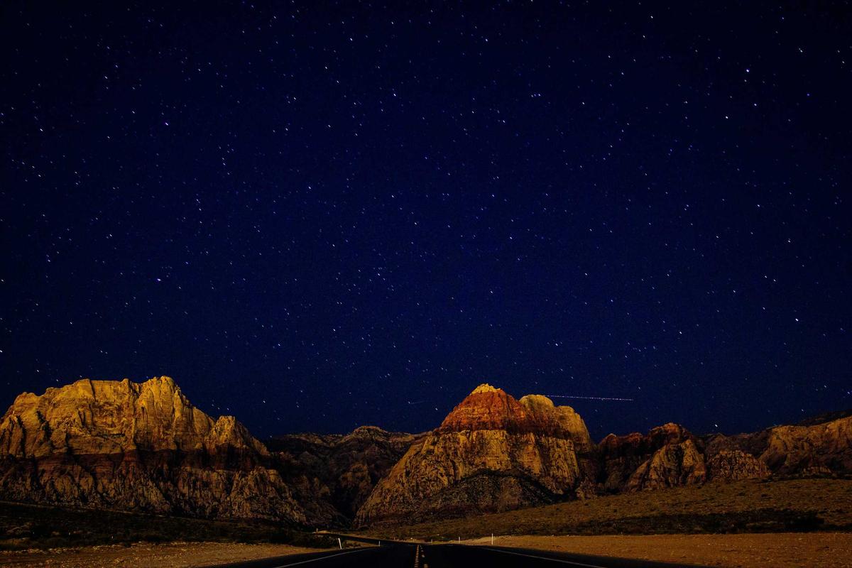
The Sierra Nevada — California’s Mountain Treasure
The Sierra Nevada is one of the most spectacular mountain ranges in North America, stretching 400 miles through eastern California and into Nevada. If you are looking for a destination that combines dramatic peaks, crystal-clear lakes, ancient forests, and some of the best hiking in the United States, this is it. From the granite walls of Yosemite to the summit of Mount Whitney, the Sierra Nevada delivers an experience that stays with you for life.
Key Takeaways
- The Sierra Nevada spans roughly 400 miles along California edge, with peaks reaching over 14,000 feet.
- Yosemite, Sequoia, and Kings Canyon National Parks all sit within the range, offering world-class hiking, camping, and wildlife viewing.
- The range is home to giant sequoia trees, the largest living organisms on Earth by volume.
- Best time to visit is late June through September for hiking, and December through March for winter sports.
- Over 400 miles of trails cater to everyone from casual day hikers to serious backpackers.
What Makes the Sierra Nevada Special
There is something about the Sierra Nevada that hits different from other mountain ranges. Maybe it is the way the granite catches the light at sunset, turning entire cliff faces gold and pink. Maybe it is the sheer scale of the landscape — valleys carved by glaciers millions of years ago, now filled with rivers and meadows so green they look photoshopped. Or maybe it is the fact that you can stand at the summit of the highest peak in the contiguous United States and see wilderness stretching in every direction.
The range runs north to south along California eastern side, forming a natural wall between the Central Valley and the Great Basin. Its name means snowy range in Spanish, and for good reason — winter storms dump massive amounts of snow here, feeding rivers that supply much of California water. The snowpack is so important that scientists measure it every year to predict water availability for the entire state.
But the Sierra Nevada is not just about snow and water. It is a place of incredible biodiversity. You will find ecosystems ranging from oak woodlands at lower elevations to alpine tundra above the tree line. Black bears, mule deer, coyotes, and mountain lions all call these mountains home. And if you are lucky, you might spot a Sierra Nevada bighorn sheep — one of the rarest mammals in North America.
The Iconic Parks and Destinations
Yosemite National Park
No conversation about the Sierra Nevada is complete without Yosemite. This is the crown jewel, the place that made people realize mountains were worth protecting. El Capitan rises 3,000 feet from the valley floor, a sheer granite wall that draws rock climbers from around the world. Half Dome, with its distinctive sliced profile, is one of the most recognizable landmarks on the planet.
But Yosemite is not just about the big names. Walk the Mist Trail to Vernal Fall on a spring morning and you will feel the spray on your face as thousands of gallons of water crash over the edge. Drive up to Glacier Point for a view that will make your jaw drop. Or simply sit by the Merced River in Yosemite Valley and watch the light change on the cliffs as the day goes by.
Best time to visit: May through October. Spring brings the waterfalls at peak flow. Summer offers warm days and access to high-country trails. Fall is quieter, with fewer crowds and beautiful color in the valley.
Sequoia and Kings Canyon National Parks
Head south and you will find Sequoia and Kings Canyon, two parks that share a border and a common claim to fame: giant sequoia trees. These are the largest trees on Earth by volume, and standing next to one is a humbling experience. The General Sherman Tree, located in the Giant Forest, is the biggest of them all — 275 feet tall and over 36 feet in diameter at the base.
Kings Canyon itself is one of the deepest canyons in North America, deeper than the Grand Canyon in some measurements. The Kings River has carved a dramatic gorge through the granite, and the drive down into the canyon is one of the most scenic in California.
Best time to visit: June through September. The road to Cedar Grove in Kings Canyon typically opens in late April or May and closes after the first significant snowfall, usually in November.
Lake Tahoe
Straddling the California-Nevada border, Lake Tahoe is the largest alpine lake in North America. The water is famously clear — on a calm day, you can see down 70 feet or more. The lake sits at 6,225 feet elevation, surrounded by peaks that rise another 3,000 to 4,000 feet above the shoreline.
In summer, Tahoe is a paradise for swimming, kayaking, and paddleboarding. The water is cold — it rarely gets above 68 degrees even in August — but that is part of the appeal. In winter, the area transforms into one of the premier ski destinations in the country, with resorts like Palisades Tahoe, Heavenly, and Northstar drawing millions of visitors.
Best time to visit: Year-round. Summer for water activities and hiking, winter for skiing and snowboarding, fall for fewer crowds and beautiful aspen color.
Mount Whitney
At 14,505 feet, Mount Whitney is the highest peak in the contiguous United States. The summit is accessible via a 22-mile round-trip trail that starts at Whitney Portal, elevation 8,360 feet. It is a serious hike — most people take two to three days — but you do not need technical climbing skills to reach the top. You do need a permit, and they are competitive. Apply early through the Inyo National Forest lottery system.
The view from the summit is extraordinary. On a clear day, you can see the Central Valley to the west and the Great Basin to the east. It is a reminder of just how vast and wild the Sierra Nevada really is.
Best time to visit: July through September, when most of the snow has melted and the trail is clear.
Devils Postpile National Monument
This is one of the Sierra Nevada hidden gems. Devils Postpile is a formation of columnar basalt — tall, hexagonal columns of cooled lava that look like they were carved by human hands. They are actually a natural phenomenon, formed when lava cooled slowly and evenly about 100,000 years ago.
The monument is located near Mammoth Lakes and is accessible via a short hike. Combine it with a visit to Rainbow Falls, a 101-foot waterfall on the Middle Fork of the San Joaquin River, for a perfect day trip.
Best time to visit: Mid-June through October. Access is typically limited to summer months due to snow.
Comparison of Top Sierra Nevada Destinations
| Place Name | Location | Best Time to Visit |
|---|---|---|
| Yosemite National Park | Central Sierra Nevada, CA | May – October |
| Sequoia and Kings Canyon | Southern Sierra Nevada, CA | June – September |
| Lake Tahoe | Northern Sierra, CA/NV border | Year-round |
| Mount Whitney | Eastern Sierra, CA | July – September |
| Devils Postpile | Near Mammoth Lakes, CA | Mid-June – October |
Wildlife You Might Encounter
The Sierra Nevada supports a rich variety of wildlife, and encountering animals in their natural habitat is one of the highlights of any visit. Black bears are common throughout the range — they are generally not aggressive, but you should always store food properly and keep your distance. Mule deer graze in meadows at dawn and dusk. Coyotes are heard more than seen, their calls echoing through canyons at night.
At higher elevations, you might spot a yellow-bellied marmot sunning itself on a rock, or a pika gathering grass for winter in a talus field. The pika is particularly interesting — it is considered an indicator species for climate change because it is extremely sensitive to warm temperatures. As the Sierra Nevada warms, pika populations are being pushed higher and higher.
Birdwatchers will find plenty to keep them busy. Steller jays are bold and colorful, often visiting campgrounds looking for handouts (please do not feed them). Red-tailed hawks soar over open meadows. And if you are very lucky, you might spot a great gray owl — one of the largest owls in North America and a rare resident of the Sierra Nevada.
Tips for Planning Your Trip
The Sierra Nevada is a big place, and a little planning goes a long way. Here are some tips to help you make the most of your visit.
Book accommodations early. Campsites in Yosemite and other popular parks fill up months in advance, especially for summer weekends. If you cannot get a campsite, look for lodging in gateway communities like Mariposa, El Portal, or Groveland near Yosemite, or Three Rivers near Sequoia.
Prepare for altitude. Many destinations in the Sierra Nevada sit above 6,000 feet, and some trailheads start above 8,000. If you are coming from sea level, give yourself a day or two to acclimate before attempting strenuous hikes. Drink plenty of water, and do not push yourself too hard on the first day.
Check road conditions. Several major roads through the Sierra Nevada close in winter. Tioga Road (Highway 120 through Yosemite) and Glacier Point Road are typically closed from November through May, depending on snowfall. Always check current conditions before you go.
Pack layers. Mountain weather changes fast. It can be 85 degrees in the valley and 45 degrees at the summit, sometimes on the same day. Bring a warm layer, rain gear, and sun protection no matter when you visit.
Respect the wilderness. The Sierra Nevada is a fragile environment. Stay on established trails, pack out all your trash, and follow Leave No Trace principles. These mountains belong to everyone, and it is up to all of us to keep them wild.
Why the Sierra Nevada Matters
Beyond its beauty, the Sierra Nevada plays a critical role in California ecosystem and economy. The range snowpack provides roughly 30 percent of the state water supply. Its forests store massive amounts of carbon. Its rivers support fisheries, agriculture, and hydroelectric power generation.
The Sierra Nevada is also a living laboratory for scientists studying climate change. Glaciers that have existed for thousands of years are shrinking. Wildfires are becoming more frequent and intense. Species are shifting their ranges upward in elevation as temperatures rise. What happens in the Sierra Nevada in the coming decades will have implications far beyond California.
But perhaps the most important thing about the Sierra Nevada is what it offers each of us personally. It is a place to disconnect from the noise of daily life and reconnect with something bigger. Standing on a granite summit with nothing but wilderness in every direction, you remember what it feels like to be small — and how good that feeling can be.
Frequently Asked Questions
What is the best time of year to visit the Sierra Nevada?
The best time depends on what you want to do. For hiking and backpacking, July through September offers the most accessible trails and the warmest weather. For waterfall viewing, May and June are ideal when snowmelt is at its peak. Winter visitors will find excellent skiing and snowboarding from December through March.
Do I need a permit to hike in the Sierra Nevada?
Day hikes generally do not require permits, though you may need to pay an entrance fee at national parks. Overnight backpacking trips in wilderness areas do require permits, and popular trails like the John Muir Trail and Mount Whitney have competitive permit systems. Apply as early as possible — some permits are distributed by lottery months in advance.
Are there bears in the Sierra Nevada?
Yes, black bears are common throughout the range. They are generally not aggressive toward people, but they are attracted to food. Always use bear-proof food storage containers when camping, and never leave food unattended at your campsite. In Yosemite and other developed areas, bear boxes are provided at campsites and trailheads.
How difficult is the hike to the summit of Mount Whitney?
The Mount Whitney Trail is 22 miles round trip with about 6,100 feet of elevation gain. It is strenuous but does not require technical climbing skills. Most fit hikers complete it in 12 to 14 hours as a long day hike, though many prefer to camp at Trail Camp or Outpost Camp and summit over two days. A wilderness permit is required.
Can I visit the Sierra Nevada on a budget?
Absolutely. Dispersed camping is available throughout the Sierra National Forest and Inyo National Forest at no cost. Many trailheads offer free or low-cost parking. If you prefer developed campsites, they typically run 5 to 5 per night. The America the Beautiful Pass, at 0 per year, covers entrance fees at all national parks and federal recreation areas.
What should I pack for a trip to the Sierra Nevada?
Essentials include sturdy hiking boots, layers for changing weather, a rain jacket, sunscreen, a hat, plenty of water (or a water filter for refilling from streams), a map and compass or GPS, and a first aid kit. If you are camping, add a warm sleeping bag (temperatures drop below freezing at elevation even in summer), a headlamp, and a bear canister for food storage.
Is the Sierra Nevada safe for beginner hikers?
Yes, there are plenty of trails suitable for beginners. Yosemite Valley has several flat, well-maintained trails with stunning views. The Mist Trail to the foot of Vernal Fall is moderate and very popular. Around Lake Tahoe, the Eagle Falls Trail and Vikingsholm Trail are great options for those new to hiking. Start with shorter hikes at lower elevation and work your way up as your fitness improves.
Conclusion
The Sierra Nevada is more than a mountain range — it is a destination that rewards every kind of traveler. Whether you are a hardcore backpacker looking to tackle the John Muir Trail, a family wanting to see giant sequoias for the first time, or someone who just needs a weekend away from the city, these mountains have something for you. The granite peaks, the alpine lakes, the ancient forests, and the wild open spaces are waiting. All you have to do is show up.
Start planning your trip today. Pick a trail, book a campsite, or just point your car toward the mountains and see where the road takes you. The Sierra Nevada has been here for millions of years, and it is not going anywhere. But the experience of discovering it for yourself — that is something you create. And once you do, you will understand why people have been falling in love with these mountains for generations.
Share this post with your friends and start planning your Sierra Nevada adventure today.
The Incredible Migration of Wildebeest in Africa
Every year, over 1.5 million wildebeest march across the plains of East Africa in one of the most spectacular wildlife events on Earth. This journey spans roughly 1,800 kilometers through Tanzania and Kenya, and it doesn’t just involve wildebeest — hundreds of thousands of zebras, gazelles, and other animals join in. It is the largest terrestrial mammal migration in the world, and witnessing it in person is one of those life-changing experiences that stays with you forever.
If you have ever dreamed of seeing Africa’s wildlife at its most raw and dramatic, this is the trip to plan for. Here is everything you need to know about the great wildebeest migration — when it happens, where to go, and how to make the most of it.
Key Takeaways
- The wildebeest migration involves over 1.5 million animals moving in a circular route between Tanzania’s Serengeti and Kenya’s Maasai Mara.
- The migration follows seasonal rainfall patterns and happens year-round — there’s always something going on.
- The best times to witness major river crossings are roughly July through October.
- The migration passes through some of Africa’s most iconic national parks and reserves.
- Planning your trip around the right season and location dramatically increases your chances of seeing dramatic action.
What Exactly Is the Wildebeest Migration?
The great wildebeest migration is a continuous, year-round movement of animals following the rains in search of fresh grass and water. Unlike a migration with a clear start and end point, this one is a loop — the herds travel clockwise through the Serengeti ecosystem in Tanzania and the Maasai Mara in Kenya, covering about 1,800 kilometers in total.
While wildebeest are the main characters — making up the vast majority of the migrating herd — they don’t travel alone. Around 200,000 zebras, 500,000 Thomson’s gazelles, and 18,000 elands join the procession. Predators like lions, cheetahs, leopards, and hyenas follow closely behind, which means predator-prey interactions are common and often dramatic to watch.
This isn’t a staged event. It’s a raw, natural process driven by survival. The wildebeest are following instinct, chasing the youngest, most nutritious grass that only appears after seasonal rains. Nature has been running this show for tens of thousands of years.
What Is a Plunge Pool and How Does It Form
Along the migration route, several major rivers cross the path of the herds — and these river crossings are what most travelers come to see. When wildebeest gather at a riverbank, the tension is incredible. They know there are Nile crocodiles lurking in the water. Sometimes they wait for hours. Sometimes they don’t wait at all.
The crossings at the Grumeti River (in Tanzania) and the Mara River (on the Kenya-Tanzania border) are the most famous. Hundreds or thousands of wildebeest may plunge into the water at once, Stampeding across in massive groups. The noise, the splashing, the crocodiles — it is genuinely one of the most intense things you will ever see as a traveler.
Important to note: River crossings don’t happen on a schedule. Patience is essential. You might sit at a river for an entire day and see nothing. Or you might arrive just as the first brave wildebeest takes the leap and triggers a massive crossing. That unpredictability is part of what makes it so special.
Month-by-Month Breakdown of the Migration
Since the migration moves continuously, the best place to be depends entirely on when you visit. Here is a month-by-month guide to where the herds typically are:
January to March — Southern Serengeti Calving Season
The herds gather on the short-grass plains of the southern Serengeti (in Tanzania) for the calving season. In just a few weeks, around 500,000 wildebeest calves are born. This is an extraordinary time to visit because the newborn calves make easy pickings for predators. You will see lions, cheetahs, and hyenas hunting constantly. The landscape is open and flat, which makes for excellent photography.
April to May — Moving Northwest Toward the Western Corridor
As the rains end, the herds begin moving northwest through the central and western Serengeti. The columns of wildebeest can stretch for kilometers across the landscape. This is the least touristy time to follow the migration, partly because the long rains can make roads muddy and access tricky.
June — Reaching the Grumeti River
The herds arrive at the Grumeti River in western Serengeti. The first major river crossings happen here. The crocodiles in the Grumeti are large, and crossings can be dramatic, though this location receives fewer tourists than the Mara.
July to October — The Mara River Crossings (Peak Season)
This is the headline act. The herds push north into Kenya’s Maasai Mara, and the Mara River crossings are what most nature documentaries show. The river is deep, the currents are strong, and the crocodiles are massive. Crossings happen repeatedly during this window, and the Mara’s open grasslands offer superb visibility.
August and September are widely considered the absolute best months for seeing crossings, but July and October can also deliver incredible action. If you only have one chance to see the migration, aim for this window.
November to December — Returning South
As the short rains begin in Tanzania, the herds start their long trek back south toward the Serengeti plains. By December, they are typically arriving back in the southern Serengeti, ready to do it all again.
Where to Stay During the Migration
The Serengeti and Maasai Mara offer a range of accommodation options, from luxury safari lodges to mobile tented camps that move with the migration. Mobile camps are especially popular during migration season because they position themselves close to where the herds are at any given time.
For the calving season in January and March, look at camps in the southern Serengeti near Kusini, Ndutu, or the Ngorongoro Conservation Area. For the Mara crossings between July and October, focus on camps along the Mara River in the Maasai Mara or the northern Serengeti.
A tip that experienced safari-goers know: Book well in advance, especially for July through October. The best migration camps fill up months ahead of time — sometimes a year in advance for the most sought-after spots.
The Spectacular Wildlife Beyond Wildebeest
While the wildebeest are the stars, the migration puts you in one of the richest wildlife areas on the planet. During a migration safari, you are very likely to see the Big Five (lion, leopard, elephant, buffalo, and rhino) along with hippos, giraffes, warthogs, jackals, and dozens of bird species.
The Maasai Mara alone is home to one of the highest densities of lions in Africa. Cheetahs hunt openly on the grasslands. Even elephants in the area become part of the backdrop of an already unforgettable experience.
For bird enthusiasts, the Serengeti and Mara host over 450 and 470 bird species respectively — from lilac-breasted rollers to martial eagles. Bring binoculars even if birds aren’t your primary interest; the variety is remarkable.
Practical Tips for Planning Your Migration Safari
1. Choose the right operator. A good safari company makes all the difference. Look for operators with experienced guides who understand migration patterns, and who work with conservation-minded lodges. Ask about group size — smaller vehicles mean better views and more flexibility.
2. Budget realistically. Migration safaris in Kenya and Tanzania aren’t cheap. Expect to pay anywhere from $300 to $1,000+ per person per day for accommodation and game drives, depending on the level of luxury. That usually includes meals, park fees, and guided drives, but confirm what’s included.
3. Pack for early mornings. Game drives start at dawn, when animals are most active. Mornings in the Serengeti and Mara can be surprisingly cold — bring a warm layer, a windbreaker, and a hat. Midday heat is intense, so breathable clothing and sun protection are equally important.
4. Bring good optics. While your guide will get you close to the action, a quality pair of binoculars (8×42 or 10×42) will dramatically improve your experience. If you’re into photography, a telephoto lens of at least 200mm (ideally 300mm or more) is essential.
5. Be patient. Wildlife doesn’t perform on command. The best migration viewing often comes down to waiting — sometimes at a river crossing for hours. Let go of your schedule and let the wilderness set the pace.
Why You Should Visit
There is a reason the wildebeest migration is on almost every serious wildlife traveler’s bucket list. It isn’t just about the animals, though the sheer numbers are mind-blowing. It is about witnessing a process that has shaped the African landscape for millennia. It is about standing on the edge of a river and feeling the ground shake as thousands of wildebeest charge toward the water. It is about watching a cheetah teach her cubs to hunt on grasslands that seem to go on forever.
Modern life rarely offers moments this pure. The migration is the opposite of controlled, predictable, and convenient — and that is exactly what makes it worth the effort.
Comparison of Key Migration Locations
| Location | Country | Best Time to Visit |
|---|---|---|
| Southern Serengeti (Ndutu / Kusini) | Tanzania | January – March (calving season) |
| Western Serengeti (Grumeti River) | Tanzania | May – June (river crossings) |
| Northern Serengeti | Tanzania | July – October (Mara crossings) |
| Maasai Mara National Reserve | Kenya | July – October (peak crossings) |
Frequently Asked Questions
Q: How long does the wildebeest migration last?
The migration is year-round — it never stops. The herds are always moving. The timing of dramatic events like river crossings and calving is seasonal, so plan your trip around those windows.
Q: Is it better to see the migration in Kenya or Tanzania?
Both are extraordinary. The Maasai Mara in Kenya offers more concentrated wildlife during July to October and is generally easier to access. The Serengeti in Tanzania gives you access to the full migration cycle across a much larger area, including the incredible calving season. Many travelers do both.
Q: What is the cheapest month to see the migration?
The green season (March to May) tends to have lower rates, but road conditions can be challenging. November and early December also offer good value as the herds are moving south.
Q: How close can you get to the animals during a crossing?
Your guide will position the vehicle at a safe distance that doesn’t disturb the wildlife. In the Mara, you can sometimes get within 50 to 100 meters of river crossings. Telephoto lenses are very helpful.
Q: Do I need vaccinations or malaria medication for Tanzania or Kenya?
Yes. Talk to a travel health clinic at least 6 weeks before your trip. Yellow fever vaccination is often required. Malaria prophylaxis is strongly recommended for both countries. Your doctor will advise based on your travel dates and itinerary.
Q: Can I see the migration on a budget?
It’s possible, though not easy. Budget camping safari options exist in both Kenya and Tanzania. Sharing vehicle costs with other travelers also helps. Expect to spend a minimum of $200-300 per day for a basic but functional safari experience.
Q: What is the difference between the Serengeti and the Maasai Mara?
They are actually one continuous ecosystem split by a national border. The Serengeti is in Tanzania and is much larger — about 14,750 square kilometers. The Maasai Mara in Kenya is smaller at about 1,510 square kilometers, but has higher wildlife density. Together, they form the stage for the entire migration.
Conclusion
The great wildebeest migration is one of those rare natural events that lives up to the hype — and then exceeds it. Whether you time it for the drama of a Mara River crossing, the vulnerability of the calving season, or the sheer spectacle of a million animals moving across an ancient landscape, this is a journey that reshapes what you think nature is capable of.
Start planning now. Talk to a reputable safari operator, pick your season, and commit. The migration waits for no one, but if you get your timing right, you will witness something that a lifetime of nature documentaries cannot come close to capturing.
Share this post with your friends who love wildlife and adventure — someone in your circle deserves to see this.

Why Bioluminescence Makes Some Oceans Glow at Night
Why Bioluminescence Makes Some Oceans Glow at Night Have you ever seen the ocean glow an electric blue at night,...

The Most Beautiful Forests in the World to Visit
The Most Beautiful Forests in the World to Visit If you have ever stood among ancient trees with sunlight filtering...

How Ant Colonies Work Like Superorganisms
How Ant Colonies Work Like Superorganisms Ant colonies function as single living entities called superorganisms. Every ant, from the queen...
-

 World2 years ago
Types of Ants Living in the World and Information
-

 Wildlife4 years ago
(10) Insects Are Animals in the world?
-

 Forests2 years ago
The 10 Best Forests to Visit in the World
-

 Ocean2 years ago
Oceans in the World and Their Information & Locations
-

 Forests4 years ago
What Is The Biggest Rainforest In The World?
-

 Wildlife4 years ago
Most Popular Wild Animals in The World
-

 Forests2 years ago
The Main Factors That Contribute to Forest Destruction
-

 World1 year ago
The 10 Largest Farms in the World