
Mountain
The Carpathian Mountains – Europe’s Wild Frontier

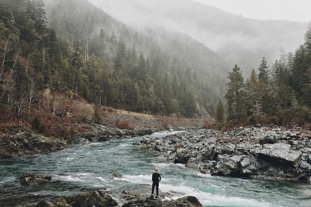
The Carpathian Mountains — Europe’s Wild Frontier
Imagine a mountain range where wolves roam freely through ancient forests, where brown bears fish in crystal-clear streams, and where traditional shepherds still tend their flocks just like their ancestors did hundreds of years ago. That is the Carpathian Mountains,one of Europe’s most wild and least explored natural treasures. Stretching across seven countries, these mountains are a paradise for nature lovers, hikers, and anyone who wants to experience true wilderness without leaving Europe.
This article will take you on a journey through the Carpathians. You will learn where they are, what makes them so special, which animals call them home, and how to plan your own adventure to one of Europe’s last great wild places.
Key Takeaways
- The Carpathian Mountains stretch over 1,500 kilometers across seven European countries
- They contain Europe’s largest population of wolves, bears, and lynx
- More than half of Europe’s virgin forests are found in the Carpathians
- The range includes the highest peak in Romania, Moldoveanu Peak at 2,544 meters
- Traditional villages and shepherding culture are still alive throughout the range
- The Carpatians are home to over 15,000 species of plants and animals
- They offer some of the best hiking, wildlife watching, and nature photography in Europe
Where Are the Carpathian Mountains
The Carpathian Mountains form a giant arc across Central and Eastern Europe. They stretch for over 1,500 kilometers, starting in Romania, curving through Ukraine, Slovakia, Poland, Hungary, Czech Republic, and ending in Serbia. Some geographers also include a separate section in Austria. The range covers a total area of about 190,000 square kilometers, making it one of the largest mountain systems in Europe after the Alps and the Scandinavian Mountains.
Unlike the Alps, which are famous around the world, the Carpathians remain relatively unknown to international travelers. That is part of their charm. These mountains feel untouched and authentic, with small villages where wooden churches stand beside hand-built haystacks and local farmers still use horses instead of tractors. The Carpathians are not polished or commercialized. They are raw, real, and breathtakingly beautiful.
The range is usually divided into three main sections: the Western Carpathians in Slovakia, Poland, Czech Republic, and Hungary; the Eastern Carpathians in Ukraine and Poland; and the Southern Carpathians in Romania. Each section has its own character, scenery, and wildlife, but all share the same spirit of wild, unspoiled nature.
Why the Carpathians Are Europe’s Wildest Mountain Range
Europe is a crowded continent. Most of its wild places have been tamed, developed, or turned into ski resorts. But the Carpathians are different. They remain one of the last truly wild corners of Europe, and here is why that matters.
Europe’s biggest wildlife populations. The Carpathians are home to around 60% of Europe’s brown bears, 50% of its wolves, and 40% of its lynx. These numbers are staggering when you consider that Europe has lost most of its large predators over the centuries. In the Carpathians, you can still see bears foraging in mountain meadows, hear wolves howling at night, and spot tracks from a lynx padding through the snow. Nowhere else in Europe can you experience such a complete large predator community.
Ancient forests still stand. The Carpathians hold more than half of Europe’s remaining virgin and old-growth forests. These are forests that have never been logged by humans. Trees here are hundreds of years old, and the forest floor is covered in moss, fallen logs, and fungi. Walking through a Carpathian old-growth forest feels like stepping back in time. The air smells different here, earthy and rich, full of decomposing leaves and damp bark.
Traditional culture survives. In many parts of Europe, traditional rural life has disappeared. But in the Carpathians, shepherds still move their sheep and cattle to high mountain pastures every summer, a practice called transhumance. Villagers make their own cheese, weave their own rugs, and build wooden houses without nails. This living culture adds a human dimension to the natural beauty that is hard to find anywhere else.
Wildlife You Can See in the Carpathians
The Carpathians are a wildlife lover’s dream. The combination of vast forests, high meadows, and clean rivers creates perfect habitats for a huge variety of animals.
Brown bears. Romania alone has an estimated 6,000 to 7,000 brown bears, the largest population in Europe outside Russia. The Carpathian brown bear is shy and generally avoids humans, but early morning and late evening are the best times to spot them. National parks like Piatra Craiului and the Bucegi Mountains have dedicated bear-watching hides where visitors can observe these magnificent animals safely.
Wolves. The Carpathian wolf population is estimated at around 2,500 to 3,000 individuals. They are harder to spot than bears, but their howling can be heard echoing through mountain valleys at dawn and dusk. Wolf tracking tours are available in several areas, and experienced guides can help you find tracks, scat, and other signs of wolf activity.
Eurasian lynx. The Carpathian lynx is the largest lynx subspecies in the world. About 1,200 to 1,500 live in the Carpathians, mostly in Romania, Slovakia, and Poland. They are incredibly elusive and rarely seen by humans, but camera traps have captured stunning images of these spotted cats in the deep forest.
Bison. The European bison, the continent’s largest land animal, was reintroduced to the Carpathians after being hunted to extinction in the wild. Herds now roam freely in several areas, including the Tarcu Mountains and the Bieszczady Mountains in Poland. Seeing a bison in the wild is an unforgettable experience.
Other notable animals. The Carpathians are also home to chamois, wild boar, red deer, roe deer, golden eagles, eagle owls, black storks, and over 100 species of butterflies. The rivers and streams support healthy populations of otters and trout. The biodiversity is remarkable for a European mountain range.
Comparison of Key Carpathian Destinations
| Destination | Country | Best Time to Visit |
|---|---|---|
| Transylvania and Piatra Craiului | Romania | May to October |
| Tatra Mountains | Slovakia/Poland | June to September for hiking; December to March for skiing |
| Bieszczady Mountains | Poland | May to October |
| Bucegi Natural Park | Romania | June to September |
| Maramureș Region | Romania | Year-round |
| Ukrainian Carpathians | Ukraine | June to September |
| High Tatras | Slovakia | June to September |
Exploring the Romanian Carpathians
Romania holds the largest share of the Carpathian range, and it is where most visitors begin their exploration. The Transylvania region, nestled inside the great arc of the Carpathians, is famous for its medieval castles, fortified churches, and wild mountain landscapes.
The Bucegi Mountains are the most popular hiking destination. They offer dramatic limestone ridges, deep gorges, and stunning views. The Babele rock formations and the Sphinx, natural rock sculptures shaped by wind and rain, are among the most photographed landmarks in Romania. Moldoveanu Peak, the highest point in Romania at 2,544 meters, is located here and is a challenging but rewarding climb.
Piatra Craiului National Park is another must-visit. Its narrow limestone ridge, called the Zarnesti Gorges, is surrounded by old-growth beech and fir forests. This area has some of the best wildlife viewing in the Carpathians, with regular sightings of bears, wolves, and chamois. The park also has a chamois breeding center where you can learn about conservation efforts.
The Fagaras Mountains, the highest section of the Southern Carpathians, offer the longest mountain ridge hike in Romania. The Transfagarasan highway, carved through the mountains, is one of the most spectacular drives in Europe. But the real magic happens on foot, camping beside alpine lakes and waking up to sunrise over jagged peaks.
Exploring the Tatra Mountains
The Tatra Mountains straddle the border between Slovakia and Poland. They are the highest part of the Carpathians, with several peaks exceeding 2,600 meters. The Tatras have a more alpine character than other sections of the Carpathians, with glacial lakes, steep valleys, and dramatic peaks.
Slovakia’s High Tatras are the most visited section. The town of Stary Smokovec serves as a base for hikes of all difficulty levels. Trails range from easy walks through pine forests to challenging ridge walks with chains and ladders. The Popradske Pleso lake, sitting at 1,494 meters, is one of the most beautiful glacial lakes in the range and is accessible by a well-maintained trail.
Poland’s Tatras are wilder and less developed. The town of Zakopane, known as the winter capital of Poland, is the gateway. Polish trails are generally more challenging than Slovak ones, with more exposed sections and steeper climbs. The Orla Perch, one of Via Ferrata in Poland, is a thrilling route that traverses a narrow ridge with cable protection.
What makes the Tatras special within the Carpathians is their concentration of endemic species. The Tatra chamois, found nowhere else in the world, lives on the highest ridges. The Tatra marmot, a large rodent that whistles to warn its colony of danger, can often be heard before it is seen. These animals are protected and have become symbols of the range.
Exploring the Bieszczady Mountains
The Bieszczady Mountains in southeastern Poland are the wildest and most remote part of the Polish Carpathians. This area was heavily affected by World War II and the post-war forced relocations, which left the mountains largely depopulated. Nature reclaimed the land, and today the Bieszczady are a haven for wildlife and solitude seekers.
The landscape here is different from the rocky Tatras. Rolling mountain meadows, called polonyny, stretch across the summits, offering panoramic views in every direction. These grassy peaks feel more like the Scottish Highlands than a typical mountain range. In summer, the meadows are covered in wildflowers, and the silence is overwhelming, no traffic, no crowds, just wind and birdsong.
The Bieszczady National Park protects the core of this region and is home to the largest wild animal populations in Poland. Bears, wolves, lynx, bison, and wild horses all roam freely here. Dawn walks through the meadows often reward visitors with sightings of grazing deer, trotting wild horses, or even a bear digging for roots on a distant slope. For those who want to truly disconnect, the Bieszczady offer peace that is hard to find elsewhere in Central Europe.
The Ukrainian Carpathians
The Ukrainian Carpathians are the least explored section of the range, which gives them a special appeal for adventurous travelers. Hoverla, the highest peak in Ukraine at 2,061 meters, is located here and is a popular climb. The trail from the Shelest mountain hut to the top takes about four hours and offers stunning views of the surrounding peaks.
The region has a unique cultural heritage. The Hutsul people, an ethnic group that has lived in these mountains for centuries, have preserved their traditional wooden churches, colorful clothing, and folk music. Many Hutsuls are shepherds and still practice the seasonal movement of livestock to high mountain pastures. Visiting a Hutsul village is like traveling back in time.
The Synevyr lake, sometimes called the Sea Eye, is the most famous natural attraction in the Ukrainian Carpathians. Sitting at 989 meters, this glacial lake has crystal-clear water surrounded by dense forest. On calm days, the surrounding mountains are perfectly reflected in the lake surface, creating a scene so beautiful it looks almost unreal.
Best Hiking Trails in the Carpathians
The Carpathians offer hundreds of hiking trails, from easy day walks to multi-day expeditions. Here are some of the best.
The Transfagarasan Ridge, Romania. This is a two-day hike along the highest ridge of the Southern Carpathians. You cross several peaks over 2,400 meters, with views stretching across the entire Transylvania region. The trail is challenging but does not require technical climbing skills. Camping on the ridge under a sky full of stars is an experience you will never forget.
The Tatras Ridge Traverse, Slovakia. This multi-day trek follows the main ridge of the High Tatras, passing by dozens of glacial lakes and scenic peaks. The route requires good fitness and some scrambling experience. Mountain huts along the way provide accommodation and food, so you can travel light.
Bieszczady Meadow Loop, Poland. A moderate day hike that takes you through the famous polonyny meadows of the Bieszczady Mountains. The trail from Ustrzyki Gorne to Tarnica, the highest peak in the Polish Bieszczady, is about 12 kilometers round trip. The lack of trees on the summits means you get 360-degree views, perfect for spotting wildlife in the valleys below.
Piatra Craiului Ridge, Romania. A challenging full-day hike along one of the narrowest and most dramatic limestone ridges in the Carpathians. The trail is exposed in places with steep drops on both sides, but the views are extraordinary. On a clear day, you can see the entire Piatra Craiului range stretching before you.
Why You Should Visit the Carpathian Mountains
If you love nature, the Carpathians deserve a place on your travel list. Here is why these mountains are worth the trip.
Wildlife watching like nowhere else in Europe. Nowhere else on the continent can you see bears, wolves, lynx, and bison in a single forest. The Carpathian wildlife is not in a zoo or a wildlife park. It is truly wild and free, living in vast, connected habitats. Even if you do not see a bear, the knowledge that one might be watching you from behind the next tree adds a thrill that no safari park can match.
No crowds, no queues. While the Alps are packed with tourists every summer, the Carpathians remain refreshingly quiet. Even on the most popular trails in the Romanian Carpathians, you might hike for hours without seeing another person. In the Bieszczady or the Ukrainian Carpathians, you can walk for an entire day and not meet a soul.
Affordable adventure. The Carpathians are one of the most affordable mountain destinations in Europe. Accommodation, food, and transportation cost a fraction of what you would pay in the Alps or the Dolomites. Guesthouses in Romanian mountain villages offer home-cooked meals and warm hospitality for very reasonable prices.
Authentic culture. The Carpathians are not just about mountains. They are about the people who live there. You can taste traditional cheese made by shepherds, hear folk songs sung by villagers, and see wooden churches that are hundreds of years old. This cultural experience adds depth to any nature trip.
Travel Tips for the Carpathians
Planning a trip to the Carpathians requires some preparation. Here are practical tips to help you make the most of your visit.
Best time to go. The main hiking season runs from June to September. July and August are the warmest months but also the busiest. June and September offer cooler temperatures, fewer crowds, and beautiful wildflower displays or autumn colors. Winter brings heavy snow and skiing opportunities, especially in the Tatras.
Getting there. Most visitors fly into major cities like Bucharest, Krakow, Bratislava, or Lviv, then take trains or buses to the mountain regions. Renting a car gives you the most flexibility, but mountain roads can be narrow and winding. Book accommodation in advance, especially in July and August.
Safety in bear country. The Carpathians have a large bear population, so take basic precautions. Hike in groups of three or more. Make noise on the trail by talking or clapping to alert bears to your presence. Never leave food unattended. Carry bear spray if you are hiking in remote areas. If you encounter a bear, stay calm, do not run, and back away slowly following park guidelines.
What to pack. Waterproof hiking boots are essential. Bring layers because mountain weather can change quickly. Rain gear, sun protection, and insect repellent are must-haves. A good map or GPS device is important because some trails are poorly marked. If you are camping, a four-season tent is recommended for higher elevations.
Respect local culture. Many Carpathian communities are traditional and can be shy around strangers. Dress modestly when visiting villages. Ask before taking photographs of people. If you stay in a local guesthouse, try the local food and learn a few words in the local language. Simple respect goes a long way.
Frequently Asked Questions
Are the Carpathian Mountains safe for tourists?
Yes, the Carpathians are very safe for tourists. The biggest natural risks are weather changes and wildlife encounters with bears. Both can be managed by following park guidelines, hiking in groups, and being prepared. Crime rates in Carpathian regions are very low. The main concerns are physical ones like getting lost or injured on the trail, so always tell someone your hiking plans and carry emergency supplies.
Do I need a guide to hike in the Carpathians?
For most hiking trails, you do not need a guide. Well-marked trails in national parks like Bucegi, Piatra Craiului, and the High Tatras can be navigated independently with a good map. However, hiring a local guide is highly recommended for wildlife watching tours, multi-day treks in remote areas like the Bieszczady, or for climbing routes that require technical skills. Local guides also enrich the experience with their knowledge of wildlife, history, and folklore.
What is the best country to visit in the Carpathians?
It depends on what you are looking for. Romania offers the best wildlife watching and the most dramatic mountain scenery, including the Transfagarasan and Piatra Craiului. Slovakia’s High Tatras have the most developed infrastructure for hiking and the most accessible alpine scenery. Poland’s Bieszczady are perfect for solitude seekers and those who want to see wild horses and bison. Ukraine’s Carpathians appeal to adventurous travelers looking for off-the-beaten-path experiences.
How many days do I need for a Carpathians trip?
You need at least five to seven days to get a meaningful taste of the Carpathians. A week allows you to explore one section, such as the Romanian Fagaras or the Slovak Tatras, without rushing. If you want to visit multiple countries or do a long-distance trek, plan for two to three weeks. Many visitors underestimate travel times between destinations because mountain roads are slow.
Can I see bears in the Carpathians?
Yes, bear watching is one of the biggest draws of the Carpathians. Romania and Slovakia have the largest bear populations. Many national parks offer bear-watching hides where you can observe bears at dawn and dusk. The success rate is high, sometimes over 70% on organized bear-watching outings. Always book bear-watching experiences through reputable operators and follow all safety instructions.
What animals live in the Carpathian Mountains?
The Carpathians are home to an impressive variety of animals. Large mammals include brown bears, gray wolves, Eurasian lynx, European bison, chamois, wild boar, red deer, and roe deer. Smaller mammals include pine martens, European badgers, and beavers. Over 6,000 species of insects have been recorded, and the mountains support rich birdlife including golden eagles, eagle owls, black storks, and woodpeckers. Rivers and streams are home to otters, trout, and rare amphibians.
When is the best time to photograph the Carpathians?
For landscape photography, June and July offer lush green meadows and wildflowers. September brings autumn colors that turn the forests into a patchwork of gold, orange, and red. For wildlife photography, spring (April to May) and early autumn are best because animals are more active and visible. Winter offers dramatic snow-covered landscapes and the chance to photograph animal tracks, but access to higher areas may be limited.
Conclusion
The Carpathian Mountains are one of Europe’s best kept secrets. They offer everything a nature lover could want, vast forests teeming with wildlife, dramatic peaks and valleys, clean rivers and streams, and a living traditional culture that adds warmth and authenticity to every visit. While the Alps and other famous European mountain destinations have become crowded and commercialized, the Carpathians remain refreshingly wild and genuine.
Whether you are a seasoned hiker looking for a new challenge, a wildlife enthusiast hoping to see brown bears in their natural habitat, or simply someone who wants to escape the noise of modern life and breathe clean mountain air, the Carpathians have something special for you. These mountains remind us what Europe looked like before highways and cities covered the continent, alive, unpredictable, and gloriously untamed.
The Carpathians do not shout for attention. They do not have famous brand names or Instagram-famous viewpoints. What they have is something far more valuable, real wilderness, real wildlife, real silence. And in a world where true wildness is becoming rarer every year, that is worth more than any tourist attraction.
Share this post with your friends and start planning your trip to the Carpathian Mountains today.

How to Read a Topographic Map for Mountain Hiking
A topographic map shows you the shape of the land using contour lines. If you have ever looked at one and felt confused, you are not alone. Once you understand a few basics, you will be able to read the terrain like an experienced hiker and make smarter decisions on the trail.
Key Takeaways
- Contour lines show elevation. The closer they are together, the steeper the terrain.
- Every fifth contour line is thicker. This is the index contour, and it has the elevation printed on it.
- Contour lines that form V shapes usually point uphill. That often means a stream or valley.
- Concentric circles mean a hill or mountain peak.
- Always check the map scale and declination before heading into the mountains.
Why Every Mountain Hiker Needs This Skill
You are halfway up a mountain trail when the path splits. One side looks steep but short. The other curves gently out of sight. Your phone has no signal. What do you do?
This is exactly when a topographic map saves the day. Unlike a simple trail map or your phone GPS, a topo map shows you the actual shape of the land. Valleys, ridges, peaks, saddles, cliffs, and gentle slopes all become visible once you know how to read the lines.
You do not need to be an expert. You just need to understand a handful of concepts. By the end of this guide, you will know how to look at a topographic map and picture the real terrain in your mind. You will also learn how to plan safer routes, avoid steep climbs you are not ready for, and find your way even when trails disappear.
Whether you are hiking the Appalachians, the Rockies, the Alps, or your local hills, this skill makes every trip more confident and more fun. Let’s break it down step by step.
What Is a Topographic Map?
A topographic map is a two-dimensional map that represents three-dimensional terrain. The key feature is contour lines. Each contour line connects points of equal elevation above sea level.
Think of it like slicing a mountain horizontally at regular intervals, like cutting a layer cake. Each slice leaves a ring on the map. Those rings are contour lines.
Topographic maps also show water features in blue, vegetation in green, roads and trails in black or red, and human-made structures in black or gray. They include a scale bar, a north arrow, and usually a grid system for finding coordinates.
Government agencies like the United States Geological Survey (USGS) produce free topographic maps for most of the US. In other countries, national mapping agencies do the same. You can also find digital versions on apps like Gaia GPS, AllTrails, and CalTopo.
Understanding Contour Lines
Contour lines are the heart of every topographic map. Here is how to read them.
1. Each line represents one elevation. If the contour interval is 40 feet, then every time you cross a line, you go up or down by 40 feet. The map legend tells you the contour interval.
2. Close lines mean steep terrain. When contour lines are packed tightly together, the ground rises sharply. This is a cliff or a very steep slope. When they are spaced far apart, the terrain is gentle and flat.
3. Index contours help you count. Every fourth or fifth line is drawn thicker than the others. This is the index contour, and it usually has the elevation number printed on or beside it. You can count from an Index line to figure out any spot’s elevation.
4. Contour lines never cross. A single point on the ground cannot have two different elevations. If lines seem to cross on a map, you are probably looking at an overhanging cliff or a cave, which is rare.
5. Contour lines form V shapes in valleys. When a V points uphill (toward higher elevation), it usually marks a drainage, stream bed, or valley. Water flows down the V, so the open end points downstream.
6. Closed loops mean a hill or depression. Concentric circles indicate a peak or hilltop. If the inner circles have small tick marks called hachures, the shape is a depression or basin instead.
Key Terrain Features You Will See on a Map
Once you understand contour lines, certain patterns appear over and over. Here are the most common ones you should learn to recognize.
Ridges
Ridges show up as elongated U or V shapes pointing downhill (toward lower elevation). They are the high ground between two valleys. Many ridge trails offer great views but can be exposed to wind and weather.
Saddles (Cols or Passes)
A saddle is a low point between two higher peaks. On the map, it looks like an hourglass shape. Saddles are often the easiest way to cross from one valley to another, which is why many trails go through them.
Cliffs
Cliffs appear as contour lines that merge into a single line or nearly touch. Some maps use special symbols or hachure marks for very steep rock faces. If you see this, expect a dangerous area and give it a wide berth unless you are an experienced climber.
Valleys and Drainages
Valleys are the V or U shapes where water collects and flows. They usually have a stream or river running through them. Valleys are often the easiest walking but can flood during heavy rain, so be aware of weather conditions.
Spurs
A spur is a smaller ridge that extends out from a larger ridge. On the map, the contour lines form U shapes pointing away from the main ridge. Spurs often provide good campsites and viewpoints.
Peaks and Summits
As mentioned, concentric circles mark peaks. The highest point may have a small X with an elevation number next to it. Some peaks have benchmark symbols, which are survey markers placed by mapping agencies.
How to Use a Map and Compass Together
A topographic map is most powerful when you use it with a compass. Here is a basic workflow.
Step 1: Orient the map. Place your compass on the map. Rotate the map until the map’s north lines align with the compass needle. Now the map matches the real world around you.
Step 2: Find your location. Look for landmarks you can see. A lake, a peak, a trail junction. Then find those landmarks on the map. Use two or more landmarks to triangulate your position.
Step 3: Pick your route. Trace your planned path with your finger. Note the elevation changes by counting contour lines. Identify any saddles, valleys, or landmarks you will pass along the way.
Step 4: Note the declination. Magnetic north and true north are not the same place. The difference is called declination, and it is printed on most topographic maps. If you ignore this, your compass bearings will be off by several degrees, which can put you miles off course on a long hike.
Practical Tips for Reading Topo Maps While Hiking
It takes practice to read a map while walking. Some tips help you get better faster.
- Start with easy terrain. Practice on well-marked trails where you can check your reading against trail signs and landmarks.
- Hold the map oriented. Keep the map rotated so it matches the landscape in front of you. It feels strange at first, but it gets natural quickly.
- Check your elevation. If your watch or phone has a barometer, compare your current elevation to what the map says. This confirms your position.
- Look back often. The terrain looks different from the opposite direction. Train yourself to recognize features from multiple angles.
- Use the handrail technique. Follow a clear linear feature like a stream, ridge, or trail that runs parallel to your direction of travel. When you reach a known landmark, you know where you are.
- Trust the map more than the trail. Especially in the backcountry, trails fade, move, or get rerouted. The terrain on the map never changes.
Choosing the Right Topographic Map
Not all topographic maps are created equal. The two main things to look for are scale and detail.
Common scales for hiking:
- 1:24,000 (USGS 7.5-minute quadrangle) — Great detail. One inch equals 2,000 feet. Best for hiking where you need to see small features.
- 1:50,000 — Common in Europe and many other countries. Good balance of detail and coverage area.
- 1:100,000 or smaller — Useful for planning long trips or car camping, but less detail for foot navigation.
Digital maps let you zoom in and out, which effectively changes the scale. Apps like CalTopo let you print custom maps at your preferred scale. Many experienced hikers still carry paper maps as a backup because batteries fail and phones break.
Common Mistakes to Avoid
Even experienced hikers make navigation errors. Here are some to watch out for.
- Ignoring the contour interval. Different maps use different intervals. A 10-foot interval map looks very different from a 40-foot interval map. Always check the legend first.
- Confusing ridges and valleys. Look at the V shapes carefully. Remember: Vs point uphill in valleys and downhill on ridges.
- Forgetting about declination. In the western US, declination can be 15 degrees or more. That is a significant error over distance.
- Relying only on GPS. Devices are great, but they can fail. A paper map and compass never run out of batteries.
- Not updating the map. Trails change. Roads are built. Old maps may not reflect current conditions. Check the map’s revision date.
Practice Makes Confident
The best way to learn topographic map reading is to practice in the field. Start with a nearby trail you already know. Bring a topo map and compare what you see on the map with what you see around you. Try to identify the ridge you are standing on, the valley below, and the saddle you crossed to get there.
Once you are comfortable with familiar terrain, try a new trail. Plan your route using the map before you go. Track your progress as you hike. By the end of the trip, you will start to see the landscape in a new way.
Many outdoor clubs and park services offer navigation workshops. These can accelerate your learning with hands-on instruction. You might also enjoy learning about natural navigation, using the sun, stars, and landscape cues as backups to your map.
Frequently Asked Questions
What does a topographic map show that a regular map does not?
A topographic map shows elevation through contour lines. A regular road or trail map shows paths and landmarks but not the shape of the terrain. Contour lines let you see hills, valleys, cliffs, and saddles before you encounter them.
What is the contour interval?
The contour interval is the elevation difference between two adjacent contour lines. For example, if the interval is 20 feet, each line represents a 20-foot change. The interval is printed in the map legend.
How do I read elevation on a topographic map?
Find the nearest index line, which is thicker and labeled with an elevation number. Count the contour lines between that index line and your location. Multiply the number of lines by the contour interval and add or subtract from the index line’s elevation.
What do the V shapes mean on a topographic map?
V shapes in contour lines usually indicate a drainage or valley. The point of the V points uphill, toward higher elevation. This is where water flows downhill through the V.
Can I use a topographic map on my phone?
Yes. Apps like Gaia GPS, AllTrails, CalTopo, and Avenza Maps let you load topographic maps on your phone. They work with GPS even without a cell signal, as long as you download the maps in advance.
Why do I need a paper map if I have GPS?
Batteries die, screens crack, and phones get lost. A waterproof paper map and a basic compass weigh almost nothing and work in any weather. Most search and rescue teams recommend carrying both.
How do I find north on a topographic map?
Most topographic maps are oriented with true north at the top. The map margin includes a declination diagram that shows the difference between true north and magnetic north. Use this to adjust your compass bearing.
Conclusion
Reading a topographic map is one of the most valuable skills any mountain hiker can learn. It turns a confusing tangle of lines into a clear picture of the terrain ahead. You will plan better routes, avoid dangerous surprises, and feel more confident when the trail gets rough.
Start with the basics. Learn what contour lines mean. Practice identifying ridges, valleys, saddles, and peaks. Use a compass alongside your map. And most importantly, get outside and practice on real trails.
Every mountain you hike will teach you something new about reading the land. The more you use your map, the more natural it becomes. Before long, you will glance at a topo map and instantly see the mountains, valleys, and trails it represents.
Share this post with your friends who are getting into hiking. The more people who learn this skill, the safer and more enjoyable the trails become for everyone.

The Most Beautiful Mountain Railways in the World
Some train journeys are about getting from point A to point B. Then there are mountain railways that make the journey itself the destination. These incredible rail lines wind through towering peaks, cross dramatic gorges, and climb to altitudes that will leave you breathless — both from the height and the views.
We’ve rounded up ten of the most stunning mountain railways on the planet, from century-old engineering marvels to modern lines cutting through dramatic landscapes. Whether you are a train enthusiast or a nature lover, these routes deserve a spot on your travel list.
Key Takeaways
- Mountain railways offer some of the most scenic train journeys on Earth, crossing high-altitude passes, deep valleys, and dramatic landscapes
- Many of these lines are engineering marvels built over a century ago, still running with original carriages and steam locomotives
- The best time to ride most mountain railways is between May and October, when weather is clear and mountain views are at their peak
- Some routes require advance booking, especially during summer months and holiday seasons
- These railways are perfect for travelers who want to experience high-altitude landscapes without the physical demands of hiking
Why Mountain Railways Are So Special
There is something about watching mountains roll past your train window that no airplane or car can replicate. You move slowly enough to absorb every detail — the way light shifts across a glacier, the tiny wildflowers clinging to a cliff face, the distant sound of a waterfall you cannot quite see.
Mountain railways were often built as feats of engineering necessity, connecting isolated communities through terrain that seemed impossible to cross. Today, many of these lines have become heritage attractions, drawing travelers from around the world who want to experience the golden age of rail travel against some of the most dramatic backdrops on Earth.
The Most Beautiful Mountain Railways in the World
1. The Glacier Express, Switzerland
About: Often called the “slowest express train in the world,” the Glacier Express runs 291 kilometers between Zermatt and St. Moritz through the heart of the Swiss Alps, crossing 291 bridges and passing through 91 tunnels.
Highlights: The Oberalp Pass at 2,033 meters offers panoramic views of snow-capped peaks and the Rhine Gorge, sometimes called the “Swiss Grand Canyon.” Panoramic windows are designed specifically for sightseeing.
Best Time to Visit: June through September for the clearest views. December through March is stunning for snow-covered landscapes.
Why You Should Visit: Widely considered the most scenic train ride in Europe, connecting two iconic mountain resorts through dramatic Alpine scenery.
Travel Tips: Reserve seats 2-3 months ahead in summer. Panorama car seats cost extra but are worth it. Bring sunglasses for snow glare at altitude. Official Glacier Express website
2. The Darjeeling Himalayan Railway, India
About: This narrow-gauge railway, known as the “Toy Train,” runs 88 kilometers from New Jalpaiguri up to Darjeeling in West Bengal. Built between 1879 and 1881, it climbs to over 2,200 meters and is a UNESCO World Heritage Site.
Highlights: The line passes through tea plantations and dense forests with views of Kanchenjunga, the world’s third-highest mountain. The loop at Batty Loop and spiral at Agony Point are remarkable engineering feats.
Best Time to Visit: October through December for the clearest mountain views. March and April bring blooming rhododendrons. Avoid monsoon season (June-September).
Why You Should Visit: One of the most charming heritage railways in the world, combining colonial-era engineering, Himalayan scenery, and the cultural richness of the Darjeeling region.
Travel Tips: The full journey takes about 7 hours. The “Joy Train” joyride from Darjeeling to Ghum is a good shorter option. Wikipedia: Darjeeling Himalayan Railway
3. The Bernina Express, Switzerland to Italy
About: Running from Chur, Switzerland, to Tirano, Italy, the Bernina Express crosses the Bernina Pass at 2,253 meters — the highest adhesion railway in Europe. The route is part of the Rhaetian Railway UNESCO World Heritage site.
Highlights: The Landwasser Viaduct — a curved stone bridge plunging into a tunnel carved through solid rock — is unforgettable. You will pass glaciers, alpine meadows, and the stunning Lago Bianco before descending into Mediterranean Italy.
Best Time to Visit: May through October for clear views. Autumn is spectacular when larch trees turn gold between Ospizio Bernina and Poschiavo.
Why You Should Visit: This railway crosses one of the most dramatic altitude changes in Europe, taking you from Alpine glaciers to Mediterranean landscapes in just a few hours.
Travel Tips: Seat reservation is mandatory. The Swiss Travel Pass covers the route but not the reservation fee. Bring layers — it is much colder at the pass summit. Rhaetian Railway official site
4. The Rocky Mountaineer, Canada
About: The Rocky Mountaineer operates daylight-only routes through the Canadian Rockies, with the flagship “First Passage to the West” running from Vancouver to Banff and Lake Louise.
Highlights: The route passes through the Fraser Canyon, crosses the Continental Divide, and winds along the Kicking Horse River. Glaciers, turquoise lakes, and wildlife including bears and mountain goats are visible from glass-domed carriages.
Best Time to Visit: April through October. September is particularly beautiful when larch trees turn brilliant gold at higher elevations.
Why You Should Visit: The Canadian Rockies are among the most dramatic mountain landscapes on Earth, and the daylight-only schedule means every minute is spent soaking in the views.
Travel Tips: GoldLeaf service starts around $1,500 USD for the two-day journey. Book 3-6 months ahead for summer. Bring binoculars and a polarizing filter for the turquoise lakes. Rocky Mountaineer official site
5. The Tren a las Nubes, Argentina
About: One of the highest railways in the world, the Tren a las Nubes runs from Salta to the La Polvorilla viaduct in northwestern Argentina, reaching 4,220 meters as it crosses the Andes.
Highlights: The La Polvorilla viaduct — a curved steel bridge 64 meters high spanning a deep gorge at extreme altitude — is the star. The Quebrada del Toro’s red-rock canyon formations look almost otherworldly.
Best Time to Visit: April through November (dry season) for the clearest skies. The service can be disrupted by weather between December and March.
Why You Should Visit: Riding a train above the clouds at over 4,000 meters is a bucket-list experience. The stark, colorful landscapes of the Argentine Andes are unlike anything else on Earth.
Travel Tips: Take altitude sickness seriously — drink water, avoid alcohol the night before, and bring warm layers. A doctor travels on every trip. Wikipedia: Tren a las Nubes
6. The Flåm Railway, Norway
About: One of the steepest standard-gauge railways in the world, the Flåm Railway descends 864 meters over just 20 kilometers from Myrdal to the village of Flåm on the Aurlandsfjord.
Highlights: The train passes through 20 tunnels and crosses gorges with waterfalls cascading down sheer rock faces. The Kjosfossen waterfall stop lets passengers watch water plunge 225 meters down the mountainside.
Best Time to Visit: May through September for the best weather. The Kjosfossen waterfall is most impressive in late spring during snowmelt.
Why You Should Visit: Incredible scenery packed into a one-hour journey. Easily combined with a fjord cruise on the UNESCO-listed Nærøyfjord for one of Norway’s best day trips.
Travel Tips: Sit on the right side for the best views on the descent. Book online in advance — it is extremely popular in summer. Flåm Railway official site
7. The Qinghai-Tibet Railway, China
About: The highest railway in the world, climbing to 5,072 meters at the Tanggula Pass on its 1,956-kilometer route from Xining to Lhasa across the Tibetan Plateau.
Highlights: The train passes Qinghai Lake, crosses the Kunlun and Tanggula ranges, and traverses vast grasslands with snow-capped peaks on the horizon. Tibetan antelope and wild yaks can sometimes be spotted from the train.
Best Time to Visit: May through October for the best weather. September and October offer stable conditions and excellent visibility.
Why You Should Visit: A journey across one of the most extreme and beautiful landscapes on the planet. The engineering required to build a railway across permafrost at 5,000 meters is staggering.
Travel Tips: You need a Tibet Travel Permit in addition to your Chinese visa. Acclimatize in Xining (2,200m) before continuing to Lhasa (3,650m). Bring warm clothing even in summer. Wikipedia: Qinghai-Tibet Railway
8. The Semmering Railway, Austria
About: Built between 1848 and 1854, the Semmering Railway was the first mountain railway in Europe built with a standard-gauge track. It runs 41 kilometers through the Semmering Pass and is a UNESCO World Heritage Site.
Highlights: Sixteen viaducts and 15 tunnels cross the pass, with stone arch bridges blending seamlessly into forested mountains. The views of rolling green hills and distant Alpine peaks are stunning in every season.
Best Time to Visit: May through October for green mountain views. December through February for a snowy winter wonderland.
Why You Should Visit: This is where mountain railway history began. The viaducts and tunnels are the same ones engineers built 170 years ago, and the scenery has not changed a bit.
Travel Tips: Regular Austrian Federal Railways (ÖBB) trains run this route — no special ticket needed. Check for special steam train runs on select weekends. Wikipedia: Semmering Railway
9. The PeruRail Central Andean Railway, Peru
About: Running from Cusco to Puno on Lake Titicaca, this railway crosses the Andean altiplano at altitudes up to 4,313 meters, covering about 388 kilometers in approximately 10 hours.
Highlights: The vast altiplano grassland dotted with llamas and alpacas, the La Raya Pass at 4,313 meters, and small Andean villages where locals sell handmade textiles at station stops.
Best Time to Visit: May through September (dry season) for the clearest skies and best views.
Why You Should Visit: Dramatic mountain scenery, indigenous culture, and the sheer altitude make this one of the most unique rail experiences in the world, ending at the world’s highest navigable lake.
Travel Tips: Acclimatize in Cusco (3,400m) for at least a day before riding. Bring warm layers, sunscreen, and water. The observation car is worth the upgrade. PeruRail official site
10. The West Highland Line, Scotland
About: Running from Glasgow to Mallaig on Scotland’s west coast, this 264-kilometer line passes through some of the most wild and beautiful landscapes in the British Isles, including the famous Glenfinnan Viaduct.
Highlights: The Glenfinnan Viaduct — a 21-arch curved stone bridge crossing a deep valley with Loch Shiel behind it — is the showstopper. Rannoch Moor, a vast and desolate expanse of bog and water, feels like the edge of the world.
Best Time to Visit: May through September for the longest days. The Jacobite steam train runs from May to October. Autumn brings beautiful heather colors to the moors.
Why You Should Visit: One of the most atmospheric train journeys in the world. Rugged moors, misty lochs, and historic viaducts create a landscape that feels ancient and untamed.
Travel Tips: Sit on the left side for the best views. The regular ScotRail service is much cheaper than the Jacobite steam train. Book the Jacobite months ahead for summer. ScotRail official site
Comparison Table: Mountain Railways at a Glance
| Railway | Country | Max Altitude | Best Time to Visit |
|---|---|---|---|
| Glacier Express | Switzerland | 2,033 m | Jun – Sep |
| Darjeeling Himalayan Railway | India | 2,200 m | Oct – Dec |
| Bernina Express | Switzerland / Italy | 2,253 m | May – Oct |
| Rocky Mountaineer | Canada | 1,600 m | Jun – Sep |
| Tren a las Nubes | Argentina | 4,220 m | Apr – Nov |
| Flåm Railway | Norway | 864 m | May – Sep |
| Qinghai-Tibet Railway | China | 5,072 m | May – Oct |
| Semmering Railway | Austria | 898 m | May – Oct |
| PeruRail Central Andean | Peru | 4,313 m | May – Sep |
| West Highland Line | Scotland | 411 m | May – Sep |
Tips for Making the Most of Your Mountain Railway Journey
Book early. The most popular railways — the Glacier Express, Rocky Mountaineer, and Jacobite Steam Train — sell out months in advance during peak season. Aim to reserve at least 3 months ahead for summer trips.
Choose your seat wisely. One side of the train almost always offers better views. On the Flåm Railway, sit right for the descent. On the West Highland Line, sit left. Research the route before you book.
Bring the right gear. Pack warm layers, sunglasses, and sunscreen even in summer. For routes above 3,000 meters, bring water and consider altitude sickness medication.
Camera ready. The best views come and go in seconds. Keep your camera charged and within reach. A polarizing filter helps with mountain lake and snow glare.
Frequently Asked Questions
Q: Are mountain railways safe for people afraid of heights?
A: Most are very safe and travel at moderate speeds. Some routes cross high viaducts that can be intense for acrophobic travelers. If heights bother you, choose a center seat and focus on the mountains rather than the drops below.
Q: What is the highest railway in the world?
A: The Qinghai-Tibet Railway in China reaches 5,072 meters at the Tanggula Pass. The Tren a las Nubes in Argentina is second at 4,220 meters. Both require preparation for altitude sickness.
Q: How much does a mountain railway journey cost?
A: Prices range dramatically. Scotland’s West Highland Line costs around $50-80 USD. The Glacier Express runs about $150-300 USD. The Rocky Mountaineer starts at around $1,500 USD for the two-day GoldLeaf experience.
Q: Do mountain railways operate in winter?
A: Most do, though schedules may be reduced. Winter rides through snow-covered mountains can be spectacular. The Flåm, Semmering, and West Highland lines operate year-round. The Rocky Mountaineer and Tren a las Nubes are seasonal.
Q: Can I use a rail pass?
A: In Europe, the Eurail Pass covers the Semmering and West Highland lines. The Swiss Travel Pass covers the Glacier Express route (seat reservations extra). Premium experiences like the Rocky Mountaineer require separate tickets.
Q: What should I pack for a mountain railway trip?
A: Warm layers, sunscreen, sunglasses, a water bottle, snacks, and a camera. For routes above 3,000 meters, bring altitude sickness medication. For longer journeys, bring a book or downloaded entertainment for the less scenic stretches.
Conclusion
Mountain railways offer something no other form of travel can match — the chance to sit comfortably while the world’s most dramatic landscapes unfold outside your window. From the snow-capped Swiss Alps to the vast Tibetan Plateau, from the red-rock canyons of Argentina to the misty Scottish Highlands, these routes prove that sometimes the journey really is better than the destination.
These railways were built by people who refused to let mountains stand in their way. Riding them is a reminder of what human ingenuity can achieve — and a promise that some of the best views in the world are best enjoyed from a train seat.
Share this post with your friends and start planning your next mountain railway adventure today.
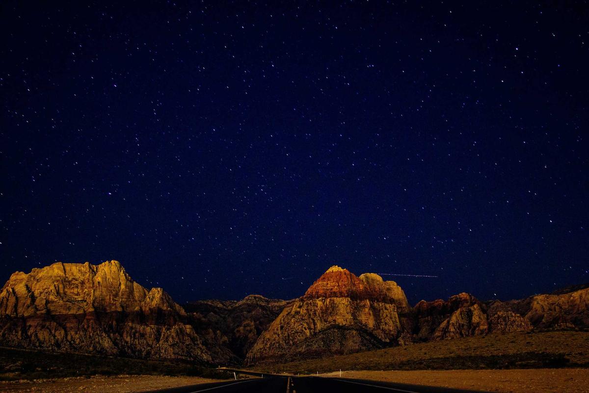
The Sierra Nevada — California’s Mountain Treasure
The Sierra Nevada is one of the most spectacular mountain ranges in North America, stretching 400 miles through eastern California and into Nevada. If you are looking for a destination that combines dramatic peaks, crystal-clear lakes, ancient forests, and some of the best hiking in the United States, this is it. From the granite walls of Yosemite to the summit of Mount Whitney, the Sierra Nevada delivers an experience that stays with you for life.
Key Takeaways
- The Sierra Nevada spans roughly 400 miles along California edge, with peaks reaching over 14,000 feet.
- Yosemite, Sequoia, and Kings Canyon National Parks all sit within the range, offering world-class hiking, camping, and wildlife viewing.
- The range is home to giant sequoia trees, the largest living organisms on Earth by volume.
- Best time to visit is late June through September for hiking, and December through March for winter sports.
- Over 400 miles of trails cater to everyone from casual day hikers to serious backpackers.
What Makes the Sierra Nevada Special
There is something about the Sierra Nevada that hits different from other mountain ranges. Maybe it is the way the granite catches the light at sunset, turning entire cliff faces gold and pink. Maybe it is the sheer scale of the landscape — valleys carved by glaciers millions of years ago, now filled with rivers and meadows so green they look photoshopped. Or maybe it is the fact that you can stand at the summit of the highest peak in the contiguous United States and see wilderness stretching in every direction.
The range runs north to south along California eastern side, forming a natural wall between the Central Valley and the Great Basin. Its name means snowy range in Spanish, and for good reason — winter storms dump massive amounts of snow here, feeding rivers that supply much of California water. The snowpack is so important that scientists measure it every year to predict water availability for the entire state.
But the Sierra Nevada is not just about snow and water. It is a place of incredible biodiversity. You will find ecosystems ranging from oak woodlands at lower elevations to alpine tundra above the tree line. Black bears, mule deer, coyotes, and mountain lions all call these mountains home. And if you are lucky, you might spot a Sierra Nevada bighorn sheep — one of the rarest mammals in North America.
The Iconic Parks and Destinations
Yosemite National Park
No conversation about the Sierra Nevada is complete without Yosemite. This is the crown jewel, the place that made people realize mountains were worth protecting. El Capitan rises 3,000 feet from the valley floor, a sheer granite wall that draws rock climbers from around the world. Half Dome, with its distinctive sliced profile, is one of the most recognizable landmarks on the planet.
But Yosemite is not just about the big names. Walk the Mist Trail to Vernal Fall on a spring morning and you will feel the spray on your face as thousands of gallons of water crash over the edge. Drive up to Glacier Point for a view that will make your jaw drop. Or simply sit by the Merced River in Yosemite Valley and watch the light change on the cliffs as the day goes by.
Best time to visit: May through October. Spring brings the waterfalls at peak flow. Summer offers warm days and access to high-country trails. Fall is quieter, with fewer crowds and beautiful color in the valley.
Sequoia and Kings Canyon National Parks
Head south and you will find Sequoia and Kings Canyon, two parks that share a border and a common claim to fame: giant sequoia trees. These are the largest trees on Earth by volume, and standing next to one is a humbling experience. The General Sherman Tree, located in the Giant Forest, is the biggest of them all — 275 feet tall and over 36 feet in diameter at the base.
Kings Canyon itself is one of the deepest canyons in North America, deeper than the Grand Canyon in some measurements. The Kings River has carved a dramatic gorge through the granite, and the drive down into the canyon is one of the most scenic in California.
Best time to visit: June through September. The road to Cedar Grove in Kings Canyon typically opens in late April or May and closes after the first significant snowfall, usually in November.
Lake Tahoe
Straddling the California-Nevada border, Lake Tahoe is the largest alpine lake in North America. The water is famously clear — on a calm day, you can see down 70 feet or more. The lake sits at 6,225 feet elevation, surrounded by peaks that rise another 3,000 to 4,000 feet above the shoreline.
In summer, Tahoe is a paradise for swimming, kayaking, and paddleboarding. The water is cold — it rarely gets above 68 degrees even in August — but that is part of the appeal. In winter, the area transforms into one of the premier ski destinations in the country, with resorts like Palisades Tahoe, Heavenly, and Northstar drawing millions of visitors.
Best time to visit: Year-round. Summer for water activities and hiking, winter for skiing and snowboarding, fall for fewer crowds and beautiful aspen color.
Mount Whitney
At 14,505 feet, Mount Whitney is the highest peak in the contiguous United States. The summit is accessible via a 22-mile round-trip trail that starts at Whitney Portal, elevation 8,360 feet. It is a serious hike — most people take two to three days — but you do not need technical climbing skills to reach the top. You do need a permit, and they are competitive. Apply early through the Inyo National Forest lottery system.
The view from the summit is extraordinary. On a clear day, you can see the Central Valley to the west and the Great Basin to the east. It is a reminder of just how vast and wild the Sierra Nevada really is.
Best time to visit: July through September, when most of the snow has melted and the trail is clear.
Devils Postpile National Monument
This is one of the Sierra Nevada hidden gems. Devils Postpile is a formation of columnar basalt — tall, hexagonal columns of cooled lava that look like they were carved by human hands. They are actually a natural phenomenon, formed when lava cooled slowly and evenly about 100,000 years ago.
The monument is located near Mammoth Lakes and is accessible via a short hike. Combine it with a visit to Rainbow Falls, a 101-foot waterfall on the Middle Fork of the San Joaquin River, for a perfect day trip.
Best time to visit: Mid-June through October. Access is typically limited to summer months due to snow.
Comparison of Top Sierra Nevada Destinations
| Place Name | Location | Best Time to Visit |
|---|---|---|
| Yosemite National Park | Central Sierra Nevada, CA | May – October |
| Sequoia and Kings Canyon | Southern Sierra Nevada, CA | June – September |
| Lake Tahoe | Northern Sierra, CA/NV border | Year-round |
| Mount Whitney | Eastern Sierra, CA | July – September |
| Devils Postpile | Near Mammoth Lakes, CA | Mid-June – October |
Wildlife You Might Encounter
The Sierra Nevada supports a rich variety of wildlife, and encountering animals in their natural habitat is one of the highlights of any visit. Black bears are common throughout the range — they are generally not aggressive, but you should always store food properly and keep your distance. Mule deer graze in meadows at dawn and dusk. Coyotes are heard more than seen, their calls echoing through canyons at night.
At higher elevations, you might spot a yellow-bellied marmot sunning itself on a rock, or a pika gathering grass for winter in a talus field. The pika is particularly interesting — it is considered an indicator species for climate change because it is extremely sensitive to warm temperatures. As the Sierra Nevada warms, pika populations are being pushed higher and higher.
Birdwatchers will find plenty to keep them busy. Steller jays are bold and colorful, often visiting campgrounds looking for handouts (please do not feed them). Red-tailed hawks soar over open meadows. And if you are very lucky, you might spot a great gray owl — one of the largest owls in North America and a rare resident of the Sierra Nevada.
Tips for Planning Your Trip
The Sierra Nevada is a big place, and a little planning goes a long way. Here are some tips to help you make the most of your visit.
Book accommodations early. Campsites in Yosemite and other popular parks fill up months in advance, especially for summer weekends. If you cannot get a campsite, look for lodging in gateway communities like Mariposa, El Portal, or Groveland near Yosemite, or Three Rivers near Sequoia.
Prepare for altitude. Many destinations in the Sierra Nevada sit above 6,000 feet, and some trailheads start above 8,000. If you are coming from sea level, give yourself a day or two to acclimate before attempting strenuous hikes. Drink plenty of water, and do not push yourself too hard on the first day.
Check road conditions. Several major roads through the Sierra Nevada close in winter. Tioga Road (Highway 120 through Yosemite) and Glacier Point Road are typically closed from November through May, depending on snowfall. Always check current conditions before you go.
Pack layers. Mountain weather changes fast. It can be 85 degrees in the valley and 45 degrees at the summit, sometimes on the same day. Bring a warm layer, rain gear, and sun protection no matter when you visit.
Respect the wilderness. The Sierra Nevada is a fragile environment. Stay on established trails, pack out all your trash, and follow Leave No Trace principles. These mountains belong to everyone, and it is up to all of us to keep them wild.
Why the Sierra Nevada Matters
Beyond its beauty, the Sierra Nevada plays a critical role in California ecosystem and economy. The range snowpack provides roughly 30 percent of the state water supply. Its forests store massive amounts of carbon. Its rivers support fisheries, agriculture, and hydroelectric power generation.
The Sierra Nevada is also a living laboratory for scientists studying climate change. Glaciers that have existed for thousands of years are shrinking. Wildfires are becoming more frequent and intense. Species are shifting their ranges upward in elevation as temperatures rise. What happens in the Sierra Nevada in the coming decades will have implications far beyond California.
But perhaps the most important thing about the Sierra Nevada is what it offers each of us personally. It is a place to disconnect from the noise of daily life and reconnect with something bigger. Standing on a granite summit with nothing but wilderness in every direction, you remember what it feels like to be small — and how good that feeling can be.
Frequently Asked Questions
What is the best time of year to visit the Sierra Nevada?
The best time depends on what you want to do. For hiking and backpacking, July through September offers the most accessible trails and the warmest weather. For waterfall viewing, May and June are ideal when snowmelt is at its peak. Winter visitors will find excellent skiing and snowboarding from December through March.
Do I need a permit to hike in the Sierra Nevada?
Day hikes generally do not require permits, though you may need to pay an entrance fee at national parks. Overnight backpacking trips in wilderness areas do require permits, and popular trails like the John Muir Trail and Mount Whitney have competitive permit systems. Apply as early as possible — some permits are distributed by lottery months in advance.
Are there bears in the Sierra Nevada?
Yes, black bears are common throughout the range. They are generally not aggressive toward people, but they are attracted to food. Always use bear-proof food storage containers when camping, and never leave food unattended at your campsite. In Yosemite and other developed areas, bear boxes are provided at campsites and trailheads.
How difficult is the hike to the summit of Mount Whitney?
The Mount Whitney Trail is 22 miles round trip with about 6,100 feet of elevation gain. It is strenuous but does not require technical climbing skills. Most fit hikers complete it in 12 to 14 hours as a long day hike, though many prefer to camp at Trail Camp or Outpost Camp and summit over two days. A wilderness permit is required.
Can I visit the Sierra Nevada on a budget?
Absolutely. Dispersed camping is available throughout the Sierra National Forest and Inyo National Forest at no cost. Many trailheads offer free or low-cost parking. If you prefer developed campsites, they typically run 5 to 5 per night. The America the Beautiful Pass, at 0 per year, covers entrance fees at all national parks and federal recreation areas.
What should I pack for a trip to the Sierra Nevada?
Essentials include sturdy hiking boots, layers for changing weather, a rain jacket, sunscreen, a hat, plenty of water (or a water filter for refilling from streams), a map and compass or GPS, and a first aid kit. If you are camping, add a warm sleeping bag (temperatures drop below freezing at elevation even in summer), a headlamp, and a bear canister for food storage.
Is the Sierra Nevada safe for beginner hikers?
Yes, there are plenty of trails suitable for beginners. Yosemite Valley has several flat, well-maintained trails with stunning views. The Mist Trail to the foot of Vernal Fall is moderate and very popular. Around Lake Tahoe, the Eagle Falls Trail and Vikingsholm Trail are great options for those new to hiking. Start with shorter hikes at lower elevation and work your way up as your fitness improves.
Conclusion
The Sierra Nevada is more than a mountain range — it is a destination that rewards every kind of traveler. Whether you are a hardcore backpacker looking to tackle the John Muir Trail, a family wanting to see giant sequoias for the first time, or someone who just needs a weekend away from the city, these mountains have something for you. The granite peaks, the alpine lakes, the ancient forests, and the wild open spaces are waiting. All you have to do is show up.
Start planning your trip today. Pick a trail, book a campsite, or just point your car toward the mountains and see where the road takes you. The Sierra Nevada has been here for millions of years, and it is not going anywhere. But the experience of discovering it for yourself — that is something you create. And once you do, you will understand why people have been falling in love with these mountains for generations.
Share this post with your friends and start planning your Sierra Nevada adventure today.

The Most Amazing Animal Migrations on Earth
The Most Amazing Animal Migrations on Earth Every year, billions of animals across the planet embark on incredible journeys that...

Why Bees Are Disappearing and Why It Matters
Why Bees Are Disappearing and Why It Matters Bee populations are falling at alarming rates across the globe. In the...

How Sharks Keep the Ocean Healthy
How Sharks Keep the Ocean Healthy Sharks are far more than the scary predators you see in movies. They are...
-

 World2 years ago
Types of Ants Living in the World and Information
-

 Wildlife4 years ago
(10) Insects Are Animals in the world?
-

 Forests2 years ago
The 10 Best Forests to Visit in the World
-

 Ocean2 years ago
Oceans in the World and Their Information & Locations
-

 Forests4 years ago
What Is The Biggest Rainforest In The World?
-

 Wildlife4 years ago
Most Popular Wild Animals in The World
-

 Forests2 years ago
The Main Factors That Contribute to Forest Destruction
-

 World1 year ago
The 10 Largest Farms in the World