
Mountain
22 Best Glacier Nature Destinations Worth the Journey

Key Takeaways
- Glaciers are among the most awe-inspiring natural wonders on the planet, and this guide covers 22 of the best glacier destinations worth traveling for.
- From Patagonia to Iceland, Alaska to New Zealand, these locations offer everything from gentle glacier walks to epic ice cave explorations.
- Each destination includes practical travel tips, the best time to visit, and what makes it stand out from the rest.
- Whether you’re a seasoned adventurer or a first-time nature traveler, you’ll find options that fit your comfort level and budget.
Introduction
There’s something about standing in front of a glacier that puts the world into perspective. The sheer mass of ancient ice, the deep blue crevasses, the quiet rumble of ice shifting — it’s humbling in a way few natural experiences can match. And the best part? You don’t have to be a mountaineer to see one.
Glacier tourism has exploded in recent years, and for good reason. Climate change is making these icy giants all the more precious, and more travelers are adding them to their bucket lists. But with so many options around the world, it can be tough to figure out where to start.
That’s exactly why we put this guide together. These 22 glacier destinations span six continents and offer an incredible range of experiences — from sea kayaking among icebergs in Alaska to hiking on top of ancient ice fields in Norway. Every pick here is worth the journey, whether you’re planning a dedicated glacier trip or adding one to an existing travel itinerary.
| Place Name | Location | Best Time to Visit |
|---|---|---|
| Perito Moreno Glacier | Argentina | October to April |
| Vatnajökull Glacier | Iceland | June to August |
| Fox and Franz Josef Glaciers | New Zealand | November to March |
| Glacier National Park | Montana, USA | July to September |
| Athabasca Glacier | Canada | June to September |
| Grey Glacier | Chile | November to March |
| Viedma Glacier | Argentina | December to March |
| Sólheimajökull Glacier | Iceland | May to September |
| Mendenhall Glacier | Alaska, USA | May to September |
| Hubbard Glacier | Alaska, USA | May to September |
| Jostedalsbreen Glacier | Norway | June to August |
| Aletsch Glacier | Switzerland | June to September |
| Pasterze Glacier | Austria | June to September |
| Fiescher Glacier | Switzerland | July to September |
| Siachen Glacier | India (restricted) | May to October |
| Baltoro Glacier | Pakistan | June to August |
| Lambert Glacier | Antarctica | November to February |
| Tasman Glacier | New Zealand | October to April |
| Skaftafell Ice Cave | Iceland | November to March |
| Glacier Bay | Alaska, USA | May to September |
| Los Glaciares National Park | Argentina | October to April |
| Ilulissat Icefjord | Greenland | June to September |
1. Perito Moreno Glacier, Argentina
About
Perito Moreno is arguably the most famous glacier in South America, located in Los Glaciares National Park in Argentine Patagonia. It stretches about 30 kilometers long and rises roughly 70 meters above the surface of Lago Argentino. Unlike most glaciers worldwide, Perito Moreno has remained relatively stable over the past century, making it a rare and remarkable sight.
Highlights
The glacier’s massive blue-white face is the main draw, but the surrounding park is equally stunning. Towering Andes peaks, turquoise lakes, and dense Patagonian forests create a dramatic backdrop. The rupture cycle — where the glacier’s ice dam periodically collapses — is one of nature’s most spectacular shows, though it doesn’t happen on a predictable schedule.
Experience
The most popular activity is walking along the extensive network of viewing platforms that face the glacier. For something more immersive, guided mini-trekking tours let you walk across the glacier’s surface with crampons. Kayaking on Lago Argentino with views of the glacier’s face is another unforgettable option.
Best Time to Visit
October through April, during the Southern Hemisphere’s spring and summer. December through February offers the warmest weather and longest days, but shoulder seasons mean fewer crowds.
Why You Should Visit
Perito Moreno delivers a glacier experience that’s accessible to almost anyone. You can see it from well-built platforms without breaking a sweat, or you can strap on crampons and walk across ancient ice. The combination of scale, accessibility, and raw beauty makes it a must-see.
Travel Tips
El Calafate is the gateway town, about 80 kilometers away. Book accommodation in advance during peak season. Bring layers — Patagonian weather is notoriously unpredictable, and wind chill near the glacier can be intense even in summer.
2. Vatnajökull Glacier, Iceland
About
Vatnajökull is Europe’s largest glacier by volume, covering about 8% of Iceland’s total land area. Beneath its ice cap lie several active volcanoes, creating a dramatic landscape of fire and ice that defines Iceland’s character. The glacier feeds numerous outlet glaciers, each with its own personality.
Highlights
The glacier lagoon at Jökulsárlón is the crown jewel — a lake filled with icebergs that have calved from the glacier. Diamond Beach, where ice chunks wash up on black volcanic sand, is right nearby. Ice caves form naturally within the glacier during winter, offering an otherworldly blue-lit experience.
Experience
Guided glacier hikes are available year-round on various outlet glaciers. Ice cave tours run from November to March. Boat tours on Jökulsárlón get you up close to floating icebergs. In winter, the area is also excellent for northern lights viewing.
Best Time to Visit
June to August for glacier hikes and midnight sun. November to March for ice caves and aurora borealis. Each season offers a completely different experience.
Why You Should Visit
Vatnajökull isn’t just a glacier — it’s an entire ecosystem of ice, volcanic landscapes, waterfalls, and lagoons. The variety of experiences packed into one region is hard to beat anywhere in the world.
Travel Tips
Never attempt to walk on the glacier or enter ice caves without a certified guide. Conditions change rapidly and the ice can be dangerous. Rent a car for flexibility — the glacier area is about 4-5 hours from Reykjavik.
3. Fox and Franz Josef Glaciers, New Zealand
About
These two glaciers on New Zealand’s South Island are unusual because they descend from the Southern Alps all the way down to near sea level, surrounded by temperate rainforest. Fox Glacier is about 13 kilometers long, while Franz Josef stretches roughly 12 kilometers. Their accessibility in a lush green setting makes them unique among the world’s glaciers.
Highlights
The contrast between ice and rainforest is what makes these glaciers special. Helicopter tours that land on the glacier surface are a signature experience. The nearby lakes — Lake Matheson for Fox and Lake Wombat for Franz Josef — offer stunning mirror reflections of the surrounding peaks.
Experience
Helicopter-hiking combos are the most popular option — a scenic flight that drops you on the glacier for a guided walk. For a budget-friendly alternative, well-maintained hiking trails lead to valley viewpoints. Hot pools in the town of Franz Josef are perfect for unwinding afterward.
Best Time to Visit
November through March offers the most stable weather. Winter visits are possible but helicopter tours are more likely to be canceled due to poor visibility.
Why You Should Visit
Where else can you walk through ancient ice and then soak in hot springs surrounded by rainforest? The combination of glacier and jungle is something you won’t find anywhere else on Earth.
Travel Tips
Weather on the West Coast is extremely changeable. Book helicopter tours for early morning when conditions tend to be calmer. Bring waterproof gear regardless of the season.
4. Glacier National Park, Montana, USA
About
Glacier National Park in Montana was once home to an estimated 150 glaciers. Today, around 25 remain, and scientists predict they could disappear entirely within a few decades. The park spans over a million acres of pristine wilderness, with glacier-carved valleys, alpine meadows, and crystal-clear lakes.
Highlights
The Going-to-the-Sun Road is one of America’s most spectacular drives, cutting through the heart of the park with jaw-dropping views at every turn. Grinnell Glacier and Sperry Glacier are the most accessible ice fields. Wildlife is abundant — grizzly bears, mountain goats, moose, and bighorn sheep are commonly spotted.
Experience
Hiking is the main attraction here. The Grinnell Glacier Trail is a challenging but rewarding day hike. Boat tours on Lake McDonald and Swiftcurrent Lake offer a more relaxed way of taking in the scenery. Ranger-led programs provide excellent context about the glaciers and their retreat.
Best Time to Visit
July through September. The Going-to-the-Sun Road is typically fully open from late June to early October, depending on snowfall. Wildflower season peaks in July and August.
Why You Should Visit
This is one of the last places in the lower 48 states where you can see glaciers in a wild, untouched setting. The urgency of seeing them before they’re gone adds weight to the experience, but the park’s beauty stands on its own regardless.
Travel Tips
Vehicle reservations are required for the Going-to-the-Sun Road during peak season — book well in advance. Carry bear spray on all trails and know how to use it. Kalispell and Whitefish are the nearest towns with full services.
5. Athabasca Glacier, Canada
About
The Athabasca Glacier is the most visited glacier in North America, located in Jasper National Park in the Canadian Rockies. It’s one of six major toe glaciers flowing from the Columbia Icefield, which spans the Continental Divide. The glacier is about 6 kilometers long and covers roughly 6 square kilometers.
Highlights
The Columbia Icefield is the largest ice field in the Rocky Mountains, and its meltwater feeds rivers that flow to three different oceans. The Ice Explorer ride takes you onto the glacier surface in a massive all-terrain vehicle. The nearby Glacier Skywalk — a glass-floored observation platform — offers vertigo-inducing views of the valley below.
Experience
The standard Ice Explorer tour includes time to walk on the glacier surface. For a deeper experience, guided ice walks with crampons are available. The Icefield Parkway connecting Jasper and Banff is consistently rated as one of the most scenic drives in the world.
Best Time to Visit
June through September. The Icefield Centre and tours operate from roughly April to October, with the best weather in July and August.
Why You Should Visit
The Athabasca Glacier is incredibly accessible — you can literally step out of a vehicle and onto ancient ice. The surrounding Icefields Parkway scenery alone is worth the trip, and the glacier adds a powerful centerpiece.
Travel Tips
The Icefields Parkway between Jasper and Banff is about 230 kilometers and deserves a full day. Fill up on gas before starting — services are limited. Dress warmly even in summer; temperatures on the glacier are significantly cooler than in the valley.
6. Grey Glacier, Chile
About
Grey Glacier is the southernmost glacier in Torres del Paine National Park, one of South America’s premier trekking destinations. The glacier flows into Lago Grey, a milky turquoise lake dotted with floating icebergs. It’s part of the Southern Patagonian Ice Field, the largest temperate ice mass in the Southern Hemisphere.
Highlights
Icebergs floating in Lago Grey create a photographer’s paradise. The glacier’s face is massive and dramatic, with deep blue ice visible where chunks have recently calved. The surrounding Torres del Paine massif — with its iconic granite towers — provides a stunning backdrop.
Experience
Kayaking among the icebergs on Lago Grey is a highlight for many visitors. Boat tours offer a closer look at the glacier face. The full “W” trek or “O” circuit through Torres del Paine passes near Grey Glacier and is one of the world’s great multi-day hikes.
Best Time to Visit
November through March. December and January have the longest days but also the most visitors. February and March offer a good balance of weather and solitude.
Why You Should Visit
Grey Glacier combines the raw power of Patagonian ice with some of the most dramatic mountain scenery on the planet. It’s a destination that rewards both casual visitors and serious trekkers.
Travel Tips
Torres del Paine requires advance booking for campsites and refugios during peak season. Puerto Natales is the gateway town. Wind is a constant factor — bring a windproof outer layer and secure all gear.
7. Viedma Glacier, Argentina
About
Viedma Glacier is another giant of the Southern Patagonian Ice Field, located in Los Glaciares National Park near El Chaltén. It’s the largest glacier in Argentina by area, stretching about 975 square kilometers. While less visited than Perito Moreno, it offers a more remote and wild glacier experience.
Highlights
The glacier feeds Lago Viedma, where boat tours navigate among icebergs. The views of Mount Fitz Roy from the glacier area are extraordinary. El Chaltén itself is Argentina’s trekking capital, with world-class trails right from town.
Experience
Boat tours on Lago Viedma provide access to the glacier face. Trekking to nearby viewpoints like Laguna de los Tres offers stunning perspectives. Ice trekking on the glacier is available through local operators for those seeking a more hands-on experience.
Best Time to Visit
December through March for the best weather and longest days. October and November are shoulder seasons with fewer tourists.
Why You Should Visit
If you want a glacier experience without the crowds that Perito Moreno attracts, Viedma is your answer. Combined with the trekking around El Chaltén, it makes for an unforgettable Patagonian adventure.
Travel Tips
El Chaltén is about a 3-hour drive from El Calafate. The town is small but well-equipped for trekkers. Weather can change fast — always carry rain gear and warm layers.
8. Sólheimajökull Glacier, Iceland
About
Sólheimajökull is an outlet glacier of the larger Mýrdalsjökull ice cap in southern Iceland. It’s one of the most accessible glaciers in Iceland, located just off the Ring Road about 3 hours from Reykjavik. The glacier has retreated significantly in recent years, and the landscape around it tells a powerful story about climate change.
Highlights
The glacier’s edge is dramatic, with deep crevasses and ice formations. Nearby attractions include the black sand beach at Reynisfjara, the Dyrhólaey arch, and the Skógafoss and Seljalandsfoss waterfalls. The area was also used as a filming location for several movies and TV shows.
Experience
Guided glacier hikes are the main draw, ranging from easy walks to more technical ice climbing. Some tours include visits to nearby ice caves. The glacier’s proximity to other South Iceland attractions makes it easy to combine with a broader Ring Road itinerary.
Best Time to Visit
May through September for glacier hikes. The glacier is accessible year-round, but winter conditions can make hiking more challenging.
Why You Should Visit
Sólheimajökull is the perfect introduction to glacier hiking. It’s easy to reach, the hikes are manageable for most fitness levels, and the surrounding South Coast scenery is some of Iceland’s best.
Travel Tips
Book a guided tour — walking on the glacier alone is dangerous and not recommended. Wear sturdy hiking boots (many tours provide crampons). Combine with a South Coast day trip for maximum value.
9. Mendenhall Glacier, Alaska, USA
About
The Mendenhall Glacier is located just 19 kilometers from downtown Juneau, Alaska’s capital. It’s one of the most accessible glaciers in North America, stretching about 21 kilometers from the Juneau Icefield. The glacier has been retreating since the mid-1700s, and the visitor center documents this change extensively.
Highlights
The Mendenhall Glacier Visitor Center offers excellent views and educational exhibits. Nugget Falls, a powerful waterfall right next to the glacier, is a favorite photo spot. The surrounding Tongass National Forest is the largest temperate rainforest in the United States. Salmon viewing along the Mendenhall River is a seasonal bonus.
Experience
Hiking trails range from short walks to the glacier viewpoint to longer backcountry routes. Kayaking on Mendenhall Lake gets you close to the glacier face. In winter, the frozen lake sometimes allows for ice skating near the glacier’s edge.
Best Time to Visit
May through September. Summer offers the best weather and longest days. The visitor center is open from May to September.
Why You Should Visit
The combination of accessibility, educational value, and sheer beauty makes Mendenhall a standout. You can see a glacier, a waterfall, and a rainforest all in a single afternoon — and you don’t even need to leave the Juneau area.
Travel Tips
Juneau is only accessible by air or sea — no roads connect it to the rest of Alaska. Book flights or ferry tickets in advance. Black bears are common in the area, so carry bear awareness knowledge on trails.
10. Hubbard Glacier, Alaska, USA
About
Hubbard Glacier is North America’s largest tidewater glacier, located in Disenchantment Bay in eastern Alaska. Unlike most glaciers, Hubbard has been advancing rather than retreating over the past century. The glacier face is about 10 kilometers wide and rises up to 120 meters above the waterline.
Highlights
The calving events at Hubbard are spectacular — massive chunks of ice crash into the sea with a thunderous roar. The surrounding Wrangell-St. Elias National Park is the largest national park in the United States, covering over 13 million acres. Marine life in the area includes humpback whales, orcas, and Steller sea lions.
Experience
Most visitors see Hubbard Glacier via cruise ships that sail through Yakutat Bay and Disenchantment Bay. Smaller expedition ships and charter boats offer more intimate encounters. Kayaking near the glacier face is possible through specialized tour operators.
Best Time to Visit
May through September. Cruise season typically runs from May to September, with the best weather in June and July.
Why You Should Visit
Hubbard Glacier’s advancing nature makes it a fascinating counterpoint to the retreating glaciers most people hear about. The scale is immense, and the calving events are among the most dramatic natural spectacles you’ll ever witness.
Travel Tips
Most visitors arrive via cruise ship. Independent travelers can fly to Yakutat and arrange boat tours from there. Bring binoculars and a good camera with a zoom lens — the glacier face is vast and details matter.
11. Jostedalsbreen Glacier, Norway
About
Jostedalsbreen is the largest glacier in mainland Europe, covering about 487 square kilometers in western Norway. It’s part of Jostedalsbreen National Park and feeds numerous outlet glaciers that reach down into lush valleys. The glacier sits above the famous fjords of Norway, creating a landscape of dramatic contrasts.
Highlights
The Nigardsbreen and Briksdalsbreen outlet glaciers are the most popular access points. The surrounding national park features deep valleys, waterfalls, and traditional Norwegian farms. The nearby towns of Fjærland and Oldevatnet serve as charming base camps.
Experience
Guided glacier hikes on Nigardsbreen are the most popular activity, ranging from family-friendly walks to challenging full-day treks. Boat tours on glacial lakes offer a different perspective. The Norwegian Glacier Museum in Fjærland is an excellent stop for understanding glaciology and climate science.
Best Time to Visit
June through August. Glacier hikes typically operate from June to September, with July and August offering the most stable conditions.
Why You Should Visit
Jostedalsbreen combines classic Norwegian scenery — fjords, waterfalls, green valleys — with the raw power of a massive ice field. It’s glacier tourism with a distinctly Scandinavian flavor.
Travel Tips
The glacier is accessible from several towns along the Sognefjord region. Public transportation is limited — renting a car is the most practical option. Book guided hikes in advance during July and August.
12. Aletsch Glacier, Switzerland
About
The Aletsch Glacier is the largest glacier in the Alps, stretching about 23 kilometers through the Swiss canton of Valais. It’s a UNESCO World Heritage Site and the centerpiece of the Jungfrau-Aletsch protected area. The glacier is fed by three smaller glaciers that converge at Konkordiaplatz, creating a massive ice field.
Highlights
The views from Bettmerhorn and Eggishorn are among the best glacier panoramas in the Alps. The surrounding area includes some of Switzerland’s most iconic peaks — the Eiger, Mönch, and Jungfrau. Alpine meadows, traditional villages, and crystal-clear mountain streams complete the picture.
Experience
Hiking trails around the glacier range from easy walks to multi-day alpine routes. The Bettmerhorn cable car provides access to a stunning viewpoint. Guided glacier hikes are available for those who want to walk on the ice. The nearby Jungfraujoch railway — the highest in Europe — offers another perspective on the alpine ice.
Best Time to Visit
June through September. Cable cars and mountain railways typically operate from June to October. July and August offer the best weather for high-altitude hiking.
Why You Should Visit
Aletsch is the quintessential Alpine glacier experience. The combination of world-class infrastructure, stunning scenery, and the sheer scale of the ice makes it a bucket-list destination for anyone interested in mountain landscapes.
Travel Tips
The villages of Bettmeralp and Riederalp are car-free and accessible by cable car. Accommodation books up quickly in summer. Bring sun protection — UV exposure at altitude is intense.
13. Pasterze Glacier, Austria
About
The Pasterze Glacier is Austria’s longest glacier, stretching about 8.4 kilometers beneath the Grossglockner, the country’s highest peak at 3,798 meters. Located in the Hohe Tauern National Park, the glacier has been extensively studied and is one of the most well-documented retreating glaciers in the world.
Highlights
The Grossglockner High Alpine Road (Hochalpenstraße) is one of Europe’s most spectacular drives, with viewpoints overlooking the Pasterze Glacier. The Kaiser-Franz-Josefs-Höhe viewpoint provides a panoramic perspective of the glacier and surrounding peaks. The area is also known for its alpine wildlife, including golden eagles and ibex.
Experience
The drive itself is an experience, with multiple stops and viewpoints. Hiking trails lead from the road to closer glacier viewpoints. A funicular railway descends to the glacier’s edge for those who want to get up close. Guided glacier walks are available during summer months.
Best Time to Visit
June through September. The Grossglockner High Alpine Road is typically open from May to November, depending on snow conditions.
Why You Should Visit
Pasterze offers a glacier experience that’s deeply intertwined with Austrian alpine culture. The combination of a world-class scenic drive, accessible viewpoints, and the dramatic backdrop of the Grossglockner makes it a uniquely Austrian adventure.
Travel Tips
There’s a toll for the Grossglockner High Alpine Road. Start early to avoid crowds at popular viewpoints. Weather at altitude can change rapidly — bring warm layers even in summer.
14. Fiescher Glacier, Switzerland
About
The Fiescher Glacier is one of the largest glaciers in the Bernese Alps, located in the canton of Valais. It stretches about 16 kilometers from the Fiescherhorn peak down into the valley below. Less visited than Aletsch, it offers a more secluded glacier experience with equally impressive scenery.
Highlights
The glacier is surrounded by towering 4,000-meter peaks, including the Finsteraarhorn, the highest mountain in the Bernese Alps. The Fiescheralp cable car provides access to high-altitude viewpoints. The area is a paradise for serious mountaineers and alpine hikers.
Experience
High-altitude hiking trails offer stunning views of the glacier and surrounding peaks. The nearby Märjela lake, a small glacial lake, is a hidden gem. Guided glacier tours are available for those with appropriate fitness and equipment. The area is also popular for ski touring in spring.
Best Time to Visit
July through September for hiking. The cable car typically operates from June to October.
Why You Should Visit
If you want a glacier experience away from the crowds, Fiescher Glacier delivers. The scenery is as dramatic as anything in the Swiss Alps, but with a fraction of the visitors.
Travel Tips
The area is best suited for experienced hikers and those comfortable with altitude. Accommodation options are limited — the Fiescheralp hut is the main option for overnight stays. Check weather forecasts carefully before heading out.
15. Siachen Glacier, India
About
The Siachen Glacier is the longest glacier in the Karakoram Range and the second-longest non-polar glacier in the world, stretching about 76 kilometers. It’s located in the disputed territory between India and Pakistan at altitudes above 5,400 meters. Access is extremely restricted due to its military significance.
Highlights
The glacier sits in one of the most remote and dramatic mountain landscapes on Earth. The surrounding peaks exceed 7,000 meters, and the ice field is vast beyond imagination. For those who can access it, the experience is unlike anything else in the world.
Experience
Access is primarily limited to military personnel and a small number of permitted civilian expeditions. Organized treks are occasionally available through specialized adventure companies with government approval. The extreme altitude and remote location make this a serious undertaking.
Best Time to Visit
May through October, when weather conditions are least hostile. Even during this window, conditions are extremely challenging.
Why You Should Visit
Siachen represents the ultimate glacier adventure — remote, extreme, and awe-inspiring. While access is limited for most people, it remains one of the most significant glaciers on the planet and a symbol of nature’s power in the harshest environments.
Travel Tips
Civilian access requires special permits from the Indian government. Physical fitness requirements are extreme due to the altitude. This is not a destination for casual travelers — it requires months of preparation and a qualified expedition team.
16. Baltoro Glacier, Pakistan
About
The Baltoro Glacier is one of the longest glaciers outside the polar regions, stretching about 63 kilometers through the Karakoram Range in northern Pakistan. It’s surrounded by some of the world’s highest peaks, including K2 at 8,611 meters. The glacier leads to the Concordia base camp, often called the “Throne Room of the Mountain Gods.”
Highlights
The concentration of 8,000-meter peaks visible from the glacier is unmatched anywhere on Earth. Concordia, where the Baltoro and Godwin-Austen glaciers meet, offers views of K2, Broad Peak, Gasherbrum I and II, and Masherbrum. The Trango Towers, some of the tallest vertical rock faces in the world, are visible from the upper glacier.
Experience
The trek to Concordia and K2 base camp is one of the world’s great multi-day hikes, typically taking 14-20 days round trip. Porters and guides are essential — this is not a solo trek. The journey follows the Braldu River valley and passes through remote Balti villages.
Best Time to Visit
June through August. July is generally considered the optimal month, balancing weather stability with manageable river crossings.
Why You Should Visit
The Baltoro Glacier trek is a once-in-a-lifetime experience for serious trekkers. The combination of massive glaciers, towering peaks, and remote mountain culture creates an adventure that’s hard to top anywhere in the world.
Travel Tips
Book through a reputable trekking agency in Islamabad or Skardu. The trek requires a permit and must be done with a registered guide. Physical preparation is essential — you’ll be hiking at altitude for weeks. Budget for porter fees and tips.
17. Lambert Glacier, Antarctica
About
The Lambert Glacier is the largest glacier in the world, draining about 8% of the Antarctic ice sheet into the Amery Ice Shelf. It’s roughly 400 kilometers long, 100 kilometers wide, and up to 2,500 meters deep. This is glacier tourism at its most extreme — and its most spectacular.
Highlights
The scale of Lambert Glacier is almost incomprehensible. Ice streams, crevasses the size of canyons, and the vast white expanse of the Antarctic plateau create a landscape that feels alien. Wildlife in the surrounding area includes emperor penguins, seals, and seabirds.
Experience
Most visitors see Lambert Glacier from expedition cruise ships that sail along the Antarctic coast. Some specialized flights offer aerial views. Research station visits (Mawson Station is nearby) provide a glimpse into life on the ice. True exploration of the glacier itself is limited to scientific expeditions.
Best Time to Visit
November through February, during the Antarctic summer. December and January offer the most daylight and best wildlife viewing.
Why You Should Visit
Lambert Glacier represents the ultimate frontier of glacier tourism. Seeing the world’s largest glacier in the world’s most remote continent is a humbling, perspective-shifting experience that stays with you forever.
Travel Tips
Antarctic travel is expensive — budget $10,000-$30,000+ depending on the expedition. Book well in advance (12-18 months). Pack for extreme cold and follow all environmental protocols. Travel insurance that covers Antarctic evacuation is essential.
18. Tasman Glacier, New Zealand
About
The Tasman Glacier is the longest glacier in New Zealand, stretching about 27 kilometers through Aoraki/Mount Cook National Park. While it has retreated significantly in recent years — a glacial lake has formed at its terminus — it remains an impressive sight in one of the most beautiful mountain settings in the Southern Hemisphere.
Highlights
The glacier sits in the shadow of Aoraki/Mount Cook, New Zealand’s highest peak at 3,724 meters. The turquoise Tasman Lake at the glacier’s terminus is filled with icebergs. The surrounding national park offers world-class hiking, with trails ranging from easy valley walks to challenging alpine routes.
Experience
Boat tours on Tasman Lake navigate among icebergs with views of the glacier face. Scenic flights over the glacier and surrounding peaks are a popular option. The Hooker Valley Track, one of New Zealand’s best day hikes, offers stunning views of the glacier and Mount Cook.
Best Time to Visit
October through April. December through February offers the warmest weather, but the shoulder seasons have fewer crowds and beautiful autumn colors.
Why You Should Visit
Tasman Glacier combines accessibility with dramatic alpine scenery. The boat tour on Tasman Lake is a unique experience, and the surrounding national park is one of New Zealand’s greatest natural treasures.
Travel Tips
The village of Mount Cook is about 5 kilometers from the glacier viewpoint. Accommodation books up fast in summer. Weather can change quickly — check forecasts and be prepared for all conditions.
19. Skaftafell Ice Cave, Iceland
About
The Skaftafell Ice Cave is located within Vatnajökull National Park in southeast Iceland. These natural ice caves form within the glacier during autumn and winter when meltwater carves tunnels through the ice. Each year’s caves are unique — they change shape, size, and color as the glacier moves and melts.
Highlights
The ice caves are famous for their intense blue color, created by centuries of compressed ice absorbing all light wavelengths except blue. The cave interiors feature intricate ice formations, layers of volcanic ash trapped in the ice, and shafts of light that create an almost supernatural atmosphere.
Experience
Guided ice cave tours are the only way to visit — the caves are dangerous to enter without expert knowledge. Tours typically last 2-4 hours and include transportation from nearby towns. Photography tours are available for those who want extra time with their cameras.
Best Time to Visit
November through March. The caves are only accessible and safe during winter when the ice is stable. January and February typically offer the most reliable conditions.
Why You Should Visit
Walking inside a glacier is one of the most surreal experiences in nature. The blue ice, the silence, the sense of being inside a living, moving river of ice — it’s something you’ll never forget.
Travel Tips
Book tours well in advance — ice cave tours are extremely popular and fill up fast. Wear warm, waterproof clothing and sturdy boots. Tours are weather-dependent and can be canceled, so build flexibility into your schedule.
20. Glacier Bay, Alaska, USA
About
Glacier Bay National Park in southeastern Alaska is home to 1,045 glaciers, including seven tidewater glaciers that calve directly into the bay. The area was designated a UNESCO World Heritage Site in 1990 and is one of the best places in the world to see tidewater glaciers up close.
Highlights
The Margerie and Johns Hopkins glaciers are the most accessible and dramatic. Whale watching in the bay — particularly humpback whales — is world-class. The surrounding temperate rainforest, alpine meadows, and coastal ecosystems create a diverse and beautiful landscape. The park is also a living laboratory for studying glacial retreat and ecological succession.
Experience
Most visitors arrive via cruise ships or the daily tour boat from Bartlett Cove. Kayaking in the bay offers an intimate glacier experience. Hiking trails near the visitor center provide land-based perspectives. Ranger-led programs and boat tours provide excellent educational context.
Best Time to Visit
May through September. Cruise ships operate throughout this period, with June through August being the peak months.
Why You Should Visit
Glacier Bay offers the highest concentration of accessible tidewater glaciers in the world. The combination of massive calving glaciers, abundant wildlife, and pristine wilderness makes it one of Alaska’s greatest natural treasures.
Travel Tips
The park is only accessible by air or sea. Gustavus is the gateway town, with a small airport. The park service operates a free shuttle from the lodge to the visitor center. Layer up — the bay can be cold and wet even in summer.
21. Los Glaciares National Park, Argentina
About
Los Glaciares National Park is Argentina’s largest national park, covering over 726,000 hectares of Patagonian wilderness. It’s a UNESCO World Heritage Site and home to the Southern Patagonian Ice Field — the largest temperate ice mass in the Southern Hemisphere. The park contains numerous glaciers, including Perito Moreno, Upsala, and Viedma.
Highlights
Beyond the glaciers, the park features the dramatic Fitz Roy massif near El Chaltén, turquoise lakes, and vast Patagonian steppe. The contrast between ice fields and arid grasslands is striking. Wildlife includes guanacos, condors, and the endangered huemul deer.
Experience
The park offers two main hubs: El Calafate for Perito Moreno and El Chaltén for Fitz Roy trekking. Multi-day treks connect the two towns through remote wilderness. Boat tours on Lago Argentino visit multiple glaciers. Horseback riding and kayaking are also popular.
Best Time to Visit
October through April. December through February is peak season. March and April offer autumn colors and fewer crowds.
Why You Should Visit
Los Glaciares is more than a single glacier — it’s an entire ice field surrounded by some of Patagonia’s most dramatic landscapes. The variety of experiences and the sheer scale of the ice make it one of the world’s great nature destinations.
Travel Tips
El Calafate and El Chaltén are connected by a 3-hour bus ride. Book accommodation in advance during peak season. The park entrance fee is charged in Argentine pesos — bring cash. Wind is a constant factor throughout the park.
22. Ilulissat Icefjord, Greenland
About
The Ilulissat Icefjord is a UNESCO World Heritage Site on Greenland’s west coast, where the Sermeq Kujalleq glacier calves enormous icebergs into the fjord. This is the most productive glacier in the Northern Hemisphere, producing about 20 million tons of ice per day. The icebergs can be as tall as skyscrapers and some take years to melt as they drift through the fjord.
Highlights
The scale of the icebergs is staggering — some are so large they become grounded in the fjord and create their own ecosystems. The town of Ilulissat is charming, with colorful houses and a strong Inuit cultural heritage. Dog sledding, northern lights, and whale watching are all available in the area.
Experience
Boat tours navigate among the icebergs for up-close encounters. Hiking trails along the fjord offer panoramic views. Scenic flights provide a bird’s-eye perspective of the ice field. In winter, dog sledding on the sea ice is a traditional Greenlandic experience.
Best Time to Visit
June through September for boat tours and midnight sun. December through March for dog sledding and northern lights. Each season offers a completely different Greenland experience.
Why You Should Visit
Ilulissat Icefjord is one of the most powerful demonstrations of glacial force on Earth. Watching house-sized chunks of ice calve into the sea is a visceral, unforgettable experience. The combination of natural spectacle and Inuit culture makes it truly unique.
Travel Tips
Fly into Ilulissat from Reykjavik or Copenhagen. Greenland is expensive — budget accordingly. Book boat tours in advance during summer. Bring warm clothing regardless of the season — this is the Arctic.
Frequently Asked Questions
Q: What is the best glacier destination for beginners?
A: For first-time glacier visitors, Perito Moreno in Argentina and Mendenhall Glacier in Alaska are excellent choices. Both offer well-developed infrastructure, easy access, and viewing options that don’t require technical skills. You can see incredible glaciers without needing to hike or climb.
Q: Are glacier hikes dangerous?
A: Glacier hiking with a certified guide is generally safe for people with a basic level of fitness. The main risks include crevasses, slippery ice, and changing weather. Always go with a reputable guide service, follow their instructions, and wear the provided safety equipment including crampons and helmets.
Q: How should I dress for a glacier visit?
A: Layering is key. Start with a moisture-wicking base layer, add an insulating mid-layer (fleece or down), and finish with a waterproof and windproof outer layer. Wear sturdy hiking boots, gloves, a hat, and sunglasses. Even in summer, temperatures on a glacier are significantly colder than in the surrounding area.
Q: Why are glaciers retreating?
A: Most glaciers worldwide are retreating due to rising global temperatures caused by climate change. While some glaciers naturally advance and retreat in cycles, the current rate of melting is unprecedented in human history. This makes visiting glaciers now all the more meaningful — many may not exist in their current form within our lifetimes.
Q: Can you visit glaciers year-round?
A: It depends on the destination. Some glaciers, like those in Iceland and New Zealand, can be visited year-round with appropriate gear and guides. Others, particularly in Alaska and Patagonia, are best visited during their respective summer seasons. Ice caves are typically only accessible during winter months.
Q: How much does a glacier trip cost?
A: Costs vary enormously. A day trip to Mendenhall Glacier from Juneau might cost $50-$100. A helicopter hike on a New Zealand glacier runs $200-$400. An Antarctic expedition can cost $10,000 or more. Budget destinations like Iceland and Argentina offer excellent glacier experiences at moderate prices.
Q: Do I need special permits to visit glaciers?
A: Most glacier destinations don’t require special permits for standard visits. However, some locations like Siachen Glacier in India require government permits, and trekking in national parks often requires park entry permits. Always check local regulations before planning your trip.
Conclusion
Glaciers are among the most powerful and beautiful natural features on Earth, and seeing one in person is an experience that stays with you. Whether you choose the accessible platforms of Perito Moreno, the ice caves of Iceland, or the remote wilderness of the Baltoro Glacier, each destination on this list offers something genuinely special.
The reality is that many of these glaciers are shrinking. Climate change is reshaping our planet’s ice at an alarming rate, and some of the glaciers on this list may look very different in a generation. That’s not meant to be depressing — it’s meant to be motivating. These places are worth seeing, worth protecting, and worth traveling responsibly for.
Start planning your glacier adventure. Pick a destination that matches your comfort level, budget, and travel style. Book a guide, pack your layers, and get ready to stand in front of something truly ancient and awe-inspiring.
Share this guide with your fellow travelers and start planning your next glacier adventure today. These icy wonders won’t wait forever.

If you’re searching for the most dramatic cliff and escarpment nature destinations on Earth, this guide covers 18 jaw-dropping locations that will leave you speechless. From towering sea cliffs to ancient escarpments carved by millions of years of erosion, these places showcase the raw power of nature at its most vertical.
Key Takeaways
- The Cliffs of Moher in Ireland are among the highest sea cliffs in Europe, rising 214 meters above the Atlantic Ocean.
- Table Mountain in South Africa features a flat-topped summit that has become one of the most recognizable escarpments on the planet.
- Many of these destinations offer well-maintained hiking trails, making them accessible to beginners and experienced adventurers alike.
- The best time to visit most cliff destinations is during spring or fall when weather conditions are mild and crowds are smaller.
- Safety is paramount — always stay on marked trails and keep a safe distance from cliff edges, especially in wet or windy conditions.
Introduction
There is something deeply humbling about standing at the edge of a massive cliff and looking down at the world far below. Cliffs and escarpments are among the most dramatic landforms on our planet, shaped over millions of years by tectonic forces, wind, water, and ice. They offer some of the most breathtaking views you will ever witness, and they attract millions of visitors every year who come to experience that heart-pounding moment of looking over the edge.
Whether you are a seasoned hiker, a photography enthusiast, or simply someone who loves the beauty of the natural world, this list of 18 dramatic cliff and escarpment destinations has something for you. These locations span six continents and range from famous icons to hidden gems that most travelers have never heard of. So let us dive in and explore the most spectacular vertical landscapes on Earth.
The 18 Most Dramatic Cliff and Escarpment Destinations
| # | Place Name | Location | Best Time to Visit |
|---|---|---|---|
| 1 | Cliffs of Moher | Ireland | May – September |
| 2 | Table Mountain | South Africa | October – April |
| 3 | Preikestolen (Pulpit Rock) | Norway | June – August |
| 4 | White Cliffs of Dover | England, UK | April – June |
| 5 | Cliffs of Etretat | France | May – September |
| 6 | Grand Canyon South Rim | Arizona, USA | March – May, September – November |
| 7 | Havasu Falls Cliffs | Arizona, USA | May – September |
| 8 | Drakensberg Escarpment | South Africa / Lesotho | March – May |
| 9 | Zhangjiajie National Forest | China | April – June, September – November |
| 10 | Cliffs of Gigante | Philippines | December – May |
| 11 | Kalaupapa Cliffs | Hawaii, USA | Year-round (April – October best) |
| 12 | Mount Thor | Nunavut, Canada | July – August |
| 13 | Sutherland Falls Cliffs | New Zealand | October – April |
| 14 | Ronda Gorge | Spain | March – June, September – November |
| 15 | Vixía Herbeira | Spain (Galicia) | May – September |
| 16 | Watamu Sea Cliffs | Kenya | October – March |
| 17 | Trolltunga (Troll’s Tongue) | Norway | June – August |
| 18 | Dettifoss Canyon Cliffs | Iceland | June – August |
1. Cliffs of Moher, Ireland
About
The Cliffs of Moher stretch for 14 kilometers along Ireland’s western coast in County Clare. Rising 214 meters above the Atlantic, they are among Europe’s highest sea cliffs and draw over 1.5 million visitors annually.
Highlights
The cliffs offer panoramic views of the Aran Islands, the Maumturks, and Galway Bay. The area is a designated seabird sanctuary home to over 30,000 nesting pairs including puffins, razorbills, and guillemots.
Best Time to Visit
The best time to visit is from May through September when daylight hours are long and weather conditions are most favorable. Summer months offer the warmest temperatures, though rain is always possible on the Irish coast. Visiting at sunrise or sunset provides the most dramatic lighting for photography.
2. Table Mountain, South Africa
About
Table Mountain overlooks Cape Town, South Africa, with a distinctive plateau stretching 3 kilometers and sheer cliffs rising about 1,000 meters. It is one of the New7Wonders of Nature.
Highlights
The summit offers 360-degree views of Cape Town and the Atlantic Ocean. The mountain hosts over 2,200 plant species, many endemic. A cable car and hiking trails lead to the top, and the Twelve Apostles cliffs on the eastern face are especially dramatic.
Best Time to Visit
The best time to visit is from October to April during the Southern Hemisphere summer. Clear skies are more common during these months, and the cable car operates more reliably. Early morning hikes help avoid afternoon clouds that frequently cover the summit, known locally as the “tablecloth.”
3. Preikestolen (Pulpit Rock), Norway
About
Preikestolen, known in English as Pulpit Rock, is a massive cliff plateau rising 604 meters above the Lysefjord in Rogaland county, Norway. The top of the cliff is remarkably flat, measuring approximately 25 by 25 meters, and has become one of Norway’s most iconic natural landmarks.
Highlights
The sheer drop to the fjord below is dizzying, with no railings at the top. The 8-kilometer round-trip hike is moderately challenging, and the surrounding Ryfylke landscape features rolling hills and dramatic fjord scenery.
Best Time to Visit
June through August is the ideal window, with long daylight hours and the most stable weather. The trail can be slippery and dangerous in rain or snow, so always check conditions before starting. Aim to arrive early in the morning to avoid the heaviest crowds during peak summer season.
4. White Cliffs of Dover, England
About
The White Cliffs of Dover are iconic chalk cliffs along England’s southeastern coast, rising up to 110 meters. They have served as a symbol of Britain for centuries.
Highlights
The chalk face is composed of tiny marine organisms dating back millions of years. National Trust trails offer stunning Channel views, and on clear days France is visible just 34 kilometers away. WWII tunnels and fortifications add historical interest.
Best Time to Visit
April through June offers the best combination of mild weather, blooming wildflowers on the cliff tops, and fewer tourists. The chalk cliffs are striking in any season, but spring brings the added bonus of colorful flora along the coastal path. Be cautious of cliff erosion, which is an ongoing natural process in this area.
5. Cliffs of Etretat, France
About
The Cliffs of Etretat on France’s Normandy coast are famous for their natural arches and needle-like rock formation. They inspired artists including Claude Monet.
Highlights
The three main arches — Porte d’Aval, Porte d’Amont, and the Manneporte — are carved by centuries of wave action. The Falaise d’Aval with its needle rock formation is especially photogenic. Clifftop trails and the beach below offer stunning perspectives.
Best Time to Visit
May through September provides the warmest weather and longest days for exploring. Sunset is an especially magical time when the chalk cliffs glow in shades of gold and pink. The area can be windy year-round, so bring a light jacket even in summer.
6. Grand Canyon South Rim, Arizona, USA
About
The Grand Canyon South Rim in Arizona is one of the world’s most famous escarpment viewpoints. The canyon stretches 446 kilometers long and over 1.8 kilometers deep, exposing nearly two billion years of geological history.
Highlights
The South Rim offers numerous overlooks including Mather Point and Desert View Watchtower. The Rim Trail provides easy walking with changing canyon perspectives, while the Bright Angel Trail descends for a more immersive experience.
Best Time to Visit
March through May and September through November are the best times, with comfortable temperatures and smaller crowds. Summer months bring extreme heat at the canyon floor and heavy visitor traffic at the rim. Winter offers solitude and occasional snow dusting that transforms the landscape, though some facilities may have reduced hours.
7. Havasu Falls Cliffs, Arizona, USA
About
Havasu Falls lies within the Havasupai Indian Reservation in a Grand Canyon side canyon. The red rock cliffs are famous for vibrant blue-green waterfalls and travertine pools.
Highlights
Havasu Falls plunges 30 meters into a stunning turquoise pool. Mineral-rich water creates glowing travertine terraces in brilliant blue and green. Nearby Mooney Falls drops 65 meters, accessed via chains and ladders bolted into the cliff face.
Best Time to Visit
May through September is the best time to visit, when temperatures are warm enough for swimming and the water flow is reliable. Permits are required and sell out months in advance, so plan ahead. Flash flooding can occur, so always check weather forecasts before hiking in the canyon.
8. Drakensberg Escarpment, South Africa and Lesotho
About
The Drakensberg is southern Africa’s highest mountain range, forming a dramatic escarpment on the South Africa-Lesotho border. The highest peak reaches 3,482 meters, and the escarpment stretches over 1,000 kilometers.
Highlights
The range features towering basalt cliffs and the famous Amphitheatre — a cliff face 5 kilometers long and up to 1,200 meters high. Thousands of San rock art paintings date back over 3,000 years, and the Tugela Falls cascades down the escarpment in nine leaps.
Best Time to Visit
March through May during autumn offers the most stable weather, clear skies, and comfortable hiking temperatures. Summer brings afternoon thunderstorms that can be dangerous at high elevations, while winter can bring snow and freezing conditions to the upper reaches of the range.
9. Zhangjiajie National Forest, China
About
Zhangjiajie National Forest Park in Hunan Province, China, features thousands of towering quartzite sandstone pillars rising over 200 meters. These formations inspired the floating mountains in Avatar.
Highlights
The Southern Sky Column was renamed “Avatar Hallelujah Mountain” after the film. Cliffside walkways and observation platforms perch on sheer edges, while a glass skywalk and the world’s tallest outdoor elevator add thrilling perspectives.
Best Time to Visit
April through June and September through November are the ideal windows. Spring brings misty conditions that create an ethereal atmosphere among the pillars, while fall offers clear skies and comfortable temperatures. Summer can be hot and crowded, and winter may bring icy conditions to the higher trails.
10. Cliffs of Gigante, Philippines
About
The Gigantes Islands in Iloilo, Philippines, feature dramatic limestone cliffs rising from the turquoise Visayan Sea. These remote islands remain relatively untouched by mass tourism.
Highlights
The cliffs feature caves, hidden lagoons, and secluded beaches accessible only by boat. The Tangke Saltwater Lagoon between towering limestone walls feels like a secret world. Kayaking along the base reveals dramatic rock formations and vibrant marine life.
Best Time to Visit
December through May during the dry season offers the calmest seas and best visibility for island hopping. The wet season from June to November brings rough waters that can make boat travel difficult and sometimes dangerous. Plan for at least a two-day stay to fully explore the islands.
11. Kalaupapa Cliffs, Hawaii, USA
About
The Kalaupapa Cliffs on Molokai, Hawaii, are the world’s tallest sea cliffs at approximately 1,010 meters. They are accessible only by mule trail, small aircraft, or a strenuous hike.
Highlights
The area’s isolation has preserved pristine valleys, waterfalls, and untouched coastal scenery. The mule ride down 26 switchbacks is a bucket-list experience. Humpback whales, spinner dolphins, and monk seals inhabit the surrounding waters.
Best Time to Visit
Year-round visitation is possible, but April through October offers the driest weather and calmest ocean conditions. Access to the Kalaupapa settlement is limited and requires a permit, so arrangements must be made well in advance. The area’s remote nature means facilities are basic, adding to the sense of adventure.
12. Mount Thor, Nunavut, Canada
About
Mount Thor, located in Auyuittuq National Park on Baffin Island, Nunavut, features the world’s greatest vertical drop of 1,250 meters at an angle of 105 degrees. This means the cliff face actually overhangs at the bottom, making it a legendary destination for extreme rock climbers from around the world.
Highlights
The sheer granite face attracts elite climbers worldwide. The surrounding Akshayuk Pass offers spectacular hiking through a glacial valley. Located above the Arctic Circle, summer brings 24-hour daylight and wildlife including Arctic foxes and snowy owls.
Best Time to Visit
July through August is the only practical window for visiting, as the park is inaccessible during the long Arctic winter. Even in summer, temperatures can drop below freezing, and weather conditions change rapidly. Proper Arctic gear and experience with remote wilderness travel are essential for anyone planning a trip to Auyuittuq National Park.
13. Sutherland Falls Cliffs, New Zealand
About
Sutherland Falls in Fiordland National Park, New Zealand, plunges 580 meters over three dramatic cliff drops. The falls lie along the famous Milford Track.
Highlights
The falls drop in three tiers, with the longest single drop measuring 248 meters. The surrounding Fiordland landscape features glacier-carved valleys and dense beech forests. The Milford Track takes four days, but day hikers can reach the falls via a shorter route.
Best Time to Visit
October through April during the New Zealand summer and early autumn is the best time to visit. The Milford Track hiking season runs from late October to mid-April, and booking well in advance is essential as spots fill up quickly. Rain is common in Fiordland year-round, so waterproof gear is a must.
14. Ronda Gorge, Spain
About
Ronda in southern Spain sits atop the dramatic El Tajo gorge, over 100 meters deep, spanned by the iconic Puente Nuevo bridge. The escarpment divides the old Moorish quarter from the newer town.
Highlights
The Puente Nuevo, completed in 1793, is one of Spain’s most photographed bridges. Walking paths along the gorge offer stunning views of the Andalusian countryside. The cliff walls reveal geological layers telling the story of an ancient seabed.
Best Time to Visit
March through June and September through November offer the most pleasant weather for exploring Ronda on foot. Summer months can be extremely hot, with temperatures regularly exceeding 38 degrees Celsius. Spring brings wildflowers to the surrounding hillsides, while fall offers golden light that enhances the dramatic gorge scenery.
15. Vixía Herbeira, Spain (Galicia)
About
Vixía Herbeira in Galicia, northwestern Spain, rises approximately 620 meters above the Atlantic, making it among Europe’s highest sea cliffs. It remains relatively unknown and uncrowded.
Highlights
The cliff edge provides sweeping views of the rugged Galician coastline and the Cantabrian Sea below. The Ermita de Santa Marta hermitage adds history, and the nearby Santo Andre de Teixido pilgrimage site adds a mystical element.
Best Time to Visit
May through September offers the best weather for visiting, with warmer temperatures and a lower chance of rain. Galicia’s climate is milder than much of Spain, but the cliff tops can be very windy, so dress accordingly. Visiting during the shoulder seasons of May or September provides the best balance of good weather and fewer visitors.
16. Watamu Sea Cliffs, Kenya
About
The Watamu coast in Kenya features dramatic coral rock cliffs dropping into the Indian Ocean. Part of Malindi-Watamu National Park, the area is known for pristine beaches and marine biodiversity.
Highlights
The ancient coral limestone layers reveal the geological history of the East African coast. Watamu Marine National Park offers world-class snorkeling with sea turtles and reef fish. Mida Creek mangrove forest is a birdwatcher’s haven with over 60 species.
Best Time to Visit
October through March is the best time to visit, with warm temperatures, calm seas, and excellent underwater visibility for snorkeling and diving. The long rains from April to May and short rains in November can make some coastal paths slippery and less enjoyable. This period also coincides with sea turtle nesting season on Watamu’s beaches.
17. Trolltunga (Troll’s Tongue), Norway
About
Trolltunga, meaning “Troll’s Tongue,” is a dramatic rock ledge jutting from a cliff 700 meters above Lake Ringedalsvatnet in Norway. It is one of Scandinavia’s most photographed spots.
Highlights
The tongue-shaped ledge extends 23 meters from the cliff, and standing on its edge is an unforgettable adrenaline rush. The 27-kilometer round-trip hike is a full-day challenge through high mountain terrain with panoramic Hardangerfjord views.
Best Time to Visit
June through August is the primary hiking season, when the trail is mostly free of snow and mountain cabins are open. The weather can change rapidly in the Norwegian highlands, so proper hiking gear and layers are essential. Start early in the day to allow enough time for the return hike before darkness falls.
18. Dettifoss Canyon Cliffs, Iceland
About
Dettifoss in Vatnajokull National Park, Iceland, is Europe’s most powerful waterfall by volume. The Jokulsa a Fjollum river plunges 44 meters over dramatic basalt cliffs into a churning canyon below.
Highlights
The canyon features striking columnar basalt formations. Nearby Selfoss and Hafragilsfoss waterfalls make this a triple threat for enthusiasts. The stark volcanic landscape was used as a filming location for Prometheus.
Best Time to Visit
June through August offers the best access, as the highland roads leading to Dettifoss are only open during summer months. The midnight sun provides extended daylight for exploration, and temperatures are mild by Icelandic standards. Winter visits are possible via the western approach road, but conditions are harsh and require a capable vehicle and experienced winter driver.
Frequently Asked Questions
What is the difference between a cliff and an escarpment?
A cliff is a steep rock face, typically vertical or near-vertical, that can form along coastlines, river valleys, or mountain sides. An escarpment is a longer, more extensive slope or cliff that separates two relatively level areas of different elevations. Essentially, all escarpments include cliff-like features, but not all cliffs are escarpments. Escarpments are usually formed by tectonic activity or erosion over vast timescales.
Are cliff destinations safe for families with children?
Many cliff destinations have well-maintained viewing areas, safety barriers, and marked trails that are perfectly safe for families. However, some locations like Preikestolen and Trolltunga have unprotected edges and require caution. Always supervise children closely, stay on designated paths, and avoid cliff edges in wet or windy conditions. Research the specific destination beforehand to ensure it matches your family’s comfort level.
What should I pack for a cliff hiking trip?
Essential items include sturdy hiking boots with good ankle support, layered clothing for changing weather, plenty of water, sunscreen, a hat, and a basic first aid kit. A camera with a strap is important for capturing views safely. For more remote destinations, bring a map, compass or GPS device, and emergency supplies. Always check weather forecasts before heading out and let someone know your planned route.
Which cliff destination is best for beginners?
The White Cliffs of Dover and the Cliffs of Moher are excellent choices for beginners, with well-maintained paths, visitor facilities, and relatively easy walking conditions. Ronda Gorge in Spain is another great option, as the viewpoints are easily accessible from the city. For those seeking a gentle introduction to dramatic cliff scenery without a strenuous hike, these destinations deliver spectacular views with minimal physical challenge.
How were most cliffs and escarpments formed?
Cliffs and escarpments form through a combination of tectonic uplift, erosion, and weathering. Coastal cliffs are shaped by wave action constantly wearing away the base of rock formations. River canyons like the Grand Canyon are carved by flowing water over millions of years. Tectonic escarpments like the Drakensberg are created when sections of the Earth’s crust are pushed upward along fault lines. Glacial activity also plays a major role, carving steep valley walls in places like Fiordland, New Zealand.
Conclusion
The world’s most dramatic cliffs and escarpments remind us of the incredible geological forces that have shaped our planet over billions of years. From the towering sea cliffs of Ireland and Norway to the ancient rock pillars of China and the thundering waterfalls of Iceland, each destination on this list offers a unique and awe-inspiring experience. Whether you prefer a gentle walk along a clifftop path or a challenging hike to a remote viewpoint, these 18 destinations prove that sometimes the most beautiful views come from the most vertical places on Earth.
Start Planning Your Adventure
Which of these dramatic cliff destinations is at the top of your travel list? Share this guide with your friends and start planning your next adventure today. The world’s most spectacular vertical landscapes are waiting for you to explore them.
Europe’s mountain landscapes offer some of the most breathtaking scenery on the planet. From the jagged peaks of the Alps to the volcanic ridges of the Canary Islands, there’s a mountain destination for every type of traveler. Whether you’re into serious hiking, scenic photography, or just soaking in panoramic views, this guide covers 25 incredible spots you need to explore.
Key Takeaways
- Europe has over 25 stunning mountain destinations spanning 15+ countries, each with unique landscapes and outdoor experiences.
- The Alps alone host 8 of the destinations on this list, making Western and Central Europe a mountain lover’s paradise.
- Best visiting times vary — summer (June–September) is ideal for most hiking, while winter (December–March) is perfect for snow sports.
- Many of these destinations are accessible by public transport, making them budget-friendly for solo travelers and families.
- From beginner-friendly trails to expert-level climbs, there’s something for every fitness level across these mountain ranges.
Quick Reference: 25 Best Mountain Nature Destinations in Europe
| # | Destination | Country | Best Time to Visit |
|---|---|---|---|
| 1 | The Matterhorn | Switzerland | July – September |
| 2 | Dolomites | Italy | June – September |
| 3 | Mont Blanc | France | June – August |
| 4 | Jotunheimen | Norway | June – August |
| 5 | Mount Olympus | Greece | May – October |
| 6 | Tatras Mountains | Poland/Slovakia | June – September |
| 7 | Picos de Europa | Spain | May – October |
| 8 | Mount Etna | Italy | April – June, September – October |
| 9 | Swiss National Park | Switzerland | June – September |
| 10 | Rila Mountains | Bulgaria | June – September |
| 11 | Ordesa Valley | Spain | May – October |
| 12 | Lake District Fells | United Kingdom | May – September |
| 13 | Mount Elbrus | Russia | June – August |
| 14 | Saxon Switzerland | Germany | April – October |
| 15 | Julian Alps | Slovenia | June – September |
| 16 | Retezat National Park | Romania | June – September |
| 17 | Mount Teide | Spain (Canary Islands) | April – May, October – November |
| 18 | Durmitor National Park | Montenegro | June – September |
| 19 | Sierra de Guadarrama | Spain | May – October |
| 20 | Bieszczady Mountains | Poland | June – September |
| 21 | Mount Triglav | Slovenia | July – September |
| 22 | Cairngorms | Scotland | May – September |
| 23 | Pindus Mountains | Greece | May – October |
| 24 | High Tatras | Slovakia | June – September |
| 25 | Wilder Kaiser | Austria | June – September |
1. The Matterhorn, Switzerland
About
The Matterhorn is arguably the most iconic mountain in the world. Standing at 4,478 meters on the Swiss-Italian border, this pyramid-shaped peak draws climbers and photographers from every corner of the globe. The charming village of Zermatt sits at its base, offering car-free streets and stunning views.
Highlights
The Gornergrat railway takes you to one of the best panoramic viewpoints in the Alps. The Matterhorn Glacier Paradise is the highest cable car station in Europe. You’ll also find pristine alpine meadows, glacial lakes, and wildlife like ibex and chamois.
Best Time to Visit
July through September offers the clearest skies and warmest temperatures for hiking and sightseeing. Winter brings excellent skiing from November to April.
2. Dolomites, Italy
About
The Dolomites are a UNESCO World Heritage Site in northeastern Italy, known for their dramatic pale limestone peaks. This range stretches across South Tyrol, Trentino, and Belluno provinces, offering some of the most photogenic mountain scenery in Europe.
Highlights
Tre Cime di Lavaredo is the most famous viewpoint, accessible via a moderate hike. The Seceda ridgeline offers jaw-dropping sunrise views. In winter, the Dolomiti Superski area provides over 1,200 kilometers of ski slopes.
Best Time to Visit
June to September is perfect for hiking and via ferrata routes. December to March is ideal for skiing and snowboarding.
3. Mont Blanc, France
About
Mont Blanc is the highest peak in the Alps at 4,808 meters, straddling the border between France and Italy. The French town of Chamonix serves as the gateway and has been a mountaineering hub since the first ascent in 1786.
Highlights
The Aiguille du Midi cable car lifts you to 3,842 meters for spectacular views of the Mont Blanc massif. The Tour du Mont Blanc is one of Europe’s most famous long-distance hikes, circling the entire massif over 170 kilometers.
Best Time to Visit
June through August is the prime hiking and climbing season. Chamonix is also a world-class ski destination from December to March.
4. Jotunheimen, Norway
About
Jotunheimen means “Home of the Giants” in Norwegian, and it lives up to the name. This national park in southern Norway contains the 25 highest peaks in Northern Europe, including Galdhøpiggen at 2,469 meters.
Highlights
The Besseggen Ridge hike is one of the most spectacular day hikes in Europe, with views over emerald-green glacial lakes. The park also offers glacier walks, wild camping, and excellent chances to spot reindeer and wolverines.
Best Time to Visit
June to August is the only practical window, as snow covers most trails outside this period. July offers the longest days and warmest weather.
5. Mount Olympus, Greece
About
Mount Olympus, the legendary home of the Greek gods, rises to 2,917 meters in northern Greece. It’s the country’s first national park and offers a unique blend of Mediterranean and alpine ecosystems.
Highlights
The summit trail from Prionia is a challenging but rewarding day hike through dense forests and alpine meadows. The Enipeas Gorge provides a scenic approach route. Over 1,700 plant species grow here, including several endemic varieties.
Best Time to Visit
May through October offers the best conditions. June and September are ideal — warm enough for comfortable hiking without the intense summer heat.
6. Tatras Mountains, Poland/Slovakia
About
The Tatras are the highest range in the Carpathian Mountains, forming a natural border between Poland and Slovakia. Rysy, at 2,503 meters, is the highest peak in Poland and a popular two-country summit hike.
Highlights
Morskie Oko is a stunning glacial lake accessible by a scenic forest trail on the Polish side. The Slovak side offers dramatic granite peaks and the charming town of Zakopane is a cultural hub for mountain culture.
Best Time to Visit
June through September for hiking. The winter season from December to March brings excellent skiing in both countries.
7. Picos de Europa, Spain
About
The Picos de Europa are a dramatic limestone massif in northern Spain’s Asturias, Cantabria, and Castile and León regions. Despite being relatively unknown internationally, they’re considered some of the most spectacular mountain scenery in the country.
Highlights
The Cares Gorge trail, known as the “Divine Gorge,” is a spectacular walkway carved into sheer canyon walls. The Naranjo de Bulnes is an iconic limestone tower that’s a mecca for Spanish climbers. Brown bears and wolves still roam these mountains.
Best Time to Visit
May through October provides the best weather. July and August are the warmest but also the busiest months.
8. Mount Etna, Italy
About
Mount Etna on Sicily is Europe’s tallest active volcano at approximately 3,350 meters. It’s one of the most active volcanoes in the world and a UNESCO World Heritage Site. The fertile volcanic slopes support vineyards and orchards.
Highlights
Guided tours take you to the summit craters for an otherworldly volcanic landscape. The Etna Park offers hiking trails through lava fields and ancient forests. In winter, you can ski on a volcano — a truly unique experience.
Best Time to Visit
April to June and September to October offer the most comfortable temperatures. Summer can be extremely hot at lower elevations.
9. Swiss National Park, Switzerland
About
Switzerland’s only national park, established in 1914, covers 170 square kilometers in the Engadin Valley near the Italian border. It’s one of the most strictly protected natural areas in the Alps, with no camping and no trails off the marked paths.
Highlights
Over 500 kilometers of well-marked hiking trails wind through alpine meadows, forests, and high peaks. Wildlife spotting is exceptional — ibex, marmots, golden eagles, and chamois are commonly seen. The park is a model for conservation in Europe.
Best Time to Visit
June through September when all trails are snow-free. The park is closed in winter to protect wildlife during the harsh alpine season.
10. Rila Mountains, Bulgaria
About
The Rila Mountains in southwestern Bulgaria are home to Musala, the highest peak in the Balkans at 2,925 meters. The range is known for its glacial lakes, dense conifer forests, and the famous Rila Monastery at its foothills.
Highlights
The Seven Rila Lakes are a chain of glacial lakes at different elevations, connected by hiking trails with stunning views. The hike to Musala summit is a moderate day trip from Borovets. The region offers excellent value compared to Western European mountain destinations.
Best Time to Visit
June through September for hiking. Borovets and nearby resorts offer good skiing from December to March.
11. Ordesa Valley, Spain
About
Ordesa y Monte Perdido National Park in the Spanish Pyrenees is a UNESCO World Heritage Site centered around the spectacular Ordesa Valley. The canyon walls rise over 1,000 meters from the valley floor, creating one of the most dramatic landscapes in Europe.
Highlights
The Faja de Pelay trail loops through the valley along cliff faces with breathtaking views. The Cola de Caballo waterfall is a highlight, and the Monte Perdido summit (3,355 meters) is a challenging but rewarding climb. Lammergeiers and griffon vultures soar above the cliffs.
Best Time to Visit
May through October. July and August are peak season — arrive early to avoid crowds on popular trails.
12. Lake District Fells, United Kingdom
About
The Lake District in Cumbria, England, is a UNESCO World Heritage Site famous for its combination of lakes and mountains. Scafell Pike, at 978 meters, is England’s highest peak, and the fells offer some of the best hillwalking in Britain.
Highlights
The Lake District has over 2,000 kilometers of footpaths. Helvellyn’s Striding Edge is one of the most thrilling ridge walks in England. Wordsworth and Beatrix Potter drew inspiration from these landscapes, and the cultural heritage adds depth to every walk.
Best Time to Visit
May through September offers the best weather, though the Lake District is beautiful year-round. Spring brings wildflowers, and autumn colors are spectacular.
13. Mount Elbrus, Russia
About
Mount Elbrus, at 5,642 meters, is the highest peak in Europe. Located in the Caucasus Mountains near the Georgian border, this dormant volcano has two summits and is one of the Seven Summits — the highest mountains on each continent.
Highlights
The standard route is non-technical but requires good fitness and acclimatization. A cable car system takes climbers to 3,800 meters, making the summit more accessible than most 5,000-meter peaks. The surrounding Caucasus scenery is wild and dramatic.
Best Time to Visit
June through August offers the most stable weather. Winter ascents are possible but extremely challenging and only for experienced mountaineers.
14. Saxon Switzerland, Germany
About
Saxon Switzerland is a sandstone climbing region along the Elbe River near Dresden. Despite its name, it’s entirely within Germany and has been a rock climbing destination since the early 1900s. The bizarre rock formations create a landscape unlike anywhere else in Central Europe.
Highlights
The Bastei Bridge is an iconic stone bridge perched between rock towers with views over the Elbe Valley. The region has over 1,100 rock towers and 20,000 climbing routes. Königstein Fortress, built on a massive table mountain, is a fascinating historical site.
Best Time to Visit
April through October. The climbing season peaks in late spring and early autumn when temperatures are moderate.
15. Julian Alps, Slovenia
About
The Julian Alps in northwestern Slovenia are a compact but stunning mountain range that packs incredible scenery into a small area. Triglav National Park protects the heart of the range, and Slovenia’s reputation as Europe’s greenest country is well earned here.
Highlights
Lake Bled and Lake Bohinj are the most famous sights, but the Soča Valley with its emerald river is equally spectacular. The Vršič Pass road is one of the most scenic drives in the Alps. The region is also known for excellent local cuisine and wine.
Best Time to Visit
June through September for hiking. Winter offers skiing at Vogel and Kranjska Gora resorts.
16. Retezat National Park, Romania
About
Retezat is Romania’s oldest national park and one of the wildest mountain areas in Europe. The Carpathian range here features over 80 glacial lakes, rugged peaks, and some of the last remaining old-growth beech forests on the continent.
Highlights
Peleaga Peak at 2,509 meters is the highest in the range. The glacial lakes, especially Bucura Lake, are incredibly scenic. Brown bears, wolves, and lynx roam freely — this is one of the best places in Europe to experience truly wild nature.
Best Time to Visit
June through September. Trails can be muddy in early summer, so August and September are often the best months.
17. Mount Teide, Spain (Canary Islands)
About
Mount Teide on Tenerife is Spain’s highest peak at 3,718 meters and the tallest volcano in the Atlantic. The surrounding Teide National Park is a UNESCO World Heritage Site with a lunar-like landscape that has been used to test Mars rovers.
Highlights
A cable car takes you to 3,555 meters, and a free permit gets you to the summit. The volcanic landscape of Las Cañadas caldera is otherworldly. The Canary Islands’ subtropical climate means you can visit year-round, and the stargazing from the summit is world-class.
Best Time to Visit
April to May and October to November offer the clearest skies and most comfortable temperatures. Summer can be hot at the base, and winter sometimes brings snow that blocks the summit trail.
18. Durmitor National Park, Montenegro
About
Durmitor is a UNESCO World Heritage Site in northern Montenegro, centered around a dramatic massif with 48 peaks above 2,000 meters. The park includes the spectacular Tara River Canyon, the deepest canyon in Europe at 1,300 meters.
Highlights
Bobotov Kuk at 2,523 meters is the highest peak and a challenging day hike. The park has 18 glacial lakes, called “mountain eyes,” with Black Lake being the most accessible and popular. White-water rafting through the Tara Canyon is an unforgettable experience.
Best Time to Visit
June through September for hiking. Žabljak, the main base town, also offers skiing in winter from December to March.
19. Sierra de Guadarrama, Spain
About
The Sierra de Guadarrama is a mountain range just north of Madrid, making it one of the most accessible mountain destinations in Europe. Peñalara, at 2,428 meters, is the highest peak and the centerpiece of a national park established in 2013.
Highlights
The Peñalara glacial cirque and its alpine lakes are the main attraction. The range is easily reached by train from Madrid in under an hour. La Pedriza is a unique granite landscape popular for bouldering and rock climbing. Wildlife includes Spanish ibex and imperial eagles.
Best Time to Visit
May through October. Spring brings wildflowers to the lower slopes, and autumn colors are beautiful in the beech forests.
20. Bieszczady Mountains, Poland
About
The Bieszczady Mountains in southeastern Poland are among the most remote and least populated areas in Central Europe. The “Połoniny” — treeless alpine meadows at the summits — create a unique landscape that feels more like Mongolia than Europe.
Highlights
Tarnica at 1,346 meters is the highest peak in the Polish Bieszczady and offers panoramic views across three countries. The region is a stronghold for European bison, wolves, and bears. The Solina Lake reservoir adds a water element to the mountain scenery.
Best Time to Visit
June through September. The meadows are at their greenest in June and July, with wildflowers blooming across the summits.
21. Mount Triglav, Slovenia
About
Mount Triglav, at 2,864 meters, is Slovenia’s highest peak and a national symbol that appears on the country’s flag and coat of arms. Climbing Triglav is practically a rite of passage for Slovenians, and the mountain holds deep cultural significance.
Highlights
The ascent from the Krma Valley is the easiest route, while the north face offers serious climbing challenges. The Triglav Lakes Valley is a beautiful high-altitude area with a chain of alpine lakes. The Aljaž Tower on the summit is a distinctive landmark and shelter.
Best Time to Visit
July through September when the snow has melted and the via ferrata sections are safe. Guided climbs are available for less experienced mountaineers.
22. Cairngorms, Scotland
About
The Cairngorms National Park is the largest national park in the UK, covering 4,528 square kilometers of Scottish Highlands. The arctic-alpine plateau is one of the harshest environments in Britain and supports unique wildlife found nowhere else in the country.
Highlights
Ben Macdui at 1,309 meters is the second-highest peak in Britain. The Cairngorms are home to reindeer herds, golden eagles, and ptarmigan. The Speyside whisky trail runs through the park, combining mountain scenery with Scotland’s finest distilleries.
Best Time to Visit
May through September for hillwalking. The Cairngorms are also one of the most reliable ski areas in Scotland from December to March.
23. Pindus Mountains, Greece
About
The Pindus Mountains form the backbone of mainland Greece, running from the Albanian border down to the Peloponnese. Known as the “spine of Greece,” this range includes deep gorges, traditional stone villages, and some of the most remote terrain in southern Europe.
Highlights
The Vikos Gorge is one of the deepest gorges in the world relative to its width. The Meteora rock pillars with their perched monasteries are a UNESCO World Heritage Site. The stone bridges of Zagorochoria villages are architectural gems set in stunning mountain scenery.
Best Time to Visit
May through October. Spring brings waterfalls and wildflowers, while autumn offers golden beech forests and comfortable hiking temperatures.
24. High Tatras, Slovakia
About
The High Tatras on the Slovak side offer a more rugged and less developed experience than their Polish neighbors. Gerlachovský štít at 2,655 meters is the highest peak in Slovakia and the entire Carpathian range.
Highlights
The Tatra Mountain Rescue Service maintains excellent trail markings. Štrbské Pleso is a beautiful glacial lake and popular base for hikes. The Belianske Tatras are a protected area with caves and rare flora accessible only with a guide. Chamois are commonly spotted on the higher ridges.
Best Time to Visit
June through September for hiking. The Slovak Tatras have reliable snow cover for skiing from December to April.
25. Wilder Kaiser, Austria
About
The Wilder Kaiser is a compact limestone range in Austria’s Tyrol region, famous for its dramatic north faces that tower over the Kaisertal valley. Ellmauer Halt at 2,344 meters is the highest peak and a classic Alpine summit.
Highlights
The Kaiserstieg trail offers a multi-day trek along the base of the famous north faces. The region is a world-renowned rock climbing destination with routes for all levels. Kufstein at the base is a charming town with a medieval fortress overlooking the Inn Valley.
Best Time to Visit
June through September for climbing and hiking. The nearby SkiWelt area is one of Austria’s largest ski resorts in winter.
Frequently Asked Questions
What is the best mountain destination in Europe for beginners?
The Lake District in England and the Dolomites in Italy are excellent for beginners. Both offer well-marked trails, good infrastructure, and plenty of moderate huts-to-huts options. The Lake District has gentle fells perfect for first-time hikers, while the Dolomites have an extensive network of rifugios (mountain huts) along easy trails.
Do I need a guide to climb Europe’s major peaks?
For most peaks on this list, you don’t need a guide if you have proper experience and equipment. However, Mont Blanc, Mount Elbrus, and the Matterhorn summit all require technical skills or a certified guide. Many guided options are available for those without mountaineering experience.
What gear do I need for mountain hiking in Europe?
Essential gear includes sturdy hiking boots, layered clothing, a waterproof jacket, a map or GPS device, plenty of water, and sun protection. For higher peaks, add crampons, an ice axe, and a helmet. Most mountain huts in the Alps provide bedding and meals, so you can carry a lighter pack on multi-day hikes.
Are European mountain destinations expensive?
Costs vary widely. Switzerland and Norway are among the most expensive, while Bulgaria, Romania, and Poland offer incredible mountain experiences at a fraction of the price. Eastern European destinations like the Rila Mountains and Retezat National Park are particularly budget-friendly.
Can I visit European mountains without a car?
Absolutely. Many destinations on this list are accessible by train, bus, or cable car. Zermatt, Chamonix, and the Dolomites all have excellent public transport. The Lake District is reachable by train from London, and the Sierra de Guadarrama is just a short train ride from Madrid.
Conclusion
Europe’s mountain landscapes are as diverse as the continent itself. From the volcanic slopes of Mount Teide to the arctic plateaus of the Cairngorms, every destination on this list offers something unique. Whether you’re planning a summer hiking trip or a winter ski adventure, these 25 mountain destinations will inspire your next escape into nature. Start with one that matches your fitness level and budget, and you’ll quickly understand why mountain lovers keep coming back to Europe year after year.
Save this guide for your next adventure and share it with your fellow nature enthusiasts. Europe’s mountains are waiting.
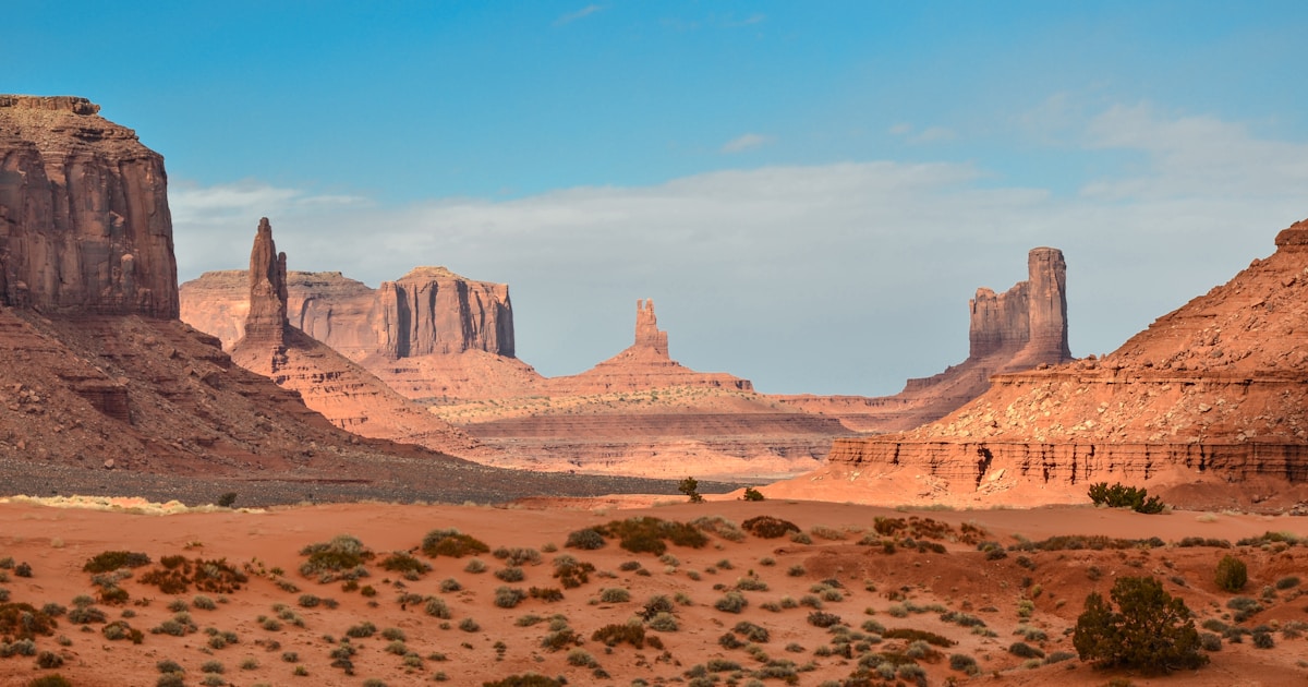
If you have ever seen a flat-topped mountain rising from a desert floor, you already know the magic of mesas and buttes. Carved by millions of years of erosion, these landforms are among the most breathtaking sights on Earth. Here are 18 of the most beautiful mesa and butte desert mountain destinations you should add to your travel list.
Key Takeaways
- Mesas and buttes are formed by millions of years of erosion, creating flat-topped and steep-sided landforms found across deserts worldwide.
- The American Southwest is the world’s top destination for mesa and butte landscapes, with Utah and Arizona leading the way.
- Many of these destinations are located within national parks and protected areas, making them accessible for hiking, photography, and camping.
- The best time to visit most mesa and butte destinations is during spring and fall when temperatures are moderate and light conditions are ideal.
- These landscapes hold deep cultural significance for Indigenous peoples and offer a window into Earth’s geological history.
Overview of the 18 Most Beautiful Mesa and Butte Destinations
| Place Name | Location | Best Time to Visit |
|---|---|---|
| Monument Valley | Arizona/Utah, USA | March – May, September – November |
| Mesa Verde National Park | Colorado, USA | April – June, September – October |
| Capitol Reef National Park | Utah, USA | April – May, September – October |
| Valley of the Gods | Utah, USA | March – May, September – November |
| Grand Staircase-Escalante | Utah, USA | April – June, September – October |
| Chiricahua National Monument | Arizona, USA | March – May, October – November |
| Canyon de Chelly | Arizona, USA | April – June, September – October |
| Goblin Valley State Park | Utah, USA | March – May, September – November |
| Natural Bridges National Monument | Utah, USA | April – June, September – October |
| Book Cliffs | Utah/Colorado, USA | May – September |
| Comb Ridge | Utah, USA | March – May, September – November |
| Kodachrome Basin State Park | Utah, USA | April – June, September – October |
| Devils Tower | Wyoming, USA | May – September |
| Uluru (Ayers Rock) | Northern Territory, Australia | May – September |
| Mount Conner (Attila) | Northern Territory, Australia | May – September |
| Tepui Mountains | Venezuela/Brazil/Guyana | December – March |
| Jebel Uweinat | Libya/Egypt/Sudan border | November – February |
| Bardenas Reales | Navarra, Spain | March – May, September – November |
1. Monument Valley, Arizona/Utah, USA
About
Monument Valley is arguably the most iconic mesa and butte landscape on Earth. Located within the Navajo Nation on the Arizona-Utah border, this vast valley is defined by towering sandstone buttes that rise up to 1,000 feet above the desert floor. It has been featured in countless films and photographs, making it a bucket-list destination for travelers worldwide.
Highlights
The park’s most famous formations include the East and West Mitten Buttes and Merrick Butte. The 17-mile Valley Drive loop offers jaw-dropping views at every turn, with legendary golden hour light.
Best Time to Visit
Spring and fall offer the best temperatures and light. Summer is extremely hot, while winter snow creates stunning red rock contrasts.
2. Mesa Verde National Park, Colorado, USA
About
Mesa Verde, Spanish for “green table,” is a UNESCO World Heritage Site famous for its well-preserved Ancestral Puebloan cliff dwellings. The park sits on a broad mesa overlooking the Montezuma Valley in southwestern Colorado, and it protects nearly 5,000 archaeological sites.
Highlights
Cliff Palace is the largest cliff dwelling in North America with over 150 rooms. Balcony House offers thrilling ladder-climbing, and the Petroglyph Point Trail leads to ancient rock art.
Best Time to Visit
April through June and September through October are ideal. The park’s elevation means cooler temperatures than the surrounding desert, and wildflowers bloom beautifully in late spring.
3. Capitol Reef National Park, Utah, USA
About
Capitol Reef protects the Waterpocket Fold, a 100-mile-long monocline creating dramatic formations. The park’s name comes from its white Navajo sandstone domes that resemble the United States Capitol.
Highlights
The Hickman Bridge Trail leads to a stunning 133-foot natural bridge. Cathedral Valley features towering monoliths that feel like another planet, while the Fruita orchards offer a unique desert contrast.
Best Time to Visit
April through May and September through October provide the best weather. Summer temperatures can soar above 100 degrees Fahrenheit in the lower elevations.
4. Valley of the Gods, Utah, USA
About
Often called Monument Valley’s quieter cousin, the Valley of the Gods is a free, undeveloped area in southeastern Utah filled with dramatic sandstone mesas and buttes.
Highlights
The 17-mile unpaved loop winds between towering formations like Lady in the Bathtub and Rooster Butte. No entrance fees and no crowds make it a peaceful alternative to Monument Valley.
Best Time to Visit
Spring and fall are best. The dirt road can become impassable after heavy rain, so check conditions before visiting during the monsoon season in late summer.
5. Grand Staircase-Escalante National Monument, Utah, USA
About
This vast monument covers nearly 1.9 million acres of remote southern Utah desert. It is named for the colorful cliff layers that step upward like a giant staircase.
Highlights
The Escalante Canyons offer incredible slot canyon hiking including Peek-a-Boo and Spooky Gulch. Hole-in-the-Rock Road leads to Devils Garden and other remote formations.
Best Time to Visit
April through June and September through October are the most comfortable months. Flash flooding is a real danger in slot canyons during summer monsoons.
6. Chiricahua National Monument, Arizona, USA
About
Known as the “Wonderland of Rocks,” Chiricahua National Monument protects a forest of balanced rocks, stone columns, and hoodoos formed from volcanic ash deposits. Located in the Chiricahua Mountains of southeastern Arizona, this park sits at the intersection of four ecological regions.
Highlights
The Heart of Rocks Loop features Big Balanced Rock and Pinnacle Peak. Massai Point offers panoramic views, and the area is a world-class birding destination.
Best Time to Visit
March through May brings wildflowers and mild weather. October and November are also excellent, with comfortable temperatures and clear skies.
7. Canyon de Chelly, Arizona, USA
About
Canyon de Chelly is unique among national monuments because it is located entirely within the Navajo Nation and is still home to Navajo families who farm and raise livestock in the canyon. The canyon’s sheer sandstone walls rise up to 1,000 feet and contain some of the most important archaeological sites in the Southwest.
Highlights
White House Ruin descends 600 feet to a stunning cliff dwelling. Spider Rock, an 800-foot sandstone spire, is one of Arizona’s most photographed formations.
Best Time to Visit
April through June and September through October provide the best conditions. Summer can be hot in the canyon bottom, and winter occasionally brings snow to the rims.
8. Goblin Valley State Park, Utah, USA
About
Goblin Valley is a surreal landscape of thousands of mushroom-shaped rock formations in central Utah’s San Rafael Desert. This small state park packs an incredible visual punch.
Highlights
The Valley of the Goblins lets you wander freely among bizarre formations. The park’s remote location means some of Utah’s darkest skies, perfect for astrophotography.
Best Time to Visit
March through May and September through November are ideal. Summer temperatures regularly exceed 100 degrees, and the park offers little shade.
9. Natural Bridges National Monument, Utah, USA
About
Natural Bridges was the first International Dark Sky Park. Located on a mesa in southeastern Utah, it protects three stunning natural bridges carved through sandstone over millennia.
Highlights
Sipapu, Kachina, and Owachomo bridges are accessible via a scenic loop trail. Sipapu spans 268 feet, making it one of the largest natural bridges in the world.
Best Time to Visit
April through June and September through October offer the best weather. The park’s high elevation means cooler temperatures than the desert below.
10. Book Cliffs, Utah/Colorado, USA
About
The Book Cliffs stretch over 200 miles across Utah and Colorado. Named for their resemblance to a shelf of books, these dramatic cliffs are a paradise for geology enthusiasts.
Highlights
The cliffs reveal millions of years of geological history in their layered faces. The area is rich in wildlife, including mule deer, elk, and golden eagles. The remote nature of the Book Cliffs means you can often have the landscape entirely to yourself, a rare experience in the modern world.
Best Time to Visit
May through September is the best window, as some access roads may be impassable in winter and early spring due to snow and mud.
11. Comb Ridge, Utah, USA
About
Comb Ridge is a dramatic 80-mile monocline of Navajo sandstone in southeastern Utah. This razor-backed ridge is one of the most striking linear landforms in the American Southwest.
Highlights
The House on Fire ruin is one of Utah’s most photographed archaeological sites. The ridge is stunning from Highway 163 at sunrise and sunset.
Best Time to Visit
Spring and fall offer the best temperatures and light conditions. Summer heat can be intense along the exposed ridge.
12. Kodachrome Basin State Park, Utah, USA
About
Named by National Geographic in 1948 for its vivid colors, Kodachrome Basin features 67 sandstone pipes found nowhere else on Earth.
Highlights
Towering sandstone chimneys reaching 170 feet create an otherworldly landscape. The Panorama Trail offers excellent hiking, and dark skies make it a stargazer favorite.
Best Time to Visit
April through June and September through October provide the most pleasant weather for hiking and photography.
13. Devils Tower, Wyoming, USA
About
Devils Tower is a massive igneous intrusion that rises 867 feet above the surrounding terrain in northeastern Wyoming. While technically a laccolith rather than a mesa or butte, its dramatic columnar structure and flat top make it one of the most recognizable desert mountain formations in the world. It was designated as the first United States national monument in 1906.
Highlights
The Tower’s columnar jointing creates hexagonal columns visible from miles away. The 1.3-mile Tower Trail circles the base with close-up views. The area is sacred to many Indigenous nations.
Best Time to Visit
May through September offers the warmest weather and the best access to climbing and hiking routes.
14. Uluru (Ayers Rock), Northern Territory, Australia
About
Uluru is one of the most famous monoliths on the planet, a massive sandstone formation that rises 1,142 feet above the flat desert of central Australia. Located within Uluru-Kata Tjuta National Park, it is a UNESCO World Heritage Site and a deeply sacred place for the Anangu people, the traditional owners of the land.
Highlights
Uluru’s color shifts from deep red at sunrise to glowing orange at sunset. The 6-mile base walk passes ancient rock art sites and waterholes through classic central Australian desert.
Best Time to Visit
May through September (the Australian winter) offers the coolest and most comfortable temperatures. Summer temperatures can exceed 110 degrees Fahrenheit.
15. Mount Conner (Attila), Northern Territory, Australia
About
Often mistaken for Uluru by passing tourists, Mount Conner is a flat-topped mesa located about 30 miles southeast of its more famous neighbor. Known as Attila by the local Indigenous people, this massive mesa rises from the desert floor with steep sides and a perfectly flat summit, making it a textbook example of a mesa landform.
Highlights
Mount Conner’s flat top makes it a striking sight against the vast desert sky. Nearby Lake Amadeus creates surreal salt lake reflections on calm days.
Best Time to Visit
May through September provides the best weather for exploring the central Australian desert.
16. Tepui Mountains, Venezuela/Brazil/Guyana
About
The tepuis are ancient table-top mountains in South America’s Guiana Highlands. Some over 1.6 billion years old, they are among the oldest geological formations on Earth. Auyán-tepui is home to Angel Falls, the world’s tallest waterfall.
Highlights
Mount Roraima sits at the Venezuela-Brazil-Guyana border. Its summit features unique ecosystems including carnivorous plants and endemic species. The sheer cliffs inspired Conan Doyle’s “The Lost World.”
Best Time to Visit
The dry season from December to March offers the best conditions for trekking. During the wet season, the summit is often shrouded in clouds and trails become treacherous.
17. Jebel Uweinat, Libya/Egypt/Sudan Border
About
Jebel Uweinat is a massive mountain range at the Libya-Egypt-Sudan border in the heart of the Sahara. This remote area contains rock art dating back over 10,000 years.
Highlights
The mountain’s rock art depicts a time when the Sahara was green, showing cattle, giraffes, and human figures in vivid detail. The landscape itself is dramatic, with massive boulders, natural arches, and isolated buttes rising from endless sand seas. The area’s extreme remoteness means very few travelers ever see it in person.
Best Time to Visit
November through February offers the most bearable temperatures. Summer in the central Sahara is among the most extreme environments on Earth.
18. Bardenas Reales, Navarra, Spain
About
Bardenas Reales is a semi-desert badlands in northeastern Spain that looks like the American Southwest. This UNESCO Biosphere Reserve covers 100,000 acres of eroded clay, chalk, and sandstone formations.
Highlights
Castildetierra is the park’s most iconic formation, resembling a medieval castle. The area has been used as a filming location for Game of Thrones and other productions.
Best Time to Visit
March through May and September through November offer the best weather. Summer temperatures can be scorching, and the landscape offers very little shade.
Frequently Asked Questions
What is the difference between a mesa and a butte?
A mesa is wider than it is tall, while a butte is taller than it is wide. Both form through erosion, where softer rock wears away leaving a harder caprock on top. Over time, mesas erode into buttes, and buttes eventually become spires.
Where are the best mesas and buttes in the world?
The American Southwest is the premier destination, with Utah, Arizona, Colorado, and New Mexico leading the way. International highlights include Uluru, the Tepui Mountains, and Bardenas Reales.
Are mesa and butte destinations safe for beginners?
Many destinations are accessible with well-maintained roads and visitor centers. National parks like Monument Valley and Mesa Verde are great for beginners. Remote areas require extra water, sun protection, and navigation tools.
What should I pack for a desert mesa trip?
Bring plenty of water (at least one gallon per person per day), sun protection including a wide-brimmed hat and sunscreen, sturdy hiking shoes, layers for temperature changes, and a camera. A GPS device or offline maps are essential for remote areas where cell service is unavailable.
Why do mesas and buttes have different colors?
Colors come from minerals in rock layers. Red and orange come from iron oxide, white from limestone or sandstone. Black streaks known as desert varnish are manganese and iron deposits.
Conclusion
From Monument Valley’s legendary buttes to South America’s ancient tepuis, mesa and butte landscapes offer some of Earth’s most awe-inspiring scenery. Whether you are a photographer, hiker, or nature lover, these 18 destinations deserve a spot on your travel list. Start planning your adventure and discover these flat-topped giants for yourself.
Share this guide with your friends and start planning your next desert adventure today. These breathtaking mesa and butte destinations are waiting for you.
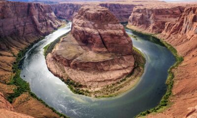

18 Most Dramatic Cliff and Escarpment Nature Destinations
If you’re searching for the most dramatic cliff and escarpment nature destinations on Earth, this guide covers 18 jaw-dropping locations...
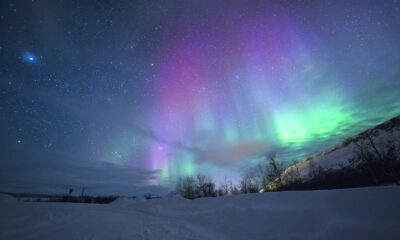

25 Best Mountain Nature Destinations in Europe to Explore
Europe’s mountain landscapes offer some of the most breathtaking scenery on the planet. From the jagged peaks of the Alps...
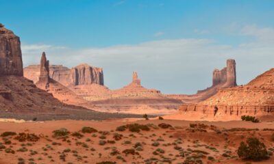

18 Most Beautiful Mesa and Butte Desert Mountain Destinations
If you have ever seen a flat-topped mountain rising from a desert floor, you already know the magic of mesas...
-

 Animals1 year ago
Types of Ants Living in the World and Information
-
 Forests1 year ago
The 10 Best Forests to Visit in the World
-

 Ocean1 year ago
Oceans in the World and Their Information & Locations
-
 Animals4 years ago
(10) Insects Are Animals in the world?
-
 Animals4 years ago
Most Popular Wild Animals in The World
-
 Forests4 years ago
What Is The Biggest Rainforest In The World?
-
 Forests1 year ago
The Main Factors That Contribute to Forest Destruction
-

 Nature1 year ago
The 10 Largest Farms in the World