
Ocean
The Most Incredible Underwater Waterfalls

The Most Incredible Underwater Waterfalls You Need to Know About
When you think of waterfalls, you probably picture water crashing down a cliff into a pool below. But did you know there are waterfalls hidden beneath the ocean surface? Underwater waterfalls are one of nature’s most mind-bending illusions and real geological phenomena. They look exactly like a waterfall pouring into an abyss, but everything is happening underwater. Some are optical illusions created by sand and sediment, while others are actual density-driven currents flowing down underwater cliffs. Either way, they are absolutely stunning.
In this guide, we will explore the most incredible underwater waterfalls on the planet, explain how they actually form, and tell you where and when to see them for yourself.
Key Takeaways
- Underwater waterfalls can be real geological features or optical illusions caused by sediment flow
- The most famous underwater waterfall is the Mauritius Underwater Waterfall, visible from the air
- Some underwater waterfalls are driven by differences in water density and temperature
- You can see several of these natural wonders by boat, helicopter, or even from the shore
- The best time to visit most underwater waterfalls is during dry seasons with clear skies
What Exactly Is an Underwater Waterfall?
An underwater waterfall is exactly what it sounds like, a cascade of water flowing downward beneath the ocean surface. But here is where it gets interesting. Not all underwater waterfalls work the same way.
The optical illusion type is the most common. What you are actually seeing is sand and sediment sliding down an underwater slope. The contrast between the shallow turquoise water and the deep dark ocean floor creates the appearance of a massive waterfall pouring into nothing. The Mauritius underwater waterfall is the classic example of this type.
The real underwater waterfall is a different beast entirely. In certain places, cold, dense water from one ocean basin flows over an underwater ridge and sinks into a warmer, less dense basin below. This is a genuine underwater cascade, driven by physics rather than just visual trickery. The Strait of Gibraltar has one of these, where Mediterranean water flows over the sill at the strait and sinks into the Atlantic.
Both types are incredible in their own right. One tricks your eyes, and the other shows you the raw power of ocean currents at work.
The Most Incredible Underwater Waterfalls in the World
1. The Mauritius Underwater Waterfall
About: This is the underwater waterfall that most people have seen in photos. Located off the southwestern coast of Mauritius in the Indian Ocean, this stunning illusion looks like a massive waterfall plunging into the deep ocean. In reality, it is sand and sediment being pushed off the edge of the Mascarene Plateau by ocean currents.
Highlights: The contrast between the shallow turquoise shelf and the deep dark blue of the open ocean creates a dramatic visual effect. From the air, it looks like the island is being swallowed by a giant drain. The “waterfall” appears to drop over 3,000 meters into the abyss below.
Experience: The best way to see this underwater waterfall is by helicopter or seaplane. Several tour operators in Mauritius offer flights over the southwest coast. You can also see it on satellite imagery, but nothing beats seeing it in person from above.
Best Time to Visit: October to December offers the clearest skies and calmest seas. The dry season from May to November is also excellent for visibility.
Why You Should Visit: Mauritius is already one of the most beautiful island destinations on Earth. Adding a helicopter flight over this natural illusion makes the trip unforgettable. It is also a great starting point for exploring the island’s coral reefs and marine life.
Travel Tips: Book your helicopter tour in advance, especially during peak season. Expect to pay around 200 to 400 USD for a flight. Bring sunglasses and a camera with a polarizing filter to cut through the glare on the water.
2. The Strait of Gibraltar Underwater Waterfall
About: This is one of the few real underwater waterfalls in the world. At the Strait of Gibraltar, where the Mediterranean Sea meets the Atlantic Ocean, dense saltier Mediterranean water flows eastward over the underwater sill and sinks into the less dense Atlantic water below. This creates a genuine underwater cascade that scientists have measured and studied extensively.
Highlights: Unlike the Mauritius illusion, this is a real flow of water moving downhill beneath the surface. The underwater waterfall drops about 1,000 meters and is one of the largest known underwater waterfalls on the planet. It plays a crucial role in global ocean circulation patterns.
Experience: You cannot see this one with your naked eye from the surface. But if you visit the Strait of Gibraltar, you can take boat tours that explain the phenomenon. The area is also one of the best places in Europe for dolphin watching, with several species regularly spotted in the strait.
Best Time to Visit: Spring (April to June) and fall (September to November) offer the best weather and calmest seas for boat tours.
Why You Should Visit: The Strait of Gibraltar is a unique crossroads of continents, oceans, and cultures. Standing on the Spanish or Moroccan coast and knowing there is a massive waterfall flowing beneath the waves is a humbling experience. It is also a fantastic destination for wildlife lovers.
Travel Tips: Take a dolphin-watching boat tour from Tarifa, Spain, or Tangier, Morocco. Many operators include educational commentary about the underwater waterfall and ocean currents. Bring layers, as it can be windy on the water.
3. The Denmark Strait Cataract
About: Hidden in the cold waters between Greenland and Iceland, the Denmark Strait cataract is the world’s largest known underwater waterfall. It is not a waterfall in the traditional sense. Instead, it is a massive flow of cold, dense water from the Nordic Seas that plunges over the Greenland-Scotland Ridge and sinks into the deep Atlantic. The drop is about 3,500 meters, making it taller than any waterfall on land.
Highlights: This underwater cataract carries an estimated 5 million cubic meters of water per second. That is roughly 2,000 times the flow of Niagara Falls. It is a critical part of the global thermohaline circulation, the system of ocean currents that regulates Earth’s climate.
Experience: You will never see this one in person. It happens in one of the most remote and stormy stretches of ocean on the planet. But visiting the Denmark Strait region by expedition cruise gives you a sense of the raw, wild environment where this hidden giant operates.
Best Time to Visit: Summer months (June to August) are the only realistic time to visit this region, when sea ice retreats slightly and expedition ships can navigate the waters.
Why You Should Visit: If you are an adventure traveler looking for something truly off the beaten path, the waters between Greenland and Iceland are about as remote as it gets. Icebergs, Arctic wildlife, and the knowledge that the world’s biggest waterfall is flowing beneath your ship make this a bucket-list experience.
Travel Tips: Book an expedition cruise that includes the Denmark Strait. These trips are expensive and require advance planning. Bring serious cold-weather gear and seasickness medication.
4. The Mauritius South Coast Sediment Flows
About: Beyond the famous main waterfall illusion, the entire southwestern coast of Mauritius features multiple sediment flow patterns that create smaller underwater waterfall effects. These are caused by the same geological processes but appear in different shapes and intensities depending on currents and tides.
Experience: A longer helicopter tour that covers more of the coastline will reveal these additional features. Some boat tours along the coast also offer views of the sediment plumes from the surface.
Best Time to Visit: Same as the main Mauritius waterfall, October to December for the clearest views.
Why You Should Visit: If you are already visiting Mauritius for the main waterfall, extending your tour to see the additional sediment flows adds even more wonder to the experience.
Travel Tips: Ask your helicopter operator about extended coastal tours. The extra flight time is worth it.
5. The Underwater Waterfalls of the Caribbean
About: Several locations in the Caribbean feature underwater waterfall illusions similar to Mauritius. The deep waters close to shore around islands like Dominica, St. Lucia, and the Bahamas create dramatic visual effects where shallow reef shelves drop off into the deep blue. Sediment and sand flowing over these edges create the appearance of underwater cascades.
Highlights: The Caribbean offers the advantage of warm, clear water and easy accessibility. You can often see the underwater waterfall effect while snorkeling or diving, especially around steep wall dives. The contrast between the shallow reef and the deep ocean is striking.
Experience: Scuba diving or snorkeling along steep reef walls is the best way to experience these underwater waterfalls. Many dive operators in the Caribbean offer wall dive experiences where you can see the dramatic drop-offs and sediment flows firsthand.
Best Time to Visit: December to April is the dry season across most of the Caribbean, offering the best visibility and calmest seas.
Why You Should Visit: The Caribbean is one of the most accessible and affordable regions for underwater exploration. Combining a dive trip with the chance to see underwater waterfall effects makes for an incredible vacation.
Travel Tips: If you are not a certified diver, many operators offer introductory wall dive experiences. Snorkeling along reef edges can also give you a glimpse of the effect. Always dive with a certified operator and follow safe diving practices.
Comparison of the Most Incredible Underwater Waterfalls
| Name | Location | Type | Best Time to Visit |
|---|---|---|---|
| Mauritius Underwater Waterfall | Southwest coast, Mauritius | Optical illusion (sediment flow) | October to December |
| Strait of Gibraltar Underwater Waterfall | Strait of Gibraltar (Spain/Morocco) | Real (density-driven current) | April to June, September to November |
| Denmark Strait Cataract | Between Greenland and Iceland | Real (density-driven current) | June to August |
| Mauritius South Coast Sediment Flows | Southwest coast, Mauritius | Optical illusion (sediment flow) | October to December |
| Caribbean Underwater Waterfall Effects | Dominica, St. Lucia, Bahamas | Optical illusion (sediment flow) | December to April |
How Do Underwater Waterfalls Form?
Understanding how underwater waterfalls form makes them even more fascinating. There are two main mechanisms at work.
Sediment flow waterfalls happen when ocean currents push sand and sediment across a shallow shelf. When the shelf ends and the ocean floor drops away, the sediment slides down the slope. From above, this moving sediment creates the illusion of water pouring over a cliff. The color contrast between the shallow, light-colored water and the deep, dark ocean amplifies the effect. Wind and wave action keep the sediment in motion, making the “waterfall” appear to flow continuously.
Density-driven waterfalls are real cascades of water flowing downhill beneath the surface. They form when two bodies of water with different densities meet. Cold water is denser than warm water, and salty water is denser than fresh water. When dense water flows over an underwater ridge or sill, it sinks into the less dense water below. This creates a genuine underwater waterfall that can be measured with scientific instruments. These underwater waterfalls play a vital role in the global ocean conveyor belt, the system that moves heat around the planet and regulates climate.
Both types remind us that the ocean is far more dynamic and complex than it appears from the surface. There are entire landscapes down there, with cliffs, valleys, and yes, waterfalls.Why Underwater Waterfalls Matter
Beyond their visual beauty, underwater waterfalls are important for several reasons.
Ocean circulation: Real underwater waterfalls like the Denmark Strait cataract are key components of global ocean circulation. They help drive the thermohaline circulation, which distributes heat around the planet and influences weather patterns worldwide. Without these underwater cascades, Earth’s climate would be dramatically different.
Marine ecosystems: The areas around underwater waterfalls are often rich in marine life. The movement of water brings nutrients from the deep ocean to the surface, supporting plankton blooms that feed fish, whales, and other animals. Divers and snorkelers often find these areas teeming with life.
Scientific research: Studying underwater waterfalls helps scientists understand ocean dynamics, climate change, and the health of marine ecosystems. These hidden features are windows into processes that affect all of us, even if we never see them.
Tourism and inspiration: Underwater waterfalls draw visitors to remote and beautiful places. They inspire awe and curiosity about the natural world, which is always a good thing. When people fall in love with nature, they are more likely to support conservation efforts.
Frequently Asked Questions About Underwater Waterfalls
Are underwater waterfalls real?
Some are real, and some are optical illusions. The Mauritius underwater waterfall is an illusion created by sand and sediment flowing over an underwater slope. But the Denmark Strait cataract and the Strait of Gibraltar underwater waterfall are real cascades of dense water sinking beneath lighter water. Both types are genuine natural phenomena.
Can you see an underwater waterfall while diving?
It depends on the type. The sediment flow waterfalls in the Caribbean and around Mauritius can sometimes be observed while diving or snorkeling along steep reef walls. However, the large-scale density-driven underwater waterfalls like the Denmark Strait cataract happen at depths far beyond what divers can reach. The Mauritius illusion is best seen from the air.
What causes the Mauritius underwater waterfall illusion?
The Mauritius underwater waterfall is caused by ocean currents pushing sand and sediment off the edge of the Mascarene Plateau. The plateau is a shallow shelf surrounding the island, and it drops off dramatically into the deep Indian Ocean. The contrast between the light-colored shallow water and the dark deep ocean creates the appearance of a waterfall when viewed from above.
Is the Denmark Strait cataract really bigger than Niagara Falls?
Yes, by a huge margin. The Denmark Strait cataract drops about 3,500 meters, compared to Niagara Falls’ 51 meters. It also carries roughly 2,000 times more water per second than Niagara. It is the largest known underwater waterfall in the world, and it is completely invisible from the surface.
Where is the best place to see an underwater waterfall?
For most travelers, Mauritius is the best option. The underwater waterfall illusion is dramatic, easy to access by helicopter, and set in one of the most beautiful island destinations on Earth. The Caribbean is a great second choice if you want to combine underwater waterfall viewing with scuba diving or snorkeling.
Do underwater waterfalls affect marine life?
Yes. The movement of water around underwater waterfalls brings nutrients up from the deep ocean, which supports rich marine ecosystems. Areas near underwater waterfalls often attract fish, dolphins, whales, and other marine animals that feed on the nutrient-rich waters.
What is the best time of year to see the Mauritius underwater waterfall?
The best time to visit Mauritius for clear views of the underwater waterfall is from October to December. The skies are clear, the seas are calm, and visibility is at its peak. The dry season from May to November is also a good window.
Conclusion
Underwater waterfalls are one of those natural wonders that remind you how much mystery still exists on our planet. Whether it is the stunning optical illusion off the coast of Mauritius or the massive hidden cataract between Greenland and Iceland, these phenomena show that the ocean holds secrets we are still discovering. They are beautiful, scientifically important, and deeply humbling.
If you are planning a trip and want to see something truly extraordinary, consider adding an underwater waterfall to your itinerary. A helicopter flight over Mauritius, a boat tour through the Strait of Gibraltar, or a dive along a Caribbean reef wall will give you a story you will tell for the rest of your life.
The ocean is full of wonders. Sometimes the most incredible ones are the ones you cannot see from the surface.
Share this post with your friends who love nature and travel. Start planning your trip today and see these incredible underwater waterfalls for yourself.

10 Rhode Island Road Trip Ideas With Hidden Gems
Rhode Island may be the smallest state in the country, but it packs an incredible amount of coastline, history, and charm into every mile. A road trip here means discovering hidden beaches, quiet seaside villages, and centuries-old landmarks that most visitors drive right past. Whether you are a first-time visitor or a local looking for new spots, these ten destinations will show you a side of Rhode Island you have never seen before.
Key Takeaways
- Rhode Island has over 400 miles of coastline despite being the smallest US state
- Block Island is accessible by ferry and offers car-free exploration
- The Newport Cliff Walk combines ocean views with Gilded Age mansion architecture
- Watch Hill is one of the quietest and most charming coastal villages in New England
- Most hidden gems are best visited in late spring or early fall to avoid summer crowds
- The state’s compact size means you can visit multiple destinations in a single day
- Local seafood shacks and farm-to-table restaurants are found in nearly every coastal town
Introduction
Most people think of Rhode Island as just Newport and maybe a quick stop at Providence. But this tiny state holds some of the most beautiful and overlooked coastal scenery in all of New England. From the dramatic cliffs of Block Island to the sleepy fishing villages along the southern shore, a Rhode Island road trip is the kind of adventure that feels like discovering a secret.
The best part about road tripping through Rhode Island is that nothing is very far away. You can have breakfast in Providence, watch the waves crash at Sachuest Point by lunch, and catch sunset over Newport Harbor by dinner. Every turn reveals another cove, another lighthouse, another small-town main street lined with independent shops and seafood shacks.
This guide covers ten destinations that go beyond the usual tourist trail. Some are well-known spots worth revisiting, while others are the kind of hidden gems that locals keep to themselves. Pack your bags, fill the tank, and get ready to fall in love with the Ocean State.
1. Block Island
About
Block Island sits about 13 miles off the southern coast of Rhode Island, accessible by ferry from Point Judith. The island spans just six square miles but feels like a world apart. With no traffic lights, no chain stores, and miles of undeveloped shoreline, it is the ultimate escape from the mainland rush.
Highlights
The Mohegan Bluffs are the island’s most iconic landmark, with dramatic clay cliffs dropping 150 feet to the ocean below. The Southeast Lighthouse, built in 1875, still guides ships through Block Island Sound and offers tours on summer afternoons. The island’s 365 ponds, rolling hills, and wildflower meadows make it a paradise for hikers and cyclists.
Best Time to Visit
Late May through early October is ideal. Summer brings the warmest weather and full ferry schedules, but September offers thinner crowds, lower accommodation prices, and golden light across the bluffs. The Block Island Race Week in June draws sailing enthusiasts from across the country.
Why You Should Visit
Block Island is one of the last truly unspoiled coastal destinations in New England. There are no fast-food restaurants, no traffic jams, and no high-rises blocking the view. The pace of life slows down the moment you step off the ferry, and the natural beauty of the island rewards every minute you spend exploring it.
Travel Tips
Rent a bike or a moped at the harbor rather than bringing a car on the ferry, as parking is limited and the island is best explored on two wheels. Book ferry tickets in advance during summer weekends, as they sell out quickly. The Mohegan Bluffs staircase has over 100 steps, so wear sturdy shoes.
2. Newport Cliff Walk
About
The Newport Cliff Walk is a 3.5-mile public pathway that runs along the rocky shoreline behind the city’s famous Gilded Age mansions. It is one of the most scenic walks in the entire Northeast, offering unobstructed views of Narragansett Bay on one side and the grand estates of America’s wealthiest families on the other.
Highlights
The walk passes directly behind The Breakers, Marble House, Rosecliff, and several other mansions that define Newport’s architectural legacy. The rocky shoreline itself is worth exploring, with tide pools and natural rock formations that change with every wave. The section near Bailey’s Beach offers a quieter, more secluded experience away from the main tourist stretch.
Best Time to Visit
Early morning in late spring or early fall provides the best combination of mild weather and manageable crowds. Summer afternoons can be busy, especially near the mansion overlooks. Winter walks offer dramatic storm-watching opportunities but require warm layers and caution on slippery rocks.
Why You Should Visit
The Cliff Walk is the only place in America where you can experience both raw natural beauty and extraordinary human achievement in a single stroll. The contrast between the wild Atlantic shoreline and the manicured lawns of the mansions tells the story of Newport itself, a place where nature and ambition have coexisted for centuries.
Travel Tips
Start from the east end near First Beach for a less crowded experience, as most people begin at the western end near Bailey’s Wear comfortable walking shoes with good grip, as some sections are uneven. The walk is free and open year-round, though some mansion-adjacent sections may close during private events.
3. Watch Hill
About
Watch Hill is a tiny coastal village at the southwestern tip of Rhode Island, right on the Connecticut border. It is one of the most exclusive and quietly beautiful seaside communities in New England, with a historic carousel, a classic lighthouse, and a main street that feels frozen in time.
Highlights
The Watch Hill Lighthouse, built in 1856, marks the western entrance to Fishers Island Sound and offers panoramic views from its base. The Flying Horse Carousel, operating since 1876, is the oldest suspended-horse carousel in the country and still costs just a dollar per ride. East Beach stretches for nearly a mile along the open Atlantic, with soft sand and gentle waves.
Best Time to Visit
Summer is peak season, but late September and early October bring warm days, empty beaches, and a peaceful atmosphere. The carousel operates from June through Labor Day. Spring visits offer wildflower displays along the coastal trails and fewer visitors overall.
Why You Should Visit
Watch Hill is the antidote to overdeveloped beach towns. There are no boardwalks, no amusement parks, and no high-rise hotels. What you get instead is a genuine New England village where the pace is slow, the beaches are pristine, and the sense of place is unmistakable. It is the kind of spot that makes you want to extend your trip by a week.
Travel Tips
Parking is extremely limited in summer, so arrive early or consider biking from nearby Westerly. The village has a small but excellent selection of cafes and ice cream shops along Bay Street. Respect private property signs along the beach, as much of the shoreline is lined with private homes.
4. Beavertail State Park
About
Located at the southern tip of Conanicut Island in Jamestown, Beavertail State Park is one of Rhode Island’s most dramatic coastal landscapes. The park encompasses 153 acres of rocky shoreline, salt marshes, and open meadows, all centered around the active Beavertail Lighthouse.
Highlights
The Beavertail Lighthouse, the third oldest in the country, has been guiding ships since 1749 and offers museum exhibits inside the keeper’s house. The rocky tide pools at low tide are teeming with sea life, from tiny crabs to starfish. On clear days, the views stretch across Narragansett Bay to Newport and the Atlantic beyond.
Best Time to Visit
Spring and fall are ideal for hiking and tide pool exploration. Summer brings the warmest weather for picnicking on the rocks, though it can get crowded on weekends. Winter storm-watching from the park’s elevated viewpoints is a local tradition, with waves crashing spectacularly against the cliffs.
Why You Should Visit
Beavertail offers the raw, untamed beauty of the Rhode Island coast without the crowds of more famous destinations. The combination of history, geology, and ocean views makes it a perfect stop on any road trip through the Narragansett Bay area. It is also one of the best spots in the state for photography, especially at golden hour.
Travel Tips
The park has a small parking lot that fills quickly on summer weekends, so arrive before 10 AM. Wear shoes with good traction on the rocks, as surfaces can be slippery. The lighthouse museum has limited hours, so check the schedule before your visit. There is a small entrance fee during peak season.
5. Bristol Harbor and the East Bay Bike Path
About
Bristol is a historic harbor town on the eastern shore of Narragansett Bay, known for its colonial architecture, its Fourth of July celebration, and the East Bay Bike Path. The 14.5-mile paved trail runs along the waterfront from Bristol to Providence, passing through some of the most scenic stretches of the bay.
Highlights
The bike path follows the old railroad bed along the shoreline, offering continuous views of the bay, salt marshes, and waterfront homes. Colt State Park, located along the path, provides open lawns, picnic areas, and views of the Mount Hope Bridge. Bristol Harbor itself is a working waterfront with fishing boats, sailboats, and a lively waterfront dining scene.
Best Time to Visit
Late spring through early fall is perfect for biking, with mild temperatures and long daylight hours. The Fourth of July celebration in Bristol, running since 1785, is the oldest continuous Independence Day celebration in the country. Fall foliage along the bike path is stunning in October.
Why You Should Visit
The East Bay Bike Path is one of the most beautiful and accessible cycling routes in New England, suitable for all fitness levels. Bristol itself is a charming town with excellent restaurants, a walkable downtown, and a deep sense of history. Together, they make for a full day of exploration that combines outdoor activity with small-town charm.
Travel Tips
Bike rentals are available in both Bristol and Providence if you do not bring your own. The path is paved and mostly flat, making it ideal for families and casual riders. Bring water and sunscreen, as there is limited shade along some sections. The path can be busy on summer weekends, so weekday visits are quieter.
6. Ninigret National Wildlife Refuge
About
Ninigret National Wildlife Refuge, located on the southern coast near Charlestown, protects over 900 acres of coastal habitat including salt ponds, barrier beaches, and shrubland. It is one of the best birdwatching destinations in Rhode Island and a peaceful retreat from the busier beach towns nearby.
Highlights
The refuge’s centerpiece is Ninigret Pond, a large salt pond that attracts thousands of migratory birds each year, including osprey, herons, and various species of ducks and geese. The barrier beach offers a quiet, undeveloped shoreline for walking and beachcombing. Several well-maintained trails wind through the refuge, ranging from short loops to longer hikes.
Best Time to Visit
Spring and fall migration seasons bring the greatest variety of bird species. Summer is warm and pleasant for walking the trails, though insects can be present in the shrubland areas. Winter visits offer solitude and the chance to see overwintering waterfowl in the pond.
Why You Should Visit
Ninigret is a reminder that Rhode Island’s natural beauty extends far beyond its famous mansions and beaches. The refuge offers a quiet, contemplative experience where the main attractions are the sounds of birds, the rustle of wind through beach grass, and the shimmer of sunlight on the salt pond. It is an essential stop for anyone who loves wildlife and open space.
Travel Tips
Bring binoculars for birdwatching, as many species are best observed from a distance. The refuge is free to enter and open from dawn to dusk. Stay on marked trails to protect sensitive habitat. Insect repellent is recommended from late spring through early fall.
7. Mohegan Bluffs and the Southeast Lighthouse
About
While Block Island was already mentioned as a whole destination, the Mohegan Bluffs and Southeast Lighthouse deserve special attention as a standalone stop. Located on the island’s southeastern corner, this area combines some of the most dramatic coastal scenery in Rhode Island with a piece of maritime history.
Highlights
The Mohegan Bluffs rise nearly 200 feet above the ocean, with a steep staircase leading down to the beach below. The clay cliffs are constantly eroding, creating a landscape that changes with every storm. The Southeast Lighthouse, a red brick tower built in 1875, was actually moved back from the cliff edge in 1993 to save it from falling into the sea.
Best Time to Visit
Summer offers the warmest weather and the most reliable ferry service from the mainland. Early morning visits provide the best light for photography and the fewest visitors. Late afternoon light turns the clay cliffs a warm golden color that is unforgettable.
Why You Should Visit
The Mohegan Bluffs are one of the most photographed locations in Rhode Island, and seeing them in person is even more impressive than any picture. The combination of the towering cliffs, the historic lighthouse, and the endless ocean creates a sense of awe that stays with you long after you leave the island.
Travel Tips
The staircase down to the beach has about 141 steps and can be strenuous on the way back up. Bring water and take your time. The lighthouse offers guided tours during summer months for a small fee. The bluffs are exposed to wind, so bring a light jacket even on warm days.
8. Providence Waterplace Park and Riverwalk
About
Providence, the capital of Rhode Island, has undergone a remarkable transformation over the past few decades, and Waterplace Park is at the heart of that revival. The park and adjacent Riverwalk follow the Woonasquatucket River through downtown, creating a green corridor of walkways, bridges, and public art in the center of the city.
Highlights
The Riverwalk passes under numerous stone bridges and alongside historic mill buildings that have been converted into apartments, restaurants, and galleries. Waterplace Park hosts the famous WaterFire events, where bonfires are lit on the river and the scent of aromatic wood fills the air. The nearby College Hill neighborhood is home to Brown University and the Rhode Island School of Design, with beautiful architecture and independent bookstores.
Best Time to Visit
WaterFire events, held on select evenings from spring through fall, are the premier attraction and draw thousands of visitors. Check the schedule in advance, as dates vary. The Riverwalk is pleasant year-round, with fall foliage reflecting beautifully on the water. Summer evenings are ideal for dining at the riverside restaurants.
Why You Should Visit
Providence is the cultural and culinary heart of Rhode Island, and Waterplace Park is the perfect starting point for exploring the city. The combination of urban energy, historic architecture, and waterfront beauty makes it a unique destination that surprises visitors who expect a typical state capital. It is also the ideal place to begin or end your Rhode Island road trip.
Travel Tips
Parking in downtown Providence can be challenging on event nights, so use the garages on the periphery and walk in. The Riverwalk is free and accessible at all times. For WaterFire nights, arrive early to secure a good viewing spot along the river. The city’s restaurant scene is excellent, with options ranging from casual seafood to fine dining.
9. Sachuest Point National Wildlife Refuge
About
Sachuest Point, located on a peninsula in Middletown just east of Newport, is a 242-acre national wildlife refuge managed by the US Fish and Wildlife Service. It offers some of the most accessible and rewarding coastal hiking in southern Rhode Island, with sweeping views of the Atlantic Ocean and Sakonnet River.
Highlights
The refuge’s 2.5-mile trail network winds through coastal grasslands, past freshwater ponds, and along rocky shorelines. The point itself offers 360-degree ocean views and is one of the best spots in Rhode Island for watching hawks and other raptors during fall migration. The visitor center has exhibits on local wildlife and the history of the site, which was formerly a Navy communications station.
Best Time to Visit
Fall is the prime season for birdwatching, particularly for hawks and owls migrating along the coast. Spring brings wildflowers to the grasslands and returning songbirds. Summer is pleasant for walking, though the exposed trails can be hot. Winter offers dramatic ocean views and the chance to see har seals offshore.
Why You Should Visit
Sachuest Point is one of those places that feels much more remote than it actually is. Just minutes from the busy streets of Newport, you can walk for hours along empty trails with nothing but the sound of waves and wind. The refuge is a testament to the power of conservation and a reminder that even in a small state, there are still wild places worth protecting.
Travel Tips
The refuge is free and open from dawn to dusk. The main trail is relatively flat and accessible, though some side trails can be uneven. Bring binoculars and a field guide if you are interested for birding. The visitor center has restrooms and water. Dogs are not allowed in the refuge to protect wildlife.
10. Galilee and the Point Judith Lighthouse
About
Galilee is a working fishing village on the southern coast of Rhode Island, best known as the departure point for the Block Island ferry. But beyond the ferry terminal, Galilee offers a genuine slice of Rhode Island’s fishing heritage, complete with a historic lighthouse, a bustling fish market, and some of the freshest seafood you will find anywhere.
Highlights
The Point Judith Lighthouse, built in 1857, marks the entrance to Narragansett Bay and is one of the most photographed lighthouses in the state. The Galilee fish market sells the day’s catch directly from the boats, including lobster, scallops, and flounder. The nearby Salty Brine State Beach is a narrow strip of sand that is popular with surfers and beachcombers.
Best Time to Visit
Summer is the busiest season, with the ferry running at full capacity and the fish market at its most active. Early morning visits to the fish market offer the best selection. Spring and fall provide a quieter experience with cooler temperatures and fewer tourists. The lighthouse grounds are accessible year-round.
Why You Should Visit
Galilee is the real Rhode Island, the working waterfront where fishermen still head out before dawn and the smell of salt air mixes with diesel fuel and fresh lobster. It is not polished or fancy, but it is authentic in a way that few tourist destinations can match. Watching the fishing boats come in at the end of the day is one of the most satisfying experiences on this entire road trip.
Travel Tips
Arrive early if you are catching the Block Island ferry, as the parking lot fills quickly in summer. The fish market is best visited in the morning when the boats come in. The lighthouse grounds are open to the public, but the tower itself is not regularly open for climbing. Several casual seafood restaurants in the area serve the day’s catch at reasonable prices.
Comparison Table
| Destination | Location | Best Time to Visit |
|---|---|---|
| Block Island | 13 miles offshore, ferry from Point Judith | Late May through early October |
| Newport Cliff Walk | Newport, eastern shore | Early morning, late spring or early fall |
| Watch Hill | Southwestern tip, Connecticut border | Late September to early October |
| Beavertail State Park | Jamestown, Conanicut Island | Spring and fall |
| Bristol Harbor and East Bay Bike Path | Bristol, eastern Narragansett Bay | Late spring through early fall |
| Ninigret National Wildlife Refuge | Charlestown, southern coast | Spring and fall migration |
| Mohegan Bluffs and Southeast Lighthouse | Block Island, southeastern corner | Summer, early morning |
| Providence Waterplace Park | Providence, downtown | Summer evenings, WaterFire nights |
| Sachuest Point National Wildlife Refuge | Middletown, east of Newport | Fall for birdwatching |
| Galilee and Point Judith Lighthouse | Southern coast, Narragansett | Summer mornings |
Frequently Asked Questions
How long does it take to road trip around Rhode Island?
You can drive across Rhode Island in about an hour, but a proper road trip covering all ten destinations on this list would take at least three to four days. This allows time for hiking, beach visits, and exploring the towns without rushing. A week-long trip would let you fully experience each destination and include spontaneous detours along the way.
Do I need a car for this road trip?
A car is highly recommended for most of these destinations, as public transportation in Rhode Island is limited outside of Providence and Newport. The East Bay Bike Path and Block Island can be enjoyed without a car, but reaching places like Watch Hill, Galilee, and Sachuest Point is much easier with your own vehicle. Rental cars are available at T.F. Green Airport near Providence.
What is the best season for a Rhode Island road trip?
Late spring (May through June) and early fall (September through October) offer the best balance of pleasant weather, manageable crowds, and full access to attractions. Summer is the peak season with the warmest weather but also the heaviest traffic and highest accommodation prices. Winter can be beautiful for storm-watching and solitude, but some attractions have reduced hours.
Is Rhode Island expensive to visit?
Rhode Island can be moderately expensive, especially in Newport and Watch Hill during summer. However, many of the best experiences, including the Cliff Walk, Beavertail State Park, Sachuest Point, and Ninigret Refuge, are free. Budget travelers can save by visiting in the shoulder season, staying in chain hotels outside the main tourist areas, and eating at local seafood shacks rather than fine dining restaurants.
Can I visit Block Island as a day trip?
Yes, the Block Island ferry from Point Judith takes about one hour each way, making a day trip feasible. However, you will only have about four to five hours on the island, which is enough to see the Mohegan Bluffs and grab lunch but not enough to fully explore. An overnight stay is highly recommended to experience the island’s quiet evening atmosphere and sunrise views.
Are there good hiking opportunities on this route?
Absolutely. Sachuest Point, Ninigret Refuge, Beavertail State Park, and the East Bay Bike Path all offer excellent walking and hiking opportunities ranging from easy waterfront strolls to more challenging coastal trails. Block Island has over 17 miles of trails that wind through meadows, along bluffs, and around the island’s many ponds.
What should I pack for a Rhode Island road trip?
Layers are essential, as coastal weather can change quickly even in summer. Bring a windbreaker or light jacket for ocean-facing destinations, comfortable walking shoes with good grip for rocky shorelines, sunscreen, and binoculars for birdwatching. If you plan to visit Block Island, pack a bike helmet if you intend to cycle, and bring cash for the carousel and some smaller vendors.
Conclusion
A Rhode Island road trip is one of the most rewarding coastal adventures in New England. In just a few days, you can experience dramatic ocean bluffs, quiet fishing villages, world-class mansions, and wild coastal refuges, all within a state you can drive across in an hour. The key is to slow down and let the journey unfold, stopping at that unmarked beach pullout, following that trail to the lighthouse, and sitting on the rocks watching the waves long after the sun has set.
Rhode Island proves that great travel experiences do not require vast distances or exotic destinations. Sometimes the best adventures are found in the smallest places, hidden in plain sight along a coastline that has been welcoming visitors for centuries. Start planning your Rhode Island road trip today, and discover the hidden gems that make the Ocean State one of America’s best-kept secrets.
Share this post with your friends and start planning your Rhode Island adventure today.
Why Dolphins Love to Surf in Front of Boats
You are cruising along the coast, maybe on a ferry or a small charter boat, when suddenly a sleek gray shape appears off the bow. A dolphin. Then another. And another. They are riding the wave your boat creates like it is the best surf break on the planet. It is one of the most magical things you can see on the water, and it happens more often than you might think.
So why do dolphins do this? The short answer is that bow riding, as it is called, is a perfect mix of energy savings, play, and social bonding. Dolphins are incredibly smart, and they figured out a long time ago that the pressure wave in front of a moving boat is basically a free ride. But there is a lot more going on beneath the surface.
Key Takeaways
- Dolphins surf boat waves, called bow riding, because it saves them enormous amounts of energy while traveling.
- It is also a form of play, which helps young dolphins develop motor skills and social bonds.
- Different species have different preferences for bow riding, with bottlenose dolphins being the most enthusiastic.
- The behavior is mostly harmless to dolphins, but boaters should follow guidelines to keep it that way.
- The best places to see this behavior include the Gulf Coast of Florida, the Azores, Hawaii, the Mediterranean coast, and Shark Bay in Australia.
What Is Bow Riding, Exactly?
When a boat moves through water, it creates a pressure wave at the front, called the bow wave. This wave pushes water outward and forward, creating a zone of moving water that travels at roughly the same speed as the boat. A dolphin that positions itself in this zone can essentially surf the wave without expending much of its own energy.
Think of it like drafting in cycling. A cyclist riding behind another rider experiences less wind resistance and can maintain the same speed with less effort. Dolphins do the same thing with water. Studies have shown that bow-riding dolphins reduce their swimming speed by up to 50 percent while maintaining the same pace as the boat. Their heart rate drops. Their oxygen consumption drops. It is the ultimate hack for efficient travel.
Dolphins do not just ride the bow wave, though. They also wave ride behind boats, surfing the wake the same way a surfer rides an ocean swell. Some dolphins will alternate between bow riding and wake riding, almost like they are deciding which wave feels better at the moment.
Why Dolphins Save Energy by Riding Boat Waves
Dolphins are powerful swimmers. A bottlenose dolphin can reach speeds of 20 miles per hour in short bursts. But swimming fast burns a lot of calories. In the wild, dolphins eat about 4 to 9 percent of their body weight in fish every day, all of it fueling a lifestyle that demands constant movement.
Here is the key physics. A dolphin swimming at 10 miles per hour on its own has to push through the water with its tail flukes, fighting drag the entire time. But a dolphin in the bow wave of a boat going 10 miles per hour is essentially stationary relative to the water around it. The wave does the work. The dolphin just holds its position and lets the wave carry it forward.
Researchers who studied dolphins off the coast of Laguna, Brazil, found that bow-riding dolphins had significantly lower tail-beat frequencies than dolphins swimming freely at the same speed. That means they were moving their tails far less often but keeping up just fine. In energy terms, it is like switching from sprinting to coasting on a bicycle downhill.
This matters because dolphins live in an environment where energy efficiency can be the difference between life and death. Young dolphins, old dolphins, and mothers nursing calves all benefit from any opportunity to save energy. A free ride from a passing boat is not just fun. It is a genuine survival advantage.
It Is Also About Play
If energy savings were the only reason dolphins rode bow waves, you would expect the behavior to be most common in populations that are struggling to find food or traveling long distances. But that is not what researchers see. Healthy, well-fed dolphin populations actually engage in bow riding just as much, and sometimes more, than others. That tells scientists that something else is going on. That something is play.
Play is a huge part of dolphin life. Calves play almost constantly in their first few years, chasing each other, tossing seaweed, and riding waves created by natural ocean swells. Adults play too, though less frequently. Bow riding fits right into this pattern. It is exciting. It involves speed, balance, and social coordination. It is, by any definition, fun.
Play in dolphins serves a real purpose. It builds motor skills, strengthens social bonds, and helps young dolphins practice the complex coordination they will need for hunting and mating later in life. When a group of dolphins rides a bow wave together, they are playing, yes. But they are also reinforcing the social ties that hold their pod together.
Scientists have noticed that bow riding often involves what they call “social positioning.” Dominant dolphins tend to take the prime spot at the front of the bow wave, while younger or less dominant individuals ride slightly behind. It is a social activity with social rules, just like most things in dolphin life.
How Dolphins Use Echolocation to Find the Sweet Spot
One of the fascinating things about bow riding is how precisely dolphins position themselves in the wave. They do not just swim up to a boat and hang out nearby. They place themselves in a very specific zone where the wave’s energy is optimal.
Dolphins use echolocation, their biological sonar system, to map the water pressure around a moving boat. They can literally “see” the shape of the bow wave using sound. Their clicks and buzzes bounce off the density differences in the water, giving them a detailed picture of where the wave is strongest and where they need to be.
This is why dolphins seem to know exactly how far to stay from the boat and at what angle to position themselves. It is not random. It is calculated. They adjust their position constantly as the boat speeds up, slows down, or changes direction, staying locked into the sweet spot with remarkable precision.
| Place Name | Location | Best Time to Visit |
|---|---|---|
| Sarasota Bay | Florida, USA | Year-round (peak: May to October) |
| The Azores | Portugal (North Atlantic) | May to October |
| Shark Bay | Western Australia | April to September |
| Kona Coast | Hawaii, USA | December to April |
| Gulf of Cádiz | Southern Spain / Portugal | June to September |
| Mediterranean French Riviera | Southern France | May to September |
Sarasota Bay, Florida
About: Sarasota Bay is home to one of the longest-studied dolphin populations in the world. The Sarasota Dolphin Research Program has been tracking these dolphins since 1970, making it one of the most important sites for understanding dolphin behavior anywhere.
Highlights: Bottlenose dolphins here are famous for their interactions with boats. Because the bay is a busy waterway, dolphins have had generations to learn the art of bow riding. You can see it from charter boats, kayaks, and even from shore near New Pass.
Experience: Dolphin-watching tours depart regularly from Marina Jack in Sarasota. Most tours last two hours and almost always encounter the resident dolphin pods.
Best Time to Visit: Dolphins are present year-round, but summer months offer calmer seas and more frequent sightings. Early morning tours tend to be best.
Why You Should Visit: This is dolphin research ground zero. You are not just seeing dolphins. You are seeing the animals that helped scientists understand how and why dolphins behave the way they do. Check out the Sarasota Dolphin Research Program for more.
Travel Tips: Book a tour with a company that follows dolphin-safe boating guidelines. The Dolphin SMART program certifies operators who maintain safe distances and limit interaction time.
The Azores, Portugal
About: This volcanic archipelago in the North Atlantic is one of the best places in Europe to see dolphins in the wild. Over 20 species of cetaceans pass through these waters, including bottlenose dolphins, common dolphins, and Atlantic spotted dolphins.
Highlights: Bow riding here is common, especially with common dolphins, which are incredibly acrobatic and travel in large groups. Picking up to 100 dolphins surrounding your boat is not unusual during peak season.
Experience: Whale and dolphin watching tours depart from Faial, Pico, and São Miguel. Many use lookouts on shore who spot dolphins and radio the boats, increasing your chances dramatically.
Best Time to Visit: May through October is peak season. Spring months bring larger pods as dolphins migrate through the area.
Why You Should Visit: The Azores offer a rare combination of wild ocean beauty and reliable dolphin encounters. The islands themselves are stunning, with volcanic craters, hot springs, and lush green landscapes.
Travel Tips: Book directly with local cooperatives like Futurismo for responsible wildlife tours. Bring a good zoom lens. The dolphins can be fast and unpredictable.
Shark Bay, Western Australia
About: Shark Bay is a UNESCO World Heritage site and home to one of the largest Indo-Pacific bottlenose dolphin populations in Australia. The bay is shallow, warm, and teeming with marine life.
Highlights: Dolphins at Monkey Mia beach are famous for walking right up to shore, but the real show happens in deeper water where they ride the bow waves of fishing boats and tour vessels with incredible skill.
Experience: Take a wildlife cruise from Denham or Monkey Mia. Some tours focus specifically on dolphin encounters in the bay’s outer channels where bow riding is most common.
Best Time to Visit: April to September offers the best weather and calmest seas. Water visibility is excellent.
Why You Should Visit: Shark Bay offers a wild, uncrowded experience. The bay’s unique ecosystem supports dugongs, sea turtles, and vast seagrass meadows alongside the dolphins.
Travel Tips: This is a remote area. Plan for a road trip from Perth or combine it with a visit to the nearby Ningaloo Reef. There is limited accommodation in Denham, so book ahead.
Kona Coast, Hawaii
About: The Kona Coast on the Big Island of Hawaii is famous for spinner dolphins, known for their spectacular aerial acrobatics. While spinner dolphins are more known for spinning than bow riding, they do engage in boat wave interactions, especially in the morning when they return to sheltered bays to rest.
Highlights: Morning snorkel and dolphin-watching tours along the Kona Coast frequently encounter spinner dolphin pods. You may see them leaping, spinning, and occasionally riding bow waves as boats move through the area.
Experience: Tours depart from Honokōhau Harbor near Kailua-Kona. Many operators offer snorkel-and-dolphin combinations that let you get in the water near resting pods.
Best Time to Visit: December to April is peak season, but spinner dolphins are present year-round. Morning trips have the highest success rates.
Why You Should Visit: Hawaiian spinner dolphins are unique in their habit of returning to the same bays every morning. It is a predictable and intimate wildlife experience unavailable almost anywhere else.
Travel Tips: Federal regulations require boaters to stay at least 50 yards from spinner dolphins in Hawaiian waters. Choose operators who respect this rule. The NOAA spinner dolphin page has current guidelines.
Gulf of Cádiz, Southern Spain and Portugal
About: The waters between southern Spain and Portugal are a major crossroads for marine life. Dolphins, whales, sea turtles, and seabirds all concentrate here where the Atlantic meets the Mediterranean.
Highlights: Common dolphins and bottlenose dolphins are frequently seen bow riding off the coast near Tarifa and Gibraltar. The Strait of Gibraltar funnels water and marine life through a narrow channel, creating rich feeding grounds.
Experience: Boat tours from Tarifa often combine dolphin watching with whale sightings. Sperm whales and orcas are also spotted here seasonally, making it a multi-species destination.
Best Time to Visit: June through September brings warm weather and calm seas. The Gibraltar Strait is most active biologically in spring and summer.
Why You Should Visit: This area offers an incredible density of marine wildlife in a relatively small area. You might see dolphins, whales, and even loggerhead turtles on a single trip.
Travel Tips: The Strait of Gibraltar can be rough when the winds blow. Check forecasts and book with operators who monitor sea conditions. Fundación Cetacea runs research-based tours in the area.
Mediterranean French Riviera, Southern France
About: The waters off southern France, particularly around the Pelagos Marine Sanctuary, are home to a rich population of bottlenose dolphins, striped dolphins, and fin whales. Established in 1999, the sanctuary spans 87,500 square kilometers of French, Italian, and Monaco waters.
Highlights: Striped dolphins are frequent bow riders here, often approaching boats with obvious enthusiasm. The deep blue water makes them easy to spot, and their acrobatic jumps are spectacular against the coastal backdrop.
Experience: Whale and dolphin watching tours depart from Nice, Cannes, and Antibes. The deep continental shelf edge is just a few hours from port, and dolphin encounters are common.
Best Time to Visit: May through September offers the best conditions. Summer months are busiest but also most reliable for sightings.
Why You Should Visit: The Pelagos Sanctuary is one of the few marine protected areas in the Mediterranean dedicated specifically to marine mammals. Your visit supports the local conservation economy.
Travel Tips: Look for operators affiliated with the Pelagos Sanctuary or labeled “eco-responsible.” The Riviera is well-connected by train, so you can combine your trip with city exploring.
Is Bow Riding Dangerous for Dolphins?
This is the question every responsible wildlife watcher should ask. The good news is that for the most part, bow riding is harmless. Dolphins are fast, agile, and experienced around boats. They have been interacting with vessels of all sizes for as long as humans have been on the water.
That said, there are some risks. In areas with heavy boat traffic, dolphins can swim closer to propellers than is safe. Young calves are curious and may not have learned to assess boat speed and direction as well as adults. There have been documented cases of propeller strikes, particularly in busy harbors and rivers.
The other concern is behavioral. If dolphins spend too much time around boats, they may become less wary of vessels, which increases injury risk. In some places, dolphins have become so habituated to boats that they approach fishing boats begging for food, which can lead to entanglement in lines or ingestion of inappropriate food.
The key guidelines for boaters are simple:
- Reduce speed if you see dolphins ahead. Slow down gradually rather than making sudden course changes.
- Never chase dolphins or direct your boat toward a pod. If they want to ride your bow wave, they will come to you.
- Maintain a steady course and speed. Erratic steering is more dangerous than anything else.
- Do not feed dolphins or encourage them to approach with food.
- In the United States, NOAA recommends staying at least 50 yards from dolphins in the wild. In the European Union, similar guidelines apply in many marine sanctuaries.
How Dolphins Learned This Behavior
Bow riding is not instinctive. It is learned, passed from mother to calf and spread through social groups. Researchers studying dolphin populations in different parts of the world have found that bow riding is more common in populations that have had long exposure to boat traffic. Dolphins in remote areas with very little boat traffic rarely exhibit the behavior.
This tells us that dolphins are not hardwired to do this. They figured it out. A dolphin at some point noticed that the wave in front of a boat was pushing water forward, realized it could ride that wave, and the behavior spread from there. It is cultural transmission, the dolphin equivalent of a useful trick being shared in a social network.
What is remarkable is how quickly some dolphin populations adopted the behavior after boats became common in their habitat. In some cases, researchers documented bow riding appearing in a population within a single generation. That is fast cultural adoption by any standard.
The Bigger Picture
Watching dolphins surf in front of a boat is one of those experiences that sticks with you. It is playful, surprising, and a little humbling. Here is an animal that has figured out something clever about physics and uses it to save energy and have fun at the same time. It makes you appreciate just how intelligent and adaptable dolphins really are.
If you love nature and the ocean, this is one wildlife experience you should put on your list. It happens all over the world, from Florida to the French Riviera, and it costs nothing extra beyond a boat ride. The main thing is to do it responsibly. Give the dolphins space, let them come to you, and enjoy the show on their terms.
If you found this article interesting, share it with your friends who love the ocean. And if you are planning a coastal trip, consider adding a dolphin-watching excursion to your itinerary. It might end up being the best part of your vacation.
Frequently Asked Questions
Why do dolphins swim in front of boats?
Dolphins ride the bow wave created by moving boats because it saves them energy. The pressure wave pushes water forward, allowing dolphins to travel at the boat’s speed while expending far less effort than swimming on their own. It is also a form of play and social bonding.
Is it safe for dolphins to swim near boats?
In most cases, yes. Dolphins are skilled at positioning themselves safely in bow waves and avoiding propellers. However, in areas with heavy boat traffic, there is a risk of injury from propeller strikes. Boaters should maintain steady courses and reduce speed when dolphins are nearby.
What types of dolphins ride boat waves?
Bottlenose dolphins are the most common bow riders, but common dolphins, striped dolphins, spinner dolphins, and Atlantic spotted dolphins also engage in the behavior. It varies by region and species. In the Azores, for example, common dolphins are the enthusiastic bow riders. In Hawaii, spinner dolphins occasionally interact with boat waves.
Where is the best place to see dolphins surfing boat waves?
Some of the best locations include Sarasota Bay in Florida, the Azores in Portugal, Shark Bay in Western Australia, the Kona Coast in Hawaii, the Gulf of Cádiz between Spain and Portugal, and the Mediterranean coast of France. Each location offers different species and experiences.
Do dolphins ride boat waves for fun or survival?
Both. The primary benefit is energy savings, which is a survival advantage. But dolphins also do it because it is enjoyable. Healthy, well-fed dolphin populations engage in bow riding just as much as others, suggesting that play is a significant motivator.
Can you attract dolphins to your boat?
You should never chase or actively attract dolphins to your boat. In most places, it is illegal and harmful to approach dolphins aggressively. If dolphins want to interact with your boat, they will come to you. The best approach is to maintain a steady course and speed and let the dolphins decide.
What should you do if dolphins start riding your bow wave?
Keep your speed steady and do not make sudden turns. Maintain your course and let the dolphins join or leave on their terms. Do not accelerate or decelerate abruptly. In the United States, maintain at least 50 yards of distance from dolphins whenever possible.
How Whales Navigate Across Entire Oceans
Whales are some of the greatest travelers on Earth. Every year, many species swim thousands of miles across vast, featureless oceans to reach feeding grounds, breeding areas, and calving sites. But how do these massive animals find their way across dark, open water where there are no roads, no signs, and no landmarks? Scientists have been studying whale navigation for decades, and the answers are as fascinating as the journeys themselves.
Key Takeaways
- Whales use a combination of Earth’s magnetic field, ocean currents, star positions, and sound to navigate across entire oceans.
- Some whale species, like humpbacks and gray whales, migrate over 10,000 miles round trip every year.
- Whales can detect the Earth’s magnetic field through tiny particles of magnetite in their brains.
- Echolocation and underwater sound travel help whales map their surroundings in complete darkness.
- Young whales often learn migration routes from their mothers, passing knowledge across generations.
- Climate change and human noise pollution are disrupting whale navigation in alarming ways.
The Greatest Migration on the Planet
Imagine swimming from Alaska to Mexico and back every single year. That is exactly what gray whales do. Their annual migration covers roughly 10,000 to 14,000 miles round trip, making it one of the longest migrations of any mammal on Earth. They spend their summers feeding in the rich, cold waters of the Bering and Chukchi Seas, then travel south to the warm, shallow lagoons of Baja California to give birth and nurse their calves. When spring comes, they head north again.
Humpback whales are just as impressive. Some populations travel from Antarctic feeding grounds near the ice edge all the way to tropical waters near Hawaii, Australia, or Tonga. That is a journey of over 5,000 miles one way. Blue whales, the largest animals ever to live on Earth, also migrate long distances, often traveling between high-latitude feeding areas in summer and low-latitude breeding grounds in winter.
These are not random wanderings. Whales follow specific routes with remarkable precision. Researchers who track individual whales using satellite tags often find that the same whale follows almost the exact same path year after year. This raises a big question: how do they do it?
Before you read further, you might also enjoy learning about why coral reefs are dying, since healthy oceans are essential for whales to survive their long journeys.
Sensing the Earth’s Magnetic Field
One of the most compelling theories about whale navigation involves the Earth’s magnetic field. Our planet generates a magnetic field that extends far into space, and many animals can detect it. Birds, sea turtles, salmon, and even some bacteria use magnetoreception to find their way. Whales appear to do the same thing.
Inside the brains of many whale species, scientists have found tiny crystals of a mineral called magnetite. Magnetite is magnetic, meaning it aligns with the Earth’s magnetic field the same way a compass needle does. These crystals are believed to act like a built-in compass, giving whales a sense of direction even when they cannot see the surface.
But it goes deeper than just knowing which way is north. The Earth’s magnetic field is not uniform. It has variations in strength and inclination depending on where you are on the planet. Some researchers believe that whales can detect these subtle differences, creating a kind of magnetic map in their minds. This would allow them to know approximately where they are based on the magnetic signature of the area.
There is real evidence for this. Dr. Simon Bundy and other researchers have studied stranding events and found correlations between whales washing ashore and local magnetic anomalies. When the Earth’s magnetic field is disturbed by solar storms or geological features, some whale populations appear to have more difficulty navigating.
Following Sound Across the Ocean
Sound travels incredibly well in water. In fact, low-frequency sounds can travel thousands of miles through the ocean, especially through a layer called the SOFAR channel (Sound Fixing and Ranging channel). Whales are masters of underwater acoustics, and sound plays a crucial role in how they navigate.
Baleen whales, including blue whales, fin whales, and humpbacks, produce very low-frequency calls that can travel enormous distances. These sounds bounce off underwater features like seamounts, ridges, and continental shelves. By listening to how the echoes return, whales may be able to build a mental picture of the underwater landscape around them, even when they cannot see it.
Toothed whales like sperm whales and orcas use echolocation in a more focused way. They produce clicks and listen for the echoes bouncing back from objects in the water. This helps them detect prey, avoid obstacles, and map their surroundings in total darkness. When navigating across open ocean, these acoustic abilities help whales identify underwater landmarks that are invisible to human eyes.
There is also the phenomenon of cultural song transmission. Humpback whale songs evolve and spread across entire ocean basins over time, moving from population to population. These songs are not just for mating. They may serve as acoustic markers that help other whales orient themselves across vast distances.
Celestial Navigation: Reading the Stars and Sun
Whales surface regularly to breathe, and when they do, they are exposed to the open sky. Some scientists believe that whales use the position of the sun during the day and the stars at night as navigation aids, much like ancient human sailors did.
At the equator, the sun is almost directly overhead at noon, while at higher latitudes, it stays lower in the sky. A whale that can sense the angle of the sun relative to the horizon would have a rough idea of its latitude. This would not give pinpoint accuracy on its own, but combined with other cues, it could help whales stay on course during long voyages.
Underwater, light penetrates to different depths depending on the time of day and the angle of the sun. Some researchers suggest that whales may use changes in light intensity and color as depth and time references, particularly near the surface where they spend time breathing and resting.
At night, the stars provide additional reference points. Many migratory animals, including birds and sea turtles, use star patterns for navigation. There is growing evidence that whales may do the same, especially on clear nights when they are near the surface.
Ocean Currents as Underwater Highways
The ocean is not still. Massive currents flow through it like rivers within rivers, and many whale species use these currents to their advantage during migration.
Warm currents like the Gulf Stream flow from the tropics toward the poles, while cold currents like the California Current flow from the poles toward the equator. Whales traveling along these routes can save enormous amounts of energy by riding with the flow rather than swimming against it.
Gray whales, for example, tend to hug the North American coastline during their southward migration, staying close to shore where they can follow the shape of the continental shelf. On their northward journey, they often move further offshore, using different currents and possibly taking advantage of the Earth’s magnetic signatures in open water.
Understanding whale migration routes also helps explain why some species are found in specific areas at certain times of year. If you are interested in ocean life, you might also want to read about the Great Barrier Reef, one of the most incredible marine ecosystems on the planet.
Learning Routes From Mother Whales
Not all whale navigation is purely instinctive. A significant part of it appears to be learned behavior passed down from one generation to the next.
Baby whales, called calves, stay close to their mothers for many months or even years. During this time, they follow the mother on her migratory routes, learning the journey step by step. Researchers have tracked mother-calf pairs and found that the calves follow almost exactly in the mother’s path, suggesting that the route itself is being taught through experience.
This has important consequences. If a mother whale dies before her calf has learned the migration route, the young whale may struggle to find its way. Similarly, if environmental changes force whales to alter their traditional routes, it may take several generations for the new route to become established in the population.
This cultural transmission of knowledge is one reason why whale populations can be so slow to recover from whaling and other threats. When experienced adults are lost, the collective knowledge of the group is diminished, and younger whales may not have the skills they need to navigate successfully.
Comparison: Major Whale Migration Routes
| Whale Species | Migration Route | Distance (Round Trip) | Best Time to Observe |
|---|---|---|---|
| Gray Whale | Bering Sea to Baja California, Mexico | 10,000-14,000 miles | December to April (south), March to June (north) |
| Humpback Whale | Antarctica to Hawaii, Tonga, or Australia | 5,000-6,000 miles (one way) | June to October (breeding), December to March (feeding) |
| Blue Whale | Southern Ocean to tropical Pacific | 4,000-6,000 miles (one way) | Varies by population; generally summer at poles, winter at tropics |
| Sperm Whale | Deep ocean foraging near poles to equatorial breeding | 3,000-5,000 miles | Year-round in deep waters; breeding peaks vary by region |
| Southern Right Whale | Southern Ocean to South Africa, Australia, Argentina | 3,000-5,000 miles | June to November at breeding grounds |
| Bowhead Whale | Arctic seas between Alaska, Canada, and Russia | 2,000-4,000 miles | March to June during spring migration |
The Gray Whale: Ocean Travel Champion
No discussion of whale navigation is complete without a closer look at the gray whale. These medium-sized baleen whales undertake the longest known migration of any mammal, and their journey along the Pacific coast of North America is one of the great wildlife spectacles on Earth.
About the Gray Whale: Gray whales can grow up to 49 feet long and weigh up to 40 tons. They are bottom feeders, scooping up sediment from the ocean floor and filtering out tiny crustaceans called amphipods. Their mottled gray skin is often covered in barnacles and whale lice, giving them a rough, weathered appearance that tells the story of a life spent in the open ocean.
Highlights: Watching a gray whale migration is one of the most accessible whale watching experiences in the world. These whales often pass within a few hundred yards of the coast, making them visible from shore. Lagoons in Baja California like San Ignacio, Magdalena Bay, and Ojo de Liebre serve as nurseries where mothers give birth to their calves in warm, protected waters. Visitors can even take small boat tours to see mothers and calves up close.
Best Time to See Them: Southbound migration runs from December through February. Northbound migration, when mothers and calves travel together, runs from March through June. The best viewing spots include the coast of California (especially around Monterey, San Diego, and Point Reyes), Oregon, and Washington State.
Why You Should Visit: Gray whales are one of the few whale species that seem genuinely curious about humans. They approach boats voluntarily, a behavior known as “friendly” or “mugging,” and will sometimes linger near kayaks and small vessels. Seeing a 40-ton whale surface just a few feet away is a life-changing experience.
Travel Tips: Bring binoculars and a camera with a zoom lens. Dress in layers because it can be cold on the water even in sunny weather. Book whale watching tours in advance during peak season. Consider visiting the calving lagoons in Baja California for a truly unique experience. For more amazing wildlife encounters, check out our guide to the Galapagos Islands.
The Humpback Whale: Singer of the Deep
Humpback whales are famous for their complex songs, which can last for hours and be heard from many miles away. These songs play a role not just in mating, but possibly in navigation as well.
About the Humpback: Humpbacks grow up to 52 feet long and weigh up to 40 tons. They are known for their acrobatic breaches, where they launch their massive bodies almost completely out of the water. Their long pectoral fins, which can be up to 15 feet long, are distinctive and make them easy to identify.
Highlights: Humpback whale watching is available in many parts of the world. Popular destinations include Hawaii (December to April), Alaska (May to September), the coast of Massachusetts (April to October), Tonga (July to November), and the Great Barrier Reef in Australia (June to November). Each location offers a different experience, from calm tropical lagoons to dramatic icy fjords.
Best Time to See Them: The best time depends entirely on where you go. In Hawaii, humpbacks arrive from Alaska between December and April. In Alaska, they come to feed between May and September. In Tonga, they breed between July and November.
Why You Should Visit: Humpback whales are among the most active and entertaining whales to watch. They breach, tail slap, spy hop (lifting their heads vertically out of the water to look around), and pectoral fin slap. If you have ever wanted to feel the raw power and beauty of the ocean, watching a humpback whale deliver a full-body breach will give you that feeling.
Travel Tips: For Hawaii, book tours out of Maui or the Big Island. For Alaska, Juneau and Seward are great starting points. For Tonga, several operators offer in-water whale watching experiences where you can snorkel near these gentle giants. If you love ocean wildlife, you may also enjoy reading about how sea turtles navigate back to their birth beaches.
How Human Activity Disrupts Whale Navigation
Whales have been navigating the oceans for millions of years, but human activity is making it harder for them. Two major threats stand out: ocean noise pollution and climate change.
The modern ocean is incredibly loud. Ship engines, sonar systems, underwater construction, and oil and gas exploration all produce noise that can interfere with whale communication and navigation. In some areas, background noise levels have increased dramatically over the past few decades. For whales that rely on sound to find their way, this is like trying to navigate a busy highway while someone is blasting a car horn next to your ear.
Climate change is altering ocean temperatures, currents, and the distribution of prey species. As the water warms, some whale populations are shifting their ranges, moving to new areas in search of food. This means they may need to learn new migration routes, which takes time and can be dangerous. Changes in sea ice coverage are particularly concerning for Arctic species like bowhead whales and narwhals, which depend on ice edges for feeding.
Ship strikes are another serious problem. As shipping traffic increases, so does the risk of collisions with whales, especially in busy shipping lanes that overlap with migration routes. Several whale species, including the critically endangered North Atlantic right whale, are killed by ship strikes every year.
Conservation efforts are underway to address these threats. Speed restrictions in whale habitats, rerouting of shipping lanes, and the development of quieter ship technologies are all helping. Marine protected areas along migration corridors give whales safe passage through some of the most dangerous stretches of ocean.
Frequently Asked Questions
How far do whales travel during migration?
Different species travel different distances. Gray whales cover 10,000 to 14,000 miles round trip, making them the champions of whale migration. Humpback whales travel 5,000 to 6,000 miles one way. Even smaller species like minke whales can travel several thousand miles between feeding and breeding grounds.
Do whales get lost during migration?
Yes, whales do occasionally get lost. Strandings sometimes occur when whales follow unusual routes or become disoriented by magnetic anomalies, storms, or human-made noise. Young whales that have not yet learned the migration route from their mothers are particularly vulnerable to getting lost.
How do whales navigate in the dark ocean depths?
Whales use echolocation, the Earth’s magnetic field, underwater sound, and possibly celestial cues to navigate. Toothed whales like sperm whales produce clicks and listen for echoes to map their surroundings. Baleen whales may rely more on magnetic sensing and low-frequency sound that travels long distances through the ocean.
Can whales sense the Earth’s magnetic field?
Yes, there is strong evidence that whales can detect the Earth’s magnetic field. Tiny crystals of magnetite found in whale brains are believed to act like a built-in compass. This ability, called magnetoreception, helps whales maintain direction during long ocean crossings.
Why do whales migrate such long distances?
Whales migrate to take advantage of seasonal changes in food availability and water temperature. Cold polar waters are rich in the krill and small fish that baleen whales eat, but they are too cold for newborn calves. Warm tropical waters are safer for raising young but have less food. By migrating between these areas, whales get the best of both worlds.
How long does a whale migration take?
It depends on the species and distance. Gray whales take about two to three months to travel from Alaska to Baja California, swimming at an average speed of about 3 to 5 miles per hour. Humpback whales may take one to two months to travel from Antarctica to tropical breeding grounds. The entire round trip, including time spent at feeding and breeding grounds, typically takes a full year.
Are whale populations recovering from whaling?
Some species are recovering well. Humpback whale populations in many parts of the world have rebounded significantly since commercial whaling was banned in 1986. Gray whales in the eastern Pacific have also recovered to near pre-whaling numbers. However, some species, like the North Atlantic right whale, remain critically endangered with fewer than 350 individuals left. Continued conservation efforts are essential.
Conclusion
Whale navigation is one of the most remarkable feats in the animal kingdom. These animals cross entire oceans using a sophisticated combination of magnetic sensing, acoustic mapping, celestial observation, and learned cultural knowledge. Every migration is a testament to millions of years of evolution and the deep connection between whales and the ocean environment they call home.
As we learn more about how whales navigate, we also learn how fragile that navigation system can be. Noise pollution, climate change, and ship traffic are all making it harder for whales to complete their ancient journeys. Protecting the oceans and reducing our impact on marine life is not just about saving whales. It is about preserving one of the most extraordinary natural phenomena on our planet.
The next time you stand at the edge of the ocean, think about the whales passing silently beneath the surface, navigating by forces we are only beginning to understand. They have been making these journeys for millions of years, and with our help, they will continue to do so for millions more.
Share this post with your friends and family who love the ocean. And if you have ever been lucky enough to see a whale in the wild, we would love to hear about your experience in the comments below.


10 Indiana Road Trip Ideas With Hidden Gems
10 Indiana Road Trip Ideas With Hidden Gems Indiana might not top your road trip list, but this state is...
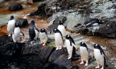

How Penguins Survive in Antarctica
How Do Penguins Survive in Antarctica? A Complete Guide Imagine standing on the ice in Antarctica. The temperature has dropped...


The Most Incredible Underwater Waterfalls
The Most Incredible Underwater Waterfalls You Need to Know About When you think of waterfalls, you probably picture water crashing...
-

 World1 year ago
Types of Ants Living in the World and Information
-

 Forests1 year ago
The 10 Best Forests to Visit in the World
-

 Wildlife4 years ago
(10) Insects Are Animals in the world?
-

 Ocean2 years ago
Oceans in the World and Their Information & Locations
-

 Forests4 years ago
What Is The Biggest Rainforest In The World?
-

 Wildlife4 years ago
Most Popular Wild Animals in The World
-

 Forests1 year ago
The Main Factors That Contribute to Forest Destruction
-

 World1 year ago
The 10 Largest Farms in the World