
World
Alabama Hills: A First Time Visitor Guide


Alabama Hills: A First Time Visitor Guide
Tucked against the eastern Sierra Nevada in California, the Alabama Hills is one of those places that looks like it belongs on another planet. With its rounded, weathered rock arches, dramatic boulder formations, and jaw-dropping views of Mount Whitney, this free public land has starred in hundreds of movies and TV shows. If you’ve ever dreamed of hiking through a landscape that feels both ancient and otherworldly, Alabama Hills should be at the top of your list. This guide covers everything you need to know for your first visit — from the best trails and photo spots to camping tips, wildlife encounters, and when to go for the best experience.
Key Takeaways
- Alabama Hills is free public land managed by the Bureau of Land Management (BLM), located just outside Lone Pine, California.
- The area is famous for its natural rock arches, including the iconic Mobius Arch, which frames Mount Whitney perfectly in a natural stone window.
- Over 400 movies and TV shows have been filmed here, including Iron Man, Django Unchained, Gladiator, and countless classic Westerns.
- Camping is free and first-come, first-served — no reservations or fees needed.
- The best time to visit is spring (March–May) and fall (September–November) for mild weather, golden light, and comfortable hiking conditions.
- There are no visitor centers, no entrance fees, and no developed facilities — come fully prepared with water, food, and supplies.
- The area is a paradise for photographers, hikers, stargazers, rock climbers, and anyone who loves wide-open desert landscapes.
- Cell service is essentially nonexistent — download offline maps and let someone know your plans before heading out.
Why Alabama Hills Is So Special
There’s something about Alabama Hills that stops you in your tracks the first time you see it. The rounded, orange-brown boulders look like they were sculpted by some ancient artist, and the backdrop of the Sierra Nevada — including the 14,505-foot Mount Whitney, the tallest peak in the contiguous United States — makes the whole scene feel impossibly grand. It’s the kind of place where you pull over just to stare, where the landscape seems to shift and change with every step you take.
But Alabama Hills isn’t just a pretty backdrop. This area has a deep and fascinating geological story. The rocks here are some of the oldest in California, dating back nearly 80 million years to the Cretaceous period. These granite formations were once buried deep beneath the earth’s surface, but over millions of years, the forces of uplift and erosion exposed them to the elements. Wind, water, and temperature extremes gradually wore away the sharp edges, creating the smooth, rounded shapes you see today. Geologists call this process “spheroidal weathering,” and Alabama Hills is one of the best examples of it anywhere in the world.
What makes the landscape truly dramatic is the contrast between the soft, weathered hills and the jagged, towering peaks of the Sierra Nevada rising directly behind them. The Sierra crest climbs from about 4,000 feet in the valley floor to over 14,000 feet in just a few miles — one of the most dramatic elevation changes anywhere in North America. Standing among the boulders of Alabama Hills and looking up at that wall of rock is a humbling experience, no matter how many times you’ve seen it.
Alabama Hills also has a rich and colorful human history. The area was named in the 1860s by Confederate sympathizers who had come to California during the Civil War era. They named their mining camp after the CSS Alabama, a famous Confederate warship that had been making headlines around the world. The name stuck, even after the war ended and the miners moved on. Remnants of old mining operations — rusted equipment, collapsed shafts, and crumbling stone walls — can still be found scattered throughout the hills if you know where to look.
In the 20th century, Alabama Hills found a new claim to fame as one of Hollywood’s most popular filming locations. The dramatic rock formations, wide-open skies, and proximity to Los Angeles made it an ideal stand-in for exotic locations around the world. Over 400 movies and TV shows have been filmed here, from silent-era Westerns to modern blockbusters. Iron Man used Alabama Hills as the backdrop for Afghanistan. Django Unchained filmed several key scenes among the boulders. Classic TV shows like The Lone Ranger, Bonanza, and Star Trek all used the area as a filming location. Walking through Alabama Hills today, you’re literally walking through movie history.
Today, Alabama Hills is managed by the Bureau of Land Management as a designated National Scenic Area — a status it received in 2019 to help protect its unique landscape from overuse and development. It’s open to everyone, free of charge, and offers some of the most accessible and rewarding outdoor experiences in the Eastern Sierra. Whether you’re a photographer chasing golden hour light, a hiker looking for easy trails with big views, a family wanting to camp under some of the darkest skies in California, or just someone who needs a break from the noise of everyday life, Alabama Hills delivers in a way that few places can.
Getting to Alabama Hills
Alabama Hills is located just west of the town of Lone Pine, California, along US Route 395 — one of the most scenic highways in the American West. If you’re coming from Los Angeles, it’s about a 4-hour drive north through the Mojave Desert and up the eastern side of the Sierra Nevada. From Reno or Lake Tahoe, it’s roughly 3 hours south along the same stunning corridor. The drive itself is half the adventure, with the Sierra Nevada towering on the west side and the White Mountains and Great Basin stretching out to the east.
The main access point is Whitney Portal Road, which heads west from Lone Pine directly into the hills. From there, a network of well-maintained dirt roads branches out to different trailheads, campgrounds, and arch locations. Most of the main roads are passable with a regular passenger car in dry conditions, though some of the more remote routes are better suited for high-clearance or four-wheel-drive vehicles. Always check road conditions before heading out, especially after rain or snow, as dirt roads can become slippery or washed out.
The nearest services — gas stations, grocery stores, restaurants, and motels — are in Lone Pine, a small but charming town with a population of about 2,000. It’s a good place to stock up on supplies before heading into the hills. There are no stores, water sources, or reliable cell service within Alabama Hills itself, so come prepared with everything you need for your visit. The Lone Pine Film History Museum is worth a stop if you’re interested in the area’s Hollywood connection — it has exhibits on the hundreds of movies filmed in the area.
If you’re flying in, the nearest major airport is in Las Vegas, about 3.5 hours to the southeast. Los Angeles International Airport (LAX) is about 4.5 hours to the south. Both routes offer beautiful desert and mountain scenery along the way.
Best Things to Do in Alabama Hills
Hiking to Mobius Arch
Mobius Arch is the crown jewel of Alabama Hills, and the hike to it is one of the most rewarding short walks in the entire Eastern Sierra. The trail is about 0.6 miles round trip, mostly flat, and suitable for all fitness levels — including families with young children and visitors who aren’t regular hikers. The arch itself is a natural granite formation that, when you stand in the right spot, frames Mount Whitney in a perfect stone window. It’s one of the most photographed spots in California, and once you see it, you’ll understand why.
The best time to photograph Mobius Arch is at sunrise, when the first light hits the Sierra peaks and glows through the arch in shades of pink, gold, and orange. Arrive about 30 minutes before sunrise to find your composition and set up your camera. The trailhead is located off Movie Road, and there’s a small parking area that fills up quickly on weekend mornings. From there, follow the well-worn path through the boulders to the arch — it’s hard to miss, and you’ll likely see other photographers heading in the same direction.
But don’t let the crowds discourage you. Even with a dozen other people around, the experience of watching the sun rise through that ancient arch, with Mount Whitney glowing in the background, is genuinely magical. And if you visit on a weekday or outside of peak season, you might have the whole place to yourself. The arch is beautiful at any time of day, but sunrise is truly something special.
Best time to visit: Year-round, but spring and fall offer the most comfortable temperatures. Sunrise is the prime photography time — arrive 30 minutes early.
Exploring the Mobius Arch Loop Trail
If you want to go beyond the arch itself and explore more of the landscape, the Mobius Arch Loop Trail extends the hike to about 1.5 miles, taking you through a beautiful stretch of boulder fields, desert scrub, and hidden corners that most visitors never see. The loop offers different perspectives of the Sierra Nevada and several smaller arch formations that are just as photogenic as Mobius Arch, minus the crowds.
Along the loop, you’ll notice the incredible variety of rock formations — some balanced impossibly on top of others, others carved into smooth, organic shapes by centuries of wind erosion. The granite here is full of quartz veins and feldspar crystals that catch the light in interesting ways, especially in the late afternoon when the sun is low. Take your time on this trail. There’s no rush, and the best views often come from the least expected angles.
Keep an eye out for desert wildlife too. Lizards sun themselves on warm rocks, jackrabbits dart between bushes, and if you’re lucky, you might spot a roadrunner — the real-life version of the cartoon character — sprinting across the desert floor. Red-tailed hawks and turkey vultures soar overhead, riding the thermals that rise from the warm rocks. In spring, the trail is dotted with wildflowers that attract butterflies and hummingbirds.
Best time to visit: Spring and fall for comfortable hiking. Early morning for solitude, wildlife, and the best light.
Movie Road Scenic Drive
Movie Road is the main dirt road that winds through the heart of Alabama Hills, and driving it is an experience in itself. The road passes through some of the most dramatic rock formations in the area and offers countless pullouts for photos, short walks, and quiet moments of appreciation. Along the way, you’ll see locations that have appeared in hundreds of films — from the opening scenes of Tremors to the cavalry charges in classic John Ford Westerns.
The road is about 5 miles long and takes 30–45 minutes to drive at a leisurely pace, depending on how often you stop. And you will stop — a lot. Every turn reveals a new arrangement of boulders, a new angle on the Sierra peaks, or a new arch hiding in the rocks. Bring a camera and take your time. Some of the best photo opportunities aren’t at the marked trailheads — they’re at random pullouts where the light happens to hit the rocks just right.
One of the nice things about Movie Road is that it’s accessible to all vehicles in dry conditions. You don’t need a four-wheel-drive truck or an SUV — a regular sedan can handle the main road just fine. Just drive slowly, watch for potholes, and yield to oncoming traffic on the narrower sections. The road is well-traveled but not crowded, and most visitors are friendly and happy to share tips about their favorite spots.
Best time to visit: Late afternoon for golden light on the rocks. The road is passable year-round but can be muddy after rain — check conditions before heading out.
Stargazing and Night Photography
Alabama Hills is one of the best stargazing locations in California, and that’s not an exaggeration. The area has minimal light pollution — the nearest city of any size is over 100 miles away — the air is dry and clear, and the wide-open landscape gives you an unobstructed view of the night sky in every direction. On a clear, moonless night, the Milky Way stretches overhead in a brilliant band of light, and you can see thousands of stars with the naked eye. It’s the kind of sky that reminds you just how vast the universe really is.
For photographers, Alabama Hills offers incredible night photography opportunities that are hard to match anywhere else. The rock formations make perfect foreground subjects for Milky Way compositions — imagine the jagged silhouette of a boulder against a sky full of stars, or the curve of an arch framing the galactic core. The best time for Milky Way photography is from April to September, when the galactic core is visible in the southern sky during the evening hours. Bring a sturdy tripod, a fast wide-angle lens (f/2.8 or faster), and a headlamp with a red light setting to preserve your night vision while you work.
If you’re camping in the area, stargazing is as simple as stepping outside your tent after dark. If you’re visiting for the day, plan to stay after sunset — the transition from twilight to full darkness is one of the most magical experiences Alabama Hills has to offer. Watch as the sky shifts from deep blue to purple to black, and the stars appear one by one until the whole dome of the sky is ablaze. If you’re visiting during a meteor shower, you’re in for an even bigger treat.
Best time to visit: April through September for Milky Way photography. Year-round for general stargazing on clear, moonless nights.
Rock Climbing and Bouldering
Alabama Hills is a hidden gem for rock climbers and bouldering enthusiasts, and it’s one of the best-kept secrets in California climbing. The granite boulders offer a wide range of problems, from beginner-friendly slabs and easy cracks to challenging overhangs and technical face climbs. The rock is generally solid and provides good friction, and the setting — with the Sierra Nevada as your backdrop and the desert stretching out below — is absolutely unbeatable.
Unlike many popular climbing areas, Alabama Hills doesn’t require permits or fees, and there are no fixed anchors or bolts. This is a traditional climbing area, meaning climbers place their own protection and remove it when they’re done. The bouldering is equally appealing, with problems ranging from V0 beginner circuits to V10+ challenges for experienced climbers. The area is significantly less crowded than famous destinations like Joshua Tree or Bishop, so you’ll often have the rocks to yourself, especially on weekdays.
If you’re new to climbing, Alabama Hills is a fantastic place to learn. The approach walks are short, the landings on the easier problems are generally good, and the atmosphere is relaxed and welcoming. Local climbers are usually happy to share beta and recommendations. Just remember to practice Leave No Trace principles — chalk should be brushed off holds, crash pads should be placed carefully to avoid damaging vegetation, and all trash should be packed out.
Best time to visit: October through April, when temperatures are cool enough for comfortable climbing. Summer can be extremely hot, making climbing dangerous without proper hydration and sun protection.
Wildflower Viewing in Spring
In a good rain year, Alabama Hills puts on a spectacular wildflower display from March through May that transforms the desert floor into a living painting. California goldfields blanket the lower elevations in bright yellow, while desert sunflowers, lupine, Indian paintbrush, and desert dandelion add splashes of purple, red, and orange. The contrast between the vibrant flowers and the orange-brown rocks is stunning, and it draws photographers, botanists, and nature lovers from across the state.
The best wildflower viewing is usually found along the lower elevations of the hills, particularly near the entrance off Whitney Portal Road and along the flatter areas between the boulder formations. The intensity of the bloom depends entirely on winter rainfall — a wet winter means an explosion of color, while a dry year may produce only scattered flowers. Check local wildflower reports from the BLM or Eastern Sierra Interagency Visitor Center before planning a wildflower-focused trip.
Even in a dry year, the subtle beauty of the desert is worth the visit. The texture of the rocks, the pattern of the sand, the silhouette of a lone juniper against the sky — these are the details that make Alabama Hills special beyond any single season or event. And the wildlife that comes with the flowers — butterflies, hummingbirds, bees — adds another layer of life to the landscape.
Best time to visit: March through May, depending on winter rainfall. Check local wildflower reports for current bloom conditions.
Exploring the Alabama Hills Arch Trail
Beyond Mobius Arch, Alabama Hills is home to dozens of other natural arches and rock formations that are just as beautiful but far less visited. The Alabama Hills Arch Trail is a moderate 4-mile loop that takes you past several of these hidden gems, including Lathe Arch, Eye of Alabama, and numerous smaller formations that you won’t find in any guidebook. This is the trail for visitors who want to escape the crowds and discover something new.
The trail is unmarked in places, so a GPS device or downloaded map is essential. The terrain is a mix of sandy washes, rocky slopes, and boulder fields, and navigation requires some attention. But the reward is solitude and the thrill of discovering arches and formations that few people have ever seen. Some of these arches are tucked into narrow canyons, while others perch on ridgelines with sweeping views of the Sierra Nevada.
Wear sturdy shoes with good ankle support, as the terrain can be uneven and rocky. Bring plenty of water — there’s no shade on most of the trail, and the desert sun can be intense even in spring and fall. A wide-brimmed hat, sunglasses, and sunscreen are essential. And don’t forget your camera — the arches along this trail are incredibly photogenic, especially in the soft light of early morning or late afternoon.
Best time to visit: Spring and fall. Start early to avoid midday heat. Bring navigation tools and plenty of water.
Where to Camp in Alabama Hills
Camping is one of the absolute best ways to experience Alabama Hills. Falling asleep under a sky full of stars, waking up to the sunrise painting the Sierra peaks pink, and stepping outside your tent to a landscape that looks like another planet — it’s the kind of experience that stays with you forever. And the best part? It’s completely free.
There are several designated campgrounds managed by the BLM along Movie Road, as well as dispersed camping throughout the hills. The most popular campgrounds include sites with fire rings, flat tent pads, and some of the most stunning views you’ll find at any campground in California. You’ll fall asleep looking up at the stars and wake up to Mount Whitney glowing in the morning light. It’s hard to beat.
There are no hookups, no water, no restrooms, and no trash collection at the campgrounds — this is primitive camping at its finest. Bring all the water you’ll need (at least one gallon per person per day, more in summer), pack out all your trash, and use existing fire rings if you plan to have a campfire. Fire restrictions may be in effect during dry periods, especially in summer and fall, so check with the BLM Bishop Field Office before your trip. The stay limit is 14 days.
For a more developed camping experience, the Lone Pine Campground is located just east of town along Whitney Portal Road. It has tent and RV sites, restrooms, potable water, and picnic tables. It’s a good option if you want some amenities while still being close to Alabama Hills. Reservations are recommended during peak season (spring and fall) and can be made through Recreation.gov.
Camping tips: Arrive early on weekends and during peak season to claim a good spot — the best sites go fast. Bring warm layers, as nighttime temperatures can drop into the 30s and 40s even in summer. Store food in sealed containers to avoid attracting coyotes, raccoons, and other wildlife. And always, always follow Leave No Trace principles — this special place needs our help to stay beautiful.
Best Time to Visit Alabama Hills
Alabama Hills is a year-round destination, but the best times to visit are spring (March through May) and fall (September through November). During these seasons, daytime temperatures are mild — typically in the 60s and 70s Fahrenheit — and the light is absolutely spectacular. Spring brings wildflowers, flowing streams, and green vegetation that contrasts beautifully with the orange rocks. Fall offers golden aspens in the nearby canyons, crisp clear skies, and some of the most dramatic sunrises and sunsets of the year.
Summer (June through August) can be very hot, with temperatures regularly exceeding 100°F in the middle of the day. If you visit in summer, plan your hikes and outdoor activities for early morning or late evening, carry plenty of water (at least two gallons per person per day), take frequent breaks in the shade, and wear light, breathable clothing. The upside of summer is long days, warm nights that are perfect for camping, and excellent stargazing conditions with the Milky Way at its most spectacular.
Winter (December through February) is the quietest season in Alabama Hills, and it has its own unique beauty. Daytime temperatures are cool, typically in the 40s and 50s, and nights can drop well below freezing. Snow is rare in the hills themselves but common on the Sierra peaks, creating a dramatic white-capped backdrop that photographers love. Winter light is low and warm, casting long shadows across the rocks and creating a moody, atmospheric feel. If you don’t mind the cold, winter is a magical time to visit.
One thing to watch out for is wind. The Eastern Sierra is known for strong winds, particularly in spring. Gusts of 40–60 mph are not uncommon, and they can make camping uncomfortable and photography challenging. Bring a sturdy tent with good stakes and guylines, and be prepared to batten down the hatches if the weather turns.
Alabama Hills Comparison Table
| Destination | Location | Best Time to Visit |
|---|---|---|
| Mobius Arch | Movie Road, Alabama Hills | Year-round (sunrise for photos) |
| Mobius Arch Loop Trail | Movie Road, Alabama Hills | Spring and Fall |
| Movie Road Scenic Drive | Central Alabama Hills | Late afternoon, year-round |
| Alabama Hills Arch Trail | Backcountry, various trailheads | Spring and Fall |
| Stargazing Spots | Throughout Alabama Hills | April–September (Milky Way) |
| Bouldering Areas | Scattered throughout the hills | October–April |
| Wildflower Viewing | Lower elevations near entrance | March–May |
| Camping | Movie Road campgrounds | Spring, Fall, and early Summer |
Travel Tips for First-Time Visitors
Bring more water than you think you need. The desert is extremely dry, and there are no water sources anywhere in Alabama Hills. Plan for at least one gallon per person per day for basic needs, and double that if you’re hiking, climbing, or visiting in warm weather. Dehydration can sneak up on you fast in the desert, so drink regularly even if you don’t feel thirsty.
Pack layers for changing temperatures. Desert environments are famous for extreme temperature swings — a day that starts at 40°F can reach 90°F by afternoon, then drop back to 40°F after sunset. Bring a warm jacket, a hat, and gloves even in summer, and always have sun protection — a wide-brimmed hat, sunglasses, and high-SPF sunscreen are essential.
Download offline maps before you go. Cell service is unreliable to nonexistent throughout Alabama Hills. Download maps, trail information, and driving directions to your phone before you leave Lone Pine. The BLM website has excellent maps of the area, and apps like Gaia GPS or AllTrails let you download maps for offline use.
Respect the fragile desert environment. Alabama Hills is a delicate ecosystem that can be damaged by careless use. Stay on established roads and trails, don’t drive or walk on vegetation, and never disturb wildlife or archaeological sites. Pack out everything you bring in — including micro-trash like food wrappers and bottle caps. The area’s growing popularity means it needs all the care it can get.
Check road and weather conditions. Dirt roads can become impassable after heavy rain, and the area is known for strong winds in spring. Check the weather forecast before your trip, and ask locals or the BLM office about current road conditions if you’re unsure. It’s better to be cautious than to get stuck.
Bring a camera and extra batteries. Alabama Hills is one of the most photogenic places in California, and you’ll want to capture as much as you can. The light at sunrise and sunset is extraordinary, and the rock formations are endlessly photogenic. Cold weather drains batteries faster, so bring spares if you’re visiting in winter.
Plan for no facilities whatsoever. There are no restrooms, no trash cans, no stores, and no water in Alabama Hills. Come prepared with everything you need, and pack out all your waste — including human waste if you’re in a remote area. Portable waste bags are available at outdoor retailers and are a responsible choice for backcountry visits.
Tell someone your plans. With no cell service and limited foot traffic on some trails, it’s important to let someone know where you’re going and when you expect to be back. This is especially important if you’re hiking alone or venturing into the backcountry.
Wildlife and Nature
Despite its arid, rocky appearance, Alabama Hills supports a surprising diversity of wildlife. The desert scrub, scattered pinyon-juniper woodlands, and seasonal water sources create a variety of microhabitats that support animals adapted to life in one of California’s harshest environments.
Mammals you might encounter include coyotes, which are commonly heard howling at night and occasionally seen trotting through the hills at dawn. Bobcats are present but elusive — you’d be lucky to spot one. Black-tailed jackrabbits are abundant, with their enormous ears and bounding gait making them one of the most recognizable residents of the desert. Kangaroo rats, named for their powerful hind legs, are nocturnal and rarely seen, but their tracks in the sand are evidence of their busy nighttime activities.
Birdwatchers will find plenty to keep them interested. Red-tailed hawks are the most commonly seen raptor, soaring on thermals above the hills. Great horned owls roost in the larger rock formations and call to each other at dusk. Western meadowlarks sing from fence posts, and during spring migration, the area hosts a variety of warblers, sparrows, and other songbirds. Roadrunners — the real, living version of the cartoon character — are frequently seen sprinting across the desert floor in pursuit of lizards and insects.
Reptiles are an important part of the desert ecosystem. Western fence lizards and side-blotched lizards are frequently seen basking on warm rocks, and the area is home to several species of snakes. The California kingsnake, a beautiful black-and-white banded snake, is harmless and actually helps control rattlesnake populations. The Great Basin rattlesnake is venomous and should be given a wide berth — watch where you step and place your hands when climbing or scrambling over rocks, especially from April through October when snakes are most active.
The plant life of Alabama Hills is equally fascinating and beautifully adapted to desert life. Joshua trees — actually a type of yucca — dot the higher elevations with their spiky, otherworldly silhouettes. Desert sage, rabbitbrush, and Mormon tea cover the lower slopes, releasing their distinctive aromas when brushed against or after rain. In spring, the wildflower blooms transform the landscape into a carpet of color that attracts butterflies, hummingbirds, and other pollinators. Even in the driest months, the subtle beauty of the desert — the texture of the rocks, the pattern of the sand, the silhouette of a lone juniper against the sky — is endlessly captivating.
Nearby Attractions Worth Visiting
While Alabama Hills is the main draw, the surrounding area has several other attractions that are worth adding to your itinerary. Mount Whitney Portal, the trailhead for the most popular route to the summit of the highest peak in the contiguous United States, is just 13 miles west of Lone Pine. Even if you’re not planning to summit, the drive up to Whitney Portal is beautiful, and the area offers excellent hiking at lower elevations.
The Manzanar National Historic Site, about 10 miles north of Lone Pine, is a former Japanese American internment camp from World War II. It’s a sobering and important place to visit, with a museum, restored barracks, and guided tours. The Eastern California Museum in nearby Independence showcases the history and culture of the Eastern Sierra, including Native American artifacts, mining exhibits, and displays on the area’s role in Hollywood history.
For a longer day trip, the Alabama Hills area is within driving distance of Death Valley National Park (about 2.5 hours south), Mammoth Lakes (about 2 hours north), and Yosemite National Park (about 3 hours north via Tioga Pass, open seasonally). Many visitors combine a trip to Alabama Hills with one or more of these destinations for an unforgettable Eastern Sierra adventure.
Frequently Asked Questions
Is Alabama Hills free to visit?
Yes, Alabama Hills is completely free to visit. It’s public land managed by the Bureau of Land Management, and there are no entrance fees, parking fees, or permits required for day use or camping. This makes it one of the most accessible and budget-friendly outdoor destinations in all of California. You can hike, camp, climb, photograph, and explore to your heart’s content without spending a dime.
Do I need a reservation to camp?
No, camping at Alabama Hills is first-come, first-served at all BLM campgrounds and dispersed camping areas. Reservations are not accepted and are not needed. That said, the best campsites — especially those with the best views of the Sierra Nevada — go quickly on weekends and during peak season (spring and fall). Arrive early in the day to claim your preferred spot. The stay limit is 14 days within any 28-day period.
Can I have a campfire?
Campfires are generally allowed in existing fire rings at designated campsites, but fire restrictions may be in effect during dry periods, especially in summer and fall when the risk of wildfire is highest. Check with the BLM Bishop Field Office (760-872-5000) for current fire restrictions before your trip. Never build a new fire ring — always use existing ones. And always fully extinguish your fire with water, stirring the ashes until they’re cold to the touch, before leaving your campsite.
Is Alabama Hills dog-friendly?
Yes, dogs are welcome in Alabama Hills, and many visitors bring their four-legged friends along for the adventure. Dogs should be kept under voice control or on a leash, especially around other visitors and wildlife. The desert environment can be tough on pets — hot sand can burn paw pads, sharp rocks can cause cuts, and rattlesnake encounters are a real concern from April through October. Bring plenty of water for your dog, consider protective booties for hot or rocky terrain, and always keep your dog within sight.
What’s the closest town with services?
Lone Pine is the closest town, located just east of Alabama Hills along US Route 395. It has gas stations, a couple of grocery stores, several restaurants and cafes, motels, and a small but excellent museum — the Lone Pine Film History Museum, which is well worth a visit if you’re interested in the area’s Hollywood history. The town is small but friendly, and locals are used to helping visitors with directions and recommendations.
How far is Alabama Hills from Mount Whitney?
Alabama Hills sits directly at the base of the Sierra Nevada, with Mount Whitney towering above the hills to the west. The Whitney Portal trailhead — the starting point for the most popular route to the summit of Mount Whitney — is about 13 miles west of Lone Pine along Whitney Portal Road. From many vantage points in Alabama Hills, you can see the summit of Mount Whitney rising above the hills, and several of the natural arches — including Mobius Arch — frame the peak in a perfect natural window.
Is there cell phone service in Alabama Hills?
Cell service is very limited to nonexistent throughout most of Alabama Hills. You may get a weak signal on some of the higher ridges, but you should not count on having service for navigation, communication, or emergencies. Download offline maps and trail information before you leave Lone Pine, and let someone know your plans and expected return time before heading into the hills. Consider carrying a satellite communicator or personal locator beacon for emergencies.
What should I bring for a day trip?
For a day trip to Alabama Hills, bring at least one gallon of water per person, sun protection (hat, sunglasses, sunscreen), sturdy closed-toe shoes, layers for changing temperatures, a camera, snacks or a packed lunch, a map or GPS device, and a small first aid kit. If you’re planning to hike, trekking poles can be helpful on the sandy and rocky terrain. And don’t forget a headlamp if you plan to stay for sunset or stargazing — it gets dark fast in the desert.
Conclusion
Alabama Hills is one of California’s most remarkable, most accessible, and most underrated destinations. Where else can you hike through ancient rock arches, camp under the Milky Way, photograph the tallest peak in the lower 48 states, walk through movie history, and watch the sunrise paint the Sierra Nevada in shades of gold and pink — all without spending a single dollar? It’s a place that rewards curiosity, encourages exploration, and reminds you of just how beautiful the natural world can be when it’s left mostly untouched.
Whether you’re a first-time visitor planning your weekend getaway or a seasoned desert explorer looking for your next adventure, Alabama Hills has something special waiting for you. The landscape is humbling, the silence is profound, and the views are the kind that stay with you for years. So pack your bags, fill up the gas tank, download your offline maps, and point your car toward Lone Pine. Alabama Hills is waiting — and trust us, you won’t regret it. Share this guide with your friends and start planning your Eastern Sierra adventure today.


The Petrified Forests of the American Southwest — A Complete Guide
Imagine walking through a forest where the trees turned to stone millions of years ago — still standing, still colorful, but made entirely of crystal. That’s exactly what you’ll find at the Petrified Forest National Park in Arizona. It’s one of the most surreal and underrated natural wonders in the United States, and if you haven’t added it to your road trip list yet, you’re missing out.
Key Takeaways
- The Petrified Forest in Arizona holds the world’s largest collection of petrified wood, dating back over 200 million years.
- The park spans more than 200,000 acres of painted desert landscapes, ancient fossils, and archaeological sites.
- Best time to visit is spring (March to May) or fall (September to November) for mild weather and fewer crowds.
- Entry is $25 per vehicle and the park is open year-round, though winter can bring snow.
- No camping is allowed inside the park, but nearby Holbrook and the Painted Desert Inn offer lodging options.
What Exactly Are Petrified Forests?
Petrified forests aren’t forests in the traditional sense. They’re ancient forests that got buried under volcanic ash and sediment millions of years ago. Over time, minerals like silica seeped into the wood and slowly replaced the organic material, turning each log into stone. The result is something that looks and feels like rock but still shows the original tree rings, bark texture, and even insect boreholes.
The process is called permineralization. Groundwater rich in dissolved minerals flows through the buried wood. As the water evaporates, it leaves behind deposits of quartz, calcite, and other minerals inside the wood cells. Bit by bit, the original plant material gets replaced by stone — but the structure stays exactly the same. It’s nature’s version of a perfect mold.
What makes the American Southwest special is that it holds some of the most extensive and best-preserved petrified forests on the planet. The combination of ancient volcanic activity, vast floodplains, and millions of years of geological pressure created perfect conditions for petrification on a massive scale.
The Petrified Forest National Park, Arizona
About the Park
Located in northeastern Arizona between Holbrook and Navajo, the Petrified Forest National Park covers about 221,000 acres. It was designated a national monument in 1906 and became a national park in 1962. Most visitors only see a fraction of it — the main park road runs about 28 miles north to south, connecting all the major viewpoints and hiking trails.
The park sits right on the edge of the Painted Desert, which means the landscape is a constantly shifting palette of red, orange, purple, and gray. It’s beautiful in a way that doesn’t look quite real.
Highlights You Can’t Miss
The Crystal Forest: This is probably the most popular stop, and for good reason. A short 0.75-mile loop trail takes you past some of the most colorful petrified wood specimens in the park. The logs here are scattered across the desert floor like debris from a giant’s campfire — deep reds, purples, yellows, and whites all mixed together.
Agate Bridge: A complete petrified log that stretches across a small gully, forming a natural bridge. It’s one of the most photographed features in the park, and standing next to it gives you a real sense of how massive these ancient trees were.
The Painted Desert Inn: This historic building right off Interstate 40 was originally built in the 1920s and restored by the Civilian Conservation Corps in the 1930s. It’s now a museum and bookstore, and the Hopi murals inside are worth the stop by itself. The views from the back porch stretch for miles across the painted desert.
Blue Mesa: A 3.5-mile loop drive takes you down into a landscape that looks like another planet. The blue, purple, and gray badlands formations here are made of bentonite clay, and the short one-mile trail drops you right into the middle of it. Petrified wood litters the hillsides.
Newspaper Rock: This rock face is covered with over 650 petroglyphs carved by ancestral Puebloan people between 650 and 2,000 years ago. It’s a powerful reminder that this landscape has been meaningful to humans for a very long time.
The Rainbow Forest Museum: Located at the south end of the park, this small museum has excellent displays on the geology of petrification and the Triassic period fossils found in the park. It’s a great place to start your visit to understand what you’re looking at.
The Experience
Most people drive through the park in about two to three hours, but that barely scratches the surface. If you really want to experience it, plan for at least half a day. Hike the Crystal Forest loop, walk down into Blue Mesa, and take the trail to Agate House — a small pueblo built entirely out of petrified wood, dating back about 700 years.
The desert silence here is something else. On a weekday in spring or fall, you can stand on a ridge overlooking the Painted Desert and hear absolutely nothing but wind. It’s the kind of quiet that makes you realize how noisy your normal life actually is.
Photographers will want to be there in the late afternoon. The low sun brings out the colors in the petrified wood and the painted desert in a way that midday light just can’t match. The blue and purple clays of Blue Mesa look almost neon when the light hits them at the right angle.
Best Time to Visit
Spring (March through May) and fall (September through November) are the sweet spots. Temperatures range from the 50s to the 80s Fahrenheit, and the light is gorgeous for photography. Summer is brutally hot — temperatures regularly exceed 100°F, and there’s almost no shade. Winter can be surprisingly cold, with occasional snow, but the park is rarely crowded and the snow on the painted desert is a sight you won’t forget.
Monsoon season runs from July through September. Afternoon thunderstorms can pop up fast, and flash flooding is a real danger in the washes and canyons. If you’re visiting in summer, do your hiking in the morning and be off the trails by early afternoon.
Why You Should Visit
The Petrified Forest is one of those places that changes how you think about time. You’re walking among trees that were alive when dinosaurs were just beginning to appear on Earth. The logs on the ground are over 200 million years old. That’s not a number most of us can really wrap our heads around, but standing next to a petrified log the size of a school bus helps put it in perspective.
It’s also one of the most accessible national parks in the Southwest. You can see the highlights in a few hours, and the main road is paved and easy to drive. It’s right off Interstate 40, so it fits naturally into a road trip that might also include the Grand Canyon, Monument Valley, or the Painted Desert.
Travel Tips
- Don’t take any petrified wood. It’s illegal to remove anything from the park, and rangers do enforce this. People who’ve taken pieces often mail them back with apology letters, claiming the wood brought them bad luck. Whether you believe in bad luck or not, just leave it where it is.
- Bring more water than you think you need. The desert is dry, the sun is intense, and there are very few water sources in the park. A gallon per person per day is a good rule of thumb.
- Wear sunscreen and a hat. There’s almost no shade on most of the trails. Sunburn happens fast at this altitude.
- Stay on marked trails. The clay hills are fragile, and walking off-trail damages the landscape in ways that take decades to heal.
- Fill up your gas tank in Holbrook. There’s no gas station in the park, and the nearest town is about 25 miles away.
Other Petrified Forests Worth Knowing About
While the Petrified Forest National Park in Arizona is the most famous, it’s not the only one in the American Southwest. Here are a few other notable sites:
Petrified Forest National Park, Arizona — The main attraction. Over 200,000 acres of petrified wood, painted desert, and Triassic fossils. Best for first-time visitors and families.
Escalante Petrified Forest State Park, Utah — Located near the Grand Staircase-Escalante National Monument, this smaller park has colorful petrified wood and a pleasant campground. The 1.5-mile Petrified Forest Trail climbs to a ridge covered with petrified logs.
Ginkgo Petrified Forest State Park, Washington — On the banks of the Columbia River, this park preserves petrified wood from trees that grew before the Cascade Mountains existed. Over 50 species of petrified wood have been identified here, which is unusual.
Florissant Fossil Beds National Monument, Colorado — Famous for its incredibly detailed fossilized insects and plants, this site also has massive petrified redwood stumps. The petrified forest here is from the Eocene epoch, about 34 million years ago.
Comparison Table: Petrified Forest Sites in the American Southwest
| Place Name | Location | Best Time to Visit |
|---|---|---|
| Petrified Forest National Park | Arizona (near Holbrook) | March – May, September – November |
| Escalante Petrified Forest State Park | Utah (near Escalante) | April – June, September – October |
| Ginkgo Petrified Forest State Park | Washington (near Vantage) | May – September |
| Florissant Fossil Beds National Monument | Colorado (near Florissant) | June – September |
How Petrified Wood Gets Its Colors
One of the first things visitors notice is how colorful the petrified wood is. The colors come from different minerals that were present during the petrification process:
- Red and orange — Iron oxide (essentially rust). This is the most common color and gives the Painted Desert its name.
- Purple and violet — Manganese oxide. The deep purple pieces are some of the most prized specimens.
- Yellow and brown — Also iron oxide, but in a different chemical form.
- White and gray — Pure silica or quartz. These pieces look the most like fresh wood.
- Blue and green — Chromium, copper, or cobalt minerals. These are rarer and harder to find.
The specific mix of minerals depends on the chemistry of the groundwater that flowed through the wood millions of years ago. That’s why you can find pieces of wildly different colors right next to each other — they were petrified under slightly different conditions.
The Ancient Forest That Used to Be Here
During the Late Triassic period, about 225 million years ago, the area that’s now northeastern Arizona looked nothing like a desert. It was a tropical floodplain with massive rivers, lush vegetation, and a warm, humid climate. The trees were mostly conifers — relatives of modern Araucaria trees — and some of them grew over 200 feet tall with trunks 10 feet in diameter.
When these trees died, they fell into the floodplain and were quickly buried by volcanic ash and river sediment. The burial was key — it sealed the wood off from oxygen, which slowed decay and gave the minerals time to do their work. Over millions of years, the wood was completely replaced by silica, preserving every detail of the original structure.
The same volcanic eruptions that buried the forest also left behind layers of ash that you can still see in the park’s rock formations today. In a very real sense, the destruction of the ancient forest is what made the petrified forest possible.
Frequently Asked Questions
How old is the petrified wood in Arizona?
Most of the petrified wood in the Petrified Forest National Park dates to the Late Triassic period, roughly 210 to 225 million years ago. That makes it older than most dinosaurs.
Can I take petrified wood home from the park?
No. Removing any natural or cultural material from a national park is illegal under federal law. Fines can be substantial. If you want a piece of petrified wood, there are rock shops outside the park that sell legally collected specimens.
Is the Petrified Forest worth visiting if I’ve seen the Grand Canyon?
Absolutely. The two parks offer completely different experiences. The Grand Canyon is about massive scale and depth. The Petrified Forest is about color, texture, and deep time. Many visitors say the Petrified Forest was the surprise highlight of their Southwest road trip.
How much time do I need at the Petrified Forest?
You can drive the main road and hit the major viewpoints in about two to three hours. But if you want to hike the trails and really explore, plan for a full day. The backcountry hiking opportunities are extensive if you’re up for it.
Is the park accessible for people with mobility issues?
Many of the main viewpoints and the Painted Desert Inn are wheelchair accessible. The Crystal Forest loop is paved but has some uneven sections. The Blue Mesa trail is not accessible due to steep, loose terrain. Check with the visitor center for the most current accessibility information.
Are there dinosaurs at the Petrified Forest?
Not exactly. The petrified wood is from the Triassic period, which is actually before the classic dinosaurs like T. rex and Triceratops. But the park does have fossils of early dinosaurs, giant amphibians, and other Triassic creatures. The Rainbow Forest Museum has excellent displays on these finds.
What should I bring when visiting?
Water (at least one gallon per person), sunscreen, a hat, sturdy walking shoes, and a camera. If you’re visiting in summer, bring electrolyte drinks and plan to be off the trails by early afternoon. In winter, bring warm layers — it gets cold.
Conclusion
The Petrified Forests of the American Southwest are one of those places that sound almost too strange to be real. Trees turned to stone. Colors that shouldn’t exist in nature. A landscape that’s been quietly sitting there for over 200 million years, waiting for you to come look at it.
Whether you’re a geology nerd, a photographer chasing the perfect light, a family looking for an easy and educational day trip, or just someone who wants to stand in a place that makes the rest of life feel a little less urgent — this park delivers. It’s not as famous as the Grand Canyon or as flashy as Zion, but it might just be the most thought-provoking place in the entire Southwest.
Start planning your trip today. The petrified wood has been waiting 225 million years — it can wait a little longer, but you shouldn’t put it off.
Share this post with your friends who love road trips and hidden natural wonders. And if you’ve already been to the Petrified Forest, tell us about your experience in the comments below.

Why Are Polar Bears Endangered and What Can We Do
Polar bears are the largest land carnivores on Earth, but their future is in serious danger. These magnificent Arctic predators face shrinking sea ice, rising temperatures, and a rapidly changing habitat. Understanding why polar bears are endangered is the first step toward protecting them before it is too late.
Key Takeaways
- Polar bears rely on sea ice to hunt seals, their primary food source
- Arctic sea ice is melting at an alarming rate due to climate change
- The current global population is estimated at 22,000 to 31,000 bears
- Polar bears are classified as Vulnerable on the IUCN Red List
- Reducing carbon emissions and supporting conservation efforts can help save them
The Arctic Home Polar Bears Depend On
Polar bears spend most of their lives on the frozen Arctic Ocean. Unlike other bears, they are built for the cold with thick layers of fat, black skin that absorbs heat, and white fur that camouflages them against the snow. They are powerful swimmers too, capable of covering dozens of miles in open water between ice floes.
But the Arctic these bears call home is changing fast. Temperatures in the Arctic are rising nearly four times faster than the global average. This rapid warming is causing sea ice to melt earlier in spring and form later in autumn. For polar bears, this means less time on the ice and more time on land where food is scarce.
Sea ice is not just a platform for polar bears to walk on. It is the foundation of their entire hunting strategy. They wait patiently by seal breathing holes or break through thin ice to catch their prey. Without solid ice, their ability to hunt effectively drops dramatically.
Why Are Polar Bears Losing Their Habitat
The single biggest threat to polar bears is the loss of their sea ice habitat. Scientists have documented a steady decline in Arctic sea ice extent over the past several decades. Satellite records show that the amount of summer sea ice today is roughly 40 percent less than it was in the late 1970s.
This loss is driven primarily by global warming caused by greenhouse gas emissions. When humans burn fossil fuels like coal, oil, and natural gas, carbon dioxide and other greenhouse gases are released into the atmosphere. These gases trap heat and warm the planet, with the Arctic feeling the effects more intensely than anywhere else.
As the ice melts, polar bears are forced to swim longer distances between remaining ice patches. Some bears have been tracked swimming over 400 miles in open water. These long swims are exhausting and dangerous, especially for young cubs that may not have the strength to complete the journey.
How Melting Ice Affects Polar Bear Survival
When sea ice retreats, polar bears are pushed onto land where they have limited access to their main prey. Seals are rich in fat and provide the energy polar bears need to survive and reproduce. On land, bears may scavenge for bird eggs, berries, or whale carcasses, but these food sources cannot replace the caloric density of a seal.
Research has shown that bears spending more time on land are thinner and have lower body condition scores. Female bears in poor condition are less likely to produce cubs, and those that do may have smaller litters with lower survival rates. A study published in Ecological Applications found that in the southern Beaufort Sea population, cub survival rates declined significantly during years with low sea ice.
The problem compounds over time. Less ice means shorter hunting seasons, which means bears enter the denning period in worse shape. Pregnant females need substantial fat reserves to produce milk for their cubs through the winter. Without enough food, the entire reproductive cycle is disrupted.
Other Threats Facing Polar Bears
While habitat loss is the primary concern, polar bears face additional pressures that make their situation even more precarious.
Pollution and Contaminants
Toxic chemicals from industrial activities around the world are carried to the Arctic by ocean currents and atmospheric patterns. These pollutants, including mercury, PCBs, and pesticides, accumulate in the fatty tissues of polar bears. High levels of these contaminants can affect the bears immune systems, hormone regulation, and reproductive health.
Human Encroachment
As the Arctic becomes more accessible due to melting ice, human activity in the region is increasing. Shipping routes are opening up, oil and gas exploration is expanding, and tourism is growing. These activities can disturb polar bears, destroy denning sites, and increase the risk of oil spills that could be devastating to Arctic ecosystems.
Overharvesting
In some regions, polar bears are hunted by Indigenous communities for subsistence. While this practice is legal and culturally important in certain areas, it adds additional pressure on populations already stressed by habitat loss. Most countries with polar bear populations have established management agreements to monitor and regulate hunting quotas.
Polar Bear Population Status Around the World
There are 19 recognized subpopulations of polar bears spread across five countries: Canada, the United States (Alaska), Russia, Norway (Svalbard), and Greenland (Denmark). The total global population is estimated at approximately 22,000 to 31,000 individuals.
The status of these subpopulations varies significantly. Some populations appear to be stable or even increasing, while others are showing clear signs of decline. The Western Hudson Bay population in Canada has decreased by roughly 30 percent since the 1980s, closely tracking the decline in sea ice duration in that region.
| Population | Region | Estimated Size | Trend |
|---|---|---|---|
| Western Hudson Bay | Canada | ~800 | Declining |
| Southern Beaufort Sea | Canada / US | ~900 | Declining |
| Baffin Bay | Canada / Greenland | ~2,800 | Stable |
| Kane Basin | Canada / Greenland | ~350 | Stable |
| Svalbard | Norway | ~2,600 | Stable |
| Chukchi Sea | US / Russia | ~3,000 | Unknown |
Scientists use a combination of aerial surveys, satellite tracking, and mark-recapture studies to monitor these populations. However, the remote and harsh conditions of the Arctic make comprehensive surveys extremely challenging and expensive.
What Happens If We Do Nothing
If greenhouse gas emissions continue at their current pace, climate models predict that the Arctic could be virtually ice-free during summer months by the 2040s or 2050s. For polar bears, this would be catastrophic. Without summer sea ice, many subpopulations would face starvation and rapid decline.
Some researchers estimate that two-thirds of the world polar bear population could disappear by mid-century if current trends continue. The species would likely be reclassified from Vulnerable to Endangered on the IUCN Red List, and some local populations could face extirpation entirely.
The loss of polar bears would also have cascading effects throughout the Arctic ecosystem. As apex predators, polar bears help regulate seal populations and influence the distribution of other species. Their disappearance would trigger changes that ripple through the entire food web.
What Can We Do to Help Polar Bears
The good news is that it is not too late to make a difference. While the situation is serious, there are meaningful actions that individuals, communities, and governments can take to protect polar bears and their habitat.
Reduce Your Carbon Footprint
The most important thing anyone can do is reduce their contribution to climate change. This means driving less, using energy-efficient appliances, choosing renewable energy sources when possible, and being mindful of consumption habits. Every ton of carbon dioxide that is not emitted helps slow the warming of the Arctic.
Support Conservation Organizations
Groups like Polar Bears International, the World Wildlife Fund, and the Arctic Council are working on research, policy, and direct conservation efforts. Donating to or volunteering with these organizations helps fund critical scientific research and advocacy work.
Advocate for Climate Policy
Individual actions matter, but systemic change is needed to address the scale of the problem. Contacting elected officials, supporting climate-friendly policies, and voting for leaders who prioritize environmental protection can drive the large-scale action that polar bears need.
Make Sustainable Consumer Choices
Choosing sustainable seafood, reducing plastic consumption, and supporting companies with strong environmental commitments all contribute to healthier oceans and a more stable climate. These choices may seem small, but they add up when millions of people make them.
Educate Others
Simply sharing what you have learned about polar bears and climate change with friends, family, and your community helps build awareness and support for conservation. The more people understand the connection between their daily choices and the fate of Arctic wildlife, the stronger the collective response will be.
Success Stories and Reasons for Hope
Despite the challenges, there are reasons to be cautiously optimistic. International agreements like the Paris Climate Accord have brought global attention to the need for emissions reductions. Renewable energy is growing rapidly and becoming more affordable every year.
In some regions, polar bear populations have remained stable thanks to effective management and conservation programs. The 1973 Agreement on the Conservation of Polar Bears, signed by all five range countries, was one of the first international treaties focused on protecting a single species and its habitat. This agreement continues to provide a framework for cooperation today.
New technologies are also helping scientists better understand polar bear behavior and population dynamics. Satellite collars, drone surveys, and genetic analysis are providing data that can guide more effective conservation strategies.
Frequently Asked Questions
How many polar bears are left in the world?
The current global population estimate is between 22,000 and 31,000 polar bears. This number is difficult to pin down precisely because of the remote and harsh conditions in which they live. Some subpopulations are stable while others are declining.
Are polar bears endangered or threatened?
Polar bears are currently classified as Vulnerable on the IUCN Red List of Threatened Species. They were listed as a threatened species under the US Endangered Species Act in 2008. Some scientists argue they should be reclassified to Endangered given the accelerating pace of Arctic warming.
What do polar bears eat?
Polar bears primarily eat ringed seals and bearded seals. They hunt by waiting near seal breathing holes or stalking seals resting on the ice. They also occasionally eat walruses, beluga whales, fish, and seabirds. On land, they may scavenge whale carcasses or eat berries and kelp, but these cannot sustain them long-term.
How long can polar bears survive without ice?
Polar bears can survive on land for extended periods, but their health and reproductive success decline significantly without access to their primary prey. Bears in Western Hudson Bay, for example, spend about 30 more days on land now than they did in the 1980s, and this has been linked to lower body condition and reduced cub survival.
Can polar bears adapt to life on land?
While polar bears are intelligent and adaptable, they are highly specialized for hunting seals on sea ice. Their large paws, powerful limbs, and hunting strategies are all optimized for the ice environment. A land-based diet simply cannot provide the calories they need to maintain their massive body size and support reproduction.
What is the biggest threat to polar bears?
The single biggest threat is the loss of Arctic sea ice due to climate change. Other threats include pollution, human disturbance, and overharvesting, but none of these compare to the fundamental challenge of losing the ice platform that polar bears depend on for survival.
How can kids help polar bears?
Kids can help by learning about climate change and sharing what they know with others. Simple actions like turning off lights, walking or biking instead of driving, and reducing waste all help. Kids can also participate in school projects, write letters to elected officials, and raise funds for conservation organizations.
Conclusion
Polar bears are facing an uncertain future, but their fate is not yet sealed. The choices we make today about energy, consumption, and conservation will determine whether these iconic Arctic predators continue to roam the frozen north or become a memory of a world we let slip away.
The connection between our daily lives and the survival of polar bears may seem distant, but it is real and direct. Every action that reduces greenhouse gas emissions, every dollar donated to conservation, and every conversation that raises awareness brings us one step closer to a future where polar bears thrive on healthy Arctic ice.
Start planning your trip today to see the Arctic and its wildlife, or simply share this post with your friends to spread the word. Together, we can make a difference for polar bears and for the planet we all share.

Why Beech Forests Turn Gold in Autumn
If you have ever walked through a forest in fall and felt like you stepped into a golden wonderland, chances are beech trees were the reason. Beech forests are some of the most spectacular sights in nature when autumn arrives, transforming entire landscapes into shades of gold, copper, and amber. But what exactly causes this magical change? And where can you see it for yourself?
The short answer: beech trees turn gold in autumn because of a combination of pigments inside their leaves, triggered by shorter days and cooler temperatures. As the green chlorophyll breaks down, golden-yellow carotenoid pigments are revealed, creating that famous autumn glow.
Key Takeaways
- Beech trees turn gold in autumn when chlorophyll breaks down and reveals yellow-orange pigments underneath.
- The best time to see golden beech forests is typically mid-October through early November in the Northern Hemisphere.
- Europe has some of the most famous beech forests in the world, including ancient UNESCO-protected stands.
- Weather conditions like cool nights and sunny days make the colors more intense.
- You do not need to be a scientist or a botanist to enjoy this spectacle. Just grab a jacket and head outside.
The Science Behind the Golden Color
During spring and summer, beech tree leaves are green because of chlorophyll. Chlorophyll is the pigment that helps the tree turn sunlight into food through photosynthesis. It is so dominant that it masks other pigments hiding in the leaves.
But as days get shorter and temperatures drop in autumn, beech trees start preparing for winter. They slow down and eventually stop producing chlorophyll. As the green pigment fades away, other pigments that were there all along finally get their moment in the spotlight.
The main pigments responsible for the golden color in beech leaves are carotenoids. These are the same pigments that make carrots orange and corn yellow. In beech trees, carotenoids produce warm golden and copper tones that are absolutely stunning when you see them across an entire hillside.
Beech trees do not produce much anthocyanin, which is the pigment responsible for red and purple colors in maples and oaks. That is why beech forests lean toward gold and amber rather than deep reds. The result is a softer, more uniform golden canopy that feels almost like sunlight is coming from within the forest itself.
What Makes Some Years More Spectacular Than Others
Not every autumn is equal when it comes to beech forest color. The intensity of the gold depends on several weather factors:
Cool nights and sunny days are the magic combination. Cool temperatures at night help break down chlorophyll faster, while sunny days allow the tree to produce sugars that get trapped in the leaves. This process enhances the golden tones.
Dull, rainy autumns tend to produce more muted colors. The leaves may turn brownish-yellow and fall before reaching their full golden potential.
An early frost can cut the show short. A hard freeze kills the leaves quickly, turning them brown before the color fully develops.
The best autumns for beech forest color usually come after a warm, dry summer followed by a cool but not freezing autumn. If you are planning a trip specifically to see golden beech forests, keep an eye on the weather forecasts in the weeks before your visit.
The Best Places to See Golden Beech Forests
Beech trees are native to temperate regions across Europe, North America, and parts of Asia. But some locations are truly world-class when it comes to autumn color. Here are the top destinations where beech forests put on their best golden show.
1. The Black Forest, Germany
The Black Forest in southwestern Germany is one of the most iconic beech forest destinations in Europe. Despite its name, the forest is far from dark in autumn. European beech trees dominate large sections, turning the rolling hills into a sea of gold every October. The region is well set up for visitors, with countless hiking trails, scenic drives, and charming villages nestled among the trees.
Best time to visit: Mid-October to early November
Why you should visit: It combines stunning autumn color with German culture, food, and wine festivals that happen at the same time of year.
2. Białowieża Forest, Poland and Belarus
This UNESCO World Heritage Site is one of the last remaining primeval forests in Europe. While it is famous for its European bison, the beech and hornbeam sections are breathtaking in autumn. Walking through a forest that has existed since the last ice age, surrounded by golden leaves, is a humbling experience.
Best time to visit: Late September to mid-October
Why you should visit: It offers a rare chance to see an ancient, untouched forest ecosystem at its most beautiful.
3. The Lake District, England
The Lake District in northern England has beautiful beech woodlands that turn gold every autumn. The combination of golden trees reflected in still lakes is one of the most photographed scenes in England. Places like Tarn Hows, Borrowdale Valley, and the woods around Derwentwater are particularly stunning.
Best time to visit: Mid-October to early November
Why you should visit: The reflections of golden beech trees in the lakes create a double dose of autumn beauty.
4. The Ardennes, Belgium and France
The Ardennes region is covered in dense beech and oak forests that put on an incredible autumn display. The hilly terrain means you can often look out over a rolling landscape of gold, orange, and green all at once. It is less crowded than some of the more famous European destinations, which makes it perfect for a peaceful autumn getaway.
Best time to visit: Mid-October to early November
Why you should visit: Fewer tourists, affordable accommodations, and some of the best hiking trails in Western Europe.
5. Great Smoky Mountains, United States
While North American beech trees are different from their European cousins, they still put on a golden show every autumn. The Great Smoky Mountains National Park in Tennessee and North Carolina has extensive beech forests, especially at higher elevations. The combination of golden beeches with red maples and orange oaks creates one of the most diverse autumn palettes in the world.
Best time to visit: Mid-October (higher elevations) to late October (lower elevations)
Why you should visit: The Smokies are one of the most visited national parks in the US for a reason. The autumn color is world-class and the park is free to enter.
6. The Cotswolds, England
The beech woodlands of the Cotswolds are some of the most beautiful in England. The famous Cotswolds beech avenues, where rows of beech trees line country roads, turn into golden tunnels in autumn. It is a sight that feels almost too perfect to be real.
Best time to visit: Late October to early November
Why you should visit: The combination of golden beech avenues, honey-colored stone villages, and rolling hills is quintessentially English.
7. Teide National Park, Tenerife, Spain
This might surprise you, but the laurel forests of the Canary Islands, including areas near Teide, contain beech-related species that show autumn color even in a subtropical climate. While not as dramatic as mainland Europe, the contrast of golden leaves against volcanic landscapes is unique.
Best time to visit: Late October to November
Why you should visit: It offers a completely different setting for autumn color, combining golden foliage with volcanic terrain.
8. Shirakami-Sanchi, Japan
This UNESCO World Heritage Site in northern Japan contains one of the last virgin beech forests in East Asia. The Japanese beech, known as buna, turns brilliant shades of yellow and gold every autumn. The forest is remote and largely untouched, offering a wild and authentic nature experience.
Why you should visit: It is one of the most pristine beech forests left on Earth, and the autumn color against Japanese mountain scenery is unforgettable.
Comparison of Top Golden Beech Forest Destinations
| Place Name | Location | Best Time to Visit |
|---|---|---|
| The Black Forest | Germany | Mid-October to early November |
| Białowieża Forest | Poland and Belarus | Late September to mid-October |
| The Lake District | England | Mid-October to early November |
| The Ardennes | Belgium and France | Mid-October to early November |
| Great Smoky Mountains | United States | Mid-October to late October |
| The Cotswolds | England | Late October to early November |
| Teide National Park | Tenerife, Spain | Late October to November |
| Shirakami-Sanchi | Japan | Early to mid-October |
How Beech Trees Prepare for Winter
The color change is not just for our enjoyment. It is part of a survival strategy that beech trees have developed over millions of years.
As autumn progresses, beech trees form a layer of cells at the base of each leaf stem called the abscission layer. This layer slowly cuts off the flow of water and nutrients to the leaf. Without water, the leaf cannot produce new chlorophyll, and the green color fades.
At the same time, the tree is pulling valuable nutrients like nitrogen and phosphorus back from the leaves and storing them in the trunk and roots. This is the tree saving its resources for next spring. The golden color you see is essentially the tree taking apart its own solar panels and packing away the useful parts for winter.
Once the abscission layer is complete, the leaves fall to the ground. Beech leaves are slow to decompose compared to other species, so they form a thick carpet on the forest floor. This leaf litter actually helps the beech tree by suppressing competing plants and retaining moisture in the soil.
Why Beech Forests Feel Different From Other Autumn Forests
There is something special about walking through a beech forest in autumn that is hard to put into words. Part of it is the color itself. The uniform golden canopy creates a warm, glowing light inside the forest that photographers call “beech gold.”
Beech trees also have a unique structure that adds to the experience. Their smooth, silver-grey trunks stand in striking contrast to the golden leaves above. In a dense beech forest, the trunks seem to glow in the warm autumn light, creating an almost cathedral-like atmosphere.
Another reason beech forests feel different is the sound. Beech leaves are relatively small and dry when they fall, so walking through a beech forest in autumn means crunching through a thick layer of golden leaves. It is one of those simple pleasures that stays with you.
Finally, beech forests tend to be quieter and more peaceful than forests with more mixed species. The dense canopy blocks out a lot of sound, and the thick leaf litter absorbs what remains. It is the kind of silence that makes you want to stop walking and just stand there, looking up through the golden leaves at the sky above.
Tips for Visiting Beech Forests in Autumn
If you are planning a trip to see golden beech forests, here are some practical tips to make the most of your visit.
Check the foliage reports. Many national parks and tourism websites publish weekly or even daily foliage updates during autumn. These reports tell you exactly how far along the color change is, so you can time your visit for peak color.
Go early in the morning. The light in beech forests is most magical in the early morning when the low sun shines through the golden leaves. You will also have the forest to yourself before the crowds arrive.
Bring layers. Autumn mornings in beech forest regions can be cold, especially at higher elevations. Dress in layers so you can adjust as the day warms up.
Look for water reflections. If there is a lake, river, or pond nearby, the reflection of golden beech trees in still water doubles the visual impact. Some of the best autumn photographs are taken at the water’s edge.
Stay on marked trails. Beech forest floors can be slippery with wet leaves, and the root systems are sensitive to trampling. Stick to established paths to protect both yourself and the forest.
Consider a guided walk. Many forest parks offer guided autumn walks led by naturalists who can explain the science behind the color change and point out things you might miss on your own.
How Climate Change Is Affecting Beech Forests
Unfortunately, beech forests face growing threats from climate change. European beech trees are sensitive to drought, and hotter, drier summers are putting stress on beech populations across central and southern Europe.
Scientists have observed that beech trees are slowly shifting their range northward and to higher elevations as temperatures rise. In some southern parts of their range, beech forests are being replaced by more drought-tolerant species like oaks and pines.
Climate change is also affecting the timing of autumn color. Warmer autumns in recent years have delayed the color change in some regions by one to two weeks compared to historical averages. This means the peak golden period may shift later in the coming decades.
There is also concern about more extreme weather events. Late spring frosts can damage new beech leaves, and summer droughts can cause trees to drop their leaves early before the full color develops. Both of these reduce the quality of the autumn display.
Conservation efforts are underway in many countries to protect existing beech forests and plant new ones in areas where the climate will remain suitable. Supporting these efforts, even through small actions like donating to forest conservation organizations or choosing sustainable tourism options, can help ensure that future generations get to experience the magic of golden beech forests.
Frequently Asked Questions
Why do beech trees turn gold instead of red?
Beech trees contain mostly carotenoid pigments, which produce yellow and gold colors. They produce very little anthocyanin, the pigment responsible for red and purple tones in trees like maples. That is why beech forests turn gold rather than red in autumn.
When is the best time to see beech forests in autumn?
In most of Europe and North America, the peak time for beech forest color is mid-October through early November. In higher elevations and more northern locations, it can start in late September. In Japan, peak color typically arrives in early to mid-October.
Do beech trees lose all their leaves in winter?
Yes, European and American beech trees are deciduous, meaning they lose all their leaves in autumn. However, young beech trees and lower branches sometimes hold onto their dead, brown leaves through winter. This is called marcescence and is common in beech and oak species.
Where is the largest beech forest in the world?
The Białowieża Forest on the border of Poland and Belarus is one of the largest and best-preserved lowland beech forests in Europe. In Asia, the Shirakami-Sanchi forest in Japan protects one of the largest remaining virgin beech forests in East Asia.
Can I grow a beech tree in my garden?
Yes, European beech and American beech trees can be grown in gardens, but they need space. Beech trees can grow very large, with canopies spreading up to 50 feet or more. They prefer well-drained soil and do best in temperate climates. They are also popular as hedging plants because they hold onto their leaves when trimmed.
What is the difference between European and American beech trees?
European beech (Fagus sylvatica) and American beech (Fagus grandifolia) are closely related but different species. European beech tends to have slightly smaller, more oval leaves and a denser canopy. American beech has larger, more pointed leaves and distinctive smooth, grey bark that is often called “elephant skin.” Both turn gold in autumn.
Are beech forests good for wildlife?
Absolutely. Beech forests support a wide range of wildlife. The trees produce nuts called beechnuts that are an important food source for birds, squirrels, deer, and bears. The dense canopy provides shelter for many bird species, and the forest floor supports fungi, insects, and small mammals. Old-growth beech forests are particularly valuable for biodiversity.
Conclusion
There is a reason beech forests have inspired poets, painters, and nature lovers for centuries. The transformation from deep summer green to brilliant autumn gold is one of the most reliable and beautiful events in the natural world. It happens every year, it is free to witness, and it reminds us that change can be the most beautiful thing of all.
Whether you visit the ancient beech woods of Białowieża, hike through the golden hills of the Black Forest, or simply take a walk through a local beech grove in your own neighborhood, the experience of standing beneath a canopy of golden leaves is something everyone should enjoy at least once.
The science behind the color change is fascinating on its own. But you do not need to understand chlorophyll and carotenoids to appreciate what a beech forest looks like when it turns gold. Sometimes nature’s best moments are the ones that simply take your breath away.
So this autumn, make a plan. Pick a beech forest, check the foliage reports, and go see the gold for yourself. You will not regret it.
Share this post with your friends and start planning your autumn nature escape today.


How to Identify Seashells on the Beach
How to Identify Seashells on the Beach Have you ever walked along the beach, picked up a shell, and wondered...


The World’s Oldest Forests That Still Exist Today
The World’s Oldest Forests That Still Exist Today Imagine walking among trees that were already ancient when the Roman Empire...
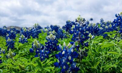

The Most Dangerous Rip Currents and How to Escape Them
The Most Dangerous Rip Currents and How to Escape Them Rip currents are powerful, narrow channels of fast-moving water that...
-

 World2 years ago
Types of Ants Living in the World and Information
-

 Wildlife4 years ago
(10) Insects Are Animals in the world?
-

 Forests2 years ago
The 10 Best Forests to Visit in the World
-

 Ocean2 years ago
Oceans in the World and Their Information & Locations
-

 Forests4 years ago
What Is The Biggest Rainforest In The World?
-

 Wildlife4 years ago
Most Popular Wild Animals in The World
-

 Forests2 years ago
The Main Factors That Contribute to Forest Destruction
-

 World1 year ago
The 10 Largest Farms in the World